RU:Tag:highway=busway
| Описание |
|---|
| A dedicated roadway for bus rapid transit systems. |
| Группа: дороги |
| Используется на элементах |
| Подразумевает теги |
| Полезные сочетания |
| Смотри также |
| Статус: одобрено |
| Инструменты |
|
Скоростной автобусный транспорт (BRT), также называемый автобусной полосой или транзитной полосой, представляет собой систему общественного транспорта, основанную на автобусах, в которой используются выделенные дороги для автобусов. Автобусные маршруты отдают предпочтение автобусам на перекрестках, где автобусы могут взаимодействовать с другими транспортными средствами. Эти системы имеют конструктивные особенности, которые сокращают время ожидания в терминале, вызванное посадкой или выходом пассажиров из автобусов или покупкой билетов.
Иногда государственные учреждения называют эти дороги «фиксированными направляющими,», но их не следует путать с управляемыми автобусными путями, в которых используются рельсовые направляющие или рельсы, а не обычные дороги с твердым покрытием. Кроме того, эта маркировка не применяется к окрашенным полосам для автобусов на дорогах общего пользования или в торговых центрах, хотя их также обычно называют автобусными полосами.
Тег highway=busway следует применять к проезжей части, которые имеют высокий уровень важности специально для пассажиров автобусов, но не предназначены для использования автомобилистами, пешеходами или велосипедистами. Другими словами, этот тег должен применяться только к дорогам, используемым для пассажирских перевозок.
Как нарисовать
Нарисуйте ![]() проезжей части системы скоростного транспорта и добавьте highway=busway.
проезжей части системы скоростного транспорта и добавьте highway=busway.
Теги в комбинации
| Tag | Description | Example |
|---|---|---|
| name=* | Name of the busway (if applicable) | Martin Luther King Jr. East Busway |
| operator=* | Name of the operator (if known) | Port Authority of Allegheny County |
| embedded_rails=* | If a busway shares a right of way with a (former or current) rail line. | light_rail |
| trolley_wire=* | For busways used by trolley-buses | |
| bus_bay=* | Whether a section of busway contains a bus bay. |
Intersections
Use highway=busway also for link roads (sliproads / ramps) leading to and from the main carriageway, as well as for "channelised" (physically separated by an obstruction) at-grade turning lanes connecting the through carriageways/through lanes of the busway to other minor roadways. The table illustrates which highway=* is to be used when mapping link roads connecting to busways. Do not apply highway=busway to any bus-only link roads that does not actually connect to the carriageway of any busway corridors.
| From | To | The link between will be tagged as: |
|---|---|---|
| busway | service | service
|
| unclassified/residential | busway | |
| tertiary | ||
| secondary | ||
| primary | ||
| trunk | ||
| busway | ||
| motorway | motorway_link |
Рендеринг
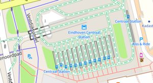
An alternative Carto style from Tracestrack location.
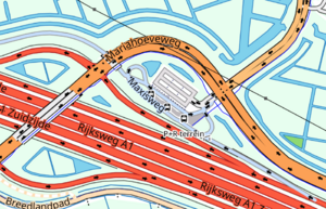
Rendering in OsmAnd (the lavender Maxisweg).
The standard OSM Carto style does not render this tag. Two pull requests have been contributed — one in September 2021[1], and one in October 2022[2] — but none of the Carto maintainers have been found willing to either apply one of these or provide an alternative.
Similar infrastructure
The following features may allow access buses while restricting other forms of traffic, but they should not be tagged with highway=busway:
| Feature | Description | Example | Correct tagging scheme |
|---|---|---|---|
| Bus-only service roads | These are short service roads connecting to bus-specific facilities (such as bus garages) off of the main carriageway. | highway=service + access=no + bus=yes | |
| Bus-only motorway links | These are motorway sliproads/ramps that are designated for buses only. Sometimes, they feed directly into an enclosed bus station. |  Ramps leading into Port Authority Bus Terminal in New York City, in which general traffic is disallowed. Image |
Any section of bus-only roadway that connects to any regular traffic road should be tagged with highway=motorway_link + access=no + bus=designated.
Any section of bus-only roadway that only leads into a bus station should be tagged with highway=service + access=no + bus=designated. |
| Physically-separated bus bypass lanes | These are short stretches of bus-only roadway at intersections that allow buses priority through an intersection before re-entering general traffic. | To determine the correct value of highway=*, consult the lookup table for link roads between different highways types. Apply bus=yes in addition to any other appropriate access tag. | |
| Also often referred to as a busway, a transit mall is a street, or set of streets, in a city or town along which automobile traffic is prohibited or greatly restricted and only public transit vehicles, bicycles, and pedestrians are permitted.[3]These types of roads may experience high levels of conflict between pedestrian/bike traffic, and bus traffic. | highway=unclassified (or a similar tag) and bus=designated are required.
If a road only allows access motor vehicles reaching their destination, use motor_vehicle=destination. If taxis are permitted, use taxi=yes. If a road requires motor vehicles to turn right at the next intersection, use turn restrictions. If the restrictions on motor vehicles only applies during certain hours of the day, use conditional restrictions. | ||
| Physically-separated bus bays | Bus bays are areas outside the main carriageways for buses to pick up and drop off passengers. Some bus bays are physically separated from the road. | highway=service + bus_bay=* | |
| Painted bus lanes | These are bus lanes that are not physically separated from general traffic. | Please consult Key:busway and bus lanes. | |
| HOV Lanes | These are physically separated sections of roads on motorways where motor vehicles must contain a minimum number occupancy in order to be allowed access. Sometimes, buses are routed onto these roads. | Please consult Key:hov. |


