User:Papou/Android
Jump to navigation
Jump to search
General information
| Name | % | Screenshot | Display map | Navigate | Make track | Monitor | License | Price | Languages | Version | Description |
|---|---|---|---|---|---|---|---|---|---|---|---|
| GPS Navigation & Maps +offline | 00 | 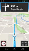
|
yes | yes | no | yes | nonfreeproprietary | nonfree1€ | 2013-06-27 3.0.1 |
Offline navigation and POI-Search | |
| AFTrack GPS-Tracking [1] | 00 | 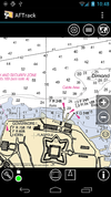
|
yes | no | yes | yes | nonfreeproprietary | nonfree3.90€;4.95$ | EN; DE; IT | 2012-12-08 1.4.2 |
Offline navigation with many map formats - BSB3 (*.kap), Bitmaps with calibration file (format: map, gmi, kml, kal, cal, pwm), OSZ (zipped osm tile collection), mbtiles, sqlitedb and online maps |
| AlpineQuest GPS Hiking [2] | 84 | 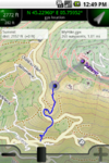
|
yes | no | yes | yes | nonfreeproprietary | nonfree3€ | EN,FR, | 2012-10-02 1.3.2 |
Orienteering focused |
| AndNav2 [3] | 29 | 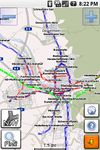
|
yes | yes | yes | no | GPL | free | EN | ?
|
No longer actively developed, map (online/offline-"andnav_atlas_format"), routing (online) |
| AndRoad [4] | 00 | 
|
yes | yes | yes | no | GPL | free | EN | ?
|
Open-source fork of AndNav2 |
| Androsm [5] | 00 | yes | yes | yes | yes | GPLv2 | free | EN; DE; FI; CS; PL; RU; FR; IT; ES; SK | 2013-06-04 0.8.5 |
fork of Gpsmid | |
| Androzic [6] | 77 | 
|
yes | yes | yes | yes | GPLv3 | free | EN; FR; DE; ES; CS; BG; FI; HU; IT; NL; PL; TR; RU | 2012-02-05 1.4 |
Android navigation client that uses OziExplorer maps (ozf2, ozfx3) |
| Ape@map [7] | 00 | 
|
yes | yes | yes | yes | nonfreeproprietary | free | DE | 2013-03-03 1.3.1 |
Outdoor GPS-navigation for Smartphones, Tablets (Android, iPhone, Blackberry) and Nokia/Sony Ericson (JAVA). Real 3D-View of OSM-Maps and other Maps. Peakfinder, statistics, place search, emergency call and much more |
| ARnav [8] | 00 | 
|
yes | yes | no | no | nonfreeProprietary | free | EN | 2012-03-03 0.9RC2 |
ARnav is an app for Android mobile devices that shows OpenStreetMap points of interest around you in augmented reality mode. |
| B.iCycle [9] | 00 | 
|
yes | no | yes | yes | nonfreeProprietary | nonfree10$ (iOS) $4 (android), | EN | 2012-03-03 3.2 |
MTB centered bike computer software |
| BackCountry Navigator [10] | 82 | 
|
yes | yes | yes | yes | nonfreeproprietary | nonfree9.99$ (fully functional time limited free demo available) | EN | 2011-05-26 4.0.6 |
Hiking focused. Many map formats available; including OpenStreetMaps, NASA landsat, MyTopo.com topo maps of US and Canada, OpenCycleMaps showing terrain worldwide, USGS Color Aerial photography, UK Ordinance Survey Explorer Maps, Topographic Maps of Spain and Italy, Outdoor maps of Germany and Austria, Topo maps of New Zealand. |
| Big Planet Tracks [11] | 00 | yes | ?
|
yes | yes | GPLv3 | free | EN; ZH-TW; ZH-CN | ? 2.1 |
maps (online/offline-"big_planet_tracks") | |
| BikeAtor [12] | 00 | 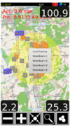
|
yes | no | yes | no | nonfreeproprietary | nonfreeFree at the moment | DE | 2011-10-10 0.1.19 |
Show Maps, Caches, Speedometer, log GPX... |
| BikeCityGuide [13] | 63 | 
|
yes | yes | no | no | nonfreeproprietary | free | EN,DE | 2012-04-28 1.0 |
Designed for cyclists in urban areas. Turn by turn navigation. Works offline. Insider tours. |
| CartoType [14] | 63 | 
|
yes | yes | no | no | nonfreecommercial | nonfreefrom £2.50 per shipped unit | EN | 2012-11-17 2.8 |
portable library |
| City Maps 2Go [15] | 55 | 
|
yes | no | no | no | nonfreeproprietary | nonfreeiPhone: 1.99$ / 1.59€ Android: free | EN,DE,FR,IT,ES | 2012-09-19 4.1.2 |
City Maps 2Go |
| CycleStreets Android App [16] | 00 | 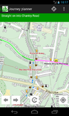
|
yes | yes | no | no | GPL; | nonfreeFree | EN | 2011-11-17 1.1 |
UK only |
| Dedee GpsLogger [17] | 00 | 
|
?
|
no | yes | no | nonfreeproprietary | free | EN | 2011-03-19 1.1 |
|
| ForeverMap [18] | 19 | 
|
yes | yes | no | no | nonfreeproprietary | nonfreeiPhone: 1,59€, Android: 1,59€ (Free Android version available) | EN; DE; FR; SP; IT | 2011-07-25 2.1 |
ForeverMap is an offline navigation app, providing address/POI search and route calculation |
| Gaia GPS [19] | 71 | 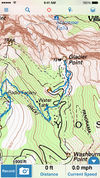
|
yes | yes | yes | yes | nonfreeproprietary | nonfree9.99$ iOS / $9.99 Android | EN | 2012-07-05 6.4 |
hiking focused logger |
| Geobucket [20] | 00 | 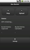
|
no | no | yes | no | GPL | free | EN | ? 1.0 |
Tool to make it dead simple to collect tracks and upload to Geobucket.org for tracing |
| GoPenS [21] | 33 | 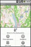
|
yes | yes | yes | no | GPL | free | EN | 2011-01-10 0.7.5 |
Open source Android GPS for OpenStreetMap, map (online/offline), routing (online) |
| Gosmore [22] | 00 | 
|
yes | yes | yes | yes | BSD | free | EN; DE | 2011-11-22 - |
|
| GPS Essentials [23] | 66 | 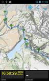
|
yes | yes | yes | yes | nonfreeproprietary | free | EN | 2012-08-27 3.0 |
All-in-one solution |
| GPS Logger for Android [24] | 65 | 
|
no | no | yes | no | GPL | free | EN | ? 1.1.7 |
Battery efficient GPX logger. |
| GPS-Tracks [25] | 00 | 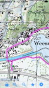
|
yes | yes | yes | yes | nonfreeproprietary | free | EN; DE; FR; IT | 2012-01-26 1.61 (iPhone); 1.52 (Windows Mobile); 1.30 (Android) |
|
| GpsMid [26] | 00 | 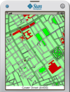
|
yes | yes | yes | yes | GPLv2 | free | EN; DE; FI; CS; PL; RU; FR; IT; ES; SK | 2012-09-08 0.8.2 |
very portable navi for Android&J2ME mobile phones, uses offline vector maps, audio navigation |
| gvSIG Mini [27] | 00 | 
|
yes | yes | no | no | GPL | free | EN; ES | 2011-03-30 1.2.2 |
supports WMS services, too; maps (online/offline-"custom") |
| inViu routes [28] | 00 | 
|
yes | ?
|
yes | yes | nonfreeproprietary | free | EN; DE; ES; FR | 2013-01-15 3.3.3 |
GPS swiss knife |
| JPSTrack [29] | 00 | 
|
yes | no | yes | ?
|
BSD (source available) | free | EN | ? early release |
Track logging for OSM w/ photo, voice, text notes |
| KeypadMapper [30] | 00 | 
|
no | no | yes | no | BSD | free | EN; DE; RU | 2012-06-08 1.8 |
Dedicated to housenumber mapping |
| komoot - Outdoor Routplaner [31] | 23 | 
|
yes | yes | yes | yes | nonfreeproprietary | free | DE | 2012-11-12 4.3 |
|
| Layar Reality Browser | 00 | yes | no | no | no | nonfreeproprietary | free | EN | ? 4.0.4 |
Augmented Reality browser mixes camera image with virtual reality | |
| LocA [32] | 00 | 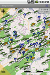
|
yes | yes | yes | yes | nonfreeproprietary | free | EN; CZ | ? 0.1.1. |
Geocaching focused logger |
| Locus Map Free [33] | 73 | 
|
yes | yes | yes | yes | nonfreeproprietary | nonfreefree, paid | EN; AR; CZ; DA; DE; EL; ES; FI; FR; HU; IT; JA; KO; NL; PL; PT; RU; SK | 2012-06-01 v2.4.1 |
Online/Offline map viewer (area downloader or tile cache), support slippy (non-free too) and vector maps (MapsForge library), guiding, routing and basic navigation (online only), track recording with detailed POIs (including photos) and altitude correction, extensive geocaching support, WMS maps and more |
| Mapdroid [34] | 00 | 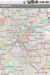
|
yes | no | no | no | LGPL | free | EN | ? alpha |
Open Source proof-of-concept Android OpenStreetMap viewer. |
| MapDroyd [35] | 00 | 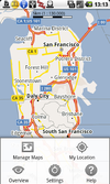
|
yes | no | no | no | nonfreeproprietary | free | EN; DE | 2012-05-23 v1.1.6 |
Offline vector map viewer for Android. Compact one-off data downloads |
| mapFactor Navigator free [36] | 73 | 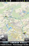
|
yes | yes | yes | yes | nonfreeproprietary | free | CZ; DE; EN; ... | 2011-07-13 11.0.12 |
professional framework for OSM-based car navigation |
| mAPPedplanet [37] | 00 | 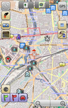
|
yes | yes | yes | no | nonfreeproprietary | nonfreefree, paid | EN; DE | 2012-10-21 v3.0 |
Online/Offline map viewer (own area vector maps with special informations), many standard tools build in |
| MapQuest [38] | 52 | yes | no | no | no | nonfreeproprietary | free | EN | 2011-02-19 1.0.0-beta |
||
| Maps (-) [39] | 00 | yes | no | no | no | Apache License 2.0 | free | EN | 2010-04-19 ?
|
Map viewer only. Caches tiles to SD card for offline viewing. | |
| Mapsforge [40] | 00 | 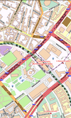
|
yes | no | no | no | LGPL3 | free | EN; DE; FI; IT | 2012-03-18 0.3.0 |
offline maps rendered on device, support for overlays, route planning, maps (offline-"custom format") |
| MapsWithMe [41] | 64 | 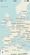
|
yes | no | no | no | nonfreeproprietary | free | EN; RU; ES; DE; FR | 2012-02-17 2.0 |
Off-line OSM world countries maps. Whole planet data takes less than 7GB |
| Mapzen POI Collector [42] | 22 | 
|
yes | no | no | no | nonfreeproprietary | free | EN | 2010-12-19 1.2.5 |
Easy to use app to map just POIs |
| Maverick [43] | 73 | 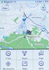
|
yes | yes | yes | yes | nonfreeproprietary | nonfreefree, pd version available | EN | ? 1.95 |
Geocaching support, POI Radar |
| My Tracks [44] | 54 | 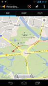
|
no | no | yes | yes | Apache License 2.0 | free | EN; | 2012-08-04 2.0 |
recording tracks (no OSM features) |
| MyTrails [45] | 73 | 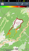
|
yes | yes | yes | yes | nonfreeproprietary | nonfreefree;paid | DE; EN; FR; IT; ES; PT; NL | 2012-05-31 1.2.40 |
MyTrails is an Android application that makes it easy and fun to view online and offline maps, and to record and share GPS tracks. It is designed to offer an uncluttered map area, and the smoothest map navigation (drag, pinch-zooming, etc.) on a mobile device. |
| Navatar [46] | 70 | yes | yes | no | no | nonfreeproprietary | free | PL | 2011-08-31 1.3.3 |
Poland only | |
| NavDroyd [47] | 43 | 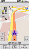
|
yes | yes | no | no | nonfreeproprietary | nonfree5€ | DE; EN; FR; IT; SP; PO | 2012-03-27 1.4.2 |
|
| NavFree [48] | 48 | 
|
yes | yes | no | no | nonfreeproprietary | ?
|
EN; ES; DA; DE; FR; SW; IT and others | ? 1.9.8.8675 |
Free satnav app. Maps available: Andorra, Argentina, Australia, Austria, Benelux (Belgium, Netherlands, Luxembourg), Brazil, Canada, Croatia, Czech Republic, Denmark, Estonia, Finland, France, Germany, Hungary, India, Ireland, Italy, Latvia, Lithuania, Mexico, Monaco, Netherlands, New Zealand, Norway, Poland, Portugal, Slovakia, Slovenia, South Africa, Spain, Sweden, Switzerland, UK. |
| Naviki [49] | 21 | 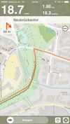
|
yes | no | yes | no | nonfreeproprietary | free | DE | 2011-02-24 1.5 |
Only Germany supported |
| Navit [50] | 31 | 
|
yes | yes | yes | yes | GPLv2 | free | 43 | 2013-01-13 0.2.0 |
Most popular OpenSource Car navigation tool; maps (offline-"custom"), vector-rendered |
| Navitel [51] | 33 | 
|
yes | yes | yes | no | nonfreeproprietary | nonfree17€ | EN; RU | 2011-06-10 5.0.0.1620 |
Popular in Russia |
| Nogago [52] | 50 | 
|
yes | yes | yes | yes | nonfreeOpenSource | free | DE; EN; NE | 2012-12-22 3.14 |
Topographic Offline-Maps and Navigation for Hiking, Cycling and Biking |
| Offline Nacht und Tag [53] | 00 | 
|
yes | no | no | no | nonfreeproprietary | 2.50€ | DE; EN; ES | 2013-01-30 1.1 |
Offline Karte verschiedener Städte mit POI-Anzeige und Echtzeitveranstaltungsdaten |
| Open GPS Tracker [54] | 62 | yes | no | yes | yes | GPLv3 | free | EN; NL; DE; IT; FR; CH | 2012-01-02 1.3.1 |
Offline GPS tracker with optional osmdroid map activity | |
| OpenFixMap [55] | 50 | 
|
yes | no | no | no | GPL | free | EN; FR; ET; DE; RU | 2012-03-20 0.5.2 |
Display errors from keepright, mapdust and openstreetbugs |
| OpenSatNav [56] | 00 | 
|
yes | yes | yes | no | GPLv3 | free | EN | 2009-12-29 0.9 |
Routing and recording trip; maps (online+cache); navigation (online) |
| OpenTrail [57] | 00 | 
|
yes | yes | no | no | GPL | free | EN | 2011-12-11 ?
|
Freemap for Android |
| OruxMaps [58] | 76 | 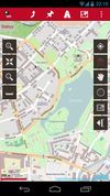
|
yes | yes | yes | no | nonfreefreeware | ?
|
EN; DE | 2011-11-11 4.6.0 |
OruxMaps is a map viewer. It can work in two modes: online with google, microsoft, yandex,... maps, and offline, with calibrated maps for OruxMaps, or online maps which have been saved |
| OSG-Explorer [59] | 00 | 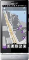
|
yes | no | no | no | nonfreeproprietary | ?
|
EN | 2013-03-07 1.0.0 |
OpenStreetMap 3D on Android |
| osm-android [60] | 00 | yes | no | yes | no | GPLv3 | free | ?
|
2009-10-21 0.0.9 |
renders OpenStreetMap maps and calculates routes | |
| OsmAnd [61] | 80 | 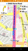
|
yes | yes | yes | yes | GPL v3 | nonfreefree or 5.99€ | EN; RU; DE; FR; AR; BG; BS; CS; DA; ES; EU; FI; HE; HI; HU; HY; ID; IT; JP; KA; KO; IT; LV; MR; NL; NO; PL; PT; RO; SK; SR; SV; UK; VI; ZH | 2013-05-31 1.3.1 |
Navigation, Routing(online-offline), OSM map display (tiles or vector) (offline), POI and address search (offline), submit OSM bugs and POI, mark favorites, public transport info etc. Actively developed. |
| OSMapTuner [62] | 37 | 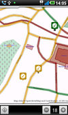
|
yes | no | no | no | nonfreeproprietary | free | ?
|
2012-03-14 1.0 |
Simple editor for manipulating tags on your smartphone |
| osmdroid [63] | 25 | 
|
?
|
no | no | no | LGPL | free | EN | 2012-04-24 3.0.8 |
Replaces GMaps views; maps (online/offline-"andnav2") |
| OsmPad [64] | 33 | 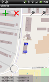
|
yes | no | no | no | ?
|
free | EN; DE | 2012-04-19 1.0 |
Utility to gather house numbers for OpenStreetMap |
| OSMTracker for Android [65] | 00 | yes | no | yes | yes | GPLv3 | free | DA; DE; ES; EN; FR; FI; IT; RU; SK; SV; TH | 2012-09-11 0.6.3 |
Offline GPS tracker with fast POI placement shortcuts. Exports in GPX format with waypoints, suitable for import in JOSM. Clone of OSMtracker | |
| PocketNavigator [66] | 25 | 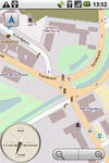
|
yes | yes | no | no | nonfreeproprietary | free | EN | 2012-03-16 3.3 |
Android navigation application, aiming at pedestrians. Information on the next waypoint can be encoded in tactile feedback. |
| RMaps [67] | 72 | 
|
yes | no | yes | yes | GPL | free | EN; RU | 2011-08-28 0.8.9 |
Maps and a compass, maps (online/offline-"rmaps") |
| Run.GPS [68] | 37 | yes | no | yes | yes | nonfreeproprietary | nonfree20€ | DE; EN; ... | 2010-07-07 2.37 |
Sport focused logger | |
| ShareNav [69] | 00 | 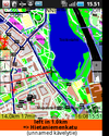
|
yes | yes | yes | yes | GPLv2 | nonfree€2.99 on Google Play Store (may vary depending on local taxes) | EN; DE; FI; CS; PL; RU; FR; IT; ES; SK | 2012-11-12 0.8.8 |
very portable navi for Android&J2ME mobile phones, uses offline vector maps, audio navigation |
| Trafficman Maps [70] | 00 | 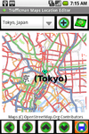
|
yes | no | no | no | nonfreeproprietary | free | EN | 2009-07-30 1.2 |
Displays maps and lets you share a link by email |
| TravelDroyd [71] | 20 | 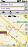
|
yes | no | no | no | nonfreeproprietary | nonfree5€+books | 20 | ?
|
Combining offline OSM+wikipedia articles for travelguides that you have to buy |
| TrekBuddy [72] | 67 | 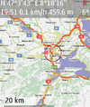
|
yes | yes | yes | yes | nonfreenonfree | free | EN, localizations | 2012-04-07 1.1.1 |
Highly customizable navigation/map display tool |
| TripAdvisor [73] | 66 | yes | no | no | no | nonfreeproprietary | free | EN | 2011-11-11 1.3.3 |
Dedicated Apps for 20 huge cities to find hotels | |
| Turbo GPS [74] | 00 | 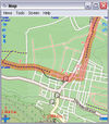
|
yes | yes | yes | yes | nonfreeproprietary | free | DE; EN; ... | 2012-09-07 2.73 |
|
| Vespucci [75] | 66 | 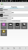
|
yes | no | yes | yes | Apache license 2.0 | free | CS; DA; DE; EN; ES; FR; HR; HU; IT; NB; NN; NO; PL; PT; RU | 2012-10-02 0.8.0 |
Online editor for OSM data |
| VGPS [76] | 00 | 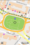
|
yes | yes | no | no | nonfreeproprietary | nonfree5$ | EN | 2011-11-28 8.0 |
OSM and Garmin offline map with routing turn-by-turn navigation for Android and J2ME mobile phones |
| ViewRanger GPS [77] | 63 | yes | ?
|
yes | ?
|
nonfreeproprietary | nonfreevaries | EN,DE | 2011-04-14 ?
|
proprietary outdoors-oriented map app for mobile phones, OSM & cycle & piste maps | |
| YourPocketMap [78] | 00 | 
|
yes | no | no | yes | nonfreeproprietary | free | EN | 2010-11-11 0.1.3 |
|
| ZANavi [79] | 53 | 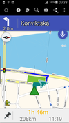
|
?
|
yes | no | yes | GPL | free | many | 2012-03-25 1.0.44 |
Offline Navigation System for Android |
| c:geo | 68 | ||||||||||
| Progorod | 31 |