Fa:Audio mapping

نقشهکشی بهکمک ضبط صدا یکی از فنون نقشهکشی است و روشی است که در آن در حین پیمایش و مشاهدهٔ عوارض، دادهها را بهشکل صوتی ضبط میکنیم. برای سادگی، از این پس آن را نقشهکشی صوتی مینامیم. این روش جایگزین یا مکمل نقشهکشی بهکمک عکس و سایر فنون نقشهکشی است. برای نقشهکشی صوتی روشهای بسیار متنوعی وجود دارد.
چرا نقشهکشی صوتی
- از کار با قلم و کاغذ سریعتر است؛
- سریعتر از آن است که بخواهیم نام معنارسانی برای راهنشانها (waypoints) در دستگاه جیپیاس بنویسیم؛
- تنها روش جمعآوری داده است که هنگام راندن خودرو یا دوچرخه برایمان خطرساز نیست (چون میتوانیم بدون نیاز به دست دادهها را ضبط کنیم)؛
- بهجای اینکه برای ثبت هر نقطه درنگ کنیم تا اطلاعات را وارد دستگاه کنیم در حین حرکت و بهسرعت آن را ضبط میکنیم و انگشتنما نمیشویم؛
- جزئیات بیشتری را که در گزارشهای جیپیاس (GPS logs) نمیآید، ضبط میکنیم:
- نام خیابانها
- نوع خیابانها
- محدودیتهای دسترسی
- نقاط پرکاربرد یا POI
- عوارض خطی که به موازات مسیر شما قرار دارند (مثلاً رودخانهها)
دردسرهای احتمالی در نقشهکشی صوتی
- در بعضی زبانها (مثلاً انگلیسی) برای یک صدا چندین شکل نوشتاری وجود دارد. برای حل این مشکل میشود آن را با جزئیات ضبط کرد، اما معمولاً هنگام ضبط کمتر متوجه ابهامی میشویم که در کلاممان پیدا شده و بنابراین به فکر گفتن جزئیات نمیافتیم.
- در انگلیسی مثلاً ممکن است بهراحتی آپاستروفها را فراموش کنیم.
چطور ضبط کنیم
اگر منطقهتان قبلا نقشهکشی شده یا اینکه تصاویر ماهوارهای خوبی در دسترستان هست، میتوانید فقط به همان ضبط صدا مشغول شوید، اما گاهی باید از جیپیاس هم بهطور همزمان استفاده کنید. اگر از جیپیاس + ضبط صدا استفاده میکنید، احتمالاً به دو دستگاه برای ضبط و یک دستگاه برای ویرایش در منزل نیاز خواهید داشت. البته، میتوانید هر سه کار را با لپتاپتان انجام دهید. در بازار ضبطصوتهای نستباً خوبی با قابلیت فعالشدن با صدا (حساس به صدا) وجود دارد. همچنین بسیاری از گوشیهای تلفن همراه و دستگاههای پخش صوت (MP3 Player) قابلیت ضبط صدا را نیز دارند. برای انتخاب دستگاه، به راهنمای سختافزار نگاهی بیندازید. بعضی وقتها استفادهٔ ترکیبی از نقشهکشی صوتی و عکسی هم مفید است؛ Dictacam را ببینید.
بعد از این کارها، در راه حرکت کنید و هر آنچه را که میبینید بگویید. شاید احساس راهنمای تور بهتان دست بدهد و کسانی هم که از کنارتان رد میشوند همینطور هاجوواج نگاهتان کنند :) کمکم بهاش عادت میکنید.
حواستان باشد که بعضی نامها ممکن است شکل گفتنشان بعدا در نوشتن برایتان ابهام ایجاد کند، بهتر است آنها را هجی کنید. مثلاً «رستوران خوان» را اینطور ضبط کنید: «رستوران خَوان» یا «رستوران خ واو الف نون» تا هنگامی که بعداً به صدای ضبطشده مراجعه میکنید اشتباهی آن را ننویسید «رستوران خان» و موارد اینچنینی دیگر...
چطور همگامسازی کنیم
اگر نتوانیم مشخص کنیم که هر دادهٔ صوتی مربوط به کدام موقعیت جغرافیایی است، این اطلاعات صوتی به هیچ کارمان نخواهد آمد. توجه کنید که حتماً این قسمت را یاد بگیرید در غیر این صورت بخشهای بعدی را متوجه نمیشوید.
راههای بسیار مختلفی برای اطمینان از این مسئله وجود دارد. بسته به انتخابتان هماهنگی صدا و موقعیت میتواند خیلی خوب و در حد ۱ متر یا خیلی بد تا حد ۵۰۰ متر شود. بنا بر سبک نقشهکشیتان شاید به این دقت نیاز داشته/نداشته باشید. بهعنوان تازهکار، شاید اول دوست داشته باشید همگامسازی محیطی را تجربه کنید و کمکم سراغ تکنیکهای دیگر بروید.
در رابطه با مسئلهٔ همگامسازی این سوال پیش میآید: آیا برای هر نقطهٔ پرکاربرد (POI) یک قطعهٔ جداگانه ضبط میکنید (مثلا ۶ ثانیه برای هر کدام) یا اینکه یک فایل بزرگ ضبط میکنید (مثلا چند ساعت یکجا)؟ بعضی از نقشهکشها مایلند که یک فایل بزرگ ضبط کنند اما به این شکل که هروقت چیزی برای گفتن نبود، ضبط را نگه دارند (pause).
خبر تازه! از این به بعد کار با قطعههای صوتی پیوسته در JOSM بسیار آسانتر شده. JOSM اکنون میتواند یک قطعهٔ صوتی پیوسته و طولانی را پخش کند و آن را با راهنشانها (waypoints) یا نقاط پیدرپی ثبتشده از یک فایل GPX هماهنگ کند. بنابراین میتوانید وقفههای طولانی را در یک ضبط پیوسته رد کنید و به لحظهٔ درست در فایل صوتی بروید. برای راهنمایی گامبهگام و عملی راهنمای JOSM و مطالب زیر را ببینید.
همگامسازی ضمنی
اگر ثبت رد جیپیاس و ضبط صدا را با یک سختـ و نرمافزار انجام میدهید، بهطور خودکار با هم هماهنگ میشوند. در این باره بخش #ضبط صدا با دستگاههای جیپیاسدار را بخوانید.
همگامسازی محیطی
تا امروز این روش محبوبترین روش بوده. اگر با هر دوری که میزنید چیزی بگویید، هنگام نگاهکردن به گزارش جیپیاس میتوانید بفهمید که کجا هستید. در این صورت میتوانید به راحتی نام خیابانها و مانند آن را در نقشه بیاورید. اگر زمینه یا محیط را گم کنید شاید نتوانید صدا را با گزارش جیپیاس هماهنگ کنید، به خصوص اگر در یک ناحیه ناشناخته و نقشهکشینشده باشید. نقشهکشی محیطی بهدرد جایی میخورد که پیچهای زیادی داشته باشد تا بتوانید از مستقیمراندن در چهارراهها بپرهیزید. اگر در جادهای طولانی و مستقیم هستید کهpoiهایی هم دارد، این تکنیک برای شما مناسب نیست. میتوانید به خودتان کمک کنید و یک دور کوچک دایرهای بزنید و مثلاً بگویید «یک رستوران نزدیک دایره هست».
اکنون میتوانید این کار در JOSM خودکارسازی کنید. توضیح آن در روش ۲ از نقشهکشی صوتی در راهنمای JOSM آمده که به صورت گامبهگام شما را راهنمایی میکند.
همگامسازی راهنشانها
بسیاری از دستگاههای GPS توانایی نشانهگذاری راهنشانها (waypoints) را دارند، که در JOSM هم نشان داده میشوند میتوانیم به این نقاط نامهای معنیدار بدهیم، اما نوشتن آن در هنگام رانندگی بهسختی ممکن است. خوشبختانه معمولا دستگاهتان بهطور خودکار نامی برای آن لحاظ میکند، مثلاً "Waypoint 242". در این صورت کافی است فقط صدایتان را ضبط کنید و بگویید «رستوران در نقطه ۲۴۲».
در JOSM میتوانید یک قطعهٔ صوتی را روی مجموعهای از راهنشانها بهکار ببرید و آنها را با استفاده از اولین نقطه در یک ضبط طولانی با هم هماهنگ کنید (هنگامی که دکمهٔ ضبط را میزنید، بگویید «حالا!»)، سپس با شروع از یک راهنشان دلخواه آن را پخش کنید. این روش روش ۱ در نقشهکشی صوتی با JOSM است که در راهنمای JOSM آمده و بهطور گامبهگام شما را راهنمایی میکند.
همگامسازی زمانی
این روش یکی از روشهای قدیمی و شناختهشده است که از زمان نقشهکشی با تصویر مرسوم است اما در مقولهٔ نقشهکشی صوتی نسبتاً جدید است. در این روش از زمان ضبط صدا استفاده میشود. بدین طریق که با استفاده از مهر زمانی ِ صدای ضبطشده، دادههای جیپیاس جستوجو میشود تا نقطهای را که در آن لحظه آنجا بودهایم پیدا کنیم و آن را روی نقشه نشان دهیم.
همگامسازی زمانی بسیار قدرتمند است بهطوری که حتی اگر دستگاهتان اطلاعات زمانی ضعیفی داشته باشد یا اصلا آن را نداشته باشد، باز هم میتوانید این روش را بهکار ببرید. اگر دقتی در حد ثانیه داشته باشید میتوانید صدا و مکان را بهدقیقترین میزان لازم برای نقشهکشی همگام کنید. این روش را «نقشهکشی صوتی قدرتمند» مینامیم. با این روش میتوانید نقشهٔ نقاط پرکاربرد و جادههای کناری را حتی بدون اینکه از میانشان عبور کنید، بکشید. کافی است هنگامی که از کنارش رد میشوید فقط بگویید «اینجا در ساعت ۴ یک خیابان به نام شقایق چهار هست که از اینجا یکطرفه است. عبور دوچرخه از هر دو طرف مجاز است، محدودیت سرعت ۳۰ دارد». در زمانی که این عبارت را بیان میکنید ممکن است مثلا ۲۰۰ متر را طی کنید. برای اینکه دقیقا متوجه شوید خیابان کجاست، کلمهٔ «اینجا» را در نزدیکترین مکان به خیابان بیان کنید.
- مهر زمانی با دقت ثانیه
- اگر دستگاهتان این توانایی را دارد، خوشبختانه میتوانید از آغاز بهشیوهٔ «نقشهکشی صوتی قدرتمند» عمل کنید. اگر نه، ناراحت نباشید و بخشهای بعدی را بخوانید.
- حتی با مهرهای زمانی در قالب 11:24:34 دستگاه ضبطتان در مقایسه با زمان GPS تفاوتهایی دارد که در نتیجه مهرهای زمانی شما خیلی نادقیق میشوند. اختلاف بیش از ۵ ثانیه ضبطهای شما را بیفایده یا حتی مضر میکند، زیرا اشیا را در جای نادرست و با زاویهٔ نادرست رسم خواهید کرد. سایر نقشهکشها شاید به دادههای نادرست شما اعتماد کنند و به دادههای خودشان بدگمان شوند و در نهایت یک آشفتگی پیش بیاید. بنابراین خواهشمندیم حتماً همگامسازی مکانی را انجام دهید. این کار را لازم است فقط یک بار انجام دهید زیرا اختلاف زمانی شما ثابت خواهد بود.
- سپس میتوانید چندین تکهٔ صوتی ضبط کنید یا اینکه یک صوت پیوسته ضبط کنید، هر طور که راحتید. اگر یک قطعهٔ پیوسته ضبط میکنید شاید دوست داشته باشید از همگامسازی زمانی خودکار در JOSM، همانطور که در بالا شرح داده شد، استفاده کنید.
- مهر زمانی با دقت دقیقه یا اصلاً نبودن مهر زمانی
- دقت در حد دقیقه برای نقشهکشی بسیار بد است. در این مورد میتوانید از همگامسازی محیطی استفاده کنید یا اینکه خودتان مهر زمانی ایجاد کنید، یعنی زمان را بگویید. اگر این زمان با زمان GPS یکی باشد که مشکلی نیست. اما اگر این زمان در حدود ۳ ثانیه با زمان GPS اختلاف دارد یک بار همگامسازی مکانی را انجام دهید. اگر ساعتی که ثانیه را نشان دهد ندارید مجبورید که پیش از هر بار ضبطکردن همگامسازی مکانی را انجام دهید. در این حالت باید یک فایل صوتی بزرگ را در نظر داشته باشید، زیرا همگامسازی زمانبر است. شرط میبندم که نمیخواهید بیشتر از سه بار در یک روز نقشهکشی این کار را انجام دهید!
همگامسازی مکانی
با این روش میتوانید از تمام مزیتهای «نقشهکشی صوتی قدرتمند» که بر اساس زمان انجام میشود بهرهمند شوید. با این روش حتی اگر دستگاهتان هیچ مهر زمانی ارائه نکند، میتوانید دقتی در حد زیر ثانیه داشته باشید. همچنین این روش راهی برای اطمینان از دقت مهرهای زمانی موجود است، حتی اگر ساعتتان عقب میماند.
در ابتدا، ضبط GPS را روشن کنید. بعد از اینکه موقعیتتان پیدا شد، ۲ تا ۵ دقیقه صبر کنید تا سیگنال GPS به بالاترین دقتش برسد. به مکان مناسبی بروید (بعد از اینکه این متن را خواندید، درمییابید که چه مکانی مناسب است...) و یک نقطهٔ قابلرؤیت و قابلشناسایی روی زمین پیدا کنید (مثلا یک خط، یک درپوش چاهک و...). بگویید «بهزودی همگامسازی میشود» و بهسرعت و با یک سرعت مشخص از این نقطه رد شوید. اگر معمولاً با سرعتی در حدود ۱۵ تا ۳۵ کیلومتر بر ساعت کارهای نقشهکشی را انجام میدهید، حداقل سرعتتان ۲۵ کیلومتر بر ساعت باشد. در لحظهای که از کنار آن عبور میکنید بگویید «حالا!». سپس دور بزنید و در این حال میتوانید بگویید «دور میزنم تا برای بار دوم رد شوم» و دوباره با همان سرعت از آن نقطه رد شوید و دوباره بگویید «حالا!». اگر در یک خیابان مستقیم هستید، از راستای مخالف از آن رد شوید (۱۸۰ درجه). اگر در یک محوطه هستید، بهتر است که با زاویهٔ ۹۰ درجه نسبت به عبور اول، از آن گذر کنید. هیچگاه هر دو گذر را در یک جهت انجام ندهید، زیرا این کار نتیجهای عایدتان نمیکند. اگر روش ۹۰ درجه را انتخاب کردید، نقطهٔ تقاطع این دو حرکت را در رد GPS ضبطشده مشاهده خواهید کرد. در حالتی که بهصورت ۱۸۰ درجه حرکت کنید این نقطه بهوضوح مشخص نیست اما اطلاعات لازم را دارد.
چگونه وارد JOSM کنیم؟
همانگونه که در بخش چطور همگامسازی کنیم آموختیم، صدای ضبطشده باید همگامسازی شود و برای این منظور با یک رد GPS ارتباط پیدا میکند. از این رو گزینهٔ واردکردن یا import، در آن محلی که معمولا فایلها را وارد نرمافزارها میکنید قرار ندارد. این گزینه در منوی File قرار ندارد بلکه از طریق منوی زمینهای ردهای GPS قابلدسترسی است. فایلهای جیپیاسی که در JOSM باز میکنید در کادر layer نمایش داده میشوند. بنابراین صرفا با واردکردن فایل صوتی با این روش، فایل صوتی بهراحتی با رد جیپیاس هماهنگ میشود.
نکته: تا مارس ۲۰۱۱ JOSM فقط از فایلهای صوتی با قالب WAV پشتیبانی میکرد.
ضبط صدا با دستگاههای جیپیاسدار
اگر از کامپیوتر، گوشی تلفن یا پیدیای استفاده میکنید، به روشهای همگامسازی بالا نیازی ندارید، زیرا این دستگاهها خودشان آن کار را انجام میدهند. مقالهای دربارهٔ ضبط صدا با PDA وجود دارد. فهرستی از نرمافزارها را در ادامه میبینید:
OSMwaypoint
Three script for taking pictures every second from the webcam, recording gpx track and mark waypoints simply by clicking a mouse. When you press the mouse the script mark the waypoint and record an audio clip paired with the waypoint, ready for import in josm.
The timestamps used in OSMwaypoint came from GPS and not from computer's clock.
Works well if you are using a netbook, or a laptop, in a car
Similar to GPStrigger, but less graphics and don't require a joystick.
Works only on Linux systems
GPSTrigger
The application gpstrigger is able to record a voice from a microphone and save it as WAV and it's GPS position (from gpsd) into a GPX file. The latest JOSM is able to display this voice tags on the map. For easier handling you could connect a joypad to your notebook and start and stop recording with two buttons. This application is under heavy development. It uses the Gtk+ library currently. But it's planned to change it into a library to better integrate it into other environments.
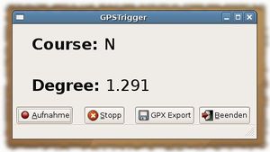
GPSTrigger works now with josm-latest!
It seems there's a problem using the Java Sound API on some Linux systems. If you get an exception while playing audio files then try to kill your sound daemon (esd, artsd,...).
Hint: gpstrigger works with Linux only!
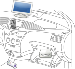
bash/dialog dictaphone
This hack is a command line recorder that uses dialog and sox. You start/pause recording with the spacebar and finish with N. Then all the little files recorded will be concatenated into an .ogg file, which you can rename as you wish. I'll take a look at GPSTrigger though, but some of you might find this toy useful or at least funny. [۱]
Manauton
http://manauton.sourceforge.net/
Manauton is a Linux CLI/nCurses application for recording sounds. The great thing for OSM is that it can work in autonomous mode, detecting speech and logging to separate files. It support negative latency (recording starts before manual/autonomous trigger) and it can put a click-track into resultant wave file to denote time (which is independent to file time/stamp).
The output wave file can be one large file, containing the sequential recordings (with click-track on each section) or autoincremented seperate files. There is a small utility for detecting/decoding the click-tracks.
No development for a while, but worked last time I played with it... it appears that the alsa library has changed since manauton was written. To get it compiling use the following at the top of Manauton/alsa_pcm_reader.c
//#include <sys/asoundlib.h
#define ALSA_PCM_OLD_HW_PARAMS_API
#define ALSA_PCM_OLD_SW_PARAMS_API
#include <alsa/asoundlib.h>
Note: I've confirmed this application works on multiple desktops, however it does not work on my laptop. I believe there is some issue with CPU speed switching, or other power saving system.
Empass
Empass is a compass application that displays the driving direction from gpsd. It shows a nice animated compass and it's fully themeable with Edje. This library is part of the Enlightenment Foundation Libraries (EFL). So you need to install this library from the Enlightenment CVS. Read this website how to do this.
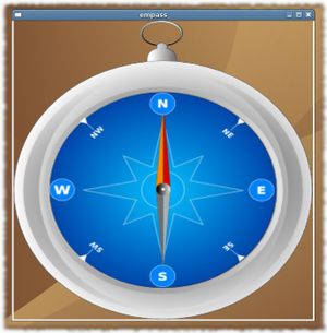
Hint: Empass works with Linux only!
OSMtracker
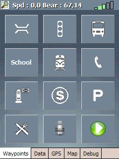
OSMtracker is an application for the Windows Mobile PDA/Pocket PC.
The main purpose for the first release is to do quick (voice) waypoint annotations when driving a car or on a bicycle.
more info on the OSMtracker (Windows Mobile) page
Gps Event Sync
Gps Event Sync is command line tool to convert a list of events (transcribed from an audio recording) and a GPX trace into a list of GPX waypoints. This may then be opened in JOSM or other editor for further work.
BT747
Intially made for MTK based loggers, BT747 can position any file on a map (well advanced dev version). It runs on Windows, Linux, Mac OS X, Mobile Phone (J2SE), Palm, WindowsCE. "Tagging" is currently available only on the first three OS's but is intended to be extended to the other ones.
GPSMid
GPSMid is a Java ME (J2ME) application that will run on most mobile phones. It is primarily an OSM router / map display application, but can be used successfully for audio mapping if it is paired with a bluetooth GPS receiver such as a Nokia LD-3W. It allows an audio clip to be recorded when required, and creates a GPX waypoint which is associated with the clip. Some processing of the files is necessary to use them with JOSM, as described in GPSMid.
Audio_wpt.py
Audio_wpt.py is a PyS60 application that allows you to save a waypoint in a GPX file and assign a voice recording to it for use in JOSM
avp2wpt
avp2wpt is a java application that parses a gpx trace file, compares times with audio/video/photo (or whatever) files, and creates waypoints accordingly.
Field reports
By David.earl
Using a voice recorder is much quicker than paper when mapping by bike. The track points you collect are ordered and JOSM (for example) can show them connected if you set the option. This means you can see the route you took and follow the voice recording in order. So you already have the topology, you just need the names of things.

I tried continuous recording in the hope that I could synchronise with the track point times, but that was too hard and I got fed up of "silence" consisting of heavy breathing and traffic noise while cycling.
The background noise out on the street is too intense for the voice activation to work, so now I am pausing recording between voice annotations. That gives an almost continuous playback which is only a few minutes long and easy to apply street names and features from it in sequence after creating the nodes, segments and ways.
I tried using a headset to support the microphone, and the clip mike that comes with the recorder, but I concluded in the end it was easier to slip the device out of my jacket pocket or bar bag and speak directly into it's built-in microphone. Mounting it on the handlebars was OK, but I found it too easy to press "stop" instead of "pause" or "continue" when mounted like that.
(Actually I've gone back to using a headset now. Playback on this device continues across file boundaries, and the record button does both 'resume after pause' and 'start new recording' so it doesn't matter much if I press stop rather than pause. Though perhaps marginally less convenient, in the end I was worried about the safety aspect of hand holding the disctaphone. David.earl 10:49, 27 September 2007 (BST))
If I note "dead end" so I know where I've turned round and retraced the route, then it is mostly sufficient simply to say "left/right into <street name>" and note context where there might be ambiguity on the track log and features like pubs, post boxes and the like (either by context if by a junction, e.g. "The Red Lion pub on north-east corner of junction with High Street" or by putting a loop in the track log by cycling in a big circle or going round the pub car park, which is quicker and less fiddly than trying to mark a waypoint on the GPS receiver). Likewise where a street ends and turns into a track, or where the name changes without any change in direction to mark the context.
The briefer the audio notes the better: short playback means quick editing time back at the computer.
By Chrismorl
I find a bit of redundancy in the audio commentary to be helpful in case of obliteration by passing cars, etc: "turn left into Cross Street, turn left from Cross Street into Pye Avenue, a cul-de-sac, P,Y,E... return Pye Down Avenue... turn left into Cross Street..." My device is a Matsui TRQ-10D which has timestamping, but no computer connection (no permanent evidence, but needing is very unlikely). It was only £15 at Currys. However, it did lose data on one occasion after needing a reset. I find I don't use the timestamping: the commentary is sufficient. As mentioned above, manual starting and stopping of recording is necessary. This device has the same beep to mark both, which is a bad idea because it is possible to get out of sync - recording the heavy breathing and no information - if you haven't checked visually what its doing.
The ideal device would be one which you wore on your lapel (or had a separate microphone) and had a remote on/off switch with two feelable positions which you mounted on the handlebars. This is a bit specialised for a commercial device especially as I see today that the OSM market will only exist in the UK for another 18 months... Chrismorl 17:17, 24 November 2006 (UTC)
By Frank
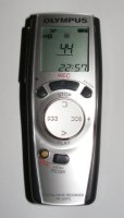
I'm using a Olympus VN-120PC. It's a nice small device for about 50€ (in 2007). There is no Linux software, so i had to reinstall the w2k that came with my test PC on a removable disk to use it.
Good things
- does by second timestamps and saves them in the wav file
- good microphone
- syncs the recordings to the PC (but win only)
- syncs the time from the PC (but win only)
Bad things
- needs special software (win only) to sync to a PC
- does only 3 x 100 recordings, even if there is space for more
My usual procedure is:
I've written 2 Perl scripts to handle the wav files. Contact me if you are interested. Here is the timestamp script.
- record the time from the gps at the start
- go on the mapping trip
- transfer the data to a win pc, copy them to my usual linux system
- run mklist.pl to create a list of the wav files, recording time
- edit the list
- add the time delta (recorded gps time)
- listen to the wav files and take notes
- run list2wp.pl with the recorded gpx file and the list file to create a waypoint gpx file
Frank 23:17, 6 February 2008 (UTC)
By Villus
some of the Olympus Voice-Recorders work with odvr
By John07
I own a typical MP3-Player (TrekStor i.Beat joy 2.0) with an internal microphone. The recording works quite good, but i wanted to have an external microphone for better handling while biking.
After i questioned talk-de about solutions for that issue (the Line-In doesn´t work with typical headsets) I removed the internal microphone and attatched a cable with an external microphone (a small one from an old dictaphone) to the pins of the internal microphone.
If you want to do the same (on your own risk!) write me an email for more information and pictures. John07
By Babstar
Thomson-Lyra 2GB MP3 player, model 6675
Available in Australia from Dick Smith Electronics, around $US35. Similar models should be available globally.
I looked around at all sorts of digital recorders, and none really fitted what I wanted for the right price. The Thomson caught my eye as it recorded directly to .wav format (for JOSM) and connects to the PC via USB mass storage, good for Linux & Mac.
One drawback of this model is the lack of an external mic jack. The on-board mic is good, sound quality is excellent when holding it at a comfortable distance from the mouth. The volume tends to drop off when sounds are more than around 75cm (2'), although still audible. I calibrated the unit and found it was spot on after approx 1 hour of recordings.
JOSM unfortunately couldn't read the .wav files produced by the unit initially. Some investigating showed the unit uses compression in the .wav format. This however can be easily fixed with SoX via conversion to the raw format.
# sox -V foo.wav -r 44100  foo.raw
# sox -V -r 44100 -b 16 -e signed-integer foo.raw foo-new.wav
The converted file can now be read by JOSM. One advantage of this compression is the reduction of the file size on the unit, approximately 15~20Mb per hour, this comfortably give the recorder about 80 hours of recording time. Once decompressed the resulting file is about 10 times the original size.
By Gilles Bonnard aka leblatt
I liked the idea of audio mapping, so I tried Mobile Trail Explorer. I had compatibility and stability issues, so I reverted to good old trekbuddy. I really missed the voice notes, and I wanted to use pictures too, so I thought of a little utility that I called avp2wpt : audio/video/photo to waypoint. I record my trip as a gpx file, while taking voice notes, pictures or videos. Then I put them all in a folder, and the program scans the files and creates waypoints for me. Its that simple, I wonder how I couldnt find such a script before.
By Chris Krahe
I do my recording while driving at 30 to 70mph, often with the convertible top down (i.e. noisy). So, I needed a device that could capture my voice despite the wind noise, was lightweight and could clip to my seat belt, allowed easy one-button-record, had a dim-able screen, and supported second precision. I also would be making lots of small recordings, maybe 5-30 seconds each, so it had to be suited to that. The Olympus VP-10 digital recorder (just under $80 US on Amazon) fits all of these requirements wonderfully. I found the "pocket" recording scene (preset collection of audio recording settings) captured my voice clearly, clipped mid-chest with head and eyes up looking at the road. The record button is simple and unambiguous, creating a new time-stamped recording each time I turn it on. The device is also quite-configurable, which is nice. Two nits: The device doesn't appear to show the seconds of each timestamp, just the hours and minutes (but I can obtain them when I transfer the MP3s to my computer); and the clip isn't as strong as I'd like, but strong enough for its intended shirt-pocket purpose (for me it fell off under heavy braking and high-load turns, albeit only a handful of times in about 400 miles of driving).