File:Dscf0220 600.jpg
Jump to navigation
Jump to search

No higher resolution available.
Dscf0220_600.jpg (600 × 450 pixels, file size: 69 KB, MIME type: image/jpeg)
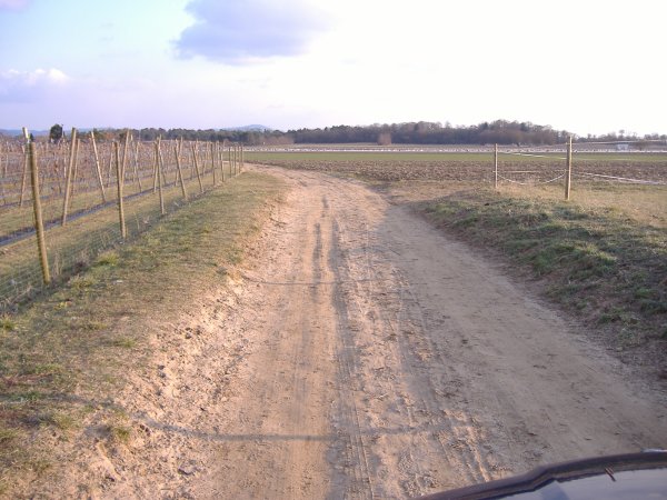
Griesheim - NN - rural area (N49.84850,E8.56253) Example for a unpaved way
File history
Click on a date/time to view the file as it appeared at that time.
| Date/Time | Thumbnail | Dimensions | User | Comment | |
|---|---|---|---|---|---|
| current | 22:23, 12 March 2006 | | 600 × 450 (69 KB) | FrankM (talk | contribs) | Griesheim - NN - rural area (N49.84850,E8.56253) Example for a unpaved way |
You cannot overwrite this file.
File usage
The following 22 pages use this file:
- Fa:کوهنوردی
- Highway tagging samples/out of town
- Pl:Przykłady tagowania dróg/poza miastem
- Pt:Key:surface
- Tajikistan
- Uk:Highway tagging samples/out of town
- Wheelchair routing
- User:FrankM/Images
- User:Mateusz Konieczny/notify uploaders/FrankM
- Template:NL:Map Features:surface
- Template:Pt:Map Features:surface
- DE:Reiten
- DE:Rollstuhlfahrer-Routing
- DE:Tagging samples/out of town
- FR:Highway tagging samples/out of town
- FR:Tagging samples/out of town
- FR:Wheelchair routing
- IT:Tagging samples/out of town
- NL:Key:surface
- RU:Belarus:Примеры обозначения дорог вне населённых пунктов
- JA:Wheelchair routing
- JA:道路のタグ付け例/郊外部