Project of the week/2010/Aug 22

Add a Trail to OpenStreetMap
Your multi-use trail might provide a path for school children with less vehicle traffic. It might provide a measured distance for runners to exercise. It might provide educational access to a protected environmental area or a place to go with the family for some fresh air and a picnic.
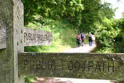
One of the most fundamental contributions that you can make to OpenStreetMap is to add a new trail, path or road. The Project of the Week is to add a Trail to OpenStreetMap. Multi-use trails provide a method of transportation, recreation, and a sense of community to a neighbourhood. Add a hike / bike / walk / roller skate trail to your area of the map.
Method
Adding a new highway to OpenStreetMap is one of the most common, basic skills for a contributor. This PotW presumes that you have a favourite editor and preferred tags. Newer mappers might find this tutorial "Add a Trail to OpenStreetMap" helpful.
Survey
Survey your trail. Note connectivity, access, surface, and amenities.
Required Tags
Provide appropriate connectivity to other OSM objects. Does the trail connect to the sidewalk / pavement? To the residential road with an accessibility ramp?
highway=*# likely a path, footway or cyclewaysurface=*# paved / unpaved at a minimum, consider asphalt, gravel, woodchip, cobbles, etc.foot=yes# add appropriate access tagsbicycle=yes# add appropriate access tags
Recommended Tags
Add amenities near the trail, where appropriate.
barrier=cycle_barrier# add details for access controlamenity=drinking_wateramenity=toiletsamenity=bench
Optional Tags
access=*# consider adding opening hours.
Edit
Use your preferred editor to record your notes in the form of OSM data and metadata.
Upload
Upload your edits to OpenStreetMap to add your new trail.