Proposal:Surface=laterite
| surface=laterite | |
|---|---|
| Proposal status: | Draft (under way) |
| Proposed by: | Julcnx |
| Tagging: | surface=laterite
|
| Applies to: | way |
| Definition: | A road, track, or path surfaced with lateritic soil: a cohesive, usually red/orange, iron-oxide-rich tropical/subtropical soil that hardens when dry but rapidly becomes slippery and potentially impassable on first wetting, then deeply plastic and adhesive under sustained rain. This proposal also includes a conditional documentation update to Tag:surface=clay to distinguish laterite from clay-mineral soils. |
| Draft started: | 2026-04-21 |
- SUMMARY
- What:
surface=lateritedocuments the red/orange tropical road soil that mappers currently fall back tosurface=dirt,surface=ground, or sometimessurface=clayfor lack of a dedicated value: the broader family of iron-oxide-influenced lateritic soils, covering roughly one third of continental land area across Africa, Southeast Asia, and Latin America. - Why it matters: Laterite has two predictable seasonal states: firm and dusty when dry; plastic and potentially impassable when wet. The wet transition is abrupt: on first rain the surface becomes near-frictionless within minutes before softening to full depth plasticity. Generic tags like
surface=dirtdo not capture this behaviour. - Bot context: A recurrent bot converts
surface=lateritetomaterial=laterite; an OSH history audit on Cambodia and Cameroon confirmed 711 such transitions with zero fallbacksurface=*tags added.[1] This proposal reinstates and documents the lost surface signal. - Laterite is not clay: laterite is red/orange and hardens in dry season; genuine clay-dominant soils like black cotton (Vertisol) stay dark grey or black and do not harden. Both are sticky when wet, which is why the confusion happens. Iron oxides dominate in laterite, not clay minerals. Clay minerals are naturally white to light-coloured; the intense red/orange comes from iron-oxide influence, not clay impurities. After this proposal
surface=clayon roads is a rare edge case; sports courts are unaffected. - Why "laterite" not "lateritic" or "murram": OSM surface values use material nouns, not adjectives, ruling out
surface=lateritic.surface=murramis accurate but East African only. "Laterite" is the most globally intelligible term across regional names (murram, terra roxa, din daeng, rahnrahn); the scope section defines exactly which soils it covers. - Community support: 38 mappers with direct field experience across Cameroon, Senegal, Thailand, Cambodia, Colombia, Brazil, DR Congo, Kenya, Philippines, Bolivia, Madagascar, Argentina, India, Ghana, and West/Central Africa confirmed the field description, provided relevant regional context, or engaged critically with the proposal's scope. Confirmation includes a soil engineer with direct Cameroon field experience.
- If rejected:
surface=clayis already documented and will continue to absorb laterite usage. Rejection does not produce cleaner tagging; it preserves and entrenches the existing clay/laterite conflation.
Problem

Laterite is a major unpaved-road material across tropical and subtropical regions,[2][3] yet OSM has no documented mainstream surface=laterite value. It covers roughly one third of continental land area.[4][5]
In practice, mappers fall back to surface=dirt, surface=ground, or sometimes surface=clay. Snapshot data shows displacement, not absence of need: material=laterite appears on 845 objects overall, including 725 highway=* ways and 120 non-highway objects (mostly natural=bare_rock), while direct surface=laterite remains almost absent. The Tag:material=laterite wiki page is a near-empty stub with no usage guidance, confirming that the bot migration left the tag undocumented and erased the routing signal without establishing any replacement.
A key cause is the recurrent bot migration from surface=laterite to material=laterite during a rock-focused cleanup.[1][6] The bot treated laterite as a rock type rather than a soil; history analysis of Cambodia and Cameroon highway ways confirms 711 such transitions, all bot-authored, with 0/711 adding any fallback surface=* tag, erasing all surface and routing signal from those ways. In the current snapshot, 330 of 725 (45.52%) material=laterite highway features remain bot-last-edited.[7]
Snapshot data
The table below summarises Overpass snapshot counts across related surface and material tags. "% highway" is the share of each tag's total features that carry a highway=* key.
| Tag | Total features | Highway features | % highway | Notes |
|---|---|---|---|---|
surface=laterite |
1 | 0 | 0% | Only 1 feature globally; a tennis court in China, not a road. Absence is explained by the bot migration that converted existing surface=laterite highway uses to material=laterite without adding a surface fallback; see row below.
|
material=laterite |
845 | 725 | 86% | Primary displacement tag. Dominated by roads (residential, unclassified, secondary, tertiary, trunk). Highway features are concentrated in Cameroon (55%) and Cambodia (43%), with minor presence in Gabon, and Laos; this geographic distribution reflects the bot migration that introduced the tag. Non-highway uses include natural=bare_rock (80), barrier=wall (17), and aeroway=runway (4); those are out of scope for this migration.
|
surface=murram (both cases) |
50 | 36 | 72% | All features are in East Africa (Kenya, Uganda, South Sudan). Lowercase (17): 35% highway, 65% aeroway. Capital-M (33): 91% highway, from a single Kenya survey cluster. Combined: 14 aeroway, 36 highway retagging candidates under this proposal. |
surface=red earth |
24 | 24 | 100% | All in Auroville, Tamil Nadu, India (lat ~12°N, lon ~79.8°E). 100% highway: tracks, paths, residential, unclassified. A local English name for laterite in this area of South India; a retagging candidate. |
surface=clay |
41,793 | 2,363 | 6% | 87% leisure/sport (dominated by tennis: 29,786 features). Highway uses are candidate migration targets where laterite can be confirmed. Current highway breakdown: track 670, footway 647, path 339, residential 230, service 110, unclassified 100; higher-classification road uses (secondary–trunk) are small in absolute terms. The "rare edge case" framing in this proposal refers to the expected post-migration state, not the current count. |
material=clay |
263 | 1 | 0.4% | Used as a construction material tag (embankments 84, boundary stones 79, artwork 28). Semantically distinct from the surface tags; not a road-surface value. |
surface=caliche |
14 | 14 | 100% | All private oil-field service roads in a small area of west Texas (USA). Caliche is calcium-carbonate hardpan, distinct from laterite, but the pattern is directly analogous: a region-specific natural soil term used by local mappers exclusively for road tagging. |
Combination forms: surface:material=*, dirt=* |
0 | 0 | — | No usage found. Mappers did not organically adopt any sub-key or combination approach; displacement went entirely to material=laterite alone, stripping the surface signal.
|
Key readings from the table:
material=lateriteis overwhelmingly a highway tag (86%), confirming that the bot migration displaced road surface data.- OSH history on Cambodia and Cameroon directly confirms 711 bot-driven
surface=laterite→material=lateritetransitions with zero fallbacksurface=*tag. Among 84 non-surface-origin rows, 80 are version-1 likely split/copy inheritance and 4 are stronger manual-add cases. surface=clayis overwhelmingly not a highway tag (6%); its primary use is sports courts. The highway uses represent the laterite/clay conflation this proposal resolves.surface=murramcombined with its capital-M variant (surface=Murram) totals 50 features, 36 highway (72%). The lowercase variant alone skews toward aeroway; the capital-M variant (from a single Kenya survey cluster) is 91% highway. Combined, the murram migration pool is 36 highway retagging candidates, not 6 as the lowercase-only count suggested.surface=calicheconfirms that region-specific natural soil terms for roads exist and are used consistently by local mappers, providing a structural parallel to murram and to the proposed laterite tag.
Proposal

Add surface=laterite as a documented value for the surface=* key, for use on highway=* ways (roads, tracks, paths, and footways) where the surface material is lateritic soil. It is not limited to graded or maintained roads.
Use surface=laterite as the preferred global value. When the material is uncertain on the ground, surface=dirt or surface=ground are valid fallbacks; surface=dirt is appropriate when you know the road is a natural soil surface but cannot identify the material, surface=ground when the surface type itself is indeterminate or may include mixed natural materials. For imagery-only mapping, surface=unpaved is the most accurate choice. Where visibly engineered as a bound applied mix, use surface=compacted.[8][9]
This proposal does not depend on material=* tagging for roads.
In addition, this proposal:
- Clarifies that
material=lateriteonhighway=*ways should be reviewed and retagged tosurface=lateritewhere locally confirmed - Keeps non-highway
material=lateriteuses out of scope - Defines follow-on documentation updates for Tag:surface=clay, Tag:surface=dirt, Tag:surface=ground, and Key:surface
Scope
This proposal follows a pragmatic middle path (Approach C, as documented on Clay_textured_road_soils): broader than strict red-only laterite taxonomy, narrower than an all-clay-textured-soils model.
Core scope for surface=laterite:
- Laterite sensu stricto (Oxisol or Ferralsol contexts)
- Latosol families (including terra roxa and tierra colorada road contexts)
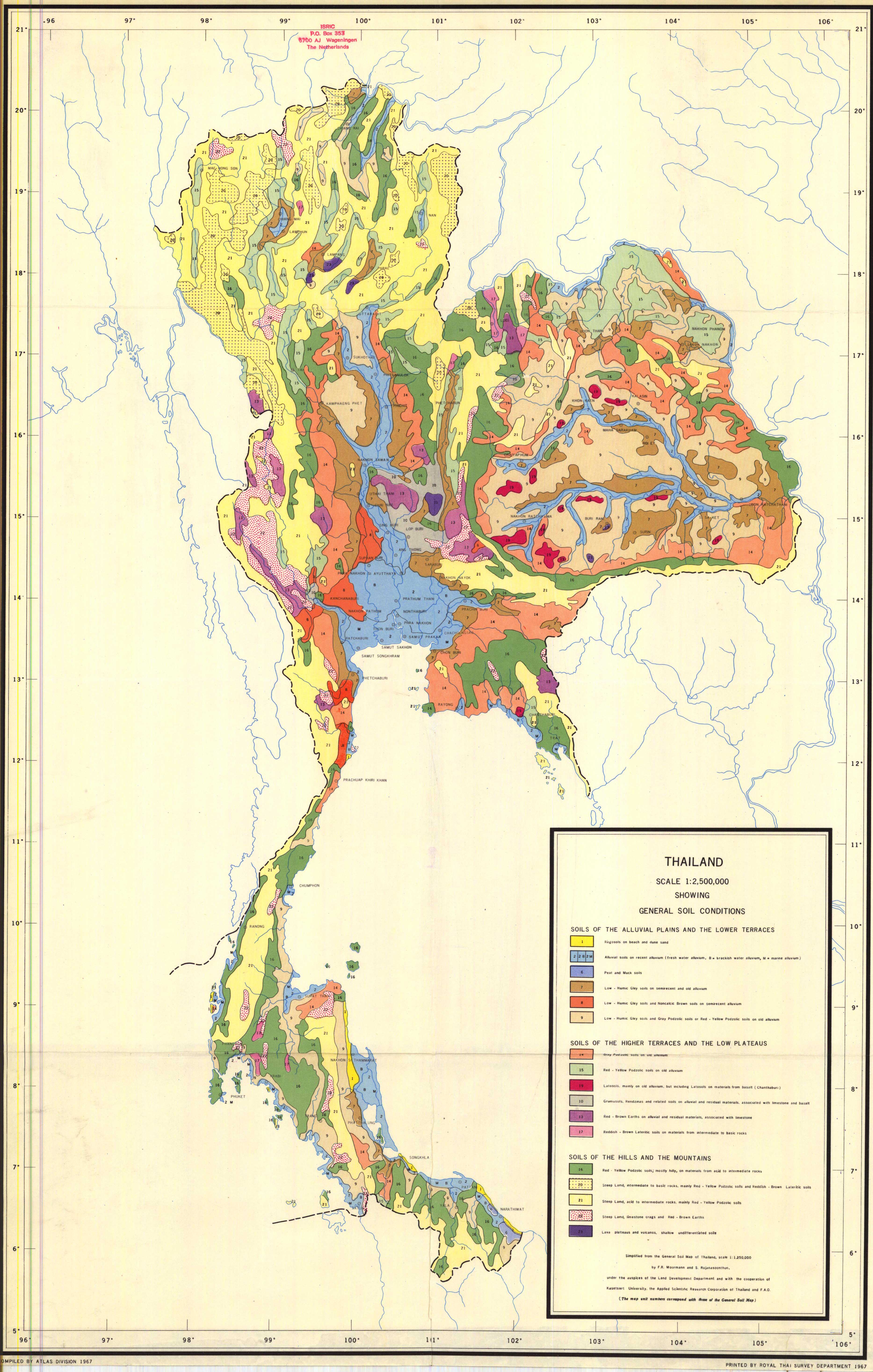
- Regional in-situ names for natural laterite road soil (including murram, tanah merah, cabook, din daeng in Thailand,[10] rahnrahn in Wolof/Senegambia, trocha in Latin America, Lehm-Piste in German field usage, red earth in Auroville/Tamil Nadu, ironstone in Nigeria, mantle rock in Ghana, moco de hierro in Venezuela, carapace in Francophone Africa, terres ferralitiques and sol ferralitique, the standard Francophone scientific terms for the lateritic soil family in Cameroon and Central Africa)[11][12] Din daeng (ดินแดง) is the fine-grained uniform in-situ lateritic soil and maps to
surface=laterite. Din lukrang (ดินลูกรัง) is a distinct material: laterite gravel, formally defined as containing more than 35% gravel or rock fragments by volume;[13][14] it is visually similar to Koffieklip (South Africa) and is not in scope forsurface=laterite. As a road surface, din lukrang maps tosurface=fine_gravelorsurface=graveldepending on particle size when unrolled, orsurface=compactedwhen rolled and compacted. Laterite nodules (pisoliths) used in din lukrang are typically 4–25 mm in diameter,[15] spanning ISO 14688-1 fine gravel (fGr, 2–6.3 mm) to medium gravel (mGr, 6.3–20 mm): usesurface=fine_gravelfor small-nodule material andsurface=gravelfor typical construction-grade din lukrang.
Extended in-scope special cases (explicitly documented):
- Red-Yellow Podzolic soil (Ultisol) road surfaces in tropical/subtropical settings where iron-oxide-coated kaolinite produces field behaviour indistinguishable from Oxisol laterite; in regions such as Northern Thailand, Ultisols and lateritic Oxisols coexist on the same hillside and cannot be separated without laboratory analysis
- Nitisol road surfaces where field behaviour and appearance are indistinguishable from laterite for mappers
Explicit exclusions from surface=laterite:
- Vertisol and black cotton soil, keep
surface=clay - Intact ferricrete or calcrete duricrust outcrop, use
surface=rock - Improved laterite roads where construction work has produced a stable surface, use
surface=compacted. The intent is to preserve existing mapper practice: in Africa, major laterite highways are already taggedsurface=compactedand should remain so.surface=lateritetargets natural, unimproved, or minimally graded surfaces where wet-season plasticity is the defining behaviour. Where construction level is ambiguous, surface texture is the practical test: visible individual nodules or particles indicate engineered aggregate (surface=compactedwhen rolled); a smooth continuous fine-grained surface indicates in-situ laterite soil (surface=laterite). Supporting basis: engineered surfaces use borrow-pit-selected laterite gravel with high nodule (pisolith) content, producing CBR values of 30–90, structurally distinct from fine-fraction-dominant natural laterite.[12][16] When uncertain,surface=lateriteis the safer default. - Natural soils that harden in dry season, including calcrete, gypcrete, silcrete, black cotton soil in dry season, desert pavement, and natural tracks compacted only by traffic: do not use
surface=compacted. Dry-season hardness is not evidence of engineering; these soils have no imported aggregate skeleton and will not behave likesurface=compactedwhen wet. Usesurface=dirtwhere you can confirm a natural soil road but cannot identify the material, orsurface=groundwhere the surface type is indeterminate. - Red sand and other loose non-cohesive red surfaces, use
surface=sandorsurface=gravelas appropriate
Scope and evidence quality
Evidence combines wiki pages, community discussions, and snapshot data. It is directional, not final proof of global consensus. Low counts for related terms should be read as uncertainty, not absence.
Verifiability
This proposal relies on field-observable characteristics, not laboratory soil classification. Verifiable indicators include tropical/subtropical setting, cohesive cut banks, wet-season plastic/sticky behaviour, slower drainage, and drying cracks. Colour is supportive but not sufficient on its own. Where evidence is ambiguous, do not guess: use surface=dirt if you can confirm it is a natural soil road but cannot identify the material, or surface=ground if the surface type itself is indeterminate.
Firmness alone does not indicate engineering. Many native soils, including iron-rich tropical soils, are firm and smooth in dry season without any construction work. The most reliable field indicator is surface texture: visible individual nodules or particles at the surface indicate a gravel-skeleton material; a smooth continuous fine-grained surface indicates fine-fraction-dominant laterite. Colour difference from surrounding native soil is unreliable in laterite regions where the surrounding soil is also laterite. Camber and drainage channels are supporting context but not definitive, as graded natural roads can have both. When uncertain, use surface=laterite: it preserves the wet-season routing signal that surface=compacted does not. See User:Julcnx/Unpaved_road_construction_levels for a full breakdown of natural, minimally improved, and engineered unpaved road tiers with corresponding surface and tracktype tags.
Imagery mapping: surface=laterite requires ground-level observation. Laterite is visually indistinguishable from generic dirt in satellite or aerial imagery. When mapping from imagery alone, surface=unpaved is the most accurate fallback; surface=ground is acceptable if the imagery clearly shows a natural (non-man-made) surface. Only upgrade to surface=laterite when ground-level evidence (photos, field survey, or reliable local knowledge) confirms the material.
Likely objections and responses
- "This is just dirt": valid as fallback when uncertain, but it loses important seasonal-behaviour signal when laterite is known. Wikipedia's own dirt-road article explicitly notes that "laterite and murram roads, depending on material used, may be dirt roads or improved roads", recognising laterite/murram as a distinct subcategory within the dirt-road context rather than equivalent to it.[17] On
highway=*ways, combinations such assurface=dirt+material=lateriteorsurface:material=lateriteshould be treated as migration candidates tosurface=lateriteafter local verification. - "Why this soil only": this is not a full soil taxonomy proposal; it targets one high-impact, field-recognisable case.
- "Term is scientifically contested": OSM needs reproducible field criteria, not laboratory certainty. "Not what is its name, but what are its significant geotechnical characteristics and engineering behaviour" is what matters (Vallerga et al., 1969, cited in Gidigasu, 1976).[11][18]
- "You cannot verify it without visiting in every season": no OSM surface tag requires year-round presence;
surface=dirtandsurface=mudface the same seasonal uncertainty. Verification uses observable field signals at survey time, the same standard as every other surface value. - "Just use surface=dirt + material=laterite (or dirt=laterite)": the recurrent bot migration tested this in practice and failed for routing semantics: in audited OSH history for Cambodia and Cameroon, 711 highway transitions replaced
surface=lateritewithmaterial=lateriteand 0/711 added any fallbacksurface=*tag. Routers lose all speed and risk signal for those ways.surface=lateriteconveys unpaved, weather-sensitive conditions directly;material=lateritealone conveys none. Adirt=lateritesub-tag has the same consumer-discovery problem: a router reading onlysurface=dirtstill gets no laterite-specific signal. It also faces a bootstrapping problem:dirt=*is an undocumented key with no established schema, so there is no mechanism for consumers to systematically detect "a tag refining surface=dirt". There is also a practical reversion risk:surface=clayis already documented and has established usage, including among mappers in laterite regions. Ifsurface=lateriteis not accepted, laterite roads do not migrate tomaterial=*combinations; they revert tosurface=clay. Rejecting this proposal does not produce cleaner tagging: it preserves the existing clay/laterite conflation. - "This adds complexity for routers": routers already handle a wide range of unpaved surface values; this slots in at the same level as
surface=dirt, with no special casing required. The known wet-season behaviour gives routers more actionable signal than a generic dirt tag, not less.
Rationale
What laterite is

Laterite sensu stricto is iron- and aluminium-oxide-rich tropical soil (Oxisol/Ferralsol contexts). For this proposal's purposes the scope extends to any iron-oxide-influenced red/orange tropical or subtropical soil where field behaviour matches: iron oxides either dominate the mineral fraction (Oxisol) or form coatings on kaolinite particles that govern field behaviour (Ultisol). "High clay content" in laterite literature usually refers to particle size, not clay-mineral dominance.[19][20] The clay mineral fraction is predominantly kaolinitic rather than smectitic; smectite-dominant soils (such as Vertisol and black cotton soil) exhibit expansive swelling that kaolinitic soils do not, which underlies their contrasting field behaviour.[11][18] The plastic and sticky wet behaviour comes from the kaolinite clay mineral fraction (amplified by fine particle size and high surface area), not from clay-mineral swelling as in smectite-dominant soils; the firm dry hardening comes from iron-oxide cementation. This explains the field pattern: red/orange colour and dry hardening from iron oxides, plastic/slippery wet behaviour from the kaolinite clay mineral fraction.[21]
In road mapping, strict pedological separation (for example Oxisol vs Ultisol) is often not field-practical; behaviour and observable profile are the usable criteria.[22] Laterite/murram roads also span a range from earth-rich to gravel-rich mixes, so they do not fit neatly into existing generic tags.[23] Natural laterite tracks form without material selection: traffic compacts the in-situ soil profile, typically fine-grained laterite, rather than borrow-pit-selected laterite gravel.[16]
Note on "laterite" vs "lateritic": in pedology, laterite sensu stricto refers to the hardened, often nodular iron-rich crust (sometimes called ferricrete or duricrust), while lateritic soils describes the broader family of iron-oxide-rich tropical soils in various stages of laterisation. This proposal uses "laterite" in the broader, road-mapping sense, covering the lateritic soil family. The tag name follows established colloquial usage (murram, red road, din daeng) and OSM convention for material nouns; the scope section defines what is and is not included.
Background: prior work on surface=clay
The author of this proposal researched clay-textured tropical road soils and updated the surface=clay documentation to reflect that work.[9] At the time, making a formal proposal was not feasible. Subsequently, community arguments in favour of a dedicated laterite value prompted a much larger research effort, documented at User:Julcnx/Clay_textured_road_soils, covering the full range of tagging approaches for tropical road soils. That research led to the conclusion that surface=laterite as a dedicated value would gain broader support than extending surface=clay, and to this proposal.
Why surface=laterite
"Laterite" is the most globally intelligible term across regional names such as murram, red murrum, terra roxa, and tierra colorada.[24] It keeps international data consistent while still accommodating local vocabulary.
Why surface=laterite is unambiguous
The recurrent bot migration correctly removed surface=granite because granite on a road is ambiguous: it could mean surface=paving_stones, surface=sett, surface=cobblestone, or surface=rock. Laterite has no such ambiguity: as a road surface it takes only one form, in-situ cohesive tropical soil, exactly like surface=mud or surface=sand. The migration applied rock-taxonomy logic to a soil value where it does not apply.
Why prefer surface=laterite over surface=murram
surface=murram is clear but regional. surface=laterite is more suitable as canonical global tagging; given the very small remaining count, existing surface=murram uses can be manually retagged to surface=laterite after quick local verification.
Why a dedicated surface value matters independently of condition
A dedicated value still matters because material type carries information that condition tags alone do not. For laterite specifically:
- Seasonal passability: often firm in dry season, potentially very slippery or impassable in wet season.
- Maintenance interpretation: wet-season degradation is often temporary material behaviour, not a permanent class change.
- Regional analysis: separates laterite infrastructure from generic dirt roads.
Rendering implications
Treat surface=laterite as equivalent to other unpaved natural surfaces. No special styling is needed beyond what renderers already apply to surface=dirt or similar values.
Routing implications (speed and risk)
surface=laterite is speed-sensitive at both seasonal extremes: wet season brings plastic, sticky, potentially impassable conditions with abrupt onset: on first wetting the road surface rapidly becomes near-frictionless before softening to full-depth plasticity, a hazard that can develop within minutes;[18] peak dry season produces heavy dust, reduced traction, and low visibility on open roads and tracks.[23] A higher default routing cost than surface=dirt is justified across the year, since challenging conditions are a known, predictable property of the material rather than random events. Where condition tags are present (tracktype=*, smoothness=*), routers can adjust cost accordingly.
Use condition tags with it (for example tracktype=grade3, smoothness=bad), but do not replace the surface tag. Use surface=compacted only when the surface is a processed bound mix made from borrow-pit-selected laterite gravel, mechanically compacted in layers, rather than in-situ natural laterite soil.[12]
A note on tracktype=* and laterite: tracktype interpretation is not fully uniform in the community. Some mappers apply it based on surface firmness and composition; others base it on infrastructure development or maintenance level. For laterite roads, this creates a specific tension: a road that is firm and dust-dry in the dry season (grade2-like in feel) may reach grade4 or grade5 conditions in wet season. tracktype=grade3 is the most defensible default for natural laterite, as it does not imply the consistent firmness that grade2 carries. smoothness=* is often more useful than tracktype for laterite roads because it captures the observable condition at survey time without making an implicit claim about year-round passability.
Limitations and alternatives (honest scope)
This proposal is intentionally limited: no full soil taxonomy, no requirement to guess, no deprecation of generic fallbacks. Use surface=laterite when recognisable; otherwise use surface=dirt or surface=ground as fallbacks (surface=unpaved for imagery-only mapping), surface=clay for genuine clay-dominant edge cases, and surface=compacted for processed bound aggregates.
Migration
Baseline usage is low, and measured history confirms displacement on roads. On Cambodia and Cameroon OSH history extracts filtered to highway=* ways, 711 transitions were found where surface=laterite changed to material=laterite; all 711 were bot-authored and none added a fallback surface=* tag. In the same dataset, 84 ways have no prior surface=laterite state on the same way history, but this set is mostly version-1 likely split/copy inheritance (80/84); only 4/84 are non-version-1 stronger manual-add candidates. This separates two practical review pools: priority bot-repair candidates and residual non-bot review candidates. Snapshot counts remain useful for scope sizing (for example 725 material=laterite highway features globally at snapshot time), while OSH history provides causal evidence.[1][6] Current material=laterite usage is broader than highways (for example natural=bare_rock, barrier=wall, and some aeroway=runway); those non-highway uses are out of scope for this migration and remain unaffected.
Migration policy for this proposal:
- Highway edits created by the bot conversion from
surface=lateritetomaterial=lateriteare treated as revert candidates back tosurface=laterite(711 measured in Cambodia and Cameroon). - Other
material=lateritehighway uses are treated as residual review candidates tosurface=laterite, with local review to confirm laterite identification before conversion (84 rows in Cambodia and Cameroon history audit, mostly version-1 split/copy inheritance).
Mechanical remapping remains inappropriate because laterite identification still requires local confirmation in ambiguous cases before converting material=laterite highway uses to surface=laterite.[7]
Recommended manual steps:
- Revert bot-converted
material=lateritehighway=*ways back tosurface=laterite(priority repair set) - Retag remaining
surface=murramandsurface=Murramuses (50 features combined, 36 highway) tosurface=lateriteafter quick local verification - Retag laterite roads currently tagged
surface=clayonhighway=*features where the material can be confirmed - Retag other
material=lateriteuses onhighway=*ways tosurface=lateriteafter manual local verification;material=lateriteon non-highway objects is unaffected - Add
surface=lateriteto the list of more precise alternatives on thesurface=groundwiki page
Existing surface=clay on sports features and outside tropical regions is unaffected. A targeted MapRoulette challenge for tropical surface=clay highways is recommended.
Features/Pages affected
Approval of this proposal triggers the following documentation edits. These changes are conditional on this proposal passing and should not be made independently.
Tag:surface=clay
- The current Roads and paths section of Tag:surface=clay states: "Clay-rich soils, including laterite, are the dominant unpaved road surface in many tropical and subtropical regions." The phrase "including laterite" is the direct source of the clay/laterite conflation this proposal resolves; it is the primary target of the replacement below.
- Replace the entire existing Roads and paths section content in Tag:surface=clay with the following text:
surface=clayon roads should be treated as a rare edge case. Use it only where clay minerals, not iron oxides, clearly dominate and laterite indicators are absent. For uncertain natural soil roads, prefersurface=dirtorsurface=ground; for imagery-only mapping, prefersurface=unpaved; for visibly engineered bound applied mixes, prefersurface=compacted.
Distinguishing clay from laterite: laterite (red/orange iron-oxide-rich soil) was historically mapped as
surface=clayin the absence of a dedicated tag. Where the surface is recognisably laterite, consistently red or orange in profile (or dry-season lightened orange-beige with red cohesive matrix visible in ruts or cut banks), in a tropical setting, usesurface=laterite. See the field identification criteria on the Proposal:surface=laterite page.
Tag:surface=dirt
- Add
surface=lateriteas a more precise alternative in the guidance for identifiable tropical/subtropical cohesive soil roads.
Tag:surface=ground
Key:surface
iD editor
- If approved, open a pull request to openstreetmap/id-tagging-schema to add
surface=lateriteas a selectable preset value in iD, with the label "Laterite".
How the wiki would look if passed
The block below is the intended post-approval content of Tag:surface=laterite, formatted as the tag page would appear. Heading levels are shifted one level deeper than on the live page. Proposal-specific sections (rationale, migration, open questions) do not appear on the tag page.
surface=laterite is the surface tag for roads, tracks, paths, and similar highway features surfaced with lateritic soil: a cohesive, usually red or orange-red, iron- and aluminium-oxide-rich tropical or subtropical soil. It becomes plastic and sticky when wet, making it potentially very difficult or impassable, and hardens to a firm dusty surface in dry conditions.
If the surface material is uncertain, use surface=dirt or surface=ground as a fallback. If mapping from imagery alone, surface=unpaved is the most accurate choice.
Field identification
No geological expertise is required. Use multiple observable signals together:
- Geography: mostly tropical/subtropical; uncommon outside these zones.
- Colour: usually red to orange-brown; the range spans yellow to purple with red predominant.[11] Can lighten to orange-beige when dry, darken toward brown when wet. Clay minerals are naturally white to light-coloured;[20] intense red/orange indicates iron-oxide influence, consistent with laterite. Wet-state colour alone is non-diagnostic.
- Wet behaviour, phase 1 (first wetting): The iron-oxide cement releases on first rain, producing a near-frictionless slip layer over a still-firm base: sudden, severe traction loss before the road has visibly changed. Can develop within minutes.[18]
- Wet behaviour, phase 2 (sustained wet): Plasticity penetrates throughout: deeply sticky, adhesive to vehicles and footwear, and potentially impassable.
- Drying pattern: polygonal cracking after wet periods.
- Drainage: puddles persist longer than on sand or gravel.
- Structure: cohesive cut banks, not loose or crumbling. Deterioration takes the form of potholes in flatter or lower-traffic contexts and deep ruts in heavily trafficked zones; cohesion is retained in intact sections in both cases.
Practical rule: tropical setting + cohesion + wet-season plasticity (+ usually red/orange) supports surface=laterite. If uncertain on the ground, use surface=dirt or surface=ground; if mapping from imagery alone, use surface=unpaved.
-
 Global extent of lateritic soils.
 -
 Wet phase 1: truck slipped on first wetting.
 -
 Wet phase 2: sticky and plastic.
 -
 Adhesion to vehicles and footwear.
 -
 Desiccation cracking after wet-dry cycle.
 -
 Cohesive cut banks with red-orange iron staining.
 -
 Firm surface and fine dust, dry season.


Tagging
Recommended combinations
surface=laterite describes material identity. Condition, quality, and passability are captured by separate orthogonal tags:
| To express | Add |
|---|---|
| Road condition / rideability | smoothness=intermediate / smoothness=bad / smoothness=very_bad etc.
|
| Track quality classification | tracktype=grade3 is the most appropriate default for natural laterite. tracktype=grade2 implies a consistently firm, compacted-like surface; laterite roads that appear grade2 in dry season commonly reach grade4–5 in wet season. Use grade2 only for roads that are demonstrably well-maintained and firm year-round, approaching surface=compacted behaviour.
|
| Seasonal physical passability | No standard OSM tag exists for weather-dependent physical passability. Community experiments include wet_weather:motor_vehicle=no and seasonal conditional access; no approach has reached consensus.
|
Summary
| Situation | Tag |
|---|---|
| Red/orange laterite road, natural or lightly graded | surface=laterite
|
| Same material in East Africa (murram) | Retag to surface=laterite after quick local verification
|
| Laterite road, well maintained, firm year-round (rare; approaching compacted behaviour) | surface=laterite + tracktype=grade2, use with caution: grade2 implies consistent firmness; if the road is only firm in dry season, use grade3
|
| Laterite road, natural or lightly graded (typical case) | surface=laterite + tracktype=grade3
|
| Natural laterite brought in and laid as road surfacing on a different subgrade (built-up road on sandy base, common in Senegambia) | surface=laterite (material identity and wet-season behaviour unchanged; use surface=compacted only if the material is mechanically processed or bound)
|
| Din lukrang (Thailand): laterite gravel (>35% gravel by volume),[13][14] natural or quarried, not rolled or compacted; visually similar to Koffieklip; nodules typically 4–25 mm[15] | surface=fine_gravel (nodules 2–6.3 mm, ISO 14688-1 fGr) or surface=gravel (nodules 6.3–25 mm, ISO 14688-1 mGr to lower cGr)
|
| Din lukrang (Thailand): same material, placed and rolled/compacted | surface=compacted
|
| Applied laterite aggregate with coarse gravel, rolled, no longer natural laterite | surface=compacted
|
| Ferricrete crushed and used as road material ("Koffieklip") | surface=gravel
|
| Intact ferricrete or bare-rock outcrop | surface=rock
|
| Genuine clay-mineral-dominant road (rare edge case, e.g. black cotton soil / Vertisol, Massapê in Brazil) | surface=clay (edge case)
|
| Tennis / sports court ("clay" by sporting convention) | surface=clay (unchanged)
|
| On-ground survey: natural soil road, material not determinable | surface=dirt or surface=ground
|
| Mapping from imagery alone, cannot confirm material | surface=unpaved
|
| Laterite suspected but not confirmable | surface=dirt or surface=ground, do not guess
|
Laterite indicated on highway via material=laterite
|
Retag to surface=laterite after local verification
|
Relations to other tags
surface=mud: a condition, not a material. Laterite alternates between firm and plastic seasonally; usesurface=lateriteregardless of current season.surface=dirt/surface=ground: fallbacks for on-ground survey when the material cannot be confirmed.surface=dirtwhen you know it is a natural soil road;surface=groundwhen the surface type itself is indeterminate.surface=unpaved: the correct fallback for imagery-only mapping, where only the absence of paving can be confirmed.
Possible tagging mistakes
- Do not use
material=lateritealone onhighway=*ways wheresurface=lateriteis known. - Do not infer laterite from colour alone outside tropical/subtropical context.
- Do not use
surface=lateritefor loose red sand or gravel wheresurface=sandorsurface=gravelis more accurate.
Examples
-
 Thailand. Dry-season orange-red laterite track, Thung Salang Luang National Park.
 -
 Benin. Red-orange laterite piste.
 -
 Uganda. Firm red laterite access road.
 -
 Senegal. Red laterite park road.
 -
 Laos. Deep red-orange laterite road.
 -
 Argentina. Basalt-derived laterite (latosol).
 -
 French Guiana. Red laterite road.
 -
 Cambodia. Dry-season laterite road.
 -
 Sri Lanka. Red laterite soil, Ussangoda National Park.
 -
 India (Kerala). Wet-season laterite track.


.jpg)


Counter-examples
Colour alone is not enough. Iron-stained rock, volcanic soils, and red sandstone gravel can look similar but are not cohesive or plastic like laterite. Outside tropical/subtropical settings, laterite is unlikely.
-
 Kyrgyzstan: iron-stained crushed rock, not laterite.
 -
 Utah (BLM): deep loose sand, not laterite.

.jpg)
See also
- Tag:surface=clay
- Tag:surface=dirt
- Tag:surface=ground
- Tag:surface=compacted
- Tag:material=laterite
- Key:surface
- Key:smoothness
- User:Julcnx/Unpaved_road_construction_levels — field indicators for distinguishing natural, minimally improved, and engineered unpaved roads; includes surface and tracktype guidance
- Wikipedia: Laterite
Community input
As part of the draft process, 100 active mappers in laterite-region countries were contacted directly. Responses received so far (38 replies) produced the following consistent findings:
- Imagery mapping is the main practical barrier. Several respondents noted that they map primarily from satellite imagery and cannot confidently distinguish laterite from generic dirt without ground-level photos or local contacts. This confirms that
surface=dirtmust remain the default for remote mapping and thatsurface=lateriteshould only be applied with ground-level evidence. - "Laterite" is not universally known. Multiple respondents were unfamiliar with the term or did not use it locally. This is expected: as the proposal notes, the term is scientific rather than vernacular, and the field identification criteria are designed to make it accessible without geological expertise.
- Similar-but-distinct soils cause hesitation. One respondent (Cuba) raised red ferralitic soils that share laterite's mechanical behaviour but are pedologically distinct. A civil engineer specialised in soil works raised a parallel concern: marl, silt, and clay road surfaces in other regions share wet-season plasticity and dry-season hardening. Red-Yellow Podzolic soils (Ultisols), which coexist with Oxisol laterite in regions such as Northern Thailand and cannot be separated without laboratory analysis, are explicitly in scope: the tag is defined by field behaviour, not pedological classification. For other similar-behaviour soils outside the lateritic family, the "when uncertain, use
surface=dirtorsurface=ground" fallback applies. - Multiple positive ground-truth confirmations: mappers in Southeast Asia, Senegambia, Colombia/Vichada, Cambodia/Siem Reap, and Kenya all confirmed that the field description (red-orange, firm/dusty when dry, plastic/sticky and slow-draining when wet) matches observed conditions. Additional confirmations received from Brazil (Mato Grosso), with wet- and dry-season photos contributed. One additional respondent confirmed yes to all questionnaire points and has photos to contribute.
- Regional name confirmed: "rahnrahn" (Wolof, Senegambia) is a local name for laterite roads, alongside "piste" as a generic unpaved-track term. Added to the scope regional names list.
- Deterioration varies by terrain: in Senegambia, laterite roads tend to produce potholes rather than ruts; in both cases slow drainage and wet-season difficulty are characteristic. The field identification now notes potholes alongside ruts.
- Built-up laterite roads: in Senegambia and similar contexts, laterite is often imported from a borrow pit and laid on top of sandy or other subgrade soils rather than forming an in-situ surface. Where the material is natural laterite (not mechanically processed or bound), this is still
surface=laterite; the material identity and wet-season behaviour are unchanged. Only mechanically processed or bound aggregate shifts tosurface=compacted. - Massapê (Brazil) is not in scope. One respondent listed both "terra roxa" and "Massapê" as local soil names. Terra roxa is already in scope (latosol family). Massapê is a dark clay soil derived from gneiss and limestone, closer to a Vertisol; it belongs to
surface=clay(rare edge case) orsurface=dirt, notsurface=laterite. - Colour range confirmed to include yellow-orange: a respondent in Arauca (Colombia) described roads as yellow with small stones rather than red; Vichada roads matched the red description. The proposal's "usually red to orange-brown" range is correct; do not require red as a necessary condition.
- Wider community consultation initiated: one respondent shared the proposal with the OSM Africa WhatsApp group; additional feedback on regional variations and names may follow on the discussion page.
- The one-third land area figure (Tardy 1997) covers lateritic soils broadly, consistent with the proposal's pragmatic scope. Strict laterite sensu stricto covers a smaller area; the broader figure reflects the soil family this proposal targets.
- Black cotton soil is clearly clay, not laterite: a respondent with Africa field experience confirmed that in most cases the description is accurate and that African black cotton soil is "definitely clay". This validates the proposal's explicit exclusion of Vertisol/black cotton from
surface=laterite. - Additional regional names: "trocha" was identified as a local term for this type of road in Latin America. In German field usage, "Lehm-Piste" is used. Both are added to the scope regional names list.
- Academic field confirmation: a soil engineer with direct Cameroon field experience confirmed that the description matches observed conditions and provided photos from Cameroon.
- Local naming as "rough road": a mapper confirmed the description matches, and noted that locally the surface is simply called "rough road" across all local languages in their area, with no specific soil term. Photos forthcoming. This reinforces that "laterite" is a mapper-facing scientific term, not a local vernacular one, and that the field identification criteria (not the name) are the practical verification tool.
- "Sable" (sand) in DR Congo: a mapper active in the Gungu and Matari areas (Kwilu and Kwango territories) reports that local contacts call laterite-looking road surfaces "sable" (sand), regardless of actual soil composition. This is a direct instance of the terminology gap the proposal addresses: local names diverge from both the scientific term and the observable material. The respondent notes that in data-scarce regions with unmapped roads, surface=dirt is the practical priority fallback; surface=laterite would apply in better-surveyed contexts. Field photos from 2018 Gungu territory are available if needed.
- Clay/laterite conflation confirmed in the Philippines: a Philippines mapper reports that locally the surface is called "clay", and is consulting the DENR (Department of Environment and Natural Resources) for official soil classification. This is a real-world example of the clay/laterite conflation this proposal resolves: the Philippines has extensive lateritic soils, and the local default term "clay" currently maps to
surface=clay. - Kenya: rapid road development affects verification: a Kenya mapper (Nakuru County) points to Mapillary tracks and Google Street View as practical verification resources, and notes that rapid road development means some previously laterite roads may now be paved. Mapping recency matters for surface tags in fast-developing areas.
- Bolivia's tropical region confirmed: a mapper from OSM Bolivia confirms that the tropical region of Bolivia has reddish (lateritic) roads and considers the proposal very relevant. He is consulting geologist colleagues for both scientific names and local vernacular terms, and will follow up. This extends the confirmed geographic scope of the tagging need to Bolivia.
- Crisis and satellite-first mapping contexts: several respondents confirmed that in crisis mapping or satellite-only workflows, the practical limit is paved vs unpaved, with local mappers filling in surface detail. This is consistent with the proposal:
surface=dirtorsurface=groundremain valid fallbacks when material cannot be confirmed on the ground, andsurface=unpavedis the most accurate choice for imagery-only workflows. - Detailed response pending: one respondent agreed that a dedicated tag is needed to distinguish from
surface=dirtandsurface=ground, and is preparing a more detailed reply. - Brown cohesive clay outside tropical context: a respondent confirmed firm-dusty dry and plastic-sticky wet behaviour matching the description, but reported colours between light and dark brown (not red/orange) and identified the material locally as "glina" (Slavic: clay). Wet- and dry-condition photos shared. The non-red colour and non-tropical setting mean this soil does not meet the laterite criteria;
surface=clayorsurface=dirtis the appropriate tag. This case validates that the red/orange colour criterion is a meaningful differentiator: a plastic cohesive soil lacking iron-oxide colouration and outside the tropical belt belongs tosurface=clayorsurface=dirt, notsurface=laterite. - Additional field confirmation: a French-speaking respondent from West/Central Africa confirmed in French that the field description matches observed conditions on the ground. Positive confirmation.
- Madagascar confirmed: a Madagascar mapper confirms that ferralitic soils are the dominant soil type in Madagascar and that most roads are unpaved. Local terms are "tany mena" (red earth) or simply "tany" (earth); the scientific term "laterite" is not used locally. Current mapping practice falls back to
surface=dirt,surface=earth, orsurface=unpaved. The respondent has photos to share. This extends the confirmed geographic scope to Madagascar and adds "tany mena" to the regional names documentation. - Argentina (Misiones) confirmed and community outreach: a mapper from Argentina confirmed that the Misiones region has this type of surface and is sharing the proposal with the local mapping community there. Misiones is already represented in the examples gallery (Tierra colorada en Misiones); this response confirms the geographic scope and that local community outreach is in progress.
- Skeptical engagement on geological scope and verifiability: a mapper with long-term experience in Africa (unpaved roads graded from existing cover material) and Qatar (desert tracks) engages critically with the proposal. Key concerns: (1) in their Africa experience, laterite was present in the road mix but not dominant, and roads were graded rather than engineered; (2) the "-ite" suffix implies a mineral or rock, which conflicts with the soil usage the proposal targets; (3) "laterite" is used in varying and contested contexts in the geotechnical literature; (4) surface tags like
surface=mud,surface=clay, andsurface=sandare already used inconsistently, and adding a geologically-loaded term compounds that problem. The respondent consistently usessurface=groundas a deliberately vague catch-all for Qatar desert tracks, because sand, rock, mud, and evaporites all collapse to a single observable fact (natural surface) and material-specific tags require more knowledge than is typically available. The respondent does not take exception to the effort but notes that being specific requires knowledge and confirmation: a constraint the proposal's own "when uncertain, usesurface=dirtorsurface=ground" fallback hierarchy addresses directly. The note on "laterite" vs "lateritic" in the Rationale already addresses the suffix ambiguity in pedological context. The broader concern that the term is contested in the literature is real and noted; the proposal's position is that OSM needs reproducible field criteria, not laboratory certainty, and that the observable indicators (tropical setting, red/orange colour, wet-season plasticity, cohesive profile) provide a usable proxy even where the pedological boundary is fuzzy. - India confirmed: a mapper with experience in parts of India confirms that the field description matches well: red-orange soil, firm and dusty when dry, sticky or difficult when wet, slow draining, with rutting. Local terms are "red soil road" or "mud road"; current mapping practice falls back to
surface=dirt,surface=ground, orsurface=clay. The respondent considers a dedicatedsurface=lateritetag valuable for improving consistency where the material is common. Note: as members of an organised editing team, they would refrain from voting on the proposal. - Eurocentric gap noted: a respondent in the OSM LatAm community forum noted that the absence of a dedicated laterite surface value is an example of OSM's tag vocabulary reflecting European road types and infrastructure, leaving tropical road surfaces without precise representation. This framing is consistent with the broader motivation of the proposal: laterite roads are widespread across tropical regions but have no documented mainstream tag, while European surface types are well covered.
- Ghana confirmed, compacted distinction validated: a mapper from Ghana confirms that "laterite" is the locally used term and that the material is recognisable on the ground. They note that imagery mapping correctly falls back to
surface=unpavedorsurface=groundwhen the material cannot be confirmed. Their current practice — usingsurface=compactedwhere laterite has been quarried, imported, and engineered into a road surface — is consistent with the proposal's distinction between natural laterite soil (surface=laterite) and processed laterite aggregate (surface=compacted). The respondent raises a valid concern that the proposal's length and number of edge cases may make the tag feel complex to apply; a streamlined version is in progress. - Cameroon confirmation and lead image concern: a mapper from Cameroon confirms support for the proposal and that "Laterite" is the locally used term. They raise a specific concern about the lead image (the Thai laterite track photograph: it could be confused with exposed bare soil rather than a laterite road surface. Photos from Cameroon are forthcoming. The image concern is noted: a photo showing characteristic road features in context, such as rut walls, a vehicle, or cohesive cut banks, would be a stronger recognition anchor than a flat dry-season track shot. An Arnold Nkwabong contribution from Cameroon could serve this role once uploaded.
- Madagascar confirmed (second independent respondent): a second Madagascar mapper, active in rural areas, confirms the field description: red soil, dusty in dry season, muddy and sometimes impassable in the rainy season. They consider "Laterite is a good description" and are open to further sharing. This independently corroborates the earlier Madagascar entry (ferralitic soils as dominant soil type, local term "tany mena"); two separate mappers from the same country arriving at the same description strengthens the field-identification case for the region.
Additional observations from the proposal talk page:
- Visual recognition and routing signal: a community observer notes that laterite is recognisable from street-level imagery (citing GeoGuesser clips as an informal baseline), supporting the position that the material is visually distinct enough to warrant a dedicated tag. The same observer highlights the "impassable when freshly wet" characteristic as a signal that routing software could feasibly act on, independently reinforcing the routing implications section.
External discussions
- OSM Community: Improving the wiki definition of surface=clay
- OSM Community: surface=compacted poll thread
- OSM Community: migrate rock-related surface tags to material
- OSM Community Africa: Draft proposal surface=laterite, seeking feedback from field mappers in Africa
- OSM Community LatAm: Borrador de propuesta surface=laterite, comentarios de mapeadores de campo en LatAm
- Highway Research Record 284 (1969), paper 9: Laterite road engineering research (Transportation Research Board)
- University of Pretoria repository: Laterite road engineering research
Questions for the community
- Are there other regional names, for example "red murrum" or "red soil" in India and Sri Lanka, "bole" or local equivalents in West Africa, that should be documented on the wiki page as regional synonyms, with
surface=lateriteas the preferred canonical value? ("rahnrahn" in Wolof, Senegambia, has been confirmed by a respondent and is now in the scope list. "Massapê" in Brazil has been flagged as a distinct dark clay soil and is explicitly excluded.) - Is there mapper experience in West Africa or South Asia that would refine the field identification criteria above? (Mainland Southeast Asia is addressed in the What laterite is section.)
- Can contributors share representative laterite-road photos on Wikimedia Commons, ideally geolocated and covering both wet- and dry-season conditions, for reuse in this proposal and related wiki pages?
Comments
Please comment on the discussion page.
References
- ↑ 1.0 1.1 1.2 Mechanical Edits: migrating rock types from surface to material (bot migration)
- ↑ Iyaruk, A., Promputthangkoon, P., Lukjan, A. (2022). "Evaluating the Performance of Lateritic Soil Stabilized with Cement and Biomass Bottom Ash for Use as Pavement Materials". Infrastructures 7(5):66. doi:10.3390/infrastructures7050066
- ↑ Wikipedia: Laterite, Road building section — "The French surfaced roads in the Cambodia, Thailand and Vietnam area with crushed laterite, stone or gravel."
- ↑ Tardy, Y. (1997). Petrology of Laterites and Tropical Soils. A.A. Balkema, Rotterdam. 408 p. ISBN 9054106786.
- ↑ Global distribution of laterite soils (Springer, doi:10.1007/978-3-030-22937-5_1)
- ↑ 6.0 6.1 Mechanical edit discussion: migrate surface tags describing rock types to material
- ↑ 7.0 7.1 Overpass view of affected ways
- ↑ OSM Community: surface=compacted poll thread, post 33
- ↑ 9.0 9.1 OSM Community: surface=clay thread, post 38
- ↑ Thailand Department of Highways (1989). Standard No. DH-S 205/2532: Aggregate Subbase Material Specification (มาตรฐานรองพื้นทางวัสดุมวลรวม). Bangkok: Department of Highways.
- ↑ 11.0 11.1 11.2 11.3 Pinard, M.I., Netterberg, F., Paige-Green, P. (2014). Review of Specifications for the Use of Laterite in Road Pavements. AFCAP Contract AFCAP/GEN/124. Crown Agents / UKAID. (Table 2-3, citing Charman et al., 1988)
- ↑ 12.0 12.1 12.2 Zame, P.Z., Assomo, P.S. and Onwualu, J.N. (2017) "Assessment of Geotechnical Properties of Lateritic Gravels from South-Cameroon Road Network". International Journal of Geosciences, 8, 949-964.
- ↑ 13.0 13.1 Thai SME Government Product Database: Din lukrang (ดินลูกรัง) — definition, characteristics and uses. Defines din lukrang as soil containing more than 35% gravel or rock fragments by volume, used for road fill and sub-base construction.
- ↑ 14.0 14.1 Din lukrang: characteristics, types and uses (Thai construction reference). Identifies three types: coarse-grained (for road compaction), fine-grained, and organic-mixed.
- ↑ 15.0 15.1 Valorization of Lateritic Nodules in Concrete: State of the Art and Perspectives. RROIJ Open Access.
- ↑ 16.0 16.1 Ministry of Transport and Public Works, Malawi (2013). Design Manual for Low Volume Sealed Roads. Roads Authority / AFCAP.
- ↑ Wikipedia: Dirt road
- ↑ 18.0 18.1 18.2 18.3 Gidigasu, M.D. (1974). "Identification of Problem Laterite Soils in Highway Engineering: A Review". Transportation Research Record 497, pp. 96–111. Transportation Research Board, Washington D.C.
- ↑ Wikipedia: Laterite, Agriculture section
- ↑ 20.0 20.1 Wikipedia: Clay — "Clay-size particles and clay minerals are not the same, despite a degree of overlap in their respective definitions."
- ↑ Wikipedia: Laterite, Building blocks section — "Upon exposure to air it gradually hardens as the moisture between the flat clay particles evaporates and the larger iron salts lock into a rigid lattice structure."
- ↑ Thailand soil classification map, European Soil Data Centre (ESDAC), 2004
- ↑ 23.0 23.1 Wikipedia: Gravel road, "Laterite and murram roads" section — "laterite soils are used to build dirt roads." Also: "laterite, called murram in East Africa, varies considerably in the proportion of stones to earth and sand... Not all laterite and murram roads are therefore strictly gravel roads." Also notes: clay-containing laterite "becomes very slippery when wet" and "can become very hard, like sun-dried bricks" when dry.
- ↑ Wikipedia (pt): Terra roxa