Coastline

|
| Description |
| Where the land meets the sea |
| Group |
| Tags |
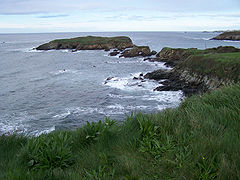
The coastline is a rich and complex environment at the edge of the marine environment including cliffs, beaches, harbors, headlands, bays, wetlands and islands.
Tagging coastlines in OSM
The natural=coastline tag is used to mark ![]() mean high water springs (also known as Mean High Water Level / MHWL) which is the point of highest tide. See natural=coastline for all the details. See also de:Coastline for much more details.
mean high water springs (also known as Mean High Water Level / MHWL) which is the point of highest tide. See natural=coastline for all the details. See also de:Coastline for much more details.
Using OSM coastline data
The presentation of the coastline is often more complex than that for other features.
The main problem of showing coastlines from OSM data is that many renderers really need closed polygons. The polygon can (and normally should) be made of several ways, but the ways should join end-to-end and eventually loop back round without interruption, to close the polygon. An imperfect coastline with many small gaps, reversed ways and other defects will cause the polygon to break, and the coastline to be rendered incorrectly . One of the features of the Coastline error checker is to try and join coastlines in such a way as to make high-quality coastlines even with these imperfections. As the coastlines are uploaded and completed the quality can be checked.
Rendering in Standard tile layer on openstreetmap.org
For OpenStreetMap Carto there can be significant delays between changes being made to the high water line and its appearance on the map. This can be easily several days.
At low zoom levels (used for z0-9), up to and including zoom level 9, Standard tile layer renders all the sea as a solid fill of blue, generated from the shapefile simplified-land-polygons-complete-3857.zip from osmdata.openstreetmap.de, which has a relatively low resolution. At higher zoom levels the coast polygons used are generated from a larger shapefile (land-polygons-split-3857.zip). These files are automatically generated daily from planet dumps + diffs, but they will only be made available if the coastlines are geometrically correct (or can be fixed to be correct, so no intersections etc.) and if they are not too different from the last valid coastline.
Coastline rendering in Standard tile layer on openstreetmap.org may update later than other rendering changes. There are two reasons for this:
- To avoid major disruptions of map rendering due to data errors (entire continents displayed as sea instead as land) the coastline is not automatically updated if there are larger changes in the geometry compared to the last time it was successfully processed. For example any addition or removal of a large lake with coastline tag will require manual intervention. You can look at the update times of the layers on https://osmdata.openstreetmap.de/data/land-polygons.html to see when the last successfull update of the coastlines was done.
- Normally changes in OSM data will be detected by the update process on the tile servers and affected tiles will be marked as to be updated. This does not always happen correctly for coastlines. The problem is that the need for the update might be detected and a re-rendering scheduled, but if at that time the new coastlines aren't available (see above), it will re-render the old coastlines. So sometimes it needs further changes to trigger the re-render again.
See also
- OSM Inspector view that helps fixing the coastline
- OSMCoastline A tool to create shapefiles for the coastline.
- Data Derived from OpenStreetMap for Download - includes processed coastline data