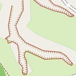
Tag:natural=earth_bank
Jump to navigation
Jump to search
| Description |
|---|
| Large erosion gully or steep earth bank. |
| Group: natural |
| Used on these elements |
| Useful combination |
| See also |
| Status: de facto |
| Tools for this tag |
|
A steep earth bank is an abrupt change in ground level which can be clearly distinguished from its surroundings, e.g. large erosion gullies, and scraps. Unlike a natural=cliff, which is mainly rock, an natural=earth_bank is mainly comprised of soil or a mix of soil and stones.
- Similar features
- For small erosion gullies (1-2.5 meters in width and less), which are designated by a single line, use the natural=gully.
- For man-made embankments use man_made=embankment.
How to map
For a linear way, the top of the object should be on the left side of the way direction and the bottom on the right side. Way represents the top of the object. (rule is the same as for cliff and retaining_wall).
Types of earth bank
Optionally you can use one of the specifying tags:
| Tag | Description | Photo |
|---|---|---|
| natural=earth_bank + earth_bank=gully | large erosion gully. For a small erosion gully use natural=gully. | 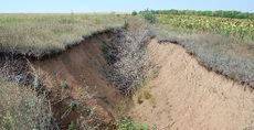
|
| natural=earth_bank + earth_bank=scarp | scarp. | 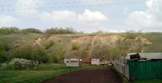
|
| natural=earth_bank + earth_bank=cut_bank | cut bank, river cliff. | 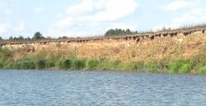
|
| natural=earth_bank + earth_bank=grassy_steep_slope | grassy steep slope, which can not be represented by SRTM or ASTER GDEM. | 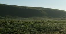
|
Tags used in combination
- depth=* - In case of relatively constant depth it could be indicated in meters.
- surface=* - Slope surface.
Rendering
Objects are not currently rendered in OSM Carto. The following image shows an example of rendering by Maperitive:

