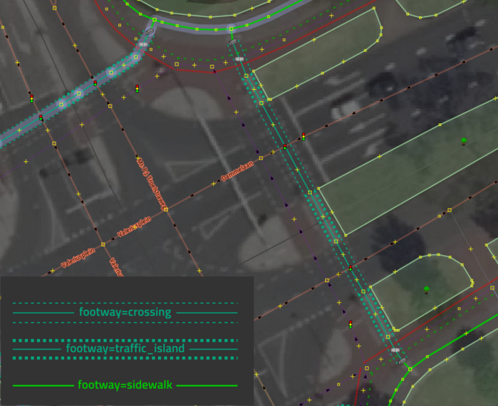
Tag:footway=traffic_island
| Description |
|---|
| Parts of a footway that serves as pedestrian refuge on a traffic island. |
| Group: highways |
| Used on these elements |
| Requires |
| Useful combination |
|
| See also |
| Status: in use |
| Tools for this tag |
|
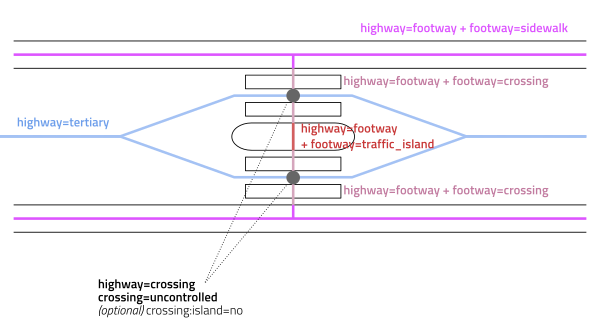
When a pedestrian crossing is mapped as multiple separate crossings (for example when crossing the two directions of traffic of a large highway=primary), the bit in between where ![]() pedestrians can find refuge and safely rest while crossing the road can be tagged with footway=traffic_island in addition to highway=footway.
pedestrians can find refuge and safely rest while crossing the road can be tagged with footway=traffic_island in addition to highway=footway.
Tagging these refuge sections of the crossing explicitly with footway=traffic_island provides data consumers with more information about the nature of the crossing (e.g., whether it can be made in steps or is one long crossing). It also tells other mappers that the crossing has traffic islands and that these bits of highway=footway have not been left without a footway=crossing accidentally.

Tagging
Tag the part of the footway that crosses the traffic island with footway=traffic_island. This way typically sits between two footways tagged with footway=crossing. Where multiple separate ways are crossed, you usually get alternating stretches of footway=crossing and footway=traffic_island.
Do not add crossing:island=yes to the highway=crossing node or footway=crossing way when the traffic islands are mapped separately like this.
Alternatives
Instead of tagging the location of the footways that cross the traffic island, the whole crossing can be tagged with footway=crossing instead. This is done, for example, where imagery is not available or sufficiently clear; usually the traffic flows are then not mapped separately either. In this case crossing:island=yes should be used if there is an island in between traffic flows where pedestrians can pause safely while crossing. See crossing:island=* for more information on this approach.

