Tag:highway=emergency_access_point
 |
| Description |
|---|
| Sign number which can be used to define your current position in case of an emergency. |
| Group: emergencies |
| Used on these elements |
| Useful combination |
|
| See also |
| Status: approved |
| Tools for this tag |
For areas which are hard to access, like woods or waterways, some countries offer a network of emergency access points. In case of an emergency you can call the emergency telephone number of the country and report the ID signposted on one of those access points. According to the ID you have given, the operator knows not only your exact location without the need of a description of yours, but sees further information like nearby helipads, access notes etc.
Some of these signs also offer a special phone number which should be called instead of the country's emergency number.
How to map
This tag is applied to nodes ![]() .
.
Using the tags highway=emergency_access_point and ref=* with the reference number / ID on the sign.
Additional tags if given / known are emergency_telephone_code=* with the phone number on the sign, operator=* with the operator, and name=* with the name of the sign.
Examples
| Photo | Remarks |
|---|---|
 |
In the United States, some local governments have deployed standardized location markers using USNG Emergency Location Markers (ELM’s). |
 |
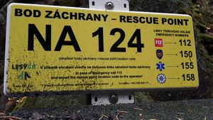
Rescue point sign in Czechia with Czech and English text |
 |
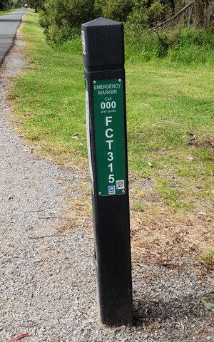
Victoria Australia emergency marker see https://data.gov.au/data/dataset/esta-emergency-markers |
See also
emergency=access_point– Sign with an ID which can be used to define your current position in case of an emergency (newer tag used by some mappers to map this feature). See this OSM Tag History for a comparison of the usage counts of both tags.emergency=assembly_point– A designated (safe) place where people can gather or must report to during an emergency or a fire drill