User:Extremecarver
| Babel user information | ||||||||
|---|---|---|---|---|---|---|---|---|
| ||||||||
| Users by language |
I support the existing CC-BY-SA 2.0 license and don't want data or active users to be abandoned.

Hello I'm Felix Hartmann a.k.a. extremecarver. I'm a ski and snowboard developper, and OSM evangelist. I spend most of my time developing openmtbmap.org and consulting on mapping / tag analysis. Last time I really updated this is 3/2010 so much of this is out of date...
Welcome to my page, feel free to contact me if you need information about Garmin map creation, especially about using TYP-Files and the OSM_Map_On_Garmin/mtb_map for mkgmap. I started getting involved with Openstreetmap as developper and mapper in September 2008. I am using it since August 2008. My main intention was that using OSM we can create for the first time good maps for outdoor sports, be it mtbiking, cycling or freeriding. I spent most of my time organising projects on OSM and working out concepts for map rendering.
Openmtbmap.org
- Please visit openmtbmap.org to download and test the maps. Maps available for all European Countries.
Openmtbmap aims to offer the best autorouting for mtbikers possible for Garmin GPS / Mapsource and offer a map that shows all objects interesting for cyclists. IMHO currently this is more or less the most feature complete OSM rendering.
Regions to which I have contributed a lot
- Anninger Moedling, Austria
- Valais and especially the Val D'Anniviers Switzerland
- Bezirk Neunkirchen Austria and Bezirk Liezen Austria
Wiki Pages I have created
- Mountainbike (there was some work done in German before, I reworked and translated the German pieces and got the portal going)
- OSM_Map_On_Garmin/mtb_map - This page is the reason why I have started all those proposals - Current maps for mountainbiking are not what we need - lets take a change with OSM....
- OSM_Map_On_Garmin/Cycle_map/TYP_files
- Mountainbiketours (I created the english version/translation, main work was done in German already)
- class:bicycle
Proposals initiated by me
- Proposed_features/mtb:scale
- Proposed_features/mtb:type
- Proposed_features/mtb:description
- Proposed_features/mtb_access
Projects I contributed much time and effort to
- mkgmap Testing and Bugreporting, as well as working on concept
Previously:
- OSM_Composer Testing and Bugreporting, as well as working on concepts. Found the whole concept to flaky and closed source ultimatly stopped me helping on development here.
My webpage - and downloading Garmin Maps
- I just registered openmtbmap.org and openmtbmap.com which both link here for the moment. In a few days I will offer mtb maps for Garmin devices for download on openmtbmap.org (I will redirect openmtbmap.com to it). Countries for the start will be Austria and Switzerland. Plus Bavaria and the Departement Haute-Alpes. I hope providing maps that take account of the mtb:scale will lead more people to use it. Have a look at theese maps once available. I promise that they are the nicest looking and most usefull OSM maps available yet. Spent lotta time designing them. Until I get openmtbmap.org going I might host the maps on a filehoster (will provide links tomorrow).
Snowboarding, Skiing and Raxskis
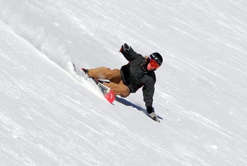
Besides OSM I spend loads of my time in the mountains. I consider myself to be one of the craziest freeriders of Austria and work with Tom, a friend of mine on bringing the ultimate Freeride Ski/Tool for everyone to you - the Raxski. Best search google for it, cause our webpage is crap (Relaunch with nice vids and pics hopefully by August/September this year).
Other interesting stuff
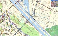
This screenshot uploaded by me of the cyclemap for Garmin for which I have written the progress of how to create it (main work consisted of adapting map-features for mkgmap and creating a good lookin Typ-file for Garmin) was chosen as Featured Image of the first week of October 2008
