Yue:Key:public_transport
Jump to navigation
Jump to search
 |
| 描述 |
|---|
| 公共交通工具基礎標籤 |
| 組: Public transport |
| 用喺呢啲元素 |
| 已記載嘅值: 12 |
| 常用組合 |
| 狀態:批咗 |
| 呢個標籤嘅工具 |
用法
- 睇睇: Public transport
public_transport 呢個關鍵字代表公共交通工具嘅停止位置同埋月台/站頭。停止位置會放一點喺條街上面。月台就放喺街嘅旁邊。呢兩樣嘢都係同stop_area 同埋route 有關係嘅。
喺60秒裡面標籤巴士站
停止位置
喺巴士行駛路線上面停站嘅嗰一點。
月台/站頭
乘客等嘅地方(點、線或者範圍):
月台/站頭範圍
增加同呢個站有關嘅所有關係,包括所有停車位置(角色:車站)同埋月台(角色:月台)[.]
type=public_transportpublic_transport=stop_areaname=*network=Bus network's name
值
| 關鍵字(Key) | 值 (Value) | 元件 (Element) | 描述 (Description) | 圖例 (Map Rendering) | 相 (photo) |
|---|---|---|---|---|---|
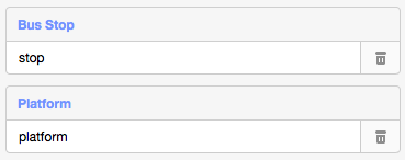
| public_transport | stop_position | 喺街上或者路軌上公共交通工具停站嘅位置。 |  | ||
| public_transport | platform | 乘客等公共交通工具嘅地方。 |  |
 | |
| public_transport | station | 指定嘅範圍可以搭到公共交通工具嘅。 |  | ||
| public_transport | stop_area | 包含所有公共交通工具元件嘅關係(例如火車、地鐵、單軌電車、電車、巴士、無軌電車、纜車、吊車或者渡輪)。 |  | ||
| public_transport | 用者自訂 | 根據Taginfo嘅常用值 |
This table is a wiki template with a default description in English. Editable here.
此表格由模版自動生成,協助改善粵語版本請按此。