RU:Comparison of editors
Jump to navigation
Jump to search
![]()
Эта страница находится в процессе перевода или помечена для этой цели, поэтому может содержать пропуски, ошибки и непереведённые фрагменты.
Исходная статья: Comparison of editors. Вы можете закончить перевод.
Если вы знаете английский, то можете помочь нам, переведя часть оригинальной статьи. Общие сведения о переводе статей на русский язык можно найти здесь.
Исходная статья: Comparison of editors. Вы можете закончить перевод.
Если вы знаете английский, то можете помочь нам, переведя часть оригинальной статьи. Общие сведения о переводе статей на русский язык можно найти здесь.
![]()
Сравнительная таблица
| Название | Для новичков | Платформа | Написан на языке | Тип редатора | Продолжает разрабатываться | Windows | Linux | macOS | Android | iOS | Бесплатный | Преимущества | Недостатки |
|---|---|---|---|---|---|---|---|---|---|---|---|---|---|
| iD | да | веб-редактор | JavaScript | полнофункциональный | да | да | да | да | да | да | да | Работает практически везде | |
| JOSM | нет | для компьютеров | Java | полнофункциональный | да | да | да | да | нет | нет | да | Широко настраиваемый функционал, расширяемый плагинами. Имеется поддержка отката чужих пакетов правок | труден для изучения |
| Vespucci | нет | для мобильных | Java | полнофункциональный | да | нет | нет | нет | да | нет | да | ||
| Go Map! | нет | для мобильных | Objective-C, Cocoa, and Swift | полнофункциональный | да | нет | нет | нет | нет | да | да | ||
| StreetComplete | да | для мобильных | Kotlin and Java | только для решения предлагаемых программой квестов | да | нет | нет | нет | да | нет | да | ||
| OsmAnd | нет | для мобильных | Java and C++ | просмотр карты с редактированием POI | да | нет | нет | нет | да | да | бесплатен ограниченный функционал | Интегрируется с JOSM | |
| MapsMe | да | для мобильных | C++ | просмотр карты с редактированием POI | да | нет | нет | нет | да | да | да | ||
| Locus | нет | для мобильных | неизвестно | просмотр карты с редактированием POI | да | нет | нет | нет | да | нет | нет | ||
| ArcGIS | нет | GIS plugin | неизвестно | полнофункциональный | да | да | да | да | нет | нет | нет | Очень дорогой | |
| Level0 | нет | веб-редактор | PHP | низкоуровневое текстовое редактирование объектов | Стабилен | да | да | да | да | да | да | ||
| Merkaator | нет | для компьютеров | C++ QT | полнофункциональный | Заброшен | да | да | да | нет | нет | да | Иногда может портить объекты-отношения на карте | |
| Potlatch 3 | да | для компьютеров | Adobe Flex | полнофункциональный | Заброшен | да | да | да | нет | нет | да | Бывший веб-редактор, но после прекращения поддержки Flash, требует установки на компьютер |
JOSM

- Описание
- JOSM предлагает большой набор функций и полезных инструментов для широкого спектра редактирования стилей: Он читает GPX треки как с вашего жесткого диска, так и загружает их с OSM. Аэрофотоснимки также можно легко загрузить в качестве фона для трассировки. JOSM поддерживает photo mapping и audio mapping. Как только вы закончите свои изменения, вы можете загружать их на OSM.
- За
-
- Быстрое гладкое панорамирование и масштабирование. Практически бесконечное масштабирование для сверх-точной картографии.
- Может работать в автономном режиме, используя загруженные файлы данных, локальные фото и файлы GPX.
- * Расширенный функционал редактирования. Например, преобразование группы узлов в окружность.
- Против
-
- Изучение тонкостей интерфейса займёт некоторое время.
- Требует Java 8 (небольшая проблема для большинства).
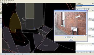
Potlatch 2

Potlatch 2 screenshot. Showing background imagery
- Summary
- Flash online редактор.
- За
-
- Он прямо здесь, во вкладке 'Edit'
- It allows quick easy immediate editing. Map changes can be sent back to the server as you make them.
- Bing and other imagery immediately available as backgrounds for tracing.
- GPS треки доступны как отдельный слой.
- Против
-
- It's not intended for power users (who are already excellently served by JOSM) or those who want the speed of a desktop client.
- Zooming and panning prompts a map fetch (not as fluid)
- photo mapping and other file accessing features are not possible
- Requires Flash (not a big problem for most people)
- Нет возможности работать полностью автономно, оффлайн.
Potlatch 1
- Summary
- Old version of the Potlatch editor offering quite a different editing experience, but it has similar pros and cons as the current Potlatch 2.
- It is still available on the edit tab (hover over the tab with your mouse).
Merkaartor

- Summary
- Merkaartor is a small editor for OpenStreetMap available under the GNU General Public License and developed using the Qt toolkit.
- More information, screenshots and download
- Pros
-
- Has some unique features like transparent display of map features like roads and true curved roads.
- Intuitive user interface
- Binaries for Windows, Mac OS X and some Linux platforms is available. Source for the rest.
- Easy to set up satellite imagery from Yahoo or any other WMS source.
- Tag styles can be customized
- Save rendered maps as SVG or bitmap graphic
- Против
-
- Merkaartor is under early development, which make new and exciting features available only by grabbing the source.
- Albeit under development (and it's not bad at all) it is very memory hungry and can freeze the machine while page-swapping (lots of disk activity)
Quantum GIS
- Pros
-
- Very comprehensive GIS program
- Бесплатен.
- Против
-
- Not focused on OpenStreetMap editing
ArcGIS
- Summary
- Esri has released a plugin for editing OSM data.
- Can be downloaded from: http://esriosmeditor.codeplex.com
- Pros
-
- Industry standard GIS Program
- Very comprehensive GIS capabilities
- Против
-
- Весьма дорог.
- Работает только с ArcGIS 10
- Редактирование отношений не поддерживается
См. также
- Editing - list of different editors (many others not described here)
- Software - list of other software categories including mobile apps (some of which have editing functionality)
- Comparison of discontinued editors - old sections moved off this page
- Component overview - Technical overview of OpenStreetMap showing how editors fit in