Cargobike

As Cargobikes (also called freight bikes) have special needs in comparison to classic bicycles, this page wants to highlight and promote tags which improve the usability of cargo bike applications.
Barriers
Possible barriers which reside on-street, which could block the drive through are:
| Example | Type | Key | Description |
|---|---|---|---|

|
Curb/Kerb | barrier=kerbheight=*
|
Whether there is a kerb on the way. Mapped as a node. Add height as height=* (in meter) and type as kerb=*
|

|
Crossing (like traffic island) | highway=crossingcrossing:island=yes
eventually: |
Crossings which have kerbs |

|
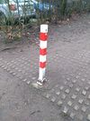
One or multiple Bollard | barrier=bollard maxwidth:physical=*
|
Maximum width in meter |

|
Cycle barrier | barrier=cycle_barrier and bicycle=*
|
Should slow down or prevent drive through for motor vehicles and/or bicycles |
General Barriers can be a huge pain, so to run past those barriers the width vehicles can pass is essential. You can tag it like this:
| Description | Key | Value |
|---|---|---|
| Maximum width for vehicles | maxwidth=*
|
Maximum legal width allowed. |
| Maximum physical width for vehicles | maxwidth:physical=*
|
Maximum possible width between individual barriers like bollards or between barrier and street edge. |
Way widths

Cargo bikes have to use bicycle infrastructure in some country, if it exists (mandatory use). But some cycleways are too narrow to get through. Therefore the width is essential to know for cargo bike applications. Depending how the infrastructure is mapped, different tagging schemas are necessary.
| Description | Key | Value |
|---|---|---|
| Width of cycleway or street | width=*
|
Measured width in meter |
| Estimated width of cycleway | est_width=*
|
Estimated width, if better measurement is not possible. Try to replace with width=* in future, if possible.
|
| Width of cycle lane/track | cycleway:left:width=* |
Measured width of cycle lane/track |
| Width of cycle lane/track | cycleway:width=*
|
Measured width if cycleway is separated from e.g. footway but is same way |
Street quality
Street smoothness is important to cargo bikes since those vehicles could also transport sensitive cargo. Also, for multilane bikes this worsen the ride.
| Description | Key | Value |
|---|---|---|
| Smoothness | smoothness=* or cycleway:smoothness=* or |
See Bicycle for appropriate tagging.
For example if cycleway is shared with foot but is different, use |
| Surface of street / cycleway | surface=* or cycleway:surface=* orcycleway:left:surface=* orcycleway:right:surface=* orcycleway:both:surface=*
|
See Bicycle for appropriate tagging.
For example if cycleway is tagged as a lane on the right hand side, use |
| Cross slope | incline:across=*
|
Like incline=*, in percentage
|
Parking

For parking, some cities install some specially designed parking infrastructure.
| Tag-Description | Key | Value |
|---|---|---|
| Special Cargobike parking exists (and/or) is designated | cargo_bike=*
|
cargo_bike=yes If possible, but not designed for and cargo_bike=designated if specially designed for it.
|
| Number of parking spaces | capacity:cargo_bike=*
|
Count parking space specifically designed for cargo bikes |
Current tagging issues
The tagging scheme of barrier=cycle_barrier currently not suffices for deciding if cargobikes can pass them. There are currently no tags which can describe the geometry of cycle barrier. Because of the wide variety of shapes and constructions of cargobikes, you can not determine if it can pass or not. Width details would be needed to describe the gaps between the individual barrier elements and the barrier itself and the wayside.
See also
- Bicycle - General bicycle infrastructure mapping
Applications
- CargoRocket - Routing and rating applications, specifically designed for cargobikes
- BRouter - routing for cyclists which allows for highly customizing the routing profile
Online Maps
- CyclOSM - a free rendering project for every cyclist