File:Flag of Bangladesh.svg
Jump to navigation
Jump to search

Size of this PNG preview of this SVG file: 800 × 480 pixels. Other resolutions: 320 × 192 pixels | 1,024 × 614 pixels | 1,280 × 768 pixels.
Original file (SVG file, nominally 1,000 × 600 pixels, file size: 165 bytes)
This file and its description are from Wikimedia Commons.
Summary
| Description |
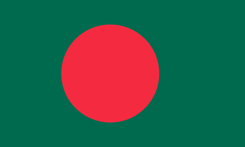
বাংলা: বাংলাদেশের জাতীয় পতাকা
Dansk: Bangladeshs flag
Deutsch: Die Flagge Bangladeschs
English: The flag of Bangladesh
العربية: علم بنغلاديش
Esperanto: La flago de Bangladeŝo
Español: Bandera de Bangladesh
Suomi: Bangladeshin lippu
Français : Le drapeau du Bangladesh
Italiano: Bandiera del Bangladesh
La .lojban.: le bengo lanci
Nederlands: De vlag van Bangladesh
Русский: Флаг Бангладеш
Slovenščina: Državna zastava Bangladeša
Svenska: Bangladeshs flagga |
||||||||
| Date | 1972-present | ||||||||
| Source |
|
||||||||
| Author | See File history below for details. | ||||||||
| Permission (Reusing this file) |
|
||||||||
| Other versions |
Derivative works of this file: Flag-map of Bangladesh.svg:
|
||||||||
| SVG development |


.svg)
.svg)
| Color Reference | ||
|---|---|---|
| Color model | Green | Red |
| Procion (official specification) |
Brilliant Green H-2RS 50 parts per 1000 | Brilliant Orange H-2RS 60 parts per 1000 |
| Pantone | 342c | 485 |
| CMYK | 100-0-26-58 | 0-83-73-4 |
| (Hex) | #006a4eff | #f42a41ff |
| RGB | 0,106,78 | 244,42,65 |
Assessment

|
This is one of the images forming part of the Valued image set: Flags of SAARC member countries on Wikimedia Commons. The image set has been assessed under the valued image set criteria and is considered the most valued set on Commons within the scope:
You can see its nomination at Commons:Valued image candidates/Flags of SAARC member countries. |
This image was selected as picture of the day on Bengali Wikipedia.
|
File history
Click on a date/time to view the file as it appeared at that time.
| Date/Time | Thumbnail | Dimensions | User | Comment | |
|---|---|---|---|---|---|
| current | 05:12, 30 September 2023 | | 1,000 × 600 (165 bytes) | wikimediacommons>Fenn-O-maniC | The official Procion specifications are meant for manufacturing and dying the flag and can't really be applied directly to digital format as the resulting colour could vary depending on the material and amount of dye used etc. Until the Bangladeshi officials regulate the digital colour standards the best way is to approximate the file's colours on how the flag looks in physical form, which the dark green and red version does the best. |
File usage
The following 36 pages use this file:
- 2017 South Asian Floods
- Asia
- Comparison of Asian road signs
- Contributors
- Cs:Tag:route=train
- Eurasia
- List of OSM centric Facebook accounts
- List of OSM centric Telegram accounts
- List of territory based projects
- National Dialogue
- OSM 17th Birthday Celebration - Asia Pacific
- OpenStreetMap 15th Anniversary Birthday party
- OpenStreetMap 17th Anniversary Birthday party
- OpenStreetMap 18th Anniversary Birthday party
- OpenStreetMap 20th Anniversary Birthday party
- Past events 2019
- Pt:Tag:boundary=administrative
- Research
- State of the Map
- Tag:boundary=administrative
- Tag:route=train
- WikiProject Bangladesh
- Zh-hans:Asia
- Zh-hans:List of territory based projects
- User:Aftab
- User:Brazilsingh
- User:Md Atikuzzaman Limon
- User:Skippern/World
- Template:Admin level
- Template:Countries of Asia
- Template:FR:Admin level
- FR:Key:admin level
- ES:Investigación
- ES:Tag:route=train
- JA:OSMを中心としたFacebookアカウントの一覧
- JA:OpenStreetMap 15th Anniversary Birthday party