File:Indian Ocean Tracetrack Topo.png
Jump to navigation
Jump to search

No higher resolution available.
Indian_Ocean_Tracetrack_Topo.png (320 × 240 pixels, file size: 149 KB, MIME type: image/png)
Summary
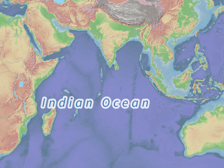
| Description | Rendering example of place=ocean. |
|---|---|
| Author | Tiles courtesy of Tracestrack. Terms of Use |
| Source | https://www.openstreetmap.org/#map=2/-10.3/62.9&layers=P |
| Date | 2023-12-04 |
Licensing

The copyright holder of this file allows anyone to use it for any purpose, provided that the copyright holder is properly attributed. Redistribution, derivative work, commercial use, and all other use is permitted.
If you are the uploader, please provide proper attribution including source and name of author.
If you are the uploader, please provide proper attribution including source and name of author.
File history
Click on a date/time to view the file as it appeared at that time.
| Date/Time | Thumbnail | Dimensions | User | Comment | |
|---|---|---|---|---|---|
| current | 21:50, 13 December 2023 | | 320 × 240 (149 KB) | Maro21 (talk | contribs) | {{Information | description = Rendering example of place=ocean. | source = https://www.openstreetmap.org/#map=2/-10.3/62.9&layers=P | date = 2023-12-04 | author = Tiles courtesy of Tracestrack. [https://wiki.osmfoundation.org/wiki/Terms_of_Use Terms of Use] }} |
You cannot overwrite this file.
File usage
The following 34 pages use this file:
- Ar:Map Features
- Cs:Key:place
- Cs:Map Features2
- Fi:Key:place
- Oc:Elements cartografics
- Oc:Key:place
- Pl:Tag:place=ocean
- Pt:Tag:place=ocean
- Tag:place=ocean
- Uk:Tag:place=ocean
- Wiki:Files used by data items/3
- Template:Ar:Map Features:place
- Template:Az:Map Features:place
- Template:Cs:Map Features:place
- Template:DE:Map Features:place
- Template:Da:Map Features:place
- Template:FR:Map Features:place
- Template:Fi:Map Features:place
- Template:Generic:Map Features:place
- Template:It:Generic:Map Features:place
- Template:JA:Map Features:place
- Template:NL:Map Features:place
- Template:Oc:Map Features:place
- Template:Pl:Generic:Map Features:place
- Template:RU:Generic:Map Features:place
- Template:Zh-hant:Map Features:place
- DE:Key:place
- FR:Key:place
- FR:Éléments cartographiques
- ES:Tag:place=ocean
- IT:Tag:place=ocean
- RU:Tag:place=ocean
- JA:Key:place
- JA:Map Features