Texas/Map features
This page is a supplement to Map Features that describes how to map in Texas. Whereas Map Features and other pages in the Key: and Tag: namespaces of this wiki offer general advice that applies globally, this page describes tagging conventions that are peculiar to Texas in OpenStreetMap and offers examples that are familiar to Texas residents.
Roadways
Road classifications
Motorway: Divided highway with 2 or more traffic lanes in each direction of travel, 55mph or greater speed limit, grade separated (no at-grade intersections), limited or controlled access through the use of entrance/exit ramps, no access from private or business driveways. Has feeder roads. This includes US Interstate Highways, Toll roads, Freeways and State Highways as long as they are divided and grade separated. Usually has shoulders or breakdown lanes. This covers US Interstate Highways and toll roads.
- Use these tags:
- Highway=motorway
- Oneway=yes
- Maxspeed=number
- Minspeed=number
- Name=name of the motorway
- Ref=reference_name
- Lanes=number
- Use these tags for special situations:
- Highway=motorway_link for entrance and exit ramps.
- Highway=motorway_junction for connections to motorway_links and add the exit number.
- Bridge=yes at bridges and overpasses.
- Layer=1 for the bridge segment.
- Tunnel=yes at tunnels.
Motorway_link: An entrance/exit ramp to a motorway.
- Use these tags:
- Highway=motorway_link
- Highway=motorway_junction for node connections to motorway_links and add the exit number.
Trunk: Divided highway with few at grade crossings. Usually limited access but may have a few intersections controlled by traffic signals, some private and business driveways. Does not have feeder roads. 55mph or greater speed limit, usually has shoulders or breakdown lanes. This covers US Highways.
- Use these tags:
- Highway=trunk
- Oneway=yes
- Maxspeed=number
- Minspeed=number
- Name=name of the trunk
- Ref=reference_name
- Lanes=number
- Use these tags for special situations:
- Highway=trunk_link for entrance and exit ramps.
- Bridge=yes at bridges and overpasses.
- Layer=1 for the bridge segment.
- Tunnel=yes at tunnels.
Trunk_link: An entrance/exit ramp to a trunk. May be a large sweeping right turn lane from the trunk road to a lesser road that allows right turning traffic to bypass the intersection and traffic lights.
- Use these tags:
- Highway=trunk_link
Primary: A highway that is a main thoroughfare or links larger cities and that does not meet any higher criteria. Business route through cities. May be multi-lane and have a lot of business’. A very busy and important road. 55mph or greater speed limit except in urban areas. In rural areas probably has shoulders or breakdown lanes. This covers State Highways.
- Use these tags:
- Highway=primary
- Oneway=yes if one way road
- Maxspeed=number
- Minspeed=number
- Name=name of the road'
- Ref=reference_name
- Loc_name=local name - unofficial or local name for the road (a State Highway might have a local name through a small town).
- Lanes=number
- Use these tags for special situations:
- Bridge=yes at bridges and overpasses.
- Layer=1 for the bridge segment.
- Tunnel=yes at tunnels.
Secondary: Urban arterials that connect to higher highway networks. Rural highways that connects smaller cities although may not be the most traveled route. Less busy than Primary with fewer business’. Blvd, Ave, most city thorough fairs, freeway feeder roads in urban areas, hard paved, striped, 2 or more lanes in each direction of travel, may or may not be divided and/or one-way, 45-55mph or greater. May or may not have shoulders. Grade crossings controlled by traffic lights with few if any stop signs.
- Use these tags:
- Highway=secondary
- Oneway=yes if one way road
- Maxspeed=number
- Name=name of the road
- Ref=reference_name
- Loc_name=local_name - unofficial or local name for the road (a State Highway might have a local name through a small town).
- Lanes=number
- Use these tags for special situations:
- Bridge=yes at bridges and overpasses.
- Layer=1 for the bridge segment.
- Tunnel=yes at tunnels.
Tertiary: Farm to Market roads and most 2 lane roads in cities – hard paved, striped, 55mph or greater (except in towns where the speed limit is reduced), may or may not have shoulders. Less busy than Secondary with fewer business’.
- Use these tags:
- Highway=tertiary
- Oneway=yes if one way road
- Maxspeed=number
- Name=name of the road
- Ref=reference_name
- Loc_name=local_name - unofficial or local name for the road (a State Highway might have a local name through a small town).
- Lanes=number
- Use these tags for special situations:
- Bridge=yes at bridges and overpasses.
- Layer=1 for the bridge segment.
Unclassified: County Roads – hard paved or gravel, no paint stripes; rural highway feeder roads or highway u-turn lanes under an overpass. Typically 45-55mph, no shoulders.
- Use these tags:
- Highway=unclassified
- Oneway=yes if one way road
- Maxspeed=number
- Name=name of the road
- Ref=reference_name
- Loc_name=local_name - unofficial or local name for the road (a State Highway might have a local name through a small town).
- Lanes=number
- Use these tags for special situations:
- Bridge=yes at bridges and overpasses.
- Layer=1: for the bridge segment.
Residential: Roads in Sub-divisions with close set houses, 35mph or less, has "Children at Play" signs. May also have Churches, schools or a minor business’ as well.
- Use these tags:
- Highway=residential
- Maxspeed=number
- Name=name of the road
- Ref=reference_name
Service: Alley, Business Driveway, Parking Isles, Privately maintained road used by several houses or a small subdivision or trailer park - May be paved or unpaved, narrow, 45mph or less, no shoulders, not maintained by State, County or City.
- Use these tags:
- Highway=service
- Maxspeed=number
- Name=name of the road
- Ref=reference_name
- Use these tags for special situations:
- Amenity=parking for parking areas.
- Service=parking_aisle for driving lanes between parking spots.
- Amenity=Fuel for a gas station.
- Service=alley
- Service=driveway
Private: Private drive ways and farm roads.
- Use these tags:
- Highway=service with service=driveway or highway=track. Add access=private
Track: Used for non-public access to farm land. Not maintained or paved, no street name or addresses. Unimproved forest roads. May require off road vehicle depending on weather conditions.
- Use these tags:
- Highway=track
History
- For objects and features from history that no longer exist, please consider https://openhistoricalmap.org/.
- To identify an object/feature of historic interest, use
historic=*.
National Register of Historic Places
There are 3,000 historic properties and districts in Texas that are listed in the National Register of Historic Places. The NHRP wiki page describes how to tag historical places.
Texas Historical Commission
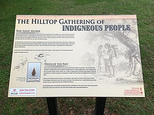
The Texas Historical Commission is an agency dedicated to historic preservation within the state of Texas. The commission identifies Recorded Texas Historic Landmarks and recognizes them with Official Texas Historical Marker medallions and descriptive plaques, State Archeological Landmarks and Historic Texas Cemeteries. The commission also operates the over 13,000 historical markers throughout the state of Texas.
The agency also maintains the online Texas Historic Sites Atlas featuring more than 300,000 site records, including data on Official Texas Historical Markers and National Register of Historic Places properties in Texas.
Recorded Texas Historic Landmark
Recorded Texas Historic Landmark (RTHL) is a legal designation and the highest honor the state can bestow on a historic structure. The Texas Historical Commission awards RTHL designation to buildings that are judged worthy of preservation based on architectural and historical merit.
Official Texas Historical Markers
The purpose of Official Texas Historical Markers, which are available in a variety of types (cemetery, building, subject) and sizes, is to educate the public about the history of the world around them. The reference numbers are all available on the Historic Sites Atlas linked above.


