uMap/Guide/Edit layer properties

The properties of a layer define the administrative properties, appearance of the layer, interactive behavior, appearance and defaults for objects.
These properties can be set/modified with panel Layer properties.
Recipe:
- Enter edit mode by ![]()
- Select on the right side Manage layers ![]()
- Select button Edit layer for the layer to be modified. ![]()
A short description of these properties is shown below. The numbers in the picture refer to the chapters in this article.
Name and description (1)
Enter name and description in the appropiate fields.
The description may contain text formatting
Type of layer (2)

The menu for the layer type shows 3 options to display the Markers:
- Default : Shows the marker symbol for every marker.
- Clustered : Groups markers and shows the number, depending on the zoom level.
- Section Advanced properties shows additional control options. (option titles are here below the fields to be filled).
 Symbol examples:
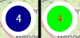


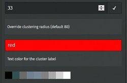
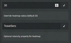
- Heatmap: Shows a 'heatmap' of the markers, depending on the zoom level.
- Section Advanced properties shows additional control options including an option to use the value of a self defined property to control the display. (option titles are here below the fields to be filled).

Display on load (3)
This option determines if a layer is displayed when the map is loaded
Data is browsable (4)
This option determines if the objects on the layer can be browsed.
Shape properties (5)
Defaults on layer level for properties like color are defined here. These properties are not valid for all objects. For explanation see:
Advanced properties (6)
Defaults on layer level for properties Simplify and dash line are defined here. For explanation see:
The Default zoom level can be set for this layer. For explanation see:
Plus some options to control the display of the layer type as shown in Type of layer.

Interaction properties (7)
Defaults on layer level for object label and object popup. See Configure shape interaction (labels…) for details.
Remote data (8)
This option enables extracting the content of the layer from a remote source.
Note: Remote data is displayed in front of existing objects on the layer.
This option will be elaborated in a separate article. For now see DE:UMap/overpass and FR:UMap/Guide/Importer des données avec Overpass.

Versions (9)
Expanding this button shows the last 10 versions of the layer. Each layer has its own history.
This list enables restore of a previous version. Recipe:
- Select the version to be restored (no preview !)
- Select OK or Cancel in the confirmation popup.

Advanced actions (10)
Actions:
- Delete the layer.
- Clone the layer
- Empty. Remove all content of the layer
- Download. See Export data of a layer