JA:Tag:highway=steps
Jump to navigation
Jump to search
| 説明 |
|---|
| 歩道や小道上の一連の階段です。 |
| OSM Cartoでのレンダリング |

|
| グループ: 道路 |
| 適用できる要素 |
| 含まれる意味 |
| よく併用されるタグ |
|
| 関連項目 |
| 状態:事実上の標準 |
| ツール |
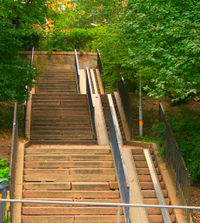
歩道上の一連の階段です。
マッピング方法
階段の長さのウェイ ![]() を追加し、 highway=steps でタグ付けしてください。
を追加し、 highway=steps でタグ付けしてください。
階段の上りまたは下りの方向は、 — ウェイの方向が上を向いている場合は — incline=up タグを使用し、 incline=down タグも同様に使用します。 習慣として、ウェイの向きはできるだけ上り方向にしますが、 incline=* キーは常にウェイに追加してください(詳しくは英語版の議論ページを参照)。
以前は、 direction=up/down タグが incline=up/down タグの代わりに使われていましたが、 direction=* キーはいくつかの他の目的に使われているので価値が下がりました。
併用されるタグ
- step_count=* で階段の段数を追加することができます。
- handrail=* は手すりがあるところを示すために使います。
- tactile_paving=yes/(no)/incorrect 階段の起点と終点に、目が不自由な人がステッキで見つけられるよう点字ブロックがあるかどうかを示します。
- tactile_writing=yes/no indicates whether there is tactile writing available at the handrail(s) of the steps.
- Note: If the handrail(s) is/are mapped separately with barrier=handrail, the key should be added on to this feature.
- Note: If possible, the type of tactile writing which is available should always be specified, for example with tactile_writing:braille:XX=yes, where XX is a language code, for example ja for Japanese
 , see tactile_writing=* for details.
- surface=* は表面を示します。
- ramp=* はスロープがあるかどうかを示します。
- level=* 階段が接続したり通り抜けたりする階数(例えば駅などで)
- level=0;1 地上階(1階)と2階の間の階段(訳注: 日本とは異なり、階数は0から始まります)
- width=* メートル単位の幅
- name=* 階段に特別な名前がある場合に追加します
エスカレーター
highway=steps + conveying=yes/forward/backward/reversible
エスカレーターの方向は、 incline=up/down で示すこともできます。詳しくは conveying=* を参照してください。
例
| 画像 | タグ |
|---|---|

|
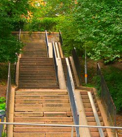
highway=steps |
|
highway=steps ramp=yes |
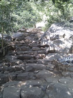
|
highway=steps ramp=no |

|
highway=steps surface=dirt |
レンダリングの例
関連項目
- Proposal:Access Ramp は独立した斜路をタグ付けするための提案です
- Proposal:Area-steps は面の階段をマッピングするための2015-03-04からの提案です
- Relations/Proposed/Area#Area-steps は面の階段をマッピングするための2009-12-02からの提案です
- Stairs modelling もっと詳細をモデリングするためのいくつかの考え
- Proposal:Steps features 階段を表す追加タグ
- MENTZ GmbH/Modellierungsvorschläge Indoor#Treppen(de)
| ||||||||||||||||||||||||||||||
