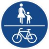
Key:segregated
 |
| Description |
|---|
| Shows if a shared path is segregated or not. |
| Group: highways |
| Used on these elements |
| Documented values: 2 |
| Useful combination |
| Status: de facto |
| Tools for this tag |
|
This key is used for designated combined cycle- and footways.
If both have their own lane, tag segregated=yes.
If they share one lane, tag segregated=no.
This key has no default value and tagging it is useful in many cases!
Note that segregated=no may be safely assumed in at least some cases.
As result, if path allows multiple transport modes (such as cyclists and pedestrians) it is always OK to explicitly tag segregated=no or segregated=yes but it is not useful to always require it.
Tagging
* highway=cycleway/footway/path + bicycle=designated + foot=designated + segregated=yes
|
 |
highway=cycleway/footway/path + bicycle=designated + foot=designated + segregated=no
|
 |
Examples
-
Segregated cycle- and footway.
-
Segregated cycle- and footway by a painted line.
-
Pedestrians and cyclists share the same lane. The way is not segregated.
See also
- Tag:highway=cycleway
sidewalk=*/shoulder=*- used for indicating whatever there is separate space for pedestrians on a roadcycleway:right=*/cycleway:left=*/cycleway:both=*- used for indicating whatever there is separate space for cyclists on a roadcycleway:surface=*+footway:surface=*- used for mapping different surfaces on combined footway + cycleway


