Featured images/Jul-Sep 2010
(Redirected from Featured Images/Jul-Sep 2010)

These are featured images, which have been identified as the best examples of OpenStreetMap mapping, or as useful illustrations of the OpenStreetMap project.
If you know another image of similar quality, you can nominate it on Featured image proposals.
| ← from July to September 2009 | ← from April to June 2010 | from October to December 2010 → | from July to September 2011 → |
Gallery of featured images, from July to September 2010
-
 2010, week 27
 -
 2010, week 28
 -
 2010, week 29
 -
 2010, week 30
 -
 2010, week 31
 -
 2010, week 32
 -
 2010, week 33
 -
 2010, week 34
 -
 2010, week 35
 -
 2010, week 36
 -
 2010, week 37
 -
 2010, week 38
 -
 2010, week 39
Details and captions
Week 27 (from Monday 5 July 2010 to Sunday 11 July 2010) [Edit]

- English : GpsDrive showing OpenCycleMap tiles of Balearic Islands
Week 28 (from Monday 12 July 2010 to Sunday 18 July 2010) [Edit]

- English : State Of The Map 2010 in Girona
Week 29 (from Monday 19 July 2010 to Sunday 25 July 2010) [Edit]

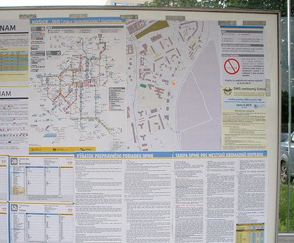
- English : Kosice bus/tram stop using OSM maps
Week 30 (from Monday 26 July 2010 to Sunday 1 August 2010) [Edit]

- English : Participants of Graian Alps Mapping Party, the second event on Italian mountain. We were guest of Gran Paradiso National Park at the hunting lodge of King
Week 31 (from Monday 2 August 2010 to Sunday 8 August 2010) [Edit]

- English : Distribution of natural=tree nodes in Szczecin obtained from the city's cadastre bureau. (Project of the week/2010/Aug 01 is to add more)
Week 32 (from Monday 9 August 2010 to Sunday 15 August 2010) [Edit]

- English : Jhabjan's map of Sinj in Croatia, printed for tourism office. Aerial images were donated by local aerial club.
Week 33 (from Monday 16 August 2010 to Sunday 22 August 2010) [Edit]

- English : 6 years after OSM was started, the British Isles are finally starting to look mapped
Week 34 (from Monday 23 August 2010 to Sunday 29 August 2010) [Edit]

- English : Hamburg has a large carnival three times a year for each 4 weeks. User mbuege maps all the attractions and fast food stands.
Week 35 (from Monday 30 August 2010 to Sunday 5 September 2010) [Edit]

Week 36 (from Monday 6 September 2010 to Sunday 12 September 2010) [Edit]

- English : You don't need fancy gear to do mapping for OSM. Sometimes, all you need is a sketchpad, pen and some attention to detail. Here's seav's sketchpad of the Ortigas slice during the Ortigas-Mandaluyong Mapping Party.
Week 37 (from Monday 13 September 2010 to Sunday 19 September 2010) [Edit]

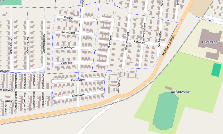
- English : Building outlines in Staffanstorp, Sweden courtesy of the town council GIS.
Week 38 (from Monday 20 September 2010 to Sunday 26 September 2010) [Edit]

- English : An 8bit-game-like map of New York City based on OSM data. http://8bitnyc.com/
Week 39 (from Monday 27 September 2010 to Sunday 3 October 2010) [Edit]

- English : OSM map of Merida[1], Venezuela. Data by Fundacion GeoHorizontes de Venezuela. Data collected by HernanRamirez.