Kingdom of the Netherlands
Jump to navigation
Jump to search

The following text is a translation of the original article in Dutch, reviewed for rev2426907. Insert all new information or information which are specific to your place before this notice.
Please avoid changing radically this text without translation also updating the original article, and notify the international community or ask for help on this site. Orthographic, grammatical, lexical or stylistic corrections are welcome.
Please avoid changing radically this text without translation also updating the original article, and notify the international community or ask for help on this site. Orthographic, grammatical, lexical or stylistic corrections are welcome.
| Conventies: |
| Deelprojecten: |
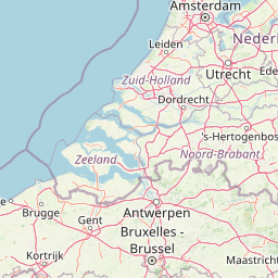
Provinces of the Netherlands: Noord-Brabant · Gelderland · Zuid-Holland · Noord-Holland · Zeeland · Utrecht · Fryslân · Overijssel · Groningen · Drenthe · Limburg · Flevoland
| V・T・E |
| latitude: 35.42, longitude: -31.52 |
| Browse map of the Kingdom 35°25′12.00″ N, 31°31′12.00″ W |
| Edit map |

|
|
External links:
|
| Use this template for your locality |
Kingdom of the Netherlands is a sovereign state on Earth at latitude 35°25′12.00″ North, longitude 31°31′12.00″ West. It consists of the countries The Netherlands, Aruba, Curaçao, and Sint Maarten, located in Europe and the Caribbean.
Administrative divisions
| Kingdom | Country[1] | Country per continent |
|---|---|---|
| boundary=administrative | boundary=legal | |
| admin_level=2 | admin_level=3 | place=region |
ISO3166-1:alpha2=NL operator=Koninkrijk der Nederlanden |
No ISO 3166 codes[2] operator=Staat der Nederlanden |
Europees Nederland No ISO 3166 codes operator=Staat der Nederlanden |
| Caribisch Nederland ISO3166-1:alpha2=BQ operator=Staat der Nederlanden | ||
ISO3166-1:alpha2=AW, ISO3166-2=NL-AW operator=Land Aruba | ||
ISO3166-1:alpha2=CW, ISO3166-2=NL-CW operator=Land Curaçao | ||
ISO3166-1:alpha2=SX, ISO3166-2=NL-SX operator=Land Sint Maarten | ||
Geographical divisions
| Kingdom | Kingdom per continent | Islands group | Island |
|---|---|---|---|
| boundary=administrative | boundary=* | boundary=place | boundary=administrative |
| admin_level=2 | place=region | ||
ISO3166-1:alpha2=NL |
Europees Nederland | ||
| Nederlands Caribisch gebied |
ABC-eilanden |
ISO3166-1:alpha2=AW, ISO3166-2=NL-AW | |
ISO3166-2=BQ-BO, ISO3166-2:2=NL-BQ1 | |||
ISO3166-1:alpha2=CW, ISO3166-2=NL-CW | |||
| SSS-eilanden |
ISO3166-1:alpha2=SX, ISO3166-2=NL-SX | ||
ISO3166-2=BQ-SA, ISO3166-2:2=NL-BQ2 | |||
ISO3166-2=BQ-SE, ISO3166-2:2=NL-BQ3 | |||
Sea areas
Contiguous zones
| Contiguous zone per sea area | Contiguous zone per decree/law |
|---|---|
| boundary=maritime border_type=contiguous | |
| admin_level=3 | admin_level=2 |
| Nederland (aansluitende zone) operator=Staat der Nederlanden |
Aansluitende zone van het Koninkrijk operator=Koninkrijk der Nederlanden |
| Aruba (aansluitende zone) operator=Land Aruba | |
| Curaçao (aansluitende zone) operator=Land Curaçao | |
| Sint Maarten (aansluitende zone) operator=Land Sint Maarten | |
Exclusive economic zones
| EEZ per sea area | EEZ per decree | EEZ per law |
|---|---|---|
| boundary=maritime border_type=eez | ||
| admin_level=3 | admin_level=2 | |
| Nederlandse exclusieve economische zone operator=Staat der Nederlanden |
Exclusieve economische zone van het Koninkrijk operator=Koninkrijk der Nederlanden | |
| Exclusieve economische zone rond Bonaire, Sint Eustatius en Saba operator=Staat der Nederlanden |
Caribische exclusieve economische zone operator=Koninkrijk der Nederlanden | |
| Exclusieve economische zone van Aruba operator=Land Aruba | ||
| Exclusieve economische zone van Curaçao operator=Land Curaçao | ||
| Exclusieve economische zone van Sint Maarten operator=Land Sint Maarten | ||
International unions
- In the
 European Union
 European Union is only the European part of the Netherlands. The Caribbean islands belong to the Overseas countries and territories Overseas countries and territories. Yet all Dutch citizens are EU citizens. At European elections Kieskring 20 (Bonaire) Kieskring 20 (Bonaire) does have polling stations, while Aruba, Curacao and Sint Maarten need to vote by mail as citizens abroad.
 - In the Benelux Unie Benelux Unie is the country of the Nederlands. Aruba, Curacao and Sint Maarten are "other constituent parts of the Kingdom of the Netherlands".
- The Dutch Language Union Dutch Language Union is currently "extended" to the entire country of the Netherlands. The application of the Language Union Treaty is currently not "extended" to Aruba, Curacao and Sint Maarten, even though there are collaborations.
Footnotes
- ↑ Each of the four countries has a
 place=country as
  label.
- ↑ Absent of a place=* of the Kingdom, the place=country of the country of the Netherlands does carry the ISO 3166 codes of the Kingdom. (This thus does not apply to the type=boundary, otherwise ambiguity would be created regarding the boundaries of the ISO 3166 codes.)