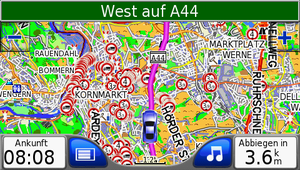
OSM Transport Karte
| OSM Transportation map (for Garmin devices) | ||||||||||||||||||||||||||||||||||||||||||||||||||||||||||||||||||||||||||
|---|---|---|---|---|---|---|---|---|---|---|---|---|---|---|---|---|---|---|---|---|---|---|---|---|---|---|---|---|---|---|---|---|---|---|---|---|---|---|---|---|---|---|---|---|---|---|---|---|---|---|---|---|---|---|---|---|---|---|---|---|---|---|---|---|---|---|---|---|---|---|---|---|---|---|
| Author: | Win32netsky | |||||||||||||||||||||||||||||||||||||||||||||||||||||||||||||||||||||||||
| License: | GNU GPL and Proprietary (free of charge) | |||||||||||||||||||||||||||||||||||||||||||||||||||||||||||||||||||||||||
| Platform: | Garmin | |||||||||||||||||||||||||||||||||||||||||||||||||||||||||||||||||||||||||
| Language: | German
| |||||||||||||||||||||||||||||||||||||||||||||||||||||||||||||||||||||||||
|
Transportation map for Garmin devices. | ||||||||||||||||||||||||||||||||||||||||||||||||||||||||||||||||||||||||||
| ||||||||||||||||||||||||||||||||||||||||||||||||||||||||||||||||||||||||||
Update & Download
The OSM Transport Map currently has 14 maps. The map is updated weekly as possible, typically during weekends.
Newsletter for a new map, send an e-mail to: osm-transport-karte@web.de
| No. | Area | Timestamp | regular update schedule | Publication | Download | Zip | Size | New | House No. |
|---|---|---|---|---|---|---|---|---|---|
| 1 | Germany | last Update. | 10:00 Uhr | 13:00 Uhr | karte-01.zip | 2,271 GB
Nord 827 MB |
1,924 GB | 2,271 GB | Yes |
| 2 | Spain Portugal with islands | last update. | 09:30 Uhr | 13:00 Uhr | karte-02.zip | 851,1 MB | 704,7 MB | 851,1 MB | Yes |
| 3 | Germany, Denmark, Belgium, Netherlands, Luxembourg | last update. | 10:30 Uhr | 15:00 Uhr | karte-03.zip | 936,4 MB | 822,5 MB | 936,4 MB | Yes |
| 4 | Germany, Denmark, Sweden, Finland, Norway | last update. | 13:30 Uhr | 15:00 Uhr | karte-04.zip | 1,526 GB | 0 GB | 1,526 GB | Yes |
| 5 | France, Netherlands, Belgium, Luxembourg | last update | 09:00 Uhr | 12:00 Uhr | karte-05.zip | 2,030 GB | 2,022 GB | 2,030 GB | Yes |
| 6 | Germany, Poland, Czechia, Slovakia | last update | 10:00 Uhr | 16:00 Uhr | karte-06.zip | 1,712 GB | 0 GB | 1,712 GB | Yes |
| 7 | Austria, Switzerland, Italy, Slovenia, Croatia, Bosnia-Herzegovina | last update | 10:00 Uhr | 16:00 Uhr | karte-07.zip | 2,434 GB | 1,503 MB | 2,434 GB | ? |
| 8 | Poland, Lithuania, Latvia, Estonia, Ukraine, Belarus, Moldova | last update | 10:00 Uhr | 16:00 Uhr | karte-08.zip | 1,396 GB | 0,0 MB | 1,396 GB | Yes |
| 9 | 1 North Central Africa | last update 09-1 | 10:00 Uhr | 18:00 Uhr | karte-09-1.zip | 1,985 GB | 1,570 MB | 1,985 GB | Yes |
| 10 | Mongolia | last update | 10:00 Uhr | 12:00 Uhr | karte-10.zip | 32,2 MB | 32,1 MB | 32,2 MB | ? |
| 11 | Bosnia Herzegowina, Croatien, Romania, Serbien, Ungarn | last update | 11:30 Uhr | 15:00 Uhr | karte-11.zip | 636,9 MB | 512,9 MB | 636,9 MB | ? |
| 13 | USA: Karte: 1 Arizona, Californien, Colorado, Idaho, Kansas, Missouri, Montana, Nebraska, Nevada, New Mexico, North-Dakota, Oklahoma, Oregon, South-Dakota, Texas, Utah, Washington, Wyoming | last update | 09:00 Uhr | 11:30 Uhr | karte-13.zip | 1,631 GB | 1,468 GB | 1,631 GB | ? |
| 14 | Australia, New Zealand, Indonesia, Papua-Neuguinea, Osttimor, Salomonen, Brunai, Malaysia | last update | 10:30 Uhr | 16:00 Uhr | karte-14.zip | 2,057 GB | 1,799 MB | 2,057 GB | ? |
| 16 | United Kingdom, Ireland, Isle of Man, Foroyar | last update | 15:00 Uhr | 16:40 Uhr | karte-16.zip | 1,270 GB | 1,270 GB | 1,270 GB | ? |
| 17 | Austria, Suisse, Slovakia, Slovenja | last update | 09.30 Uhr | 12.30 Uhr | karte-17.zip | 1,092 MB | 963 MB | 1,092 MB | Yes |
| The following cards are now larger than 2GB. These are suitable for newer Garmin devices. | |||||||||
| 12 | South-America: Argentina, Chile, Uruguay, Paraguay, Bolivia, Brazil | last update | 10:30 Uhr | 14:15 Uhr | karte-12.zip | 2,609 GB | 1,642 GB | 2,609 GB | Yes |
Upon request additional maps can be provided. The only limit is 1.99 GB as a maximum size for .img-mapfiles.
The new map with e-mail link information
This is a subscription service, which will tell you when new data is available. For accessing this feature, please drop an e-mail at osm-transport-karte@web.de and name the area of interest.
Example of such a notification:
"
- Hello!
- New map no.02 is online.
- Link for the new map.
- https://dl.dropboxusercontent.com/u/72097706/osm-karte-02/OSM-Transport-Karte-No02.zip.torrent
- Best Regards
- Marko
- This is an automatic e-mail!
"
Click on the link and start the download.
News / Example pics
Hello
Today we want to introduce the new map No.2, Spain, Portugal, with islands.
Example Pics / Card No.01
Example Pics / Card No.03
Card No 3 Example Pics Nederland / Losser
Example Pics / Card No.04
Example Pics / Card No.05
Example Pics / Card No.07
Example Pics / Card No.08
Example Pics / Card No.09
Example Pics / Card No 11
Example Pics / Card No 12
Example Pics / Card No 14
Icons
You can find the map key in the Subpage.
The Transport Map
features and generation
Coming next are limitations for hazardous good transports according to ADR/GGVSEB.
Extras:
- My map is optimized for trucks with a height of 4 meters (13.12 ft).
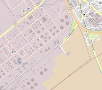
- You can recognize industrial parks easier.
- The map is being optimized for trucks more and more.
- The map download is provided via torrent so that the download can be paused and continued another time.
- The sign "no truck transit" No Trucks has been improved.
- Added sign Crossbuck.
- Added sign height limit. Ways with height limit are excluded in routing.
- Added weight limit (e.g. small bridges). Ways with weight limit are excluded in routing.
- Boundarys, towns, streets and house numbers are of the same date as the map itself.
- Company names are display at Garmin satnavs.
- Electricans with name are displayed after typing the address ("show on map").
- DIY stores with name are displayed after typing the address ("show on map").
- House numbers are displayed at high zoom levels.
- Steel construction and trade with name are displayed after typing the address ("show on map").
- Display Icon for agricultural technic companies (production, service, parts).
Installation
- In an old Garmin the internal Map in z.B. "gmapsupp1.img" change, new map from SD card.
- You need a SD oder microSD card with a size of at least 4 GB.
- Format the SD card and create a directory "Garmin" in the top directory on the SD card.
- Copy the "gmapsupp.img" file you have downloaded to the directory "Garmin" (see point 2).
- Put the SD card into your Garmin satnav and turn it on.
- The satnavs recognizes the map and the map can be used. Finish.
Do not overwrite the internal file "gmapsupp.img" on your Garmin satnav in any case!
Use in a shipping company
It may be useful to let many microSD/SD cards circulate in your company. If a driver enters the premises, he can just swap the SD card.
Proposal for a logistics company
Due to requests here is a procedure proposal.
To submit new tasks to the drivers fast and easily, the following procedure works with the OSM transportation map. The Driver has all important data readable at hand at the CMR freight bill; problems at the phone (street names not correctly understood/incorrectly noted / wrong town written down / etc.) are omitted.
Required for disposition:
free of charge:
- Libre Office office software Libre Office
- CMR form for printout CMR-Frachtbrief-4-farbig.odt CMR-Muster-blau.pdf
- CMR form with name of logistics company (at request) preview
- CMR edit form of CMR freight bill. CMR-Maske-1.0 Preview of a printed form in blanc CMR freight bill in .pdf preview
- APPs "ezPDFReader" and "PrinterShare".
- One e-mail account per vehicle i. e. WEB.de and corresponding App from WEB.de (example - demo-locistics-company-AAA-BB111@web.de)
Required for every driver/vehicle:
- a simple smartphone for data transmission i. e. Huawei G510
- an mobile printer for the vehicle i. e. HP Officejet 150
- a small box containing white carbonless paper i. e. action papier
Questions for the proposal just write to osm-transport-karte@web.de.
- Procedure locistics company:
Arrange and test everything for the relevant vehicles (long-distance traffic) on premise and instruct the driver.
- Procedure disposition:
Make a CMR form backup copy. Open CMR form, write into text fields only, remove unused text fields and send task per e-mail to the vehicle. Save task to file store as required.
- Procedure driver:
The driver prints blank CMR form in all 4 colors in vehicle, than pages are used to submit tast to CMR from smartphone Smartphone aus zu drucken. Usually blank CMR freight bills are required at the office.
After successful printout delete task from smartphone.
Screenshots

Screenshots to some features of the map.
Maxheight:
How "maxheight" should work if tagged correctly.
"maxheight" in Sweden
- Preview for Sweden Truck map for Sweden
Successful tests
Of course, there have been made several tests, e.g. if the satnav attends maxheight limits. In truck mode maxheights below bridges below 4 meters in car mode maxheight limits.
Recognition of bridge heights has been tested in truck mode.
- 1. test in truck mode. Bridge passage below 4 m are recognized. Truck Test
- 2. test in car mode. Bridge passage below 4 m are disregarded. Car Test
Recognition of bridge weight has been tested below 40 t in truck mode.
- 1. test in truck mode. Bridge weights below 40 t are recognized. Truck Test
- 2. test in car mode. Bridge weights below 40 t are disregarded. Car Test
If you zoom in, the name of a do-it-yourself store is being shown, in the same manner if there is a metal construction company.
Already tested is tagging for cross traffic.
As example the tags for "maxweight=7.5 t on cross-traffic", to protect a small bridge (Ziehte) from overload by trucks that simultaneously cross that bridge.
Garmin Devices
The Garmin satnavs have to support the truck mode to be able to use the full power of OSM Transport Map. Garmin Nüvi 660T and 560T do so.
The map also works, maybe with limitations (no truck mode, i.e. no consideration of maxheight limits) on
- Garmin Nüvi 660 T
- Garmin Nüvi 465
- Garmin Nüvi 765 TFM
- Garmin eTrex vista HCx
- Garmin Dezl 560
Loading points
A list of loading points can be found here Subpage.
OSM Transport Karte is environment friendly!
- Our sever runs with green electricity.
- You can save fuel and money because you find loading and unloading points quicker!
- Less costs because of rare damages at low bridges.
- Better usage of time because you know better how long you need for a trip.
Country List in Garmin
Parking in Industrial Areas
The parking problem for trucks is known. Everyone knows streets (in industrial areas) where you can park with large trucks. Many of these possibilities stay unused. The following is a way to enter this into OSM:
Please help us improving the map!
Data improve
If you know something that is important for trucks, you can help us improving our data.
height limits, weight limits, prohibitions of transit, see also the according wiki page with more instructions.
Tagging for trucks/transport
A correct tagging is essential as base for navigation! Editor JOSM is a very handy tool for that.
Instructions "maxheight"
A good how-to for tagging of bridge height with JOSM.
Instructions Diy
A good how-to for JOSM.
Instructions Steel construction
A good how-to for JOSM.
Instruction agricultural business
A good how-to for JOSM.
Instructions 3D Building
A good how-to for JOSM.
Tagging turn-restrictions
A good how-to for JOSM.
Tagging for HazMat Transportation!
How-to for water protection areas
This links to a good manual for the editor JOSM.
Contact
osm-transport-karte@web.de
