Project of the week/2010/Sep 12
Parks and recreation
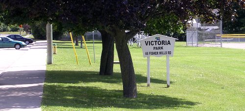
Parks and green spaces add colour to our cities. They provide organic shapes and textures to the rectilinear world of glass cladding, formed concrete and rolled asphalt. These urban oases give an opportunity walk on grass, rather than pavement, to listen to birds rather than cars, and to picnic in the shade of a tree rather than at a moulded plastic table.
Let's add a local park to OpenStreetMap.
Tagging
Small parks as points of interest
Small parks may be suitable to place as a single node. Include a name for the park if known.
Larger parks and amenities
Larger parks may be suitable for mapping with a polygon. Show the outline of the park area and use the same tags for the park and name. Include other tags like address information motor vehicle access restrictions and operating hours if appropriate.
Amenities within parks
Sometimes, and for some users, the amenities of the park may get more attention than the park. Do sport clubs use the sport pitches in the local park for organized games? Add the amenities of the park to the map as well. New mappers might find this tutorial on mapping a park helpful.
U.S. Parks armchair mapping
Already mapped all your local parks? You can add parks to OpenStreetMap as a remote "armchair mapping" exercise. This is mainly possible in the US, using their Yahoo! imagery coverage and looking for curious gaps in the TIGER data.
- Pick a random U.S. city.
- Zoom in to see all the dense residential roads (Often grid layouts)
- If you can already see a lot of parks and other landuse details, it's best not interfere. Pick a different city.
- Look for suspicious gaps in the grid of roads.
- Zoom all the way in, and switch the to 'edit' tab (Potlatch)
- Ensure 'Yahoo!' imagery is set as the background (in your settings)
Have you found a missing park (or cemetery) ?
- If there's already some data there (maybe a different landuse, maybe something which doesn't get rendered) think twice before fiddling with the data. Data contributed by local people is more precious than remote mapping contributions. We're mainly interested in adding to the crude TIGER data in areas where locals have not been very active.
- If there is a single node for a park already in place, this may well have come from a GNIS import (you'll see some tags with the 'gnis:' prefix) GNIS nodes, or other node data, should be converted to areas (
 ) This is an improvement in the level of detail in OpenStreetMap, and an improvement to the map renderings (nice green polygons will appear) Start by drawing a new way as an area around the park, then copy the important tags (leisure=park and the name tag) Finally remove the node. Do not leave the node in place. It is no longer needed.
 - If there is no GNIS node or other data, make a judgement based on the Yahoo imagery. Does it look like a park? or a cemetery (
landuse=cemetery) ? Usually you can tell pretty well from the aerial photos. If you can't really tell, it may be better to leave it. e.g "it could be a park but maybe it's industrial wasteland" - It's debatable whether park landuse areas should be connected to road ways at all. Given that this is merely a quick bit of armchair mapping, it may be better not to connect it to other data. Avoid clicking the roads as you draw in the new area (and use undo in the event of a mistake)
- Set the tag
leisure=parkorlanduse=cemetery. Also setsource=yahoo. Unless you're converting a GNIS node, you won't know the name of the park.
