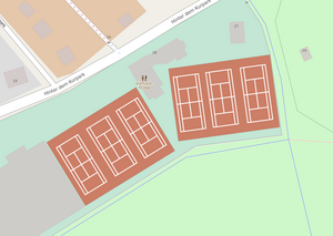
Tag:sport=tennis
| Description |
|---|
| A competition where two or four players use a ball and rackets over a net. |
| Group: sports |
| Used on these elements |
| Useful combination |
| Status: de facto |
| Tools for this tag |
|
![]() Tennis is a sport in which two or four players hit a ball back and forth using a tennis racket. The game takes place on a
Tennis is a sport in which two or four players hit a ball back and forth using a tennis racket. The game takes place on a ![]() tennis court. It is a firm rectangular surface with a low net stretched across the center. The same court can be used to play both doubles and singles.
tennis court. It is a firm rectangular surface with a low net stretched across the center. The same court can be used to play both doubles and singles.
How to map
Draw the area of every single tennis court and add leisure=pitch + sport=tennis. There is currently no consensus for if one should include the area outside of the markings (the clearance) as part of the area of the court in the mapped tennis court area.
Tennis courts are typically surrounded by a fenced area. Draw the way of the fence around the court(s) and add barrier=fence. Add any entrances to the fenced area with barrier=gate and connect them to footpaths or other equivalent ways in the surrounding area.
Tags to use in combination
Useful combination
- leisure=pitch + sport=tennis - tennis court, indoors or outdoors
- leisure=sports_centre + sport=tennis - the whole facility, it may also be a building
- leisure=sports_hall + sport=tennis - tennis hall, as part of a tennis or sports centre or standalone
- leisure=stadium + sport=tennis - tennis stadium
- name=* - name of the court or the facility / stadium
Rendering in OSM
 openstreetmap.fr |


