Proposal talk:Grade1-5
- The idea for this tag is OK, but grade1 is already defined as highway=service --- if it is surfaced then by definition it isn't a track! I would make the destinction from a track that has grass growing in the middle (i.e. full width or just tyre tracks) and then tracks that are easily passable or not (in a vehicle). grade=<num> seems a bit too ambiguous, but maybe it is OK; I'm undecided at this moment (except for not having grade1). Matthew Newton 02:33, 14 November 2006 (UTC)
- I often hear surfaced lanes, and lanes without a center strip of grass, refered to as a track, so i definatly disagree. An example is at a near village called sulgrave. (52.09860429938324, 52.113021445933384, -1.1847875352227113, -1.1568321250349483). I currently have no photos, but will try to get some. The track to the west has cement, although in places damaged. It can be driven by car 'just', but the average speed on it would be no more than 10mph without fear of heavily damaging the car. The track is not public. It is called a track by everyone. Ben. 23:17 14/11/06 (UTC)
- Generally feel the same as Matthew although I agree that we definately need something to defind these physically. Concurr that Grade 1 is already covered by service or unclassified as its a metalled road. But the various grades of track do vary considrably and its worth trying to define these or group them more precisely. I don't like grades though because these are subjective. Much better to make a physical determination, thefore some compromise is probably necsssary. So I'd probably consider something along the lines of track_stone, track_stone_ruts, track_grass, track_earth. Blackadder 09:20, 14 November 2006 (UTC).
- Grade1 tracks are not the same as unclassified roads as you cannot proceed down them unless another accsess rights way is also on it. unclassified and services both define the access rights within the name as public while grade1 is private unless otherwise specified. Often a hard surfaced track will be misshapen to the degree that a car would damage its engine scratching on the middle of the road, wich means they would not meet the standards of an unclassified road even assuming that they had the same accsess rights.
- Listing the material is too specific. There is one tag for highway=motorway, regardeless of the different surfaces, so the different grades of track is sufficent I think. Its not highway=cement_motoway for example. You can asume in reading highway=motorway, that the material used is highwaring, hard, and allows you to go at highspeed. The phisical properties of the track are stated clearly enough in the tracktype i think, as the inportant fact is the class of material rather than its specific name. e.g. grade 2 would be solid hardcore, while grade 5 would be compacted grass
- I agree that grades may not be the best name. Tracktype=type1 would be another example. I considered proposing 5 names, but couldnt think of any words that wouldn't have contradictions from real life examples. The name for this proposed feature is very open for debate, as I have put little thourght into that, but have thourght about the different types a lot before coming to this. Ben. 23:17 14/11/06 (UTC)
- I used this scheme yesterday and found it pretty confusing. Without a lookup table the values are pretty meaningless. I have to keep this page open when editing so I can see what grade is what. I think descriptive values would make editing much easier. Plus it would allow room for expansion or contraction which would cause problems with a numbered system.
- Also I think there should be at least one additional grade. For tracks where there is no path at all. For example a track that crosses the middle of an arable field which gets ploughed. These are common on footpaths and bridleways.
- It's not particually complex, but I did add this page in the hope of finding some easy to remeber keys/values, but to no avail. Please suggest better, keeping in mind the point of the tag. 1,2,3,4,5 just drops in the same way as primary/secondary/tertiary does for highways.
- For Tracks where there is no path at all, you just simple don't add a track tag!. Just as you wouln't add motorway=no to everyroad that isn't a motorway. A path that goes across a feild is just highway=footway.
- The key surfaces is incredably specific, and overly complex, and only talks about the surface texture rather than noting that the way is a sort of track. Its not really nessesery to list the material as that offers no more than just saying how hard/well trodden/what status and How suitable for use after different types of weather; wich is what this tag is aimed at. Materials may change extremly frequently, or mutliple materials may be used. The aim of this tag is just to talk about the over all status of the track. I'm not against extreme details, but I think it offers nothing to a route planner, or a person looking at the map, wich isn't covered just by classing the tracks. Just as highway=unlclassified shouldn't really be 'replaced' with surface=tarmack access=yes, I think a track is more than just a surface, its route, wich has variable noticabily on the landscape. Ben. 16:41, 25 March 2007 (BST)
Vote
Its been here for a while, and I use this tag daily, so let's vote...
End Date: 18/11/06
- I approve of this proposal Ben. 03:08 11/11/06 (UTC)
- I approve of this proposal Higgy 22:46, 3 February 2007 (UTC)
- I approve of this proposal --Lambertus 19:35, 14 March 2007 (UTC)
Voting Ended or Extended!
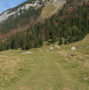
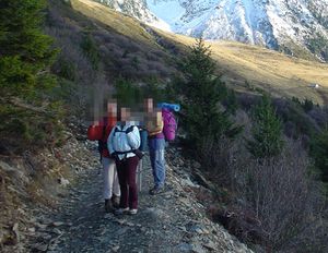
Well the vote was open for just short of 3 months, and nobody has said anything. This has been here for over 4 months also. I'm awair that 99% of osm users are mapping urban areas, but please could people consider the fact that there are other tags that they won't use that are nessesery for others. I have disccussed many tags that I probaly won't be using for a long time, and I was expecting others to do the same. I have now used these tags some 600-800 times, and I am now sticking. It would have been nice to be able to use standard tags, but although the crowds voted 100% for its approval I really think more people are needed if anything is to be agreed. Its not only been a lack of voting, but also a lack of better suggestions, hence I am just going to continue using this now regardless. There is also a lack of critisms with it that can hold up against numourous examples that I have mapped. I was hopeing people with some experience of mapping rural areas would discuss this, but evendently there are none. Just to note additional on this proposal I now use wood=yes to alter the core rendering when the tracks are in woodland. The casing is an opacity rather than set colour now also. This was nessesery I found after an IRC disccusion that found no other solution. In reference to earlier point here is an additional tracktype=grade1 image. [[1]]Ben. 03:38 3rd February 2007 (UTC
- A bit late now, but I oppose this and other subjective proposals. Bruce89 14:46, 11 June 2007 (BST)
- A bit late now, I don't like this as well. We have unclassified/minor/track roads, we can tag the width of roads, and there are proposals for a surface= tag (paved/cobblestone/gravel/...). These tags should really be able to also characterize rural roads without the need to have ambigious 1-5 graded roads. (which is bound to be applied differently by different people). I certainly won't make use of it. --spaetz 20:03, 12 June 2007 (BST)
Approval stopped
This feature Tracktype was inserted to the page Map Features on 12th june 2007. But this is not conform to the requirements of an promotion. 6 unanimous approval votes or at least 15 total votes with a majority approval are required. Please, a sufficient discussion should be finished.
6 July 2007, 21:51 (BST), OnTour
- Not shore why that text is there. Wikipedia is not a democracy, and as far as I see it, neither is OSM. It was moved after having 10 months since the original ML proposal. It is sufficient. It can always be discussed further, but currently I think only a tiny amount of people use or would be effected by this tag, hence the lack of debate/suggestions, and hence it doesn't matter that its approved. Not shore who moved it across to the standardised page, but I intend to do the same to other proposals that have had time for people to voice there opinions. If people disagree then please suggest better, don't just explain how you wouldn't use it. There was 10 months to do it before! Ben 16:17, 10 July 2007 (BST)
- Herewith you reduce an approval of 10 months of publication. This is not a good criterion. I think you also want that many people agree to the best possible suggestion. Wikipedia and OSM give the possibility to discuss, see Wikipedia is not a democracy. This should be used. OnTour 22:16, 10 July 2007 (BST)
- I have no idea what your point is. I just posted that same link in my reply, its contradictory to your previous point. I said that it should be discussed in my reply, and many times above. 10 months is a period in wich discussion has plenty of time to occur. It came to be apparent that few people are really tagging such things, so few people wish to discuss it. Just becuase the vote ended does not mean that it can't still be developed. I would be happy to discuss making the tagging scheme better. Please note that I didn't make it standadised after 10 months, so don't state that I reduced approval to a time scale. If you have some good points to rase and wish to discuss them then great, lets go. The critism's that were added were all answered above. Its not the same as surface, and its not suitbale as a highway value. To be honest If I read that then I know that people havn't really been mapping many tracks to any real level of detail, and/or havn't read this proposal through properlly. I don't clame to be good with words, but if anyone has mapped anything to do with tracks then what I'm on about is quite obvious. Please stop making this wiki so burocratic, and make constructive points, so that it can progress as a wiki should. Ben 05:15, 11 July 2007 (BST)
- OSM is not only wiki. OSM is also a software. For this is Map Features a central page. This page is bindingly for every participant. Likely also many years later. Therefore, new features should be well considered. Supplements should be wished by a majority, however, not minority of users. The tracktype feature was published too quickly. I think, the correct way is to remove the tracktype from Map Features and to discuss it ready, before it is published again. OnTour 21:40, 11 July 2007 (BST)
- Plenty of things have been added with as few as 2 votes approving it. Note that the original page was created with no votes. 10 months is not too quick. This is my last reply, unless you have something constructive to say, becuase I actually have things to be mapping, not wiki's to be holding back. Ben 00:08, 12 July 2007 (BST)
- Map features isn't binding on anyone guys... people are completely free to ignore it. Just as I'll be ignoring any abstract numbering schemes that people try and get put on it :-) Randomjunk 14:32, 31 July 2007 (BST)
Back to constructive discussion
Today I needed to classify the track road, so I've found this page. Generally I feel that everyone understands that there is some need for such classification for rural areas. So the only discussion is about the attributes. Ben himself is not sure about the grades, but he need something so he uses this. I like Bens pictures and they are quite clerly distinguishing types of track for me. I agree with arguments against his proposed naming. To recall some contraarguments (so we can learn from them):
- grade1 is not needed as
- it is already covered by service or unclassified - access argument "...unclassified and services both define the access rights within the name as public while grade1 is private unless otherwise specified...." is not good. Unclassified means different things in different countries. In Czech republic unclassified often is not private.
- if it is surfaced then by definition it isn't a track - by Matthew
- numbered system is not easily extensible - by Thewinch
- numbered system is hard to remember - by Thewinch
For me there are now two possible directions to solve this:
- descriptive tracktype values -
- some surface tag reconsideration
descriptive tracktype values
Here I can not offer too many ideas as I am not native English speaker. Therefore I can only try to ask the right questions:
What is the difference between grade2 and grade3?
I thing that the main difference here is that grade2 is covered by stone to ease its use by cars.
What is the difference between grade3 and grade4?
I am not sure. Frequence of use?
What is the difference between grade4 and grade5?
Is it absence of hedges? Is it the fact whether the track is "enforced"? I do not know if there is such a word in English, but have word "zpevněný" which I would translate as "enforced", "consolidated" or "strengthened".
- Ok, some real discussion, thats good to see. I don't think the naming matters so much, its the structure of tagging that matters. interfaces can display names as they wish in the future. Grade1/5 seemed enough to do the job. 1-5 is just like primary/secondary/tertiary, except it doens't link to status, I then added grade as that indicates quality of. As I've been using this tag now for a year, I have no difficulty at all in disiding what grade a track is when I ride/walk/drive it, its drilled its way into my head. 2 would be stones, while 3 would have some softer material mixed in, and often be rougher, with holes/bumps and a center strip of grass. 3 to 4 is the least definate difference but quite easy to tell apart really, 3 would be primerally hardcore with mudgrass mixed, while 4 would be primerally grass and mud with some hardcore on top. These are obvisously examples around me, it would need to be differently interpreted for different areas of the world. 4 is the least commonly used. This is because people usually tend to add plenty or no hardcore. Only very old tracks seem to have a small amount of hardcore. I don't tag differently based on frequency of use, but if frequently used it would usually change the track so that it is denser and maintained more so a higher status. I use grade 1 when there is a highway over the top of it. e.g. a private road with a footpath over it. I frequently use this. If the arguement against that is just to add it as a road, then thats incorrect, becuase it wouldn't be, it would be a right of way to the level that the highway value states on a private road. There are also plenty of tracks that are made up of broken up cement slabs and are far from tarmacked. Adding these seperate also enshores there not muddles up with roads that are part of the highway.
- Going on the 2 options above, heres my view on them.
- descriptive tracktype values - If its hard-soft rather than 1-5 then it specifically talks about surface density. The original idea was just that 1-5 would be based on all the different elements of the track that make it higher/lower status. I.e. I may tag a track as grade5 if its just grass but has 2 hedges either side, while if it was in the middle of the field it wouldn't be a track.
- some surface tag reconsideration - Having 5 flexible surface= values has crossed my mind, but it has the same problem as above, plus it also only says the surface, it stops also stating that it is a track. The advantage of tracktype= is that it says its a track 'and' it gives inforamtion on the track. I can then add highway=footway, or highway=bridleway ontop of that. If it was surface I would need highway=track, and this wouild then prevent adding an additional highway tag. So for surface to work route=track (for example) would be needed, so 2 tags would be required to do the job of 1. Ben 04:04, 6 August 2007 (BST)
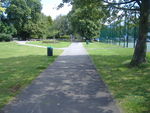
- Hi, I'm interested in this scheme but from a different perspective - how to tag paths within parks and woodlands? These aren't designed for cars, largely, but as footpaths. However, there's still a variety of different types/grades. For example:
| Big path | Small path |
|---|---|
|
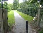
|
| Sometimes used by park service vehicles | Footpath only. |
Frankie Roberto 09:10, 6 August 2007 (BST)
- Both:highway=footway;foot=permissive;surface=paved;. There is discussion on extending the values of surface on Proposed_features/Road_Surface,--rvanderh10:01, 6 August 2007 (BST)
- There is also the generic width tag that can be used to specify the width of a way in metres. Perhaps a hierarchical set of tags for (foot|cycle|bridle)ways would help. highway=footway;route=primary as a quickly thought up example. --Thewinch 22:26, 8 August 2007 (BST)
I think it should express if you can drive a way with a normal car. If you can drive there only with four-wheel drive then it should be e.g. grade 5. Or we could mark it grade 5 if you can only drive there with 4WD trucks. I also know some roads where you have to drive carefully if you don't want to damage your car (the oil sump for example) because there are wheel ruts from forest trucks or deep road holes. You can drive them with your normal (not lowered) car and the surface is normally good (compressed gravel) if you drive very carefully and slow. I think we should keep other countries in mind where roads are normally not as good as for example European countries. I'll take some photos of the roads in mind. --blue* 20:58, 8 August 2007 (BST)
- Would the roads in other countries not map into the existing highway hierarchy? trunk, primary, secondary and so on? If there are lots of unpaved roads perhaps there are not so many different classes of paved roads. I would guess overall the total number of classes would be similar because too many classes makes navigation confusing. In any case it might be better to let other countries find where the current tagging scheme is lacking instead of trying to second guess where the problems will be.--Thewinch 22:26, 8 August 2007 (BST)
the solution of using the surface tag is not enough
After reading all this, what I think is that describing the nature of a track is not enough. If we want to tag the fact that the ground is made of grass, stones, gravel, paved, etc. then I agree that the surface tag might be more appropriate than gradeX stuff as it can be used on other path/roads/trails as well.
BUT ! I have examples to give where nature of the ground is not enough to tag and to answer what matters most ( to my point of vue) :
"Can I go on this track with my vehicule ?" ( having in mind that vehicule doesn't always mean car )
Here in the french alps, when it comes to hiking or mountainbiking we are regularly trying to answer : how far will I be able to drive, and when will I have to stop and continue by foot/bike. ( Most commercial road maps are not even accurate enough to answer this question ) only the IGN does ( and not always perfectly )
Answering this question is not only a matter of track surface but also of others parameters such as :
- strenght of the sloap
- size of the stones on the road
- maintained or not
- possibilities of branches or tree trunks on the way
- small river stream to cross without bridge
- many others reasons
Trying to extend the surface's attributes to cover all this is nonsens, what matter most is :
what do I need to go there ?
And I don't see more than 4 cases :
- Any "usual" car can do it ( unless you really care about your tires )
- Good motor engine is needed + bigger wheel + 4x4 traction
- Only Tractors can go
- ATV or motorbike
Finally, I am in favor of keeping the tracktype tag, but not in duplicate of the surface tag but by referencing the praticability of a track. Other possibilities I see might be :
- extend the highway tag to cover my 4 cases
- create a new top level tag such as trailways to include things that should have never been "highways" such as footway or track ( seams impossible now unless a robot can do it )
- Edit 2008-06-30 : Now there is a third solution, the Proposed_features/Smoothness Sletuffe
Sletuffe 15:17, 11 March 2008 (UTC)
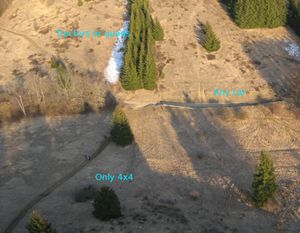
- To show a real case problem of my comment, here is a mountain track I recently maped :
[[2]] We can see :
- a road, paved => highway=tertiary
- a track, half stones/half gravel but sweetable for a car highway=track
- from the parking, the track continues with the same surface but most (but not all) car have to stop highway=footway
- then in the middle even a 4x4 whould have to stop ( but it's still a track with same surface) highway=footway
- finaly, the track goes done in the valley again, and a real footway starts highway=footway
Googlemaps (and tele atlas) solves this by saying it's a road until step 4 , but it surely isn't ! And I doubt a car could do it
I would not approve this solution - its not well suited for bicycles and it does not tell if a track can be used in wet conditions. The 'tracktype' attribute is not that bad in these aspects: Grade1+2 can be used with any bike also in wet conditions, grade3 is less comfortable in wet conditions. Grade 4 can only be used with a mountain bike then. And in Germany most tracks are forbidden for cars anyway so it does not matter if you could use them.
--Grungelborz 20:02, 11 March 2008 (UTC)
- I think that what you need here is available by the surface tag ( or an extension on values )
And if tracks are note allowed to cars in germany, it is not the case at least in France and italy so we cannot just drop the fact that car cannot go in Sletuffe 19:43, 12 March 2008 (UTC)
This is a duplicate of surface and access tags
I found the tracktype=grade[1-5] very useful in mapping rural areas but meanwhile I think that they are duplicates that we should get rid of. As far as it concerns telling about the quality or type of surface, the surface tag should be used:
As far as it concerns telling how far or whether you can go with a specific type of vehicle, I think the acccess-tag is more appropriate, i.e. using something like access=high_clearance or access=4WD or anything like that. I admit that access is so far used primarily for legal access restrictions. However, I don't se why I couldn't or shouldn't be extended to include technical access restrictions, too.
Ukuester 08:12, 3 July 2008 (UTC)
- 100% ok to depracte it, because too subjective, too track centered, and not clear as if it is a physical property or access right.
- For your replacement by surface for the physical property (grass, stones, sand), I'm very okay.
- but using Key:access might be confusing. access has (for now) a mean of "right" but not of physical property.
- Well, we could extend it to take this into account, and it would look nice. But there might be a problem :
- Suppose you are mapping a track that is suitable for 4wd, you would add something like :
- 4wd=passable, car=impassable, treking_bike=passable, wheelchair=impassable, etc...
- That would be very long to tag ;-) and more than that, if a transport mean is added, then you would have to add that new tag to every road you mapped
- One of the solution, to me, is to create a kind of "physical passable scale" such as :
- skate/roller < sport car < car/bike < 4wd/Mountain bike < russian tank ... and this is currently proposed here : Proposed_features/Smoothness
Sletuffe 16:01, 3 July 2008 (UTC)
- I never meant to propose a huge set of passable-tags for the reasons you give above. What I would like to be able to see in a map is whether for instance a road in the US is passable by passenger car or not. I would tag it like highway=tertiary, surface=unpaved, xyz=4WD (or HC). If a majority of people prefers to reserve the access tag for legal restrictions I'm ok with that and yes, the smoothness tag could do the job. I'm not overly happy with the name smoothness, but I will take the discussion to the corresponding page. Ukuester 15:18, 4 July 2008 (UTC)
