3D development: Difference between revisions
(→Common tagging features: remove additions by Xxzme that are not actually "common tagging features") |
m (Verdy p moved page 3D Development to 3D development: unnneeded capitalisation) |
(No difference)
| |
Revision as of 22:27, 4 May 2015

This page coordinates the development of 3D applications using OpenStreetMap Data.
Projects

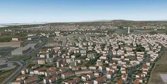
World2XPlane uses OSM2D and 3D data to generate VFR scenery for X-Plane flight simulator World2XPlane
osm2xp for X-Plane, too
OSM in 3D using XML3D
OSG-Maps on Android
HaptoRender for blind persons


People
The following users currently work on 3D related topics:
Editors
- User:kendzi working on JOSM plugin for 3D view and editing: Kendzi3d
- User:AMDmi3 created a OpenGL 3D viewer (Glosm)
- Flash viewer [1] source [2]
Renderer
- User:Aleš Janda created convertor from OSM to POV-Ray (osm2pov) and render map of Czech republic [3]
- User:Bitsteller extends the osm2pov script and does city large isometric renderings [4]
- User:Komяpa working on isometric rendering embedded 3D models (Kothic) and created an Mapnik isometric layer (see openstreetmap.ru, source at [5]
- User:Runge created the isometric MapSurfer renderer, that is now OpenMapSurfer
- SakirSoft working on ShugenDoMap
- OSMBuildings working on dynamic perspective rendering for slippy maps [6]
- ViziCities WebGL 3D rendering
- Blender
Exporter
- User:Tordanik creates a 3D scene exporter and renderer (OSM2World) and a slippy map using it (maps.osm2world.org)
- User:Aschilli developed the OSM-3D service, in cooperation with the university of Heidelberg
- User:h4ck3rm1k3 worked on a Blender3D export script [7]
- User:Jon made a 3D landscape export to FlightGear
- Osm2xp generates X-Plane 3D buildings [8]
- Supertuxkart can get levels from OSM as well
- Cinema 4D (3D rendering software) now offers an OSM importer
General
- F4-Maps created some WebGL client side rendering including animations [9]
- Skye Book doing some 2D vis in 3D OpenGL space [10]
- User:Viw/OSM3D about 3D tagging and editing
- User:Marek_kleciak working as a professional on a automotive centered 3D environment/service. Developer of OSM-4D definition. Also Roof modelling, 3d roof and dormer modelling, 3D terrain and bridges modelling, tree modelling, 3D Tunnels, DE:Stairs_modelling.
- User:Klokan Petr Přidal working on a WebGL 3D globe for the browsers: Try it [11]. Project page: [12].
- User:Jongleur thinking about more complex 3D box modells within the OSM DB [13]
- User:Anatolie had some thoughts about a Collada 3D scenery sharing for Moldava [14]
- User:!i! made some improvements to the Rostocker Gebäudehöhen import 2009 and micromapping in Rostock and shared the experience at Geoforum MV 2013 including Blender rendering and games export
- User:nickw has developed a demo OSM viewer with SRTM data using WebGL [15] and early work on a standalone OSM/SRTM OpenGL viewer [16]
- User:stefan_zst80 Project page: osm3d.org [17], did some tests with WebGL
- OpenDEM is working on a more accurate elevation model than SRTM
- User:vvoovv working on a Google Sketchup interexchange [18]
- User:Aschilli thinking about roof line tracing [19]
- User:bvbmatze works on improving OSM-3D at the University of Heidelberg, current focus on external building repository OpenBuildingModels
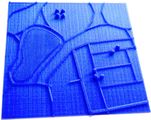
- User:Lulu-Ann is planning to produce 2.5D tactile maps for blind persons, see project HaptoRender
- Using Kinect as 3D radar [20]
- in modern browsers: http://www.webglearth.org/
- Lorenz Laucher added TMS OSM support to Rhino] 3D
- Microsoft created a Kinect based 3D scanner, [21]
- Virtual Terrain project big portal
- User:rajo Is working on OSM in 3D using Declarative 3D for the Web
- Marble community asked for joining
- osm3d.cs.technion.ac.il Showing off 3D interchanges and improvements to SRTM based on (3D) GPS traces.
Coordinated tasks
Even with most people working on their own projects, there are some shared resources and standards that could be used across projects or need support by the community to contribute data.
Feel free to chat on this topic at our dedicated 3D OSM forum.
3D model repository
As we all see the very limited features of a LOD1 model by extruding buildings along a OSM way, we all wish to have a repository to get detailed models from. Possible questions are:
- How can mappers easily create 3D models using which software?
- How can we store a catalog of POI models? How to browse/search them?
- How can we store/mark general models (e.g. a common bench in New York)
- Which 3D format can be used to exchange? How to store materials?
- How can we link relative positions (e.g. to next road)
- How can we create procedural 3D models (e.g. allotments are filled with small gardens and houses) to extend the procedure
See also: O3DM
Common tagging features

Most developers agreed to support use this tagging schema as a lowest common denominator: Simple 3D Buildings
In addition, most tools use one or several of the following tagging schemes to create 3D scenes:
- Buildings
- Layer
- Simple 3D Buildings
- OSM-4D
- Proposed features/Building attributes
- Relations/Proposed/Level
- User:Aschilli/ProposedRoofLines
- Relations/Proposed/Multipart
- DE:Dachmodellierungstechniken
- Proposed_features/lamp
OSM-3D Screenshots gives a nice overview, where 3D objects are already in heavy use.
Example Models just a start to collect buildings modeled according to Simple 3D Buildings.
Streaming services
Because of the massive grow by applying the 3rd dimension, it becomes more important to outsource the calculation/storage to a dedicated server. The client has only to download/cache tiles of the 3D world similar to games, where entering a new level means to unpack the level data. OSM-3D has such client/server architecture.
osm2x3d service
openearthview web site provide a simple service relying on osm2x3d tool:
http://www.openearthview.net/osm2x3d.php?zoom=_ZOOM_&xtile=_XTILE_&ytile=_YTILE_
It's a demo version but aims to be improved as a release in the future (with cache on disk).
LoD (Level of Detail - cf OSM-4D) will be taken into account. At the moment, zoom level 19 is the max and allow to get building divided in floors.
Discussions
There are many unresolved questions and ideas related to 3D modelling. Some discussion can be found on subpages: