User:!i!
| Userboxes | ||||||||||||||||||||||||||||
|---|---|---|---|---|---|---|---|---|---|---|---|---|---|---|---|---|---|---|---|---|---|---|---|---|---|---|---|---|
| ||||||||||||||||||||||||||||
![]() Hi ich bin Matthias, komme eigentlich aus Schwerin, studierte aber lange Informatik in Rostock. Von Mitte 2014 bis 03/2022 arbeitete ich im Katasteramt der Hansestadt und trug da als user:KVLA-HRO-Mei für OSM bei. Heute arbeite ich für die Hochschule für Musik und Theater Rostock und pflege als user:HMT-HRO-MaMe das Areal der Hochschule. Begeister mich ziemlich für OpenSource Sachen. Vielleicht noch ein paar Sachen die ich so machen:
Hi ich bin Matthias, komme eigentlich aus Schwerin, studierte aber lange Informatik in Rostock. Von Mitte 2014 bis 03/2022 arbeitete ich im Katasteramt der Hansestadt und trug da als user:KVLA-HRO-Mei für OSM bei. Heute arbeite ich für die Hochschule für Musik und Theater Rostock und pflege als user:HMT-HRO-MaMe das Areal der Hochschule. Begeister mich ziemlich für OpenSource Sachen. Vielleicht noch ein paar Sachen die ich so machen:
- ein eigenes Funknetz in Schwerin aufbauen
- OpenPandora und embedded-Spielereien
- Navit ein bißchen mithelfen
- Mit QGIS spielen
Bin also in der Südstadt unterwegs und mappe insbesondere Hausnummern.
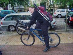
Auch hier anzutreffen: Rostocker Treffen oder falls ein schwarzer Typ mit einer "Condor" Bauchtasche durch die Gegend tigert bin ich das wohl :P
Daneben machte ich viel für die Pressearbeit und engagierte mich in Sachen Sponsoring sowie die Zusammenarbeit mit Behörden und anderen Institutionen. Aber natürlich sorgte ich mich auch um die Einhaltung der Lizenz und brachte in letzter Zeit das Wiki ein bißchen auf Vordermann. Vor einigen Jahren machte ich ein Praktikum bei der Geofabrik um noch ein wenig mehr über die ganzen Tools im OSM Umfeld zu erfahren.
Und wer meint, dass ich vor all der Arbeit nicht mehr zum Mappen komme, der sei eines besseren belehrt: Meine Edits
Aber um ehrlich zu sein habe ich seit 04/2013 viel von den Sachen erstmal an den Nagel gehängt...
Meine ersten Experimente habe ich mit einem geliehenen Adapt AD-300 GPS Empfänger und iPAQ PDA mit OSMtracker gemacht. Viele POIs habe ich auch so per Hand einfach eingetragen. Nun arbeite ich mit einem Siemens S65 + Navibe GB735 GPS und Trekbuddy und Video. Oder ebend doch mit PDA oder auch mal mit Walking Papers oder trace Bing oder oder oder...
Alles begann mit einem kleinen harmlosen Briefkasten...[1]
![]() Hi this is Matthias, I'm original from Schwerin, but studied Informatics for years in Rostock. Since mid of 2014 I work at the cadastre of Rostock and contribute as user:KVLA-HRO-Mei. I'm very interested in Open Source stuff, so a few things I do:
Hi this is Matthias, I'm original from Schwerin, but studied Informatics for years in Rostock. Since mid of 2014 I work at the cadastre of Rostock and contribute as user:KVLA-HRO-Mei. I'm very interested in Open Source stuff, so a few things I do:
- creating a free wifi with citizens in Schwerin
- OpenPandora and some embedded fun
- assist over at Navit
- play around with QGIS
So I mapping the south part of Rostock, esp. housenumbers. You can meet me here: Rostocker Treffen or if you see a guy wearing black clothes and a "Condor" bag, thats me :P
Beside I did a lot for press, sponsoring and the cooperation with other organizations and institutions. Of course I cared about license violations and worked on cleaning up the wiki. Few years ago, I took a internship at the Geofabrik to know more about all the tools in the OSM ecosphere.
But since 04/2013 I skipped a lot of that stuff...
And if you think, that I don't map anymore cause of this bunch of work, check my edits
I took my first experiences with a Adapt AD-300 GPS receiver and a iPAQ PDA with OSMtracker. A lot of POIS I added just out of mind. Now I work with a Siemens S65 + Navibe GB735 GPS and Trekbuddy and Video. Or even with a PDA or Walking Papers or tracing Bing or or or...
And all that started with a harmless postbox...[2]
Community
Ich noch bin bei einigen wenigen Projekten innerhalb der Community aktiv
![]() I still work on a few subprojects of the community
I still work on a few subprojects of the community
- Navit - try to assist on some OSM focused refactoring
- Open3DMap - my own 3D project that might start one day..
old ones:
Aus einigen Sachen habe ich mich auch zurückgezogen [3]
- WikiProject Cleanup so I founded wikiteam ...
- 3D Development - bringing Dev staff together
- Video mapping - bringing all informations together and collecting experiences that resulted in a JOSM plugin
- Presseteam - publications and promotion
- Mecklenburg Vorpommern public relations, press,...
- Research - collecting papers and Q&A support
- YaCy - some minor experiments on providing URLs from OSM data
- Wochennotiz - worked as a "reporter" to collect infos and wrote single articles
- OSM blog - some articles and tests on devices
- Project of the week - translation
- Community Updates - translation
- Sponsoring - some donations to OSM and the german chapter
- Lacking proper attribution - please people to provide full OSM attribution
- Magellan - tried to start an Opening process...without results
- Night of the living maps - maintainer of first global mapathon
- Operation cowboy - maintainer of the second global mapaton
- Rostocker Treffen - managing our local meeting and a few mapping parties
Und verbesserte ein paar Wikiseiten:
- Maps
- Software
- Develop/Frameworks
- Wikiteam
- user:UserGroupsBot
- How do you map in started the series
- healthcare=* introduced the schema
OSM bewerben:
- Geoforum MV 2013
- Tourismusforum MV 2012
- Internationalen Tourismusbörse Berlin 2012
- Workshop HS NB 2012
- Lost in MV 2011
- Geoforum MV 2011
- Geoforum MV 2010
- DGfK Treffen Schwerin 2010
- GeoMV Vortragsreihe
and at some deficated workshops:
- Katasteramt Rostock 2013
- VCWMV (Campingverein M-V) 2013
- Webmontag 2012
- Fachhochschule Neubrandenburg 2012
Leider nur auf ein paar Events:
- FOSSGIS 2014
- Mapping Party MV Juni 2009
- Mapping Party MV 2010
- OSM Koordinierungs-Treffen
- Mapping Party MV 2011
- 2nd 3D Workshop Garching 2012
- FOSSGIS 2012
Beside I use the forums and sometimes the diary blog.
articles
Während meiner Projekte, habe ich auch den ein oder anderen Artikel zu OSM geschrieben, um unser Projekt und die Community vorzustellen
![]() During this projects I wrote a few articles about OSM, to promote our project and the community
During this projects I wrote a few articles about OSM, to promote our project and the community
- Ostsee-Zeitung, Die Kartenmacher(de), 2014-06-30
 – Ein ganzseitiger Artikel über OSM in [M-V] und warum Leute seit 10 Jahren beitragen.
 - Upload Magazin, OpenStreetMap - Die freie Weltkarte im Einsatz(de), 2014-03-24
 – OSM wird für Webentwickler und netzaffine Nutzer niederschwellig vorgestellt. Wie kann man sie nutzen, einbinden und beitragen.
 - Screen Guide 14, freie Welt: openstreetmap(de), 2012-06-02
 – OSM für Webdesigner und Webworker vorgestellt
 - Deutsche Wanderjungend - Walk & more, OpenStreetMap: Wissen, wo es lang geht – eine freie Weltkarte entsteht(de), 2012-03-27
 – Eine Einführung in das Projekt
 - IHK Schwerin Wirtschaftskompass, OpenStreetMap - Eine alternative Karte auch für Touristiker(de), 2012-03
 – Kurzer Artikel zu Vorzügen und Wechsel zu OSM
 - FreiesMagazin, OpenStreetMap – Eine virtuelle Welt gedeiht(de), 2012-03-04
 – Ein größerer Artikel, der den aktuellen Stand und die Änderungen in den letzten 3 Jahren zusammenfasst
 - Dosenfischer, Dosenfischen: Geocaching-Podcast 179b(de), 2012-02-18
 – Details und Infos für Geocacher, da Groundspeak nun OSM nutzt
 - Geocaching Magazin, Open Street Maps - die kostenlosen Karten für jedermann(de), 2012-01-01
 – Langer Artikel über Hintergründe, Nutzung und mitmachen
 - Stadtgespräche Rostock, Rostock selbstgemacht(de), 2011-08-23
 – Ein kleiner Artikel über OSM in der Hansestadt Rostock mit vielen allgemeinen Details
 - Bevölkerungsschutz - Magazin 1/2011 Geoinformationen, Daten für einen modernen Bevölkerungsschutz - OpenStreetMap(de), 2011-02-22
 – Eine Einführung von OSM und Vorstellung des HOT inklusive der Vorteile für den Bevölkerungsschutz. Veröffentlicht vom Bundesamt für Bevölkerungsschutz und Katastrophenmanagement.
 - NDR Nordmagazin, Der Daten-Don Quijote(de), 2010-09-27
 – Das Fernsehen begleitet user:!i! beim Mappen in Rostock
 - Ostsee Zeitung, Mit GPS Maß nehmen(de), 2010-09-02
 – user:Kilt und user:!i! bei einem Spaziergang begleitet
 - SVZ (Lokalteil Rostock), Rostock wird kartiert(de), 2010-08-24
 – Matthias stellt OSM in Rostock vor
 - Blickpunkt Straßenbahn, Freies Geo-Projekt erfasst ÖPNV Strukturen(de), 2010-06
 – OSM wird vorgestellt, insbesondere für ÖPNV
meine Pressemitteilungen findet ihr unter Presseteam#Archiv und gebloggtes in meinem Diary
Bachelor thesis
Da ich noch keine Möglichkeit des effektiven "Total" Mappings gefunden hatte ich als Bachelor-Arbeit ein Plugin geschrieben, dass Vieos zu einem GPS Track synchron abspielen kann: JOSM/Plugins/VideoMapping and die Arbeit
![]() Cause I had no effective 'total' mapping technique, I started writing a plugin for JOSM, that links a video against GPS JOSM/Plugins/VideoMapping and the thesis
Cause I had no effective 'total' mapping technique, I started writing a plugin for JOSM, that links a video against GPS JOSM/Plugins/VideoMapping and the thesis
Master thesis
![]() As OSM is growing and growing, the topic of my master thesis was distributed map rendering in Desktop grits [4]. But sadly I was only able to create a very simple prototype to measure some values.
As OSM is growing and growing, the topic of my master thesis was distributed map rendering in Desktop grits [4]. But sadly I was only able to create a very simple prototype to measure some values.
MEMO
- forschungshafen.de
- navitestnrw.de
- http://www.vm2010.de/web/de/projekte/
- Wiki organisation
- Wiki
- Web_front_end
- Last wiki edits

