Tag:highway=trail
Jump to navigation
Jump to search
| Description |
|---|
| Don't use, use established tags like highway=path, highway=footway, highway=cycleway, highway=bridleway. For more detail see wiki |
| Group: highways |
| Used on these elements |
| Implies |
| Useful combination |
| Status: deprecated |
| Tools for this tag |
|
| The definition of this tag is not clear. Please verify, if some of the well established similar tags fits better with your needs: highway=path, highway=footway, highway=cycleway, highway=bridleway. For paths that were not intentionally created you can add informal=yes. |
The feature described here is usually mapped with other tags. Please see below for tagging which is more in line with common consensus!
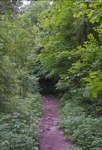
For cross-country trails, hiking trails, paths going up to a mountain etc. Trails are unpaved, unprepared and often narrow. Roots and rocks are not moved away. Wear from the users of the trail keep the vegetation away. Trail may or may not be well visible on ground, see trail_visibility=*.
Cycle route planners should not assume that a highway=trail is cycleable, with the possible exception if the user has indicated that he wants MTB routes. Take a look at mtb:scale=*.
New proposal
A new proposal is underway: Proposed features/Trail (new proposal)
