Category:Deletion Proposed
Wiki pages in this category are proposed to be deleted. At this stage it is a suggestion somebody made. Further discussion is invited and/or the deletion is disputed.
Pages are categorised here automatically by inserting the label {{Delete proposal}}.
Alternatives: Use Template:Delete to propose immediate deletion (these pages area added to Category:Labelled for deletion). use Template:Archived proposal or Template:Historic artifact start to mark as outdated and not maintained.
See entries by last edit date: https://wiki.openstreetmap.org/w/api.php?action=query&list=categorymembers&cmtitle=Category%3ADeletion_Proposed&cmsort=timestamp&cmprop=timestamp%7Ctitle&cmlimit=50
Subcategories
This category has the following 9 subcategories, out of 9 total.
Pages in category "Deletion Proposed"
The following 193 pages are in this category, out of 193 total.
E
G
I
K
M
- Mafrense
- Mafrense (Barraqueiro Transportes)
- Map Icons/Map Icons Collection
- Mapnik/Hillshading using Mapnik, GDAL and SRMT data
- MapRoulette/Challenges
- Maps 3D
- User:Mateusz Konieczny/notify uploaders/Adrian Trifan
- User:Mateusz Konieczny/notify uploaders/AlexPleiner
- Maverick
- Microformats
- MoNa
- MOSME
- Template:Zh-hant:Motorway status
- Template:Moved to Commons
- Template:Moved to Commons/doc
- My Tracks
- MyTracks for iOS
- MyTrails
O
- Open GPS Tracker
- OpenLayers Class Diagrams
- OpenLayers Dynamic POI
- OpenLayers Local Tiles Example
- OpenLayers Marker Example
- Et:OpenLayers Marker Example
- Openlayers marker multilayer example
- OpenLayers osm file example
- Openlayers POI layer example
- OpenLayers Simple Example
- Openlayers Track example
- OpenLayers/FasterTiles
- OpenStreetBugs layer/Translation
- OpenStreetRouting
- OpenTripPlanner (Android)
- OSM in MapKit
- Osm-android
- Template:Osm-query
- OsmGps PWA
- OSMGpxUploader
S
T
- User:T-i/Access-Map
- Tr:Tag:boundary=administrative
- Tag:cycleway:lane=share parking
- Tag:drink:viez=bottled
- Tag:drink:viez=draught
- Tag:drink:viez=takeaway
- Tag:man made=guy insulator
- Tagging scheme hiking walking
- Thailand/Outdoor Tagging
- ThinkGeo
- Tile proxy
- Topo GPS World
- Tourism tag overview
- Tracing Guideline Using Satellite Imagery
- Track@Way
- Trafficman Maps
- Trails App
- Transportes Sul do Tejo
- TravelDroyd
- Trekbuddy
- TurboGPS
V
W
- WikiProject Belarus/Road network/Витебская область
- WikiProject Belarus/Road network/Гомельская область
- WikiProject Belarus/Road network/Гомельская область/Рогачёвский район.wiki
- WikiProject Belarus/Road network/Гомельская область/Светлогорский район.wiki
- WikiProject Belarus/Road network/Гомельская область/Хойникский район.wiki
- WikiProject Belarus/Road network/Гомельская область/Чечерский район.wiki
- WikiProject Belarus/Road network/Гродненская область/Берестовицкий район.wiki
- WikiProject Belarus/Road network/Гродненская область/Волковысский район.wiki
- WikiProject Belarus/Road network/Гродненская область/Вороновский район.wiki
- WikiProject Belarus/Road network/Гродненская область/Гродненский район
- WikiProject Belarus/Road network/Гродненская область/Гродненский район.wiki
- WikiProject Belarus/Road network/Гродненская область/Дятловский район.wiki
- WikiProject Belarus/Road network/Гродненская область/Зельвенский район.wiki
- WikiProject Belarus/Road network/Гродненская область/Ивьевский район
- WikiProject Belarus/Road network/Гродненская область/Лидский район
- WikiProject Belarus/Road network/Гродненская область/Мостовский район.wiki
- WikiProject Belarus/Road network/Гродненская область/Новогрудский район
- WikiProject Belarus/Road network/Гродненская область/Новогрудский район.wiki
- WikiProject Belarus/Road network/Гродненская область/Островецкий район.wiki
- WikiProject Belarus/Road network/Гродненская область/Ошмянский район
- WikiProject Belarus/Road network/Гродненская область/Ошмянский район.wiki
- WikiProject Belarus/Road network/Гродненская область/Свислочский район.wiki
- WikiProject Belarus/Road network/Гродненская область/Слонимский район.wiki
- WikiProject Belarus/Road network/Гродненская область/Сморгонский район
- WikiProject Belarus/Road network/Гродненская область/Сморгонский район.wiki
- WikiProject Belarus/Road network/Гродненская область/Щучинский район.wiki
- WikiProject Belarus/Road network/Минская область
- WikiProject Belarus/Road network/Минская область/Березинский район.wiki
- WikiProject Belarus/Road network/Минская область/Вилейский район.wiki
- WikiProject Belarus/Road network/Минская область/Дзержинский район.wiki
- WikiProject Belarus/Road network/Минская область/Копыльский район.wiki
- WikiProject Belarus/Road network/Могилевская область
- WikiProject Belarus/Road network/Могилевская область/Быховский район
- WikiProject Belarus/Road network/Могилевская область/Горецкий район.wiki
- WikiProject Belarus/Road network/Могилевская область/Дрибинский район
- WikiProject Belarus/Road network/Могилевская область/Климовичский район.wiki
- WikiProject Belarus/Road network/Могилевская область/Кличевский район
- WikiProject Belarus/Road network/Могилевская область/Кричевский район
- WikiProject Belarus/Road network/Могилевская область/Круглянский район
- WikiProject Belarus/Road network/Могилевская область/Могилевский район
- WikiProject Belarus/Road network/Могилевская область/Мстиславский район
- WikiProject Belarus/Road network/Могилевская область/Осиповичский район
- WikiProject Belarus/Road network/Могилевская область/Славгородский район
- WikiProject Belarus/Road network/Могилевская область/Хотимский район
- WikiProject Belarus/Road network/Могилевская область/Чаусский район
- WikiProject Belarus/Road network/Могилевская область/Чериковский район
- WikiProject Belarus/Road network/Могилевская область/Шкловский район
- WikiProject Belarus/Road network/Республиканские автомобильные дороги
- WikiProject Norway/Import of shops/Permission:CircleK
ا
Media in category "Deletion Proposed"
The following 162 files are in this category, out of 162 total.
-
130136185-5117823e-b92c-47c5-90f5-eae06216a6e3.png 3,154 × 742; 425 KB
-
132191250-c00e5e22-bd63-4be2-ba89-ec2fc33b92bd.png 2,696 × 854; 529 KB
-
1st flr detail.gif 590 × 590; 38 KB
-
20110606 002.jpg 2,560 × 1,440; 529 KB
-
2020-12-09 14-24-51(1).jpg 4,160 × 3,120; 3.16 MB
-
20200808-osm16-kabul-02.jpg 892 × 1,189; 227 KB
-
3rd flr detail.gif 590 × 590; 47 KB
-
A110d-2016-06-16-110518.png 480 × 854; 28 KB
-
Abandoned building.jpg 1,536 × 2,048; 1.7 MB
-
ADnota Geotag screenshot.jpg 320 × 240; 94 KB
-
Advertising-fi-small-pylons.jpg 549 × 421; 9 KB
-
Aerialway station.jpg 640 × 480; 128 KB
-
Ago-tourism-toronto.jpg 1,280 × 720; 799 KB
-
Agro2017 geohash-6ujg8.jpg 538 × 357; 159 KB
-
Aizu chart.jpg 600 × 357; 75 KB
-
Aizu hazard map.jpg 600 × 394; 77 KB
-
Aizu map201412.jpg 720 × 953; 209 KB
-
Alhedestien.png 1,333 × 800; 1.91 MB
-
Alminav Bavaria.png 480 × 854; 50 KB
-
Alminav Strassenkarten Uebersicht.png 480 × 854; 137 KB
-
Alminav Strassenkarten.png 480 × 854; 100 KB
-
Anarchy.png 43 × 43; 1 KB
-
Anime ect2.jpg 1,536 × 2,048; 495 KB
-
Apartments6levels.png 645 × 963; 834 KB
-
Ascot 20080920.png 984 × 551; 60 KB
-
Barrier-bar.jpg 2,000 × 823; 457 KB
-
Bathurst.png 300 × 229; 148 KB
-
Baude.jpg 550 × 309; 45 KB
-
Belgium-trafficsign-f17.jpg 334 × 500; 46 KB
-
Berlin-c-base-1024x.jpg 1,024 × 570; 147 KB
-
Bikegpsmobile screenshot.gif 243 × 327; 41 KB
-
Billboard 4x3.jpg 240 × 180; 23 KB
-
Billboard medium.jpg 180 × 240; 29 KB
-
BluehelmetsinRCA.jpg 1,600 × 1,067; 461 KB
-
Bruenndersen Haeuser.png 459 × 680; 179 KB
-
Buoy safe water.jpg 333 × 500; 120 KB
-
CARTEL sax a4.svg 744 × 1,052; 1.2 MB
-
Cartopartie020411.png 1,995 × 2,770; 1.26 MB
-
Cavell.jpg 2,755 × 4,132; 2.22 MB
-
Cement Block.jpg 194 × 259; 9 KB
-
Cemetery sector scheme.jpg 640 × 489; 154 KB
-
CesanoBosconeSanzio.jpg 800 × 600; 234 KB
-
Chart201412.jpg 630 × 375; 82 KB
-
Classes.OpenLayers.Control.png 920 × 2,869; 72 KB
-
Classes.OpenLayers.Feature.png 461 × 61; 1 KB
-
Classes.OpenLayers.Filter.png 469 × 349; 4 KB
-
Classes.OpenLayers.Format.png 3,008 × 2,257; 99 KB
-
Classes.OpenLayers.Geometry.png 1,827 × 277; 10 KB
-
Classes.OpenLayers.Handler.png 1,152 × 637; 13 KB
-
Classes.OpenLayers.Layer.png 1,499 × 925; 31 KB
-
Classes.OpenLayers.Marker.png 437 × 61; 2 KB
-
Classes.OpenLayers.Popup.png 1,133 × 133; 3 KB
-
Classes.OpenLayers.Protocol.png 853 × 385; 6 KB
-
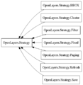
Classes.OpenLayers.Strategy.png 480 × 493; 6 KB
-
Classes.OpenLayers.Symbolizer.png 531 × 349; 4 KB
-
Classes.OpenLayers.Tile.png 429 × 133; 2 KB
-
Clock-5.jpg 600 × 800; 64 KB
-
Clock-6.jpg 600 × 800; 73 KB
-
Coastline1.jpg 811 × 603; 63 KB
-
Coastline2.jpg 814 × 600; 48 KB
-
Coastline3.jpg 807 × 608; 61 KB
-
Cr3-caterham-1.png 200 × 158; 26 KB
-
Culvert.jpg 800 × 533; 188 KB
-
Darkangel.jpg 296 × 185; 17 KB
-
Drain covered rectangular culvert.jpg 2,448 × 3,264; 1.59 MB
-
Dscf0220 600.jpg 600 × 450; 69 KB
-
Dscf0487 600.jpg 600 × 450; 63 KB
-
Dscf0590-800.jpg 586 × 480; 238 KB
-
Dscf1614-800.jpg 800 × 600; 149 KB
-
Dscf1641-800.jpg 800 × 600; 116 KB
-
Einbahnstraße Radfahrstreifen.jpg 518 × 299; 32 KB
-
Escudo de armas personal.png 436 × 429; 149 KB
-
Estrada Nacional 222.jpg 612 × 408; 146 KB
-
Field Map.jpg 3,507 × 2,480; 1.06 MB
-
FiGuideCycleIndependentPhoto.jpg 267 × 200; 18 KB
-
Fireplacehiking.png 50 × 50; 2 KB
-
Footway017.jpg 1,833 × 1,962; 691 KB
-
Freeway ramp placement=transition example.png 1,158 × 245; 340 KB
-
GLOPUS screenshot.jpg 247 × 325; 36 KB
-
Gt3cover.jpg 320 × 480; 35 KB
-
Gt3tilescover small.png 317 × 468; 246 KB
-
Hazard map201412.jpg 630 × 414; 85 KB
-
Hiking-hotel-icon.png 50 × 50; 1 KB
-
Hiking-viewpoint-icon.png 50 × 50; 3 KB
-
Hitchhiking bench Oberwolfach.jpg 1,200 × 788; 105 KB
-
Hostel symbol from Norwegian map standard.png 50 × 50; 118 KB
-
Ign track legend.jpeg 1,500 × 211; 54 KB
-
Italian-motorway.jpg 1,024 × 683; 394 KB
-
Itinerariosavio 2.jpg 2,448 × 3,264; 1.05 MB
-
Iwaki izumi1.jpg 640 × 480; 59 KB
-
Jalan Perumahan (Citra).jpg 525 × 457; 54 KB
-
JP Steps.JPG 512 × 512; 162 KB
-
Jt aed logo hh.jpg 600 × 359; 37 KB
-
Keys & Values OSM.pdf 1,752 × 1,272; 1.21 MB
-
KG.jpg 120 × 90; 2 KB
-
Kilwa Road.jpg 1,068 × 618; 93 KB
-
Kollegen2002.jpg 2,055 × 1,172; 190 KB
-
Korban Bencana Puting Beliung Kec. Belawa.jpg 448 × 336; 99 KB
-
Legend-mtbmap-se.png 143 × 573; 37 KB
-
Leingarten resampled.jpg 600 × 447; 300 KB
-
Lille grand palais entree.JPG 1,280 × 957; 1,013 KB
-
Loca screenshot.png 320 × 480; 60 KB
-
ManMadeWorks01.jpg 640 × 480; 128 KB
-
Map feature ford.jpg 880 × 518; 140 KB
-
Mapping statistics.jpeg 637 × 900; 131 KB
-
MapswipeLogoSticker-01-01.png 481 × 479; 44 KB
-
Maverick map screen.png 320 × 480; 72 KB
-
Maverick MapMenue.jpg 320 × 480; 75 KB
-
Maverick Objects.jpg 320 × 480; 59 KB
-
Maverick TrackingMenue.jpg 320 × 480; 62 KB
-
Milano050408.JPG 918 × 655; 23 KB
-
MM TO F SAMPUL.jpg 500 × 450; 50 KB
-
OSC nearby image.gif 2,880 × 1,800; 15.57 MB
-
Osm brazil FISL.jpg 480 × 319; 66 KB
-
Palina2.jpg 1,280 × 960; 145 KB
-
ParisMaps.jpg 3,281 × 2,461; 2.9 MB
-
Photosm.jpg 1,024 × 600; 195 KB
-
Place of worship-chapel-KreuzbichlkapelleVomp.jpg 1,200 × 1,600; 693 KB
-
Place of worship-embellished tree.jpg 1,200 × 1,600; 1.1 MB
-
Place of worship-Kreuzwegkapelle.jpg 1,200 × 1,600; 717 KB
-
Posyandu.png 2,048 × 1,536; 4.67 MB
-
Primorskaya-tram.jpg 2,048 × 1,259; 540 KB
-
Prune ski ge 3D.jpg 945 × 594; 138 KB
-
Rax Splitterbombenloch.jpg 2,400 × 1,800; 845 KB
-
Recycling Station Borlänge.jpg 1,546 × 869; 347 KB
-
Saddle img.png 200 × 190; 64 KB
-
Schloss Miller Aichholz.jpg 3,065 × 2,043; 1.25 MB
-
Scr000004.jpg 360 × 640; 58 KB
-
ScreenShoot Main.jpg 895 × 650; 293 KB
-
Seamark beacon.jpg 334 × 500; 101 KB
-
Sesudah.png 320 × 181; 13 KB
-
Sharif-map.png 757 × 758; 184 KB
-
Shop antiques berlin.jpg 4,128 × 3,096; 4.59 MB
-
Signatur Mischwald.png 100 × 41; 918 bytes
-
Signatur Nadelwald.png 100 × 40; 519 bytes
-
Sportklettern.jpg 237 × 400; 90 KB
-
Stairs with ramp.jpg 918 × 1,024; 753 KB
-
State of the Map Asia Taiwan3 Name Tag in Chinese.png 1,366 × 768; 220 KB
-
Statistik Hasil Pemetaan.jpeg 636 × 900; 129 KB
-
Steve coast hacking.jpg 3,072 × 2,304; 1.11 MB
-
Streckea.JPG 1,024 × 794; 379 KB
-
Street name sign.JPG 2,592 × 1,944; 951 KB
-
Street numbering example.jpg 600 × 600; 116 KB
-
Sutton 2008-02-07.jpg 916 × 428; 173 KB
-
SV-Stat screenshot.png 453 × 174; 6 KB
-
Telephone.jpg 480 × 654; 66 KB
-
Track quads only.jpg 1,096 × 846; 248 KB
-
Tracktype.jpg 2,449 × 812; 1.83 MB
-
Traffic Calming Choker.jpg 1,280 × 960; 344 KB
-
Trapezoid with elliptical base.png 419 × 348; 295 KB
-
Trash-can-icon.gif 32 × 32; 1 KB
-
Tsu2-7hgzc4fqui.jpeg 350 × 263; 18 KB
-
UK bicycle designated example.jpg 1,024 × 681; 302 KB
-
VisualGPS screenshot.jpg 340 × 261; 56 KB
-
Voie discontinue.png 800 × 1,067; 1.03 MB
-
Waggon01.jpg 650 × 435; 88 KB
-
Water point OSM.png 200 × 201; 3 KB
-
WertstoffhofWeitnau.jpg 500 × 375; 44 KB
-
With river boundary.PNG 701 × 549; 11 KB
-
WV Road Map Legend.png 1,821 × 1,394; 234 KB
-
Zdjęcie0140.jpg 2,048 × 1,536; 1.01 MB
-
Zdjęcie0224.jpg 1,600 × 1,200; 698 KB


