ES:Imágenes destacadas/Oct-Dic 2017
Jump to navigation
Jump to search


Estas son imágenes destacadas, que se han identificado como los mejores ejemplos de mapeo de OpenStreetMap, o como ilustraciones útiles del proyecto OpenStreetMap.
Si conoce otra imagen de calidad similar, puede nominarla en propuestas de imagen destacada (en).
| ← de octubre a diciembre de 2016 | ← de julio a septiembre de 2017 | de enero a marzo de 2018 → | de octubre a diciembre de 2018 → |
Galería de imágenes destacadas, de octubre a diciembre de 2017
2017, semana 40
2017, semana 41

2017, semana 42

2017, semana 43

2017, semana 44

2017, semana 45
2017, semana 46
2017, semana 47

2017, semana 48

2017, semana 49
2017, semana 50
2017, semana 51
2017, semana 52
Detalles y subtítulos
Semana 40 (desde el lunes 2 octubre 2017 hasta el domingo 8 octubre 2017) [Edit]

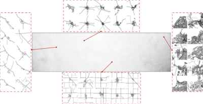
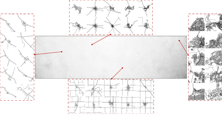
- English : An automatically generated spectrum of urban development patterns for around 1 million cities, towns and villages across the planet. Image from Vahid Moosavi's paper “Urban morphology meets deep learning” (PDF).
Semana 41 (desde el lunes 9 octubre 2017 hasta el domingo 15 octubre 2017) [Edit]

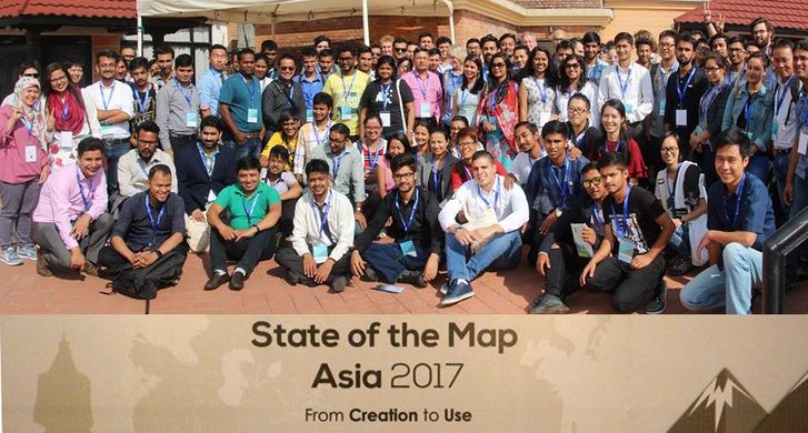
- English : Different OSM communities across Asia came together at the State of the Map Asia 2017 conference that took place in Kathmandu, Nepal from September 23 to 24th.
Semana 42 (desde el lunes 16 octubre 2017 hasta el domingo 22 octubre 2017) [Edit]

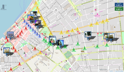
- English : The PRODEPA state agency created an online map of the city of Belém, State of Pará, Brazil, showing the location of a dozen of processions, and of points of interest, temporary medical facilities and blocked streets, for the “Círio de Nazaré” religious festival, gathering more than 2 million people during 2 weeks in October 2017.
Semana 43 (desde el lunes 23 octubre 2017 hasta el domingo 29 octubre 2017) [Edit]

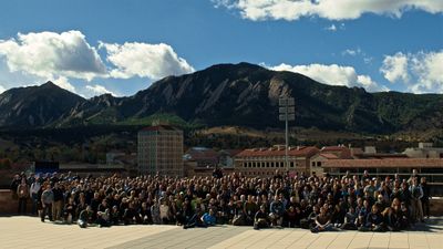
- English : Last weekend State of the Map U.S. 2017 took place in Boulder, Colorado.
Semana 44 (desde el lunes 30 octubre 2017 hasta el domingo 5 noviembre 2017) [Edit]

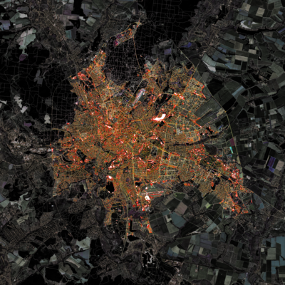
- English : Gontsa is creating a series of images merging OpenStreetMap data on top of Landsat satellite imagery. This image shows Kharkiv, Ukraine, during the autumn. You can see other works of Gontsa on his Instagram page.
Semana 45 (desde el lunes 6 noviembre 2017 hasta el domingo 12 noviembre 2017) [Edit]

- English : An award given to the (Swiss) OpenStreetMap longterm contributors, presented at the DINAcon 2017 conference in Bern on digital sustainability.
Semana 46 (desde el lunes 13 noviembre 2017 hasta el domingo 19 noviembre 2017) [Edit]

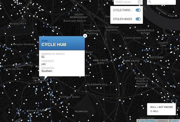
- English : A map made by Stolen Ride shows every London cycle parking location mapped on OpenStreetMap and an optional layer of police data with the places of reported stolen bikes.
Semana 47 (desde el lunes 20 noviembre 2017 hasta el domingo 26 noviembre 2017) [Edit]

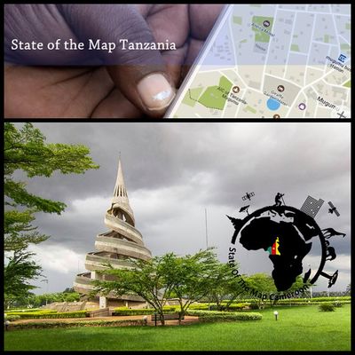
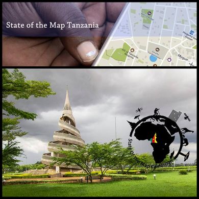
- English : December 2017 will see two State of the Map conferences in African countries! 1st-3rd, SotM Cameroon will be held in Yaoundé, and 8th-9th SotM Tanzania is in Dar es Salaam.
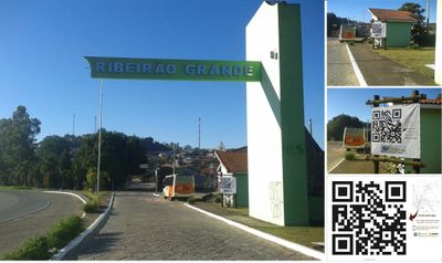
Semana 48 (desde el lunes 27 noviembre 2017 hasta el domingo 3 diciembre 2017) [Edit]

- English : The town hall of Ribeirão Grande, Brazil, put in the town entrance a map based on OpenStreetMap data, and a big QR code (containing the string
geo:-24.09498,-48.36436?z=19, an URI for representing its geographic location, based on the standard scheme proposed in RFC 5870).
Semana 49 (desde el lunes 4 diciembre 2017 hasta el domingo 10 diciembre 2017) [Edit]

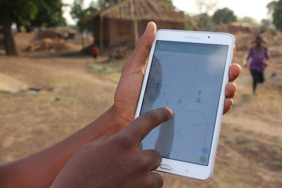
- English : Missing Maps data being used in a flood preparedness mission in Malawi, by the Malawi Red Cross Society and the Netherlands Red Cross. Information (building=*) on building quality and materials is added to OpenStreetMap to facilitate an efficient future aid response.
Semana 50 (desde el lunes 11 diciembre 2017 hasta el domingo 17 diciembre 2017) [Edit]

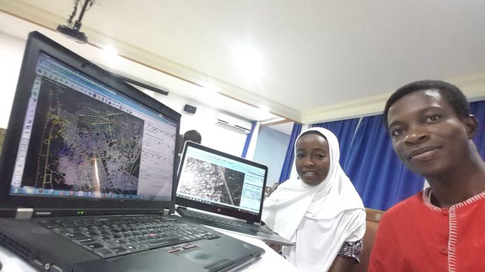
- English : Richard Folly visiting Fatima Alher and the OSMGirls, a multilingual mapping group of young African women (based in Comoros, Côte d'Ivoire, France, Ghana, Madagascar, Malawi, Mozambique, Niger, South Africa, Tanzania, Togo and Uganda).
Semana 51 (desde el lunes 18 diciembre 2017 hasta el domingo 24 diciembre 2017) [Edit]

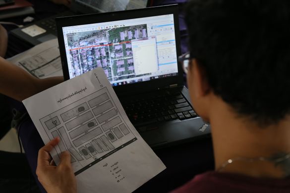
- English : Regular mapping event “Mapping Yangon” at Phandeeyar Myanmar Innovation Lab added on OpenStreetMap the street names, health centers and public locations of Dala township, Yangon region, Myanmar.
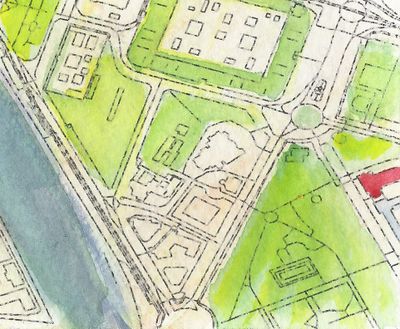
Semana 52 (desde el lunes 25 diciembre 2017 hasta el domingo 31 diciembre 2017) [Edit]

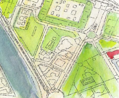
- English : Detail from a watercolour map of Seville, created by Andrew McGuire as a Christmas present for his wife. Hand-painted upon an OpenStreetMap base-map via Mapzen.