Featured images/Jan-Mar 2018
Jump to navigation
Jump to search


These are featured images, which have been identified as the best examples of OpenStreetMap mapping, or as useful illustrations of the OpenStreetMap project.
If you know another image of similar quality, you can nominate it on Featured image proposals.
| ← from January to March 2017 | ← from October to December 2017 | from April to June 2018 → | from January to March 2019 → |
Gallery of featured images, from January to March 2018
-
 2018, week 1
 -
 2018, week 2
 -
 2018, week 3
 -
 2018, week 4
 -
 2018, week 5
 -
 2018, week 6
 -
 2018, week 7
 -
 2018, week 8
 -
 2018, week 9
 -
 2018, week 10
 -
 2018, week 11
 -
 2018, week 12
 -
 2018, week 13
Details and captions
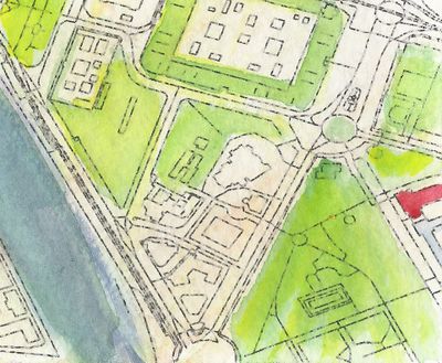
Week 1 (from Monday 1 January 2018 to Sunday 7 January 2018) [Edit]

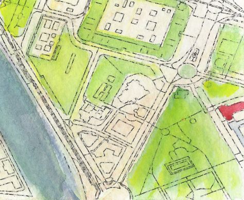
- English : Detail from a watercolour map of Seville, created by Andrew McGuire as a Christmas present for his wife. Hand-painted upon an OpenStreetMap base-map via Mapzen.
Week 2 (from Monday 8 January 2018 to Sunday 14 January 2018) [Edit]

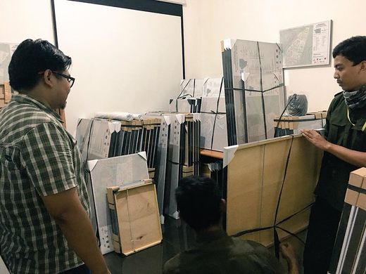
- English : As part of the InAWARE project by HOT in Indonesia, 500 framed OpenStreetMap maps were delivered to village offices around Jakarta, to help officials identify infrastructure in their area. Previously many such offices used rough hand-drawn maps.
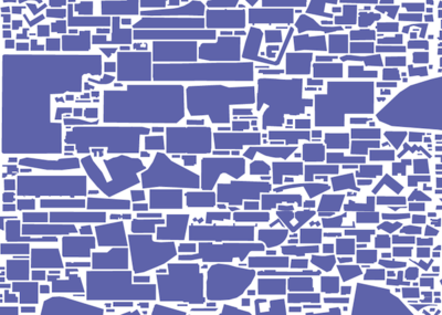
Week 3 (from Monday 15 January 2018 to Sunday 21 January 2018) [Edit]

- English : Car parks take up a lot of space within our cities. What The Street visualises this and other uses of city space for cars, trains, and cycles using OpenStreetMap data.
Week 4 (from Monday 22 January 2018 to Sunday 28 January 2018) [Edit]
- English : Christian Quest's latest creation is a 3D printed OpenStreetMap logo shaped cookie-cutter!
Week 5 (from Monday 29 January 2018 to Sunday 4 February 2018) [Edit]

- English : No image was featured this week.
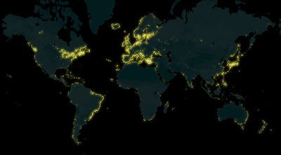
Week 6 (from Monday 5 February 2018 to Sunday 11 February 2018) [Edit]

- English : A map of lighthouses all over the world mapped on OpenStreetMap, made by Arun Ganesh (planemad). See also the interactive map on MapBox.
Week 7 (from Monday 12 February 2018 to Sunday 18 February 2018) [Edit]

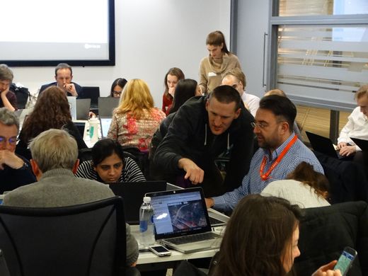
- English : Sharing OpenStreetMap editing techniques at the regular Missing Maps Project event in London.
Week 8 (from Monday 19 February 2018 to Sunday 25 February 2018) [Edit]

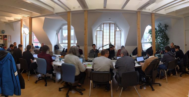
- English : Working on OpenStreetMap tech at the Karlsruhe Hack Weekend.
Week 9 (from Monday 26 February 2018 to Sunday 4 March 2018) [Edit]

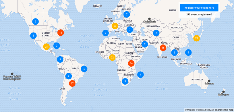
- English : This year Open Data Day will be celebrated on March 3rd and there are already 406 events registered all around the world. Many of them will have activities related to OpenStreetMap.
 Check out the map and participate in an event near you!
Week 10 (from Monday 5 March 2018 to Sunday 11 March 2018) [Edit]

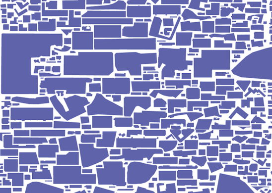
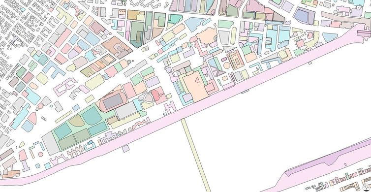
- English : Colorful exploration of OpenStreetMap buildings data on the MIT Campus in Cambridge, Massachusetts, United States. Map produced by Curran Kelleher [1].
Week 11 (from Monday 12 March 2018 to Sunday 18 March 2018) [Edit]

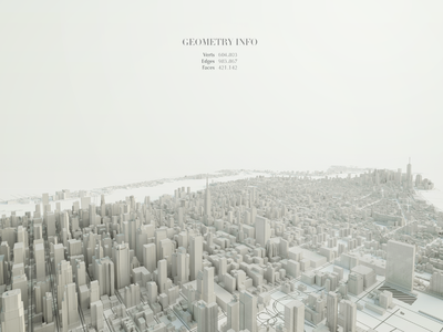
- English : Beautiful 3D visualization of Manhattan's OpenStreetMap data. Made by Matteo Prati using the open source software Blender. Check out other images in his website.
Week 12 (from Monday 19 March 2018 to Sunday 25 March 2018) [Edit]

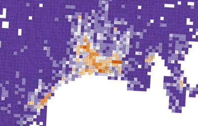
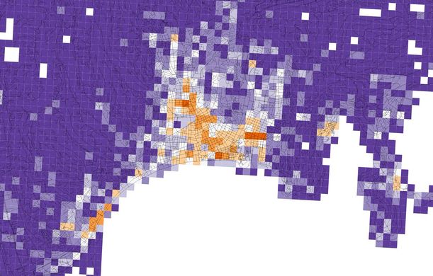
- English : Diversity of OpenStreetMap retail and services in Nice, Alpes-Maritimes, Provence-Alpes-Côte d'Azur, France. Orange tiles indicate a high diversity, while purple tiles indicate a low diversity. Image produced by Alessandro Venerandi.
Week 13 (from Monday 26 March 2018 to Sunday 1 April 2018) [Edit]

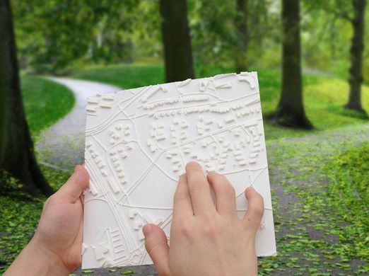
- English : Touch Mapper (touch-mapper.org) lets you create a 3D printed maps based on OpenStreetMap data. Tactile maps like this can be used for navigation by the blind.