Overpass API/Applications
Jump to navigation
Jump to search
Overpass API · Language reference · Language guide · Technical terms · Areas · Query examples · Sparse Editing · Permanent ID · FAQ · more · Web site
Servers status · Versions · Development · Technical design · Installation · XAPI compatibility layer · Public transport sketch lines · Applications · Source code and issuesOverpass turbo · Wizard · Overpass turbo shortcuts · MapCSS stylesheets · Export to GeoJSON · more · Development · Source code and issues · Web siteOverpass Ultra · Examples · Overpass Ultra extensions · MapLibre stylesheets · URL Params · more · Source code and issues · Web site
Servers status · Versions · Development · Technical design · Installation · XAPI compatibility layer · Public transport sketch lines · Applications · Source code and issuesOverpass turbo · Wizard · Overpass turbo shortcuts · MapCSS stylesheets · Export to GeoJSON · more · Development · Source code and issues · Web siteOverpass Ultra · Examples · Overpass Ultra extensions · MapLibre stylesheets · URL Params · more · Source code and issues · Web site
This page presents services based on Overpass API. Please be bold and add any Overpass API based service you know:
Maps
"Live" up-to-date data directly via Overpass API
| Application | Description | Languages | Frameworks / Browsers |
Code / License |
Screenshot |
|---|---|---|---|---|---|
| Achavi | Augmented change viewer: visualize changesets | English | OpenLayers / |
||
| Accomodation map | OSM Unterkunftskarte - Hotels, Zeltplätze, Hostel, Ferienwohnungen, Gästehäuser, Wohnwagenstellplätze, Pensionen, Motels, Campingplätze aus Openstreetmap | Deutsch | Leaflet / |
||
| Open♥Map | "The love in the palm of your hand." - Wiki | Deutsch | Leaflet / |
||
| maxheight map - OSM Truck QA Map | Check truck related tagging worldwide.
Features:
|
English Deutsch français |
OpenLayers / Firefox, Chrome, Opera, IE 8+, Mobile Versions |
Github | 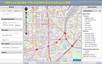 |
| OSM Buildings | OSM Buildings is a JavaScript library for visualizing OpenStreetMaps building geometry on interactive maps. | English | Leaflet / |
Github | |
| Eat, Party, Buy, Exercise - POI Map - add missing information via OSM Notes | English | Leaflet | GitHub | ||
| opening_hours map | Map which evaluates opening_hours like tags. | English Deutsch français русский português italiano українська |
OpenLayers | GitHub |  |
| Bicycle features | Bicycle tags on OSM | English | OpenLayers / |
||
| Bicycle Master Plan | Web map tool (mobile friendly) that allows visualizing cycling related data from different sources in multiple layers. Built heavily around data from OpenStreetMap, it allows full visual customization using CSS. This tool can easily visualize any (also non-cycling) data from OSM.
Written in Laravel (PHP, JS) and well documented. |
English
Slovak +easy to translate |
Leaflet | GitHubGNU GPL 3 | Live website / demo |
| Horse features | Horse related tags in OSM. | English | OpenLayers / |
||
| English | Leaflet / |
||||
| Map of Turn restrictions - | English | Leaflet / |
CC0 | ||
| Deutsch | Leaflet / |
github / MIT | |||
| CoinMap | Map showing places where Bitcoin is accepted. | English | Leaflet / |
GitHub / | 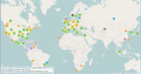
|
| Maxspeed Map | shows maxspeed tagging on streets | ||||
| Organic TransforMap | Shows where you can get organic produced stuff. Part of Project TransforMap, more maps are available here:
|
English | Leaflet | github, WTFPL | 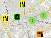
|
| Refuges Info | Covering mainly France, Switzerland, Italy, Spain : Shows a Map with Hiking amenities (mainly Alpine hut) from a local database, and hotel/camp_site/food store/parking from OSM Overpass queries. (Contact User:sletuffe) | French | Leaflet | github, WTFPL | 
|
Database updates via Overpass API
Backend database updated at regular intervals via Overpass API, no live data.
| Application | Description | Languages | Frameworks / Browsers |
Code / License |
Screenshot |
|---|---|---|---|---|---|
| CheckTheMonuments | Qualitätssicherung für Monumente | Deutsch | Slippy map | Backend code undisclosed. , , OpenStreetMap und Mitwirkende CC BY-SA; ODbL | 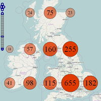
|
| Veggiekarte | Veggiekarte | Deutsch | Slippy map | GitHub | |
| haihui | Collection of hiking maps, optimized for mobile use | română | D3.js | GitHub | 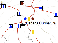
|
| Compares road name coverage in Sweden with an out-of-copyright 1996 postal number/street database. Currently limited to Greater Stockholm and some northern municipalities. Weekly updates. | svenska | Plain HTML tables | GitHub, MIT licensed code | 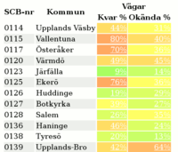
|
IDEs
| Application | Description | Languages | Frameworks | Code / License |
Screenshot |
|---|---|---|---|---|---|
| overpass turbo | A web based graphical user interface for Overpass API. With overpass turbo you can run Overpass API queries and analyse the resulting OSM data interactively on a map. |
English and many more |
Leaflet (via GeoJSON) | github / MIT | 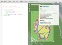 |
| Overpass Ultra | A MapLibre GL JS powered IDE. | English | MapLibre | gitlab / MIT |  |
| QuickOSM | A QGIS plugin to query Overpass. | English, French, Russian, German, Italian, Dutch | PyQGIS, OGR | github / GPL | 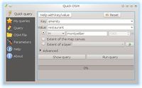 |
| OSMquery | An ArcGIS plugin to query Overpass. | github / GPLv2 |
