Proposal:Obstacle
| Obstacle | |
|---|---|
| Proposal status: | Abandoned (inactive) |
| Proposed by: | KonfrareAlbert |
| Tagging: | obstacle=yes, vegetation, fallen_tree, unevenness, precipice, hole, heap
|
| Applies to: | |
| Definition: | Objective obstacles in a path (or highways) that difficult the passability |
| Statistics: |
|
| Rendered as: | no render |
| Draft started: | 2012-10-12 |
| RFC start: | 2012-10-13 |
Proposal
This proposal derives from Proposed_features/Difficult_Passability (see the discussion page), and aims to know\avoid obstacles in a trail. I want that people can discern between trails without obstacles or objective difficulties and adventure\difficult trails. Also the key must be verifiable and for this motive I assigned values that I think that are concretes values.
Rationale
The goal of this tag is that people can select obstacles in a navigation applications that they want to avoid when calculate routes. Some navigation applications like OsmAnd can avoid routes with bumps, tolls, ferries or motorways for calculating routes for vehicles, but not can personalize calculating routes in paths, tracks, etc. and can't avoid important obstacles that could make impossible the route.
The Humanitarian OSM Team, for example, considers the key obstacle.
Examples
In the municipally term of La Palma de Cervelló (5,47Km², a very little municipally term in Catalonia, wikipedia), I calculate that there are approximately ten highway=* (paths and tracks) that could be tagged with with obstacle=vegetation, three obstacle=fallen_tree that impede the passability could be added, two highway=path could be complemented with obstacle=precipice, and two nodes with obstacle=unevenness could be added. There are much trails mapped and the pedestrian navigation experience improve with this key.
I think therefore that this key could be very useful, and could be apply to a lot of places of the world, for example the key obstacle=fallen_tree could be more used when a disaster occurs like a hurricane, earthquake... (La Palma de Cervelló was affected for extratropical Klaus cyclone in January 2009 and there were hundreds of trees fallen, a lot of them impeded the passability in trails). In Catalonia there are hard wind frequently, topcoat the Tramuntana wind (see the Wikipedia).
Tagging
|
Nodes and ways must be on the existing |
Values for key obstacle=*
| Value | Elem. | Description | Additional tags | Photo |
|---|---|---|---|---|
| yes | Static elements in the trail (in front or around) that difficult the passability[1] | |||
| vegetation | There are big shrubberies, brambleberry, very high and dense grass, big branches, lianas, etc that difficult de passability and force you to move careful[2] | 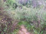 | ||
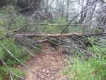
| fallen_tree | There is a big fallen tree that completely hinders passability, and you only can continue the path if you cross the tree (cross it above or below)
|
 | ||
| precipice | There is an important precipice alongside the trail (at least one side) that your eyes can't avoid see if you look forward and you see the falling. There are a minimal risk of falling[4], but it's an important difficulty for people with dizziness. You can't move over away from the precipice and take out it of your visual field | 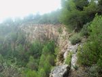 | ||
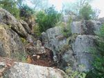
| unevenness | In front of the trail you must use hands for continue the route[6], and can't be avoid. |
|
 | |
| hole | There is a big hole in the trail that you must cross for continue the route and difficults the passability, that can't be avoid.
|
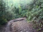 | ||
| heap | There is a heap of rocks, grit, debris, etc. in the trail that you must cross for continue the route and difficults de passability, that can't be avoid.
|
|
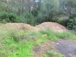 |
Notes:
- [1] i.e. For a pedestrian, you can't walk erect and with stretched arms and in beeline, evidently following the path traced ;)
- [2] i.e. For pedestrian, when you walk the personal space is limited and force you to duck or to dodge, and you must walk careful. There are risk of scratches in arms and legs, and stumbles.
- [3] If the fallen tree takes a long time is there (almost always, because wouldn't be unwise than you mark a tree that has fallen recently, since it could be cleaned).
- [4] The risk could be major for people with a tendency to fall over, small children, etc.
- [5] If there is a wall in one side, could be important.
- [6] It can be because there is a big stone, a margin that must be crossed or simply the terrain begins to be very steep.
- [7] If you need safety measures, you can combine with the proposed key Safety measures on hiking trails.
Subkeys
This key was defined for huge obstacles than difficults the pass for all types of transport. If the obstacle difficults the passability only for some (for example, heaps and holes probably aren't an obstacle for pedestrians), you can use these subkeys:
| Obstacle for | Key |
|---|---|
obstacle:foot=*
| |
obstacle:wheelchair=*
| |
obstacle:bicycle=*
| |
obstacle:motorcycle=*
| |
obstacle:horse=*
| |
obstacle:motorcar=*
| |
obstacle:hgv=*
|
For exceptional cases (I do not know what) you could use a negative tag, for example:
obstacle=fallen_tree--> Impedes the pass for some.obstacle:horse=no--> Indicates that the pass is possible only for horse riders
Obstacle description
If you want to mark an obstacle that doesn't coincide with tags descrited, you could use a description tag that contents text. You must add the key obstacle=yes for calculating routes purpose.
| Key | Value |
|---|---|
obstacle_description=*
|
Free text with description of the obstacle. Short and concise. |
Other obstacles
- Difficult bridges: In this case is better than you use
obstacle=yes, and add the key:bridge=*with its proposed values (for example,bridge=abandoned). If there is a narrow bridge you must addwidth=*orest_width=*. - Landslide: It isn't really an obstacle, is better if you use
hazard_prone=yesandhazard_type=landslide. If you consider necessary, you can add the keyobstacle=yes. If a landslide has occured and there are a heap and a hole in the trail, please see how you can tag it in «Types of landslides (holes and heaps) and tagging» in the discussion page. - Narrowness: In this case is better than you use
obstacle=yes, and add one of these keys:width=*orest_width=*. - Waterway crossing: In this case is better than you use
obstacle=yes, and add one of these keys:ford=yes,ford=stepping_stonesorflood_prone=*.
Compatible keys
Other keys like trail_visibility=*, sac_scale=*, smoothness=*, tracktype=* are compatible with the key obstacle=* proposed.
Applies to
This key always must be in a way with the key highway=* (generally in highway=path, highway=footway, highway=cycleway, highway=bridleway or highway=track).
The key obstacle=* could be a node in this way, or a key added to highway=* in the way or in a stretch of the way (if the difficulty is along five meters).
Elements for fallen tree
![]() The key
The key obstacle=fallen_tree must be only a node because always is a puntual obstacle. If a long fallen tree obstaculizes two trails, the best option would be add a node with obstacle=fallen_tree in each trail. If we mark the fallen tree like a way that affects two trails, then we lose the calculating routes proposal for avoid obstacles.
Elements for hole and heap
![]() The keys
The keys obstacle=hole and obstacle=heap could be a node, a way or an area (if the hole/heap is very big, diameter > 5 meters). For calculating routes purpose could be better to use a node or a way added in the highway=* than an area. If the hole/heap affects two trails, you must proceed like obstacle=fallen_tree that affects two trails.
Differences with other keys
barrier=*is made on purpose to hinder movement, andobstacle=*are made for other purposes or have natural origins.
hazard=*indicates the probability of risk, andobstacle=*indicates the presence of an objective elements that could difficult the passability (according yor habilities or capacities). Please, see the Proposed_features/hazard.
| Remember than an obstacle can be an important impediment for some, but a fun challenge for others. The important thing is know where they are. |
Statistics
| Obstacle |
|---|
Rendering
This key no needs to be rendered.
Examples of rendering
- Example in the Merretekerjek project (Hungary).
Features/Pages affected
If this proposal is approved most of the highway=* pages must includes this key for add.
Related proposition
- Proposed features/pathtype : Global classification for paths.
See also
- DE:Reiten#Durch Naturereignisse entstandene Hindernisse
- Used in: Meine Garmin OSM Wanderkarte
- «Come mappare un sentiero invaso dalla vegetazione.» link.
- Key:obstacle
- Hu:Key:obstacle
- RU:Саратов/Кумысная_поляна#Предложения которые можно использовать (Saràtov)
Comments
Please use the discussion page for comments.
Voting
Not yet open.