Scotland
Scotland (Gaelic: Alba) is a nation in northwest Europe and one of the four constituent countries of the United Kingdom.
| V・T・E |
| latitude: 57.88, longitude: -4.57 |
| Browse map of Scotland 57°52′48.00″ N, 4°34′12.00″ W |
| Edit map |

|
|
External links:
|
| Use this template for your locality |
Scotland is a country in United Kingdom, Europe at latitude 57°52′48.00″ North, longitude 4°34′12.00″ West.
Welcome
Welcome to the Openstreetmap wiki project page for Scotland. This page collects some of the projects that are of interest to Scottish Mappers. We also list the projects where local groups have set up regular social meetings so you can have a chance to meet other mappers face to face.
You can follow ![]() @OSMScotland
@OSMScotland![]() on twitter for Scottish OSM news
on twitter for Scottish OSM news
Social Meetings
As of 2024, we have regular pub meetings in Edinburgh on the third Tuesday of the month, usually in the Guildford Arms, sometimes elsewhere. These are generally informal and relaxed and announced in OSMCal.
Useful data sources
Ordnance Survey 7th Series
Some old Ordnance Survey maps of Britain are coming out of copyright, starting with Scotland. A project is running to scan and rectify these maps, then make them available to trace within Potlatch and JOSM.
For more information, see 7th Series.
Gaelic names
Many places in Scotland have Gaelic names - these are often shown on road signs in the West Highlands, and on street signs in some towns.
Gaelic names can be tagged using name:gd=* (with name=* for the name in English).
In places where Gaelic is the main language (eg the Western Isles), the Gaelic name can be tagged using name=*, with name:en=* for the English names.
The national advisory partnership for Gaelic names is Ainmean-Àite na h-Alba (Gaelic Place-Names of Scotland). They have produced place-name lists for several trunk roads and a number of areas of Scotland. These lists have been researched, and agreed with local authorities, so can be considered to be the definitive Gaelic forms of the names. Ainmean-Àite na h-Alba have been contacted, and confirmed the Gaelic forms of the names themselves are uncopyrightable, so are fine to use in OpenStreetMap.
A list of maps in Gaelic can be found at Key:name:gd.
See also: Multilingual names
Open Data
Quite a few open datasets have been released that could be compared to OSM data to see what we're missing.
Core Paths data. Community forum thread, map comparing OSM data to local authority data. See also designation=core_path
Listed buildings
Listed buildings are on Wikidata, so an efficient way of linking them is through https://map.osm.wikidata.link though this will only add wikidata=*, not other tags such as heritage=* or ref:GB:HS=*. See also Key:heritage#United_Kingdom.
Statutory List of Roads
Also known as Council Areas, there are 32 unitary Authorities in Scotland. They were established on 1 April 1996. [1] They were established by the Local Government etc. (Scotland) Act 1994. [2]
After searching for "Statutory list of roads" the results are shown, please update if new information comes forward or links change
| Council | Streetnames Available Online | Streetnames Available Offline | Requesting Permission |
|---|---|---|---|
| Aberdeen City | Possible | ||
| Aberdeenshire | Copyright | None | |
| Angus | None | None | |
| Argyll and Bute | None | None | |
| Clackmannanshire | Searchable | ||
| Dumfries and Galloway | Available and here and here | ||
| Dundee City | None | Possible | |
| East Ayrshire | None | Possible | |
| East Dunbartonshire | None | Copyright | |
| East Lothian District | None | None | |
| East Renfrewshire | Available | ||
| Edinburgh City | Available | ||
| Falkirk | Copyright | ||
| Fife | Possible | ||
| Glasgow City | Council Copyright | ||
| Highland | Available | Possible | |
| Inverclyde | None | None | |
| Midlothian | Available | ||
| Moray | None | None | |
| Na h-Eileanan Siar | Partial Copyright | ||
| North Ayrshire | None | None | |
| North Lanarkshire | None | None | |
| Orkney Islands | None | Copyright | |
| Perth and Kinross | Available | ||
| Renfrewshire | Copyright | ||
| Scottish Borders | Available | ||
| Shetland Islands | Possible | ||
| South Ayrshire | None | None | |
| South Lanarkshire | None | Possible | |
| Stirling | Available | ||
| West Dunbartonshire | None | None | |
| West Lothian | None | None |
Old stuff
The below content has not been updated in a while and is out of date as of 2024.
Mapping Parties
- Aberdeen/MapHack/2014-11 on 22nd November 2014
- Stirling on 23 August 2014. See the Stirling page for more details.
- Edinburgh/MappingParty/2014-03 Duddingston, near Edinburgh, March 2014
- Culbokie Mapping Party with Transition Black Isle, Sat 7 September 2013
- Mapping party in Dunbar Sat 23 March 2013
- Mapping_Party/Shotts, 2012
- Mapping_Party/New_Lanark, 2012
Workshops
There was a workshop in Glasgow on Sat 23 Feb at MAKlab more details here Glasgow/Hack_Day_Feb_2013
See details of our last mapping workshop on Saturday 17 March 2012 here
More events soon, keep an eye on this page
State of the Map Scotland
- State of the Map Scotland 2015 took place in October 2015
State of the Map Scotland 2014was postponed. Too much mapping going to arrange conference- State of the Map Scotland 2013 took place October 2013
- State of the Map Scotland 2012 took place in October 2012
- State of the Map Scotland 2011 took place in August 2011
OSM Scotland facts
Some facts about the Scottish OpenStreetMap as of October 2011:
- Approximately, 1452 unique accounts have edited the map in Scotland
- 97.9% of road names have been added when compared with the Ordnance Survey dataset (as of January 2014), with all council areas now >95% complete. Ref: ITO
- 836 bike racks with the capacity to accommodate around 6682 bikes are on the map
- 2540Km of cycle lanes and cycle paths have been mapped (only covers a select number of cycle way tags)
Cities
The following tables shows our progress with mapping the cities in Scotland.
See also Category:Cities in Scotland
| %age complete | |||||
|---|---|---|---|---|---|
| Postal Area | City | Tracks | Mapped | Labelled | Notes |
| AB | Aberdeen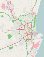 |
99.6% | 99.6% | Bing Aerial Imagery is available | |
| DD | Dundee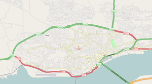 |
96.33% | 96.33% | Bing Aerial Imagery is available | |
| EH | Edinburgh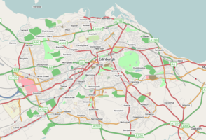 |
99.9% | 99.9% | Bing Aerial Imagery is available | |
| G | Glasgow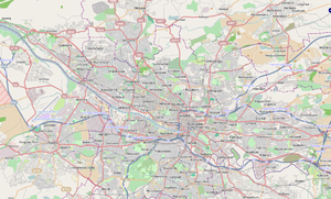 |
100.0% | 100.0% | Bing Aerial Imagery is available | |
| IV | Inverness |
Bing Aerial Imagery is available | |||
| FK7-FK9 | Stirling |
99.27% | 99.27% | Bing Aerial Imagery is available | |
Towns and villages
The following tables shows our progress with mapping various towns and villages in Scotland.
See also Category:Towns in Scotland and Category:Villages in Scotland
Please add a town or village that you're interested in or tracking/mapping here. Try to keep the list ordered by Town Name. Where necessary create a sub page to try and keep this table quite succinct.
| %age complete | |||||
|---|---|---|---|---|---|
| Postal Area | Town Name | Tracks | Mapped | Labelled | Notes |
| ML11 | Abington, South Lanarkshire |
100% | 100% | 100% | Finished 02/03/2010 |
| ML6 | Airdrie |
100% | 100% | 100% | Finished 10/11/2010 |
| ML9 | Ashgill |
100% | 100% | 100% | Finished 18/06/2008. |
| G69 | Bargeddie |
100% | 100% | 100% | Finished 13/08/2008. |
| ML4 | Bellshill |
100% | 100% | 100% | |
| IV10 | Black Isle |
||||
| PH10 | Blairgowrie |
20% | 20% | 20% | |
| ML6 | Caldercrux, North Lanarkshire |
100 | 100% | 100% | Finished 13/11/10 |
| ML5 | Coatbridge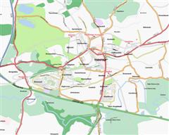 |
100% | 100% | 100% | Finished 15/11/10 |
| ML11 | Crawford, South Lanarkshire |
100% | 100% | 100% | Finished 10/02/2009 |
| TD12 | Coldstream, Borders |
100% | 100% | 100% | Finished 22/05/2009 |
| G67/G68 | Cumbernauld |
100% | 100% | 100% | |
| DG1/2 | Dumfries |
||||
| TD11 | Duns, Borders |
5% | 5% | 5% | |
| IV30 | Elgin, Moray |
20% | 20% | 20% | |
| FK1-FK5 | Falkirk |
||||
| ML5 | Glenboig |
100% | 100% | 100% | Finished 13/08/2008. |
| ML6 | Glenmavis, North Lanarkshire |
100% | 100% | 100% | |
| ML3 | Hamilton |
100% | 100% | 100% | |
| TD8 | Jedburgh, Borders |
5% | 5% | 5% | |
| TD5 | Kelso, Borders |
10% | 10% | 10% | |
| G66 | Kirkintilloch |
100% | 100% | 100% | |
| ML11 | Lanark |
100% | 100% | 100% | |
| ML9 | Larkhall |
100% | 100% | 100% | Finished 19/01/2009 |
| ML8 | Law,South Lanarkshire |
100% | 100% | 100% | Finished 20/01/2009 |
| G66 | Lenzie |
100% | 100% | 100% | |
| EH54 | Livingston |
15% | 15% | ||
| ML1 | Motherwell |
100% | 100% | 100% | |
| ML9 | Netherburn, South Lanarkshire |
100% | 100% | 100% | Finished 19/01/2009 |
| ML6 | Plains, North Lanarkshire |
100% | 100% | 100% | . |
| ML9 | Shawsburn, South Lanarkshire |
100% | 100% | 100% | Finished 18/06/2008. |
| ML7 | Shotts, North Lanarkshire |
100% | 100% | 100% | |
| ML2 | Wishaw |
100% | 100% | 100% | |
Lieutenancy areas of Scotland
Preserved counties are counties based on the historic counties of Scotland and used for lieutenancy. See also the English Wikipedia page about Lieutenancy areas of Scotland.
| Lieutenancy county | OSM relation | Note |
|---|---|---|
| Aberdeen | ||
| Aberdeenshire | ||
| Angus | ||
| Argyll and Bute | ||
| Ayrshire and Arran | ||
| Banffshire | ||
| Berwickshire | ||
| Caithness | 374913 |
|
| Clackmannanshire | ||
| Dumfries | ||
| Dunbartonshire | ||
| Dundee | ||
| East Lothian | ||
| Edinburgh | ||
| Fife | ||
| Glasgow | ||
| Inverness | ||
| Kincardineshire | ||
| Lanarkshire | ||
| Midlothian | ||
| Moray | ||
| Nairn | ||
| Orkney | 375982 |
|
| Perth and Kinross | ||
| Renfrewshire | ||
| Ross and Cromarty | ||
| Roxburgh, Ettrick and Lauderdale | ||
| Shetland | 2235077 |
|
| Stirling and Falkirk | ||
| Sutherland | ||
| The Stewartry of Kirkcudbright | Relation not defined yet | |
| Tweeddale | ||
| West Lothian | ||
| Western Isles | ||
| Wigtownshire |
See Also...
References
- ↑ Local Councils - Scotland - Direct.gov.uk
- ↑ Local Government etc. (Scotland) Act 1994.

