Template:Ast:Map Features:aeroway
Jump to navigation
Jump to search
Víes aerees (Aeroway)
Etiquetes rellacionaes principalmente con aeropuertos, aeródromos, bases aerees y otres instalaciones en tierra que dan encontu a les operaciones d'aeroplanos y helicópteros. Visita la páxina Aeroways pa una introducción al mapéu d'eses carauterístiques.
| Clave | Valor | Elementu | Comentariu | Representación | Foto |
|---|---|---|---|---|---|
| aeroway | aerodrome |  | |||
| aeroway | airstrip | A field or area where light aircraft can land and take off from. |  | ||
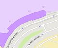
| aeroway | apron |  |
 | ||
| aeroway | control_center |  | |||
| aeroway | fuel | Fuelling station for aircraft. |  | ||
| aeroway | gate |  |
 | ||
| aeroway | hangar |  | |||
| aeroway | helipad |  | |||
| aeroway | heliport |  | |||
| aeroway | highway_strip |  | |||
| aeroway | holding_position | A point behind which aircraft are considered clear of a crossing way |  | ||
| aeroway | jet_bridge | Passenger boarding bridge |  | ||
| aeroway | model_runway | Take-off and landing runway for model aircraft |  | ||
| aeroway | navigationaid |  | |||
| airmark | beacon |  | |||
| aeroway | parking_position | A location where an aeroplane can park |  | ||
| aeroway | runway |  |
 | ||
| aeroway | spaceport | A spaceport or cosmodrome: a site for launching or receiving spacecraft |  | ||
| aeroway | stopway | Stopway is a rectangular surface beyond the end of a runway used during an aborted takeoff. |  | ||
| aeroway | taxilane | Taxilane is a path in an airport that is part of the aircraft parking area or apron (Proposed feature with low usage as of 2015-10; use with an eye towards the question correct usage). | |||
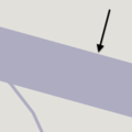
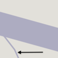
| aeroway | taxiway |  |
 | ||
| aeroway | terminal |  |
 | ||
| aeroway | tower | See also aeroway=control_tower or combination of man_made=tower + service=aircraft_control for similar schemes.
|
 | ||
| aeroway | windsock |  | |||
| aeroway | User defined | Tolos valores usaos de vezu acordies con Taginfo |
This table is a wiki template with a default description in English. Editable here. Esta tabla ye una plantía wiki que pue editase equí. The default template with description in English is editable here.

