Template:Cs:Map Features:aeroway
Jump to navigation
Jump to search
Letiště (Aeroway)
Značky vztahující se hlavně k letištím a jiným pozemním zařízením, které slouží leteckému provozu. Více informací je na stránce Letecká doprava.
| Klíč | Hodnota | Prvek | Popis | Vykreslování | Ilustrace |
|---|---|---|---|---|---|
| aeroway | aerodrome | military=airfield.
|
 | ||
| aeroway | airstrip | A field or area where light aircraft can land and take off from. |  | ||
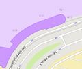
| aeroway | apron | ref=*.
|
 |
 | |
| aeroway | control_center |  | |||
| aeroway | fuel | Fuelling station for aircraft. |  | ||
| aeroway | gate | ref=*.
|
 |
 | |
| aeroway | hangar | building=hangar.
|
 | ||
| aeroway | helipad |  | |||
| aeroway | heliport |  | |||
| aeroway | highway_strip |  | |||
| aeroway | holding_position | A point behind which aircraft are considered clear of a crossing way |  | ||
| aeroway | jet_bridge | Passenger boarding bridge |  | ||
| aeroway | model_runway | Take-off and landing runway for model aircraft |  | ||
| aeroway | navigationaid |  | |||
| airmark | beacon |  | |||
| aeroway | parking_position | A location where an aeroplane can park |  | ||
| aeroway | runway | aeroway=runway.
|
 |
 | |
| aeroway | spaceport | A spaceport or cosmodrome: a site for launching or receiving spacecraft |  | ||
| aeroway | stopway | Stopway is a rectangular surface beyond the end of a runway used during an aborted takeoff. |  | ||
| aeroway | taxilane | Taxilane je cesta na letišti, která je součástí parkovací plochy pro letadla nebo stojánky. (Navrhovaný, málo užívaný prvek (v říjnu 2015), používejte s rozvahou). | |||
| aeroway | taxiway | ref=*.
|
 |
 | |
| aeroway | terminal |  |
 | ||
| aeroway | tower | See also aeroway=control_tower or combination of man_made=tower + service=aircraft_control for similar schemes.
|
 | ||
| aeroway | windsock | lit=yes.
|
 | ||
| aeroway | další hodnoty | Další často používané hodnoty najdete pomocí Taginfo. |
This table is a wiki template with a default description in English. Editable here.

