IT:Tag:sport=climbing
 |
| Descrizione |
|---|
| Indica gli elementi che rappresentano un sito di arrampicata sia naturale (falesia, zona d'arrampicata, settore, singola via isolata, cascata di ghiaccio, etc.) che artificiale (parete artificiale attrezzata, palestra d'arrampicata etc.) |
| Gruppo: Sports |
| Applicabile agli elementi |
| Combinazioni utili |
| Vedi anche |
| Stato: de facto |
| Strumenti |
Il tag sport=climbing indica gli elementi che rappresentano un sito di ![]() arrampicata sportiva sia naturale (sito d'arrampicata, sectors, falesia, gole, cascate di ghiaccio, ecc.) che artificiale (muri per arrampicate, arrampicata indoor, ecc.)
arrampicata sportiva sia naturale (sito d'arrampicata, sectors, falesia, gole, cascate di ghiaccio, ecc.) che artificiale (muri per arrampicate, arrampicata indoor, ecc.)
Per maggiori dettagli per indicare i singoli percorsi o i campi di arrampicate vedi climbing.
Mappatura
Questo schema dovrebbe essere usato preferibilmente su ![]() nodes per i muri di arrampicata artificiali. Piò essere applicato anche alle
nodes per i muri di arrampicata artificiali. Piò essere applicato anche alle ![]() ways in aggiunta a
ways in aggiunta a natural=cliff o per le sale di arrampicata con building=yes. Lo schema si applica anche a massi su pareti scoscese indicati con natural=rock e rocce singole indicate con natural=stone.
Tag base
| Tag = Valore | Descrizione |
|---|---|
sport=climbing
|
Qui è possibile arrampicare. |
name=*
|
Nome della falesia, settore o via, se ne ha uno. |
leisure=sports_centre
|
Muro di arrampicata artificiale. Può essere usato in concomitanza a building=yes o simili se al chiuso.
Per strutture simili a torri si possono aggiungere i tag |
Stili di arrampicata

Se uno qualsiasi di questi tag non è presente, si da per scontato che il suo valore sia "no".
| Tag | Valore | Descrizione |
|---|---|---|
climbing:sport=*
|
yes / no / <Numero di vie> | È possibile fare sempre arrampicata (ci sono ancoraggi fissi e permanenti) |
climbing:boulder=*
|
yes / no / <Numero di vie> | È possibile fare bouldering. |
climbing:toprope=*
|
yes / no / <Numero di vie> | È possibile fare arrampicata con corda dall'alto, top rope o moulinette. |
climbing:trad=*
|
yes / no / <Numero di vie> | È possibile fare arrampicata Trad (non vi sono ancoraggi fissi, occorre sistemare delle protezioni durante la salita). |
climbing:multipitch=*
|
yes / no / <Numero di vie> | Sono vie multi tiro multi-pitch. |
climbing:ice=*
|
yes / no / <Numero di vie> | Cascate di ghiaccio o simili. Non è presente alcun tipo di roccia. |
climbing:mixed=*
|
yes / no / <Numero di vie> | Arrampicata mista, con ghiaccio e rocce. |
climbing:deepwater=*
|
yes / no / <Numero di vie> | Rocce sotterranee a strapiombo per il Deep-Water-Soloing. |
Gradazione vie
Solitamente le singole vie sono gradate in base alla loro difficoltà. Se non sono mappate le singole vie ma piuttosto un settore o una falesia, dobbiamo specificare un intervallo di difficoltà.
| Tag | Description |
|---|---|
| Grado minimo/massimo/medio secondo il sistema di gradazione UIAA. | |
| Grado minimo/massimo/medio secondo il sistema di gradazione francese. | |
| Grado minimo/massimo/medio secondo il sistema di gradazione sassone. |
Informazioni aggiuntive
| Tag | Value | Description |
|---|---|---|
ele=*
|
Elevazione media in metri sul livello del mare del punto più basso dell'arrampicata. NON indica la lunghezza del percorso | |
| Lunghezza media, minima o massima del percorso in metri.
La lunghezza del percorso può variare significativamente rispetto al muro di roccia! Questo valore è importante per decidere quale corda utilizzare. | ||
climbing:rock=*
|
etc. |
Tipo di roccia della parete. |
climbing:quality=*
|
etc. |
Qualità della roccia o del ghiaccio |
climbing:bolted=*
|
yes / no / <average bolt distance in meters> | Ci sono degli ancoraggi fissi? Qual è la loro distanza media? |
climbing:orientation=*
|
etc. |
Orientamento della parete di roccia. Aiuta a scegliere l'ora del giorno più idonea o a stabilire quanto tempo è necessario prima ch ela parete di asciughi dopo la pioggia. |
climbing:summit_log=*
|
yes | È presente un diario in cima alla parete di arrampicata. |
climbing:routes=*
|
Integer number | Numero di percorsi su questa rupe. |
indoor=*
|
yes / no | Strutture artificiali potrebbero essere all'interno di un edificio. Se manca questo tag, si presume che la struttura sia ll'esterno. |
website=*
|
URL | Sito ufficiale |
url=*
|
URL | Sito non ufficiale con informazioni utili |
opening_hours=*
|
etc. |
Pareti artificiali potrebbero avere orari di apertura fissi. Per le pareti naturali potrebbero esserci restrizioni in caso di stagioni o periodi pericolosi. |
fee=*
|
yes / no / interval | Se è richiesto un pagamento o l'iscrizione a un club per l'accesso. |
Esempi di pittogrammi
-
 Pittogramma per l'arrampicata su roccia
 -
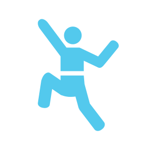 Pittogramma per l'arrampicata sportiva o il bouldering

Esempi fotografici
-
 Parete di arrampicata indoor
 -
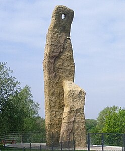 Parete di arrampicata all'esterno


Visualizzazione
Carto non visualizza questi tag, ma ci sono altri motori di rendering disponibili:
- http://openclimbingmap.bstegmaier.de
- http://martinkoeller.github.io/ClimbingMap/example1.html (dati sincronizzati a mano; ultimo aggiornamento: 11-05-2014)
Vedi anche
- Discussione per il tag nei forum inglesi o tedesco.
playground=climbingwall(generalmente senza il tag sport) per piccole pareti di arrampicata per i bambini, generalmente nei parchi giochi- High ropes course proposal
- via ferrata proposal
- bare rock proposal
- Talk:Proposed_features/Playground_Equipment#Put_new_objects_here_to_find_good_names