MUTCD/California

The California Manual on Uniform Traffic Control Devices (CA MUTCD) is the standard for road signs, signals, and markings in the U.S. state of California. It is developed by the California Department of Transportation (Caltrans) "in substantial conformance to" the national MUTCD developed by the Federal Highway Administration.
The CA MUTCD defines the content and placement of traffic signs. Design specifications are detailed on a section of the Caltrans website that is based on the national Standard Highway Signs and Markings (SHSM) document. The latest edition of the CA MUTCD was published in 2026. The latest sign specifications were published on July 1, 2025 (as of July 2025). [1]
Usage in OpenStreetMap
A traffic sign specific to the CA MUTCD is mapped as a ![]() node tagged
node tagged traffic_sign=US:CA:Z1-2, where "US:CA" is the state's ISO 3166 code and Z1-2 is the sign's alphanumeric designation.
Sign designations
Each standard sign or plaque in the CA MUTCD and on the Caltrans website is assigned an alphanumeric designation and organized by series. A sign designation generally follows the same format as in the national MUTCD and SHSD. However, some series are specific to the CA MUTCD, and the sign designation for a state-specific sign includes "(CA)" at the end, which is not included in the traffic_sign=* value.
| Category | Series | Sign | Variant | ||
|---|---|---|---|---|---|
| R | 73 | - | 3 | (CA) | |
| Regulatory | Intersection Lane Control | Left Turn Arrow No U Turn | California-specific |
| Category | Series | Sign | Variant | ||
|---|---|---|---|---|---|
| R | 28 | - | (S) | (CA) | |
| Regulatory | No Parking Any Time with Arrow | No Stopping Any Time with Arrow | California-specific |
Very rarely, Caltrans uses position and orientation suffixes such as "Grid" and "(Lt)" in state-specific designations. In some older specifications, the suffix after the hyphen indicates the size of the sign. Neighborhood electric vehicle signs have the prefix "NEV-" before the sign category.
Signs by series
- Main article: MUTCD#Signs by series
The following pages contain a correspondence between Caltrans-specific signs and their most likely tagging in OpenStreetMap:
- Series G – California Guide

- Series SG – California Special Guide


- Series S – California Special Information
- Series PS and PREP – Prohibited Recreational and Cultural Interest Area Symbols

- Series R – California Regulatory

- Series SR – California Special Regulatory

- Series C – California Temporary Traffic Control

- Series SC – California Special Temporary Traffic Control

- Series W – California Warning

- Series SW – California Special Warning

- Series OM – California Object Markers

Other standardized signs
California Public Utilities Commission
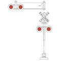
The California Public Utilities Commission has designated the following signs and signals to be used in conjunction with CA MUTCD signs at railroad crossings: [2]
City of Berkeley
The City of Berkeley Transportation Division has a coded system of seven signs for cycling infrastructure. [3]
| Type | Designation | Name | Tags | Notes |
|---|---|---|---|---|
| 1A | Identification | cycleway=shared_lane bicycle=designated lcn=yes |
How to identify it as a bike boulevard? cyclestreet=yes is often used but possibly misleading.
| |
| 1B | Destination and Distance Info | destination:bicycle=Willard Park;Telegraph;UC Berkeley;Downtown on the road aheaddestination=Willard Park;Telegraph;UC Berkeley;Downtown distance=0.2 mi;0.5 mi;0.9 mi;1.6 mi on the traffic sign node
| ||
| 1C | Destination and Distance Info (at Boulevard Crossing) | destination:bicycle=Telegraph;UC Berkeley on Channing Way to the leftdestination:bicycle=Aquatic Park on Channing Way to the rightdestination:bicycle=Telegraph;UC Berkeley;Aquatic Park distance=0.6 mi;0.6 mi;1.8 mi on the traffic sign node
| ||
| 1D | Route Guidance | cycleway=shared_lane bicycle=designated lcn=yes on 9th Street to the right |
How to identify it as a bike boulevard? cyclestreet=yes is often used but possibly misleading.
| |
| 2 | Off-route Wayfinding | cycleway=shared_lane bicycle=designated lcn=yes on Millegass Bowditch to the left |
How to identify it as a bike boulevard? cyclestreet=yes is often used but possibly misleading.
| |
| 3 | Street Identification | cycleway=shared_lane bicycle=designated lcn=yes name=Milvia Street |
How to identify it as a bike boulevard? cyclestreet=yes is often used but possibly misleading.
| |
| 4 | Advance Street Identification | cycleway=shared_lane bicycle=designated lcn=yes on Milvia Street ahead |
How to identify it as a bike boulevard? cyclestreet=yes is often used but possibly misleading.
|
City of San José
The City of San José defines a number of trail signs with MUTCD-style codes.


