Proposal:Information
| information | |
|---|---|
| Proposal status: | Proposed (under way) |
| Proposed by: | vsandre |
| Tagging: | information=* |
| Applies to: | node/area |
| Definition: | To differ between offices and other information sources tagged with tourism=information |
| Statistics: |
|
| Draft started: | 2008-11-10 |
| RFC start: | 2008-11-11 |
Page moved now to information=*
Definition
The tourism=information describes an information source for tourists, travellers and visitors. But it does not differ between diverse types of an information point. The goal of this proposal is to specify this tag a little bit more, so it should be easier to find the right information point on a map.
This tag can be also used for information boards at a educational trail. The route and the boards/maps should than be part of relation.
Values
Information
| Key | Value | Element | Comment | Rendering | Photo |
|---|---|---|---|---|---|
| information | office | An office where you can get information about a town or region. | |||
| information | visitor_centre | A place where you can get information about a specific attraction or place of interest. | |||
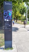
| information | board | A board with information. To describe it closer, have a look at board_type=*. | |||
| information | stele | A stele for information. | |||
| information | terminal | A information terminal provides information access via electronic methods. Mostly it is combined with access to the internet. (See internet_access=*.) | |||
| information | audioguide | A place where you can get information using headphones or a mobile phone. | |||
| information | map | A board with a map. To specify the type or shown details, have a look at map_type=* and map_size=* in information=map. To describe the access to the shown routes or the kind of route use the keys e.g hiking=yes, bicycle=yes, mtb=yes, horse=yes or ski=yes. | |||
| information | tactile_map | Tactile maps are maps for the blind, also known as haptic maps. | |||
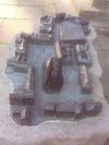
| information | tactile_model | Tactile models are models for the blind representing buildings and surroundings. | |||
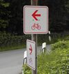
| information | guidepost | Signposts/Guideposts are often found along official hiking/cycling routes to indicate the directions to different destinations. To describe the access to the shown routes or the kind of route use the keys e.g hiking=yes, bicycle=yes, mtb=yes, horse=yes or ski=yes. | |||
| information |
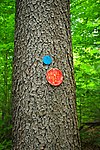
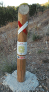
A marker that shows the position of the way of a route. Could be a symbol, a short pole or a painted marking. Note: 2 variant tag values are in use – route_marker and trail_blaze (see Taginfo comparison for the current number of uses or this tag history on taghistory.raifer.tech as a curve chart):
|
||||
| information | user defined | All commonly used values according to Taginfo |
This table is a wiki template with a default description in English. Editable here.
Access-keys to describe a guidepost or map closer
| Access tage are clearly defined as legal access tags. They are not used to describe things, but only access to something. Many people will be against suggested tagging schema in current state. |
| access-key | Description | Example/photo |
|---|---|---|
| hiking=yes | A map/guidepost which shows hiking routes.
|
|
| bicycle=yes | A map/guidepost with bicycle routes. | |
| ski=yes | A map/guidepost with of skiing paths and pistes. | |
| ... | Many more possibilities |
- See also the New vs. original scheme-section at the talk page to convert old entries.
Type of map
map_type=* - What details are on the map?
| key=value | Description | Example/photo |
|---|---|---|
| map_type=topo | A map with topographical background for e.g. a historical or hiking map. The map contains contour lines. | |
| map_type=street | A map with all streets or ways of an area. The streets are mostly named. The angles, distances etc. are accurate. Used e.g. at tourist offices for the accommodation overview. | |
| map_type=scheme | A sketched map with only important ways and POIs. The angles, distances etc. are merely illustrative, not accurate. Used e.g. by travel agencies to explain their tours. | |
| map_type=toposcope | A marker erected on high places which indicates the direction to notable landscape features which can be seen from that point (associated with tourism=viewpoint). | |
| map_type=image | Ways, POIs etc. above a base layer consisting of an aerial or satellite image. Used e.g. for a hiking map or palace garden overview map. |
map_size=* - What area is covered by the map?
| key=value | Description | Example/photo |
|---|---|---|
| map_size=building | A floor plan or similar. | |
| map_size=site | A map of special site, like of a historical castle. | |
| map_size=city | A map of a city. | |
| map_size=region | A map for a larger area. | |
| ... |
board_type=* - What information could I find on the board?
- See also taginfo page for key=board_type
- See also types of signage listed in Wikipedia:Signage#Sign technologies
| key=value | Description | Taginfo count | Example/photo |
|---|---|---|---|
| board_type=art | A board with information about a nearby art installation (sculpture). | 8[1] | |
| board_type=board | unclear why this would be used, but it is found among the most frequent values | 3,296 | |
| board_type=geology | A board with information about geological circumstances (rocks, sediments). Often used at educational trails. | 88[2] | |
| board_type=history | A board with historical information about this place. | 3,654[3] | |
| board_type=nature | A board with information about nature in this region. Often used at educational trails. | 3,362[4] | |
| board_type=notice | At (parish) notice boards you can find parish notices or adverts for local events happening soon. | 1,152[5] | |
| board_type=plants | A board with information about plants of this region. Often used at educational trails. | 459[6] | |
| board_type=public_transport | A board with public transport timetables, etc. | 9[7] | |
| board_type=wildlife | A board with information about animals living in this region. Often used at educational trails. | 553[8] | |
| ... | ... | ... | ... |
Discussion
For discussion please use the Talk page: Talk:Proposed features/information
Notes
- ↑ 1 for "art;history"
- ↑ 1 for "geologic" and 2 for "geological"
- ↑ 19 additional for "historic"; many additional combinations in the form of "history;..." and "...;history"
- ↑ several combinations available in the forms "nature;..." and "...;nature"
- ↑ 2 for "notice;history", 1 for notice;history;nature;plants" and 1 for "notice;leisure"
- ↑ 2 for "plants,wildlife"
- ↑ 3 additional for "public-transport"
- ↑ 1 "wildlife;history" and 1 "wildlife;plants"


