Talk:ÖPNVKarte
Arrows (signifying route direction?) are incorrect

Hello, thanks for the work you've put into the ÖPNV Map! I like how bus/tram route numbers are visible several zoom levels higher than in the Transport Map. However I've noticed a problem. The arrows along ways carrying only one direction of the route are sometimes pointed the opposite way. (I presume that's what the arrows signify ;)
In particular it seems that this happens most often with circuit routes (clockwise shown as counterclockwise and vice versa). It doesn't seem to impact one-way routes traveling along one-way ways. I've attached a screenshot of ÖPNVKarte at https://www.openstreetmap.org/#map=16/45.8190/15.9916&layers=O with correctly oriented arrows marked green and incorrectly oriented marked purple - hope that helps! Rostaman (talk) 13:25, 26 January 2021 (UTC)
- Thanks for bringing up that case. Seems like circular lines with roundabouts that are not splited may get the wrong direction (Like in the case you highlighted). Unfortunately it is not that easy to fix as this is due to a heuristic that determines the directions for unordered relations, but I'll try to find a solution. Do you have an example for a non circular route? That would be a different case... --Nimix (talk) 17:04, 28 January 2021 (UTC)
- Thanks, I'm glad that this is a known bug :) I've noticed many major dual-carriageway roads are also incorrectly shown as two-way, but for almost all of those I've found a route which uses them and also crosses an unsplit roundabout. Exceptions:
- This route which is shown wrongly on this link road
- Route 126 has one direction drawn the wrong way, so it's drawn as if both directions were headed downhill
- Route 237 drawn the wrong way on this dual-carriageway
- Route 109 goes the wrong way, visible on this dual-carriageway
- I couldn't find any unsplit roundabouts on those routes. There's also the Ikea bus which somehow has two directions in the same relation and both going east, but it also has a lot of unsplit roundabouts at is eastern end. Rostaman (talk) 14:25, 29 January 2021 (UTC)
- Thanks, I'm glad that this is a known bug :) I've noticed many major dual-carriageway roads are also incorrectly shown as two-way, but for almost all of those I've found a route which uses them and also crosses an unsplit roundabout. Exceptions:
- Can't seem to make this pure clockwise! Anyway some little black arrows point one way, some the other, and sometimes there are none... Jidanni (talk) 22:00, 3 October 2022 (UTC)
Sad case of route 475
https://www.openstreetmap.org/#map=18/42.16016/-87.77905&layers=O ignores all the w:Feng shui on the planet... there is not a single ingredient that says they should go the wrong way, but that's what the arrows say.
And on the other end of the route, https://www.openstreetmap.org/?mlat=42.18335&mlon=-87.79726#map=18/42.18334/-87.79726&layers=O even has both directions flowing from the same origin!
Jidanni (talk) 20:37, 27 August 2023 (UTC)
Bus platforms rendered as lines when drawn as areas
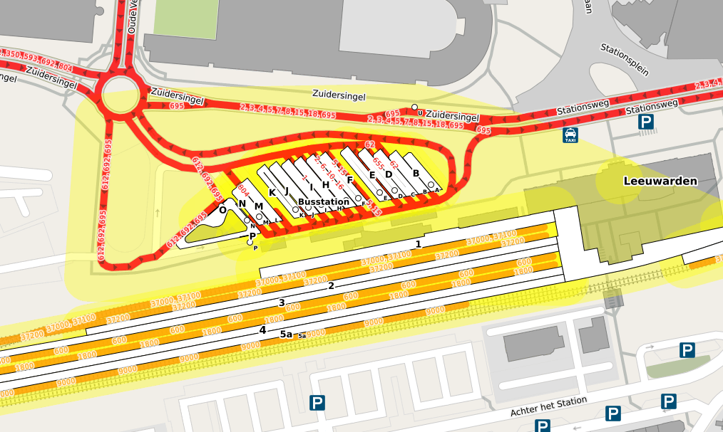
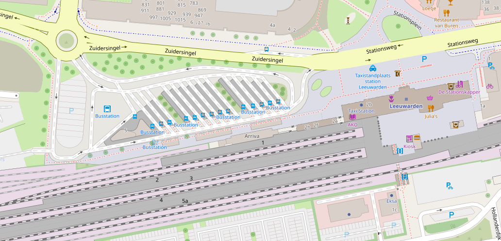
I've noticed that bus platforms that are drawn as areas are getting wrongly rendered as closed ways in ÖPNVKarte (example (look at platform E for example), OSM Carto (for reference), OSM), making them look fatter than they are, and sometimes getting a gap in the middle of them. Train platforms seem fine though. --JeroenHoek (talk) 12:30, 28 January 2021 (UTC)
- ÖPNVKarte only renders public_transport=platform as area if there is an additional area=yes tag. For train platforms railway=platform this tag is also required by OSM Carto, therefore they might already have the area=yes tag. --Nimix (talk) 17:04, 28 January 2021 (UTC)
- I don't mind adding tags if necessary, but the documentation for public_transport=platform says: “If the platform is mapped as an area, the tag area=yes is not required (round linear platforms part of a single route do not exist).” --JeroenHoek (talk) 17:24, 28 January 2021 (UTC)
parking=street_side
With the introduction of parking=street_side renderers now have the option to change the rendering of parking bays at the side of a road. In ÖPVNKarte the large blue P seems intended to draw attention to larger public parking lots. If you look at this bit of map for example, you notice that those street-side parking bays probably don't need to be emphasized as much (or at all) in a public transport layer. I would suggest using a small P, or dropping rendering completely. Alternatively, some cleverness could be done by looking at the capacity=* tag (e.g., to only show those with dozens of parking spaces). --JeroenHoek (talk) 12:44, 28 January 2021 (UTC)
- +1 --Nimix (talk) 17:04, 28 January 2021 (UTC)
- There's also the similar parking=lane (not to be confused with parking:lane=*). Rostaman (talk) 14:25, 29 January 2021 (UTC)
Boundaries tagged as relation only are not shown
See for example https://www.openstreetmap.org/#map=18/41.40938/-71.84205&layers=O https://www.openstreetmap.org/#map=18/41.40938/-71.84205 Mateusz Konieczny (talk) 14:11, 5 February 2021 (UTC)
- See also discussion on tagging mailing list Mateusz Konieczny (talk) 22:24, 5 February 2021 (UTC)
Special rendering for highway=busway

Instances of highway=motorway and motorway that are members of bus route relations have special rendering. Instances of highway=motorway that are members of bus route relations should receive similar treatment. Ideally, it should include the following:
The same should also apply to instances of highway=bus_guideway
— Colgza (talk) 15:14, 23 April 2021 (UTC)
Rendering railway=razed or railway=abandoned
Can't imagine why razed or abandoned railways are rendered, example is Annan Branch Can thisrendering be changed to cater for this map inconsistency? --TonyS (talk) 16:51, 29 August 2021 (UTC)
Add up-to-dateness information
Great map! Would it be possible to add the up-to-dateness e.g. to the "Why are my changes not showing"-section? Something like
---
The current map was created with data from the following timestamps:
Last automatic update: 2021-10-22
Next automatic update: 2021-10-23
Last manual full update: 2021-09-01
Next manual full update: 2021-11-01
---
--MomoMilkiway (talk) 09:36, 22 October 2021 (UTC)
@MomoMilkiway:: How are we able to get the timestamp information above? -- Patrickov (talk) 01:19, 1 July 2022 (UTC)
- This was only an example. I think only the admin of the server that runs the map has this information and to have it displayed one would need to adapt the source code of the map to gather this information on update. Though I cannot find the source code anywhere, otherwise I would have tried to make a pull-request. --MomoMilkiway (talk) 09:57, 8 September 2022 (UTC)
Rendering the interval key
How about rendering the interval key in the ÖPNVKarte? This could be worthwhile especially for bus routes. While OSM won't include complete timetable information anytime soon, I would find a visual representation whether a bus runs every ten minutes or only a few times a day very helpful. Some networks produce this kind of map. Think of fat lines for 10-minute intervals and narrow or dotted lines for less frequent services. --Alfons234 (talk) 16:59, 26 October 2021 (UTC)
Maintenance status
Is ÖPNVKarte still actively maintained? The wiki page notes that bugs should be reported here, but bugs reported a year ago are still open and lack replies from the lead developer. Is there another place to report bugs or pull requests? --JeroenHoek (talk) 14:03, 10 January 2022 (UTC)
- Apparently it become abandoned. I used https://wiki.openstreetmap.org/wiki/Special:EmailUser/Nimix Mateusz Konieczny (talk) 13:47, 22 June 2022 (UTC)
- @Mateusz Konieczny:: To what extent is it abandoned? If it still updates every few months then the bugs are bearable. If even the updates are stopped then maybe it's time to vote it out of the layers. How can we initiate process for the latter? -- Patrickov (talk) 01:19, 1 July 2022 (UTC)
- Server is maintained from what I know, but style is not developed and noone even responds to reports of the problems Mateusz Konieczny (talk) 05:20, 1 July 2022 (UTC)
- @Mateusz Konieczny:: My concern is that the edits to OSM seem not reflected in that layer for months, but for how many months I don't know (can be up to 1 year). IMHO if the layer is not refreshed for too long it loses its usefulness. -- Patrickov (talk) 08:28, 1 July 2022 (UTC)
- @Patrickov: och, that is far worse :( "How can we initiate process for the latter?" Featured tile layers/Guidelines for new tile layers - presumably, contact OSMF or operations? In the worst case they will direct you to whoever should be contacted Mateusz Konieczny (talk) 09:58, 1 July 2022 (UTC)
- @Mateusz Konieczny:: It's updated a few days ago (at least for Hong Kong). Apparently it has a cut-off every two months (1st day of every odd month to be precise), while the rendering takes around two to three weeks. -- Patrickov (talk) 06:09, 23 July 2022 (UTC)
- @Patrickov: och, that is far worse :( "How can we initiate process for the latter?" Featured tile layers/Guidelines for new tile layers - presumably, contact OSMF or operations? In the worst case they will direct you to whoever should be contacted Mateusz Konieczny (talk) 09:58, 1 July 2022 (UTC)
- @Mateusz Konieczny:: My concern is that the edits to OSM seem not reflected in that layer for months, but for how many months I don't know (can be up to 1 year). IMHO if the layer is not refreshed for too long it loses its usefulness. -- Patrickov (talk) 08:28, 1 July 2022 (UTC)
- Server is maintained from what I know, but style is not developed and noone even responds to reports of the problems Mateusz Konieczny (talk) 05:20, 1 July 2022 (UTC)
- @Mateusz Konieczny:: To what extent is it abandoned? If it still updates every few months then the bugs are bearable. If even the updates are stopped then maybe it's time to vote it out of the layers. How can we initiate process for the latter? -- Patrickov (talk) 01:19, 1 July 2022 (UTC)
Add rendering of train/metro station entrance/exit, and also connected footbridge/tunnel networks.
Currently, information rendered in OPNV for a metro/train station include: Platform location, rail track alignment, and station name. However, it is useless to people looking to get into or getting out of a station, where they would be guided to various station exits, and the point of station entrance/exit is where pedestrians see themselves as entering the metro network. Without rendering these information, passengers would be hard to tell where they should ride the train, or which part of street they are on if they are exiting the station from certain exits, and is also difficult for passengers a bit faraway from the physical station site to find out which is the most convenient way for them to enter the station and subsequently the platform. I propose the information start being rendering at about zoom level 16.
On top of it, sometimes train/metro station entrance/exits are connected to third party structure, like underground mall corridors, elevated walkways between buildings above street, facilities like elevators or escalators that might help connect pedestrian uphills/downhills into a metro station, inter-modal transfer center to buses or ferry or airport, or other connections, but are not formally part of the station itself.
C933103 (talk) 11:34, 22 May 2022 (UTC)
Instability
Something (not) funny happened today. For the past month (since mid-July to be precise), the layer seems to be actively updating to whatever edits, sometimes even faster than OpenStreetMap Carto. However, when I opened the layer just now, it seems to have reverted to a pre-2021 state without good reason. The instability of this layer is rather alarming. -- Patrickov (talk) 11:30, 21 August 2022 (UTC)
- Over the last weekend it seemed to slowly catch back up, but some roads are mysteriously devoid of bus routes despite some had long been placed there. Examples can be found at here (Tokkin Street south-west bound) and here (Argyle Street eastbound). -- Patrickov (talk) 15:59, 30 August 2022 (UTC)
- Some further research revealed that the missing ways are usually caused by splitting of ways already with route relations on them. If a relation is added or removed from the said way the layer will render that way correctly again. However, this is not the expected result ‐ the layer should be able to render new (or newly split) ways already with route relations correctly. Anyone knows how can I call the support? -- Patrickov (talk) 02:38, 27 November 2022 (UTC)
State Capitol building shown as just a parking lot
See https://www.openstreetmap.org/#map=17/39.96114/-82.99873&layers=O Jidanni (talk) 18:06, 17 October 2022 (UTC)
- @Jidanni: That's because there's indeed an underground parking marked beneath the building: https://www.openstreetmap.org/way/230998777 -- Patrickov (talk) 04:41, 25 November 2022 (UTC)
Hello! Will shared taxis be supported? route=share_taxi is important for my city, as are the buses. Just small. I've marked them as "bus" for now. But this is not correct. — dr&mx (talk)22:52, 24 October 2022 (UTC)
- UPD: After discussion with our community, it was decided to mark as a bus. -- dr&mx (talk) 10:09, 25 November 2022 (UTC)
Busways aren't rendered
Busways don't seem to be rendered on this map, even though seem important for a public transport map. They are generally visible due to the rendered bus lines that use them, but the lack of rendering has some unwanted effects, like missing names. For example here the name of the Voorhofdreef (road of line 64 to the north) is rendered at some places, while the name Busbaan Tanthof (busway of line 64 to the south) isn't visible anywhere. A67-A67 (talk) 21:22, 26 October 2022 (UTC)
Albuquerque New Mexico
One must zoom in rather far to Albuquerque New Mexico, before it stops being called Rio Rancho due to that nearby city. Jidanni (talk) 00:01, 28 November 2022 (UTC)
Okay, maybe it's the airport that's interfering. Jidanni (talk) 00:02, 28 November 2022 (UTC)
Indeed Las Vegas is covered by an airport and thus loses its name until zoomed rather far in. Lucky other small towns 100 Mi away aren't victims to their own airports because they don't have big ones. Same with Los Angeles, San Diego, you will never knew they existed. Victims of their own airports. Jidanni (talk) 00:06, 28 November 2022 (UTC)
Cleburne Texas
Cleburne becomes "Clebu" at certain zoom levels, because it's covered up by the railroad tracks. Jidanni (talk) 00:29, 28 November 2022 (UTC)
Wrong rendering of circular relations
I found some new unpredictable behavior.
For example, I have modified https://osm.org/relation/6478874 to not only reflect its new route, but also ordered its road members correctly.
However, on ÖPNVKarte the new sections are rendered in the wrong direction: https://www.openstreetmap.org/#map=18/22.32758/114.22972&layers=O
- The arrows should go clockwise instead of counterclockwise!
The problem is, they do not always show things wrongly, as seen in the following link: https://www.openstreetmap.org/#map=18/22.32763/114.15861&layers=O
- In the middle, three of the four routes joining the trunk road are circular, but the section shows arrow correctly.
Both are updated on the same day so I suppose this is an unpredictable behavior on ÖPNVKarte's part. Please find out what's up and fix it.
Patrickov (talk) 10:58, 11 December 2022 (UTC)
Layer failure Jan 2023
There is a rendering failure since mid-Jan 2023, with some area grey out at closest zoom and the whole layer not updating at all. Anyone to take a look and fix it? -- Patrickov (talk) 11:46, 20 January 2023 (UTC)
- As of Jan 26, 2023, the map does not grey out at the innermost zoom, but otherwise doesn't update. The map seems stuck at around mid-January. -- Patrickov (talk) 15:59, 26 January 2023 (UTC)
US-Can border disappears
What happened to the US-Can border east of here? Jidanni (talk) 04:30, 13 February 2023 (UTC)
Need proper bug tracker
It would be best to tell people to post bugs to a real bug tracker, because nobody's guaranteed to be reading this page apparently anymore. Jidanni (talk) 13:21, 12 March 2023 (UTC)
GitHub even allows attaching screenshots, easily. Jidanni (talk) 14:07, 12 March 2023 (UTC)
Line at 43° crossing the entire United States
There is a grey line crossing the entire United States, at latitude 43° north, from zoom level 5 to zoom level 7. Jidanni (talk) 13:27, 12 March 2023 (UTC)
Idaho eastern border
At map=9/49/-116.055 to the west there is a proper US - Canadian border. To the east there is no border! To the south the Idaho - Montana border is also missing. Now, at the same magnification look at the Idaho - Washington border. It's in perfect shape. Jidanni (talk) 13:55, 12 March 2023 (UTC)
No updates since at least January 2023
It seems that changes from January 2023 cannot be seen on the map yet. (example). So the sentence "The data is being updated regularly usually within minutes." at the top of the page, is incorrect at the moment. The map is lagging months behind.
This page says bugs can be reported here, but nobody is answering them. Is there a new place for bug reporting? A67-A67 (talk) 14:52, 1 May 2023 (UTC)
- Fixed the sentence. maro21 21:03, 22 May 2023 (UTC)
There should be a big diagonal banner across the map saying "[OLD DATA]".
In fact there should be a spot on OSM, even in the middle of an ocean, where there should be some buildings or roads that would be arraigned in a date formation: 20230920..., updated every day, so users could double check just how old a layer's data might be.
Same for air pictures. On the ground arrange with some company to have a certain building of theirs whose roof shows the date, via a big digital clock. Jidanni (talk) 05:46, 20 September 2023 (UTC)
- Hi Jidanni, no need to be in such detail. The fact is the layer has not been stable since January and no one has been able to contact the renderer so far. If anything, let's direct the energy to have it removed from the main panel and / or develop a new one. -- Patrickov (talk) 09:16, 23 September 2023 (UTC)
- Flower clocks like this one in Poděbrady, Czechia come to mind, but I'm afraid that would fall on a scale even smaller than micromapping. --Riolu (talk) 14:02, 16 March 2024 (UTC)