Talk:Thailand
Cycle Routes
Thanks for the effort to clarify the tagging of routes. I have purposely never tagged any bicycle lanes here in Thailand because they are not safe to use. Cars and food vendors often block them and people even drive in the wrong direction on them, consequently I don't recommend or encourage people to use cycle lanes. This is not an argument against adding information about tagging to this Wiki, only a personal opinion. AlaskaDave (talk) 12:00, 20 November 2015 (UTC)
Highway classification
According to "Thai highway network" (http://en.wikipedia.org/wiki/Thai_highway_network) highways in Thailand are numbered. There are also unnumbered highways.
- 1-digit - major highway. Some have restricted access, e.g. no bikes, motorcycles. Others have even pedestrians allowed.
- 2-digit - main highway
- 3-digit - secondary highway
- 4-digit - intra-province highway.
Comparing this to the "Map Features" for highways of OSM (http://wiki.openstreetmap.org/wiki/Map_Features#Highway) I propose the following values for the key highway in Thailand. The number is used for the ref key.
- 1-digit - major highway, restricted access - motorway, e.g. highway number 7
- 1-digit - major highway, unrestricted access - trunk, e.g. highway number 2 to Nong Khai
- 2-digit - main highway - primary
- 3-digit - secondary highway - secondary
- 4-digit - intra-province highway. - tertiary
- no number, between and through villages - unclassified
- people living in villages - residential
Examples:
- Highway 2, Saraburi–Nong Khai:
- name=ถนนมิตรภาพ. name:th=ถนนมิตรภาพ. name:en= Mittraphap Road. ref=2. highway=trunk.
- Highway 7 [Remark: I do not know the name. Is there any?]:
- ref=7. highway=motorway.
- Highway 22, Udon Thani–Nakhon Phanom:
- name=ถนนนิตโย. name:th=ถนนนิตโย. name:en=Nittayo Road. ref=22. highway=primary.
- Highway 205, Lopburi–Nakhon Ratchasima,
- name=ถนนสุรนารายณ์. name:th=ถนนสุรนารายณ์. name:en=Suranarai Road. ref=205. highway=secondary.
- Highway 3278, Min Buri-Bang Kapi (Bangkok:
- name=ถนนเสรีไทย. name=:thถนนเสรีไทย. name:en=Seri Thai Road. ref=3278. highway=tertiary.
- highway=unclassified.
- highway=residential.
For Asian Highways Numbers see http://www.unescap.org/ttdw/Publications/TIS_pubs/pub_2303/intro%20ah.pdf. Example:
- AH12 ... Vientiane – Nong Khai – Udon Thani – Khon Kaen – Nakhon Ratchasima – Hin Kong:
- int_ref=AH12.
Willi2006 03:18, 7 March 2009 (UTC)
- Routes beginning with 5–9 (of which only 7 and 9 are completed) belong to the motorway system, which is separate from the national highways. These should be easily classified as motorways, since they have restricted access, no traffic lights, etc.
- For national highways (routes beginning with 1–4), the two- and three-digit routes should definitely be classified as primary. Four-digit routes are perhaps more tricky: they are national highways (as opposed to locally maintained ones, which don't have numbers), and generally link cities and towns and are usually on the order of 10– in length. Some however are much shorter and less important; it seems primary may apply to some, while secondary would better fit others. Perhaps secondary could be applied to all if needed.
- The main national highways (routes 1–4), as you said, vary in their features even along the same route. In higher-capacity areas near Bangkok, they usually take the form of quadruple carriageways, in which the central roads enjoy grade-separation and access control. In more rural areas, they may just appear like other primary roads. I suggest tagging their entire lengths as trunk as a compromise.
- All this is of course separate from the expressway system, which should all be classified as motorways, and intra-city road networks, which so far haven't been discussed yet. --Paul_012 15:45, 15 March 2009 (UTC)
- There's one more type of road: the "provincial road", which has a province code and a number. These can be quite large, eg. "ชร.5023" (Cho Ro 5023) is a four-lane road that connects Chiang Rai's airport (hence ชร/CR) to the city. Jpatokal 06:36, 17 March 2009 (UTC)
Willi2006 14:56, 24 March 2009 (UTC) wrote:
- Why inventing the wheel again? As outlined in "Thai highway network" (http://en.wikipedia.org/wiki/Thai_highway_network) highways in Thailand are numbered. The number of digits represents the classification as defined by the Thai authorities, see "Highway numbering" http://en.wikipedia.org/wiki/Thai_highway_network#Highway_numbering. The "rural roads" are described as well http://en.wikipedia.org/wiki/Thai_highway_network#Department_of_Rural_Roads. I strongly recommend to follow this Wikipedia article. This administrative classification is available, just look at the signs, no interpretation of any rules, no or only minimal changes over time, already used for other maps.
- Not proposing to reinvent anything; simply refining your proposal. To make things clearer, this is what I'm suggesting:
- Expressway system: motorway
- Motorway system (beginning with 5–9): motorway
- National highway system (beginning with 1–4):
- 1-digit: trunk
- 2-digit: primary road
- 3-digit: primary road
- 4-digit: secondary road
Rural highway system: secondary road
- There's still the argument for all national highways to be classified as at least primary, though, which would also be reasonable. --Paul_012 12:32, 26 March 2009 (UTC)
- Not proposing to reinvent anything; simply refining your proposal. To make things clearer, this is what I'm suggesting:
Willi2006 13:37, 28 March 2009 (UTC) wrote:
- I strongly oppose to give the same class "primary" to national highways numbered with two-, three- and four-digits. This would give them the same line style on maps and you could not differentiate them anymore by a glance but only by checking the number. I never saw on any streetmap that major and minor roads are drawn with the same line style. Currently I have streetmaps of Thailand from three different publishers, one european and two Thai, in front of me. All differentiate according to the numbering and not to the responsible organisation level (national, rural, local):
- Official number: One-, two-, three-, four-digits, no number.
- Publisher A: double orange, orange, thick yellow, thin yellow, black line.
- Publisher B: thick red, yellow, thin red, thin red, black line.
- Publisher C: double red, red, orange, yellow, thin yellow line.
You are right in that the classes should be given according to road characteristics rather than administration. However, we only have green, red and orange, which is obviously not enough to serve each highway class exclusively. By definition, tertiary is not suitable for such major roads as the national highways, so the four-digits should be at least secondary (linking towns and villages). If the prevalence of primary class according to the suggested scheme is a problem, perhaps both one- and two-digit routes could be classified as trunk instead. --Paul_012 16:19, 28 March 2009 (UTC).
Willi2006 05:06, 29 March 2009 (UTC):
- Again I strongly oppose this. There is one misunderstanding: I strongly support highway classification depending on administrative classification along with the description for highway=primary, secondary and tertiary in OSM: "Map Features" and the discussion in OSM: "Highway tag usage". In Thailand it is the same situation as discussed there for UK, which is also the same for other west european countries. The classification in Wikipedia: "Thai highway network" also follows the Administration.
- I would like to use an example: highway 12 from Tak to Khon Kaen.
- Administrative classification is easy and obvious. The Thai authorities have decided: two-digit that is highway=primary.
- Physical classification (physical characteristics):
- Between a point near to Tak and Phitsanulok and also between Chumphae and Khon Kaen same as highway 2 north of Khon Kaen: two lanes separated for each direction (highway=trunk, lanes=2,oneway=yes).
- Between Phitsanulok and Chumpae due to mountains same as a typical four-digit national or rural highway and below some four-digit highways (use highway=tertiary for this section?!).
- This classification would result showing highway 12 in different colours. I never saw a map from Thailand or any other country doing this. Thus this would confuse the user of such a map. This would devaluate the OSM map of Thailand. Why should this be done?
- This could result in endless almost worthless discussions how to classify a certain road. Do we want to use our time for this? Actually we are doing this here already.
- Many or may be most highways vary in their features along their route and along time. In the mountains highways are smaller but they still carry the same classification because they are the major highway at this location. There is no broader one. I think map users know this.
- Another aspect: Collecting all this data the first time would be already a big effort. Keeping them up to date would be a multiple of this effort. The classification of a highway is a basic charecteristica and thus it is good to keep it simple and obvious.
- There are additional possibilities and tags (keys) to show the features of a highway in different sections:
- Draw two lines and use oneway: E.g. highway=primary, oneway=yes.
- Key lanes: E.g. highway=primary, lanes=2.
- Key surface. E.g. surface=concrete.
- By the way I have looked at OSM maps from west european countries. There the highways are classified motorway, trunk, primary, secondary, tertiary and with other values. Colours and rendering is obvious no problem.
- I hope we come to a conclusion and this will take not too long. To help with this I have updated the table in the section "Highway classification" of the "WikiProject Thailand" page which contained a lot of question marks to show my proposal in detail. I appreciate any other proposal but ask to add it and not replace mine.
- I agree with applying a uniform classification using the National Highway numbers. The only problem I see with your proposal is that most three-digit routes are much larger and more important than the way secondary road is described. Take for example Route 304, which runs from Pak Kret, Nonthaburi through Chachoengsao and Prachinburi Provinces to Nakhon Ratchasima, or Route 323, which branches off Phetkasem Road and runs all the way to the border with Myanmar/Burma. These roads link more than "smaller towns and villages", and pretty much fit the description for primary. Likewise, most four-digit routes don't look like this. --Paul_012 06:06, 29 March 2009 (UTC)
Willi2006 21:33, 30 March 2009 (UTC) wrote:
- I think the numbering scheme does make sense. In the most cases the number of digits represents the importance and the standard of a highway. But over time a three-digit highway may become in total or in sections the importance and the standard of a two-digit (primary) or even of a one-digit (trunk) highway. I think in these minor cases all or larger sections can be classified higher. This will show the real importance and standard on the map. I have seen this sometimes on some paper and computer maps including OSM. I do not know highways 304 and 323 but have looked them up on a ThinkNet map which does not show them in another style. But as many other decisions this is up to the person or persons mapping the individual highway. When I have strong arguments against it I will tell it. Otherwise I will accept it. And the three-digit numbering is an argument but not a strong one.
- I have seen also that three- and four-digit highways often have the same standard or sometimes four-digit highways have a higher standard. But as far as I have seen four-digit highways are more local, shorter in general. Thus I would classify them tertiary in general.
- I will add to the table to show this.
- The examples I raised are the general case rather than the exception. Most, if not all, three-digit routes serve the importance described for primary road rather than secondary.
- Perhaps an alternative solution would be to apply trunk classification to both one- and two-digit routes. This page (in Thai) on the Department of Highways' website describes both as main highways, with the difference being that routes 1–4 are inter-regional main highways while the two-digit routes are intra-regional. Most two-digit routes serve as much importance as the single-digit ones in their respective regions, and they aren't too prevalent either. --Paul_012 04:08, 31 March 2009 (UTC)
Willi2006 14:41, 31 March 2009 (UTC) wrote:
- I object to this. As you write inter-regional is not the same as intra-regional thus not the same class even when the importance is the same or opposite! They have different clearly defined roles and usages. And how would importance be defined? When importance is the amount of traffic (vehicles/day) this is not a good criteria for a longer lasting classification but for an attribute as surface or lanes is. I have enhanced the table column "Type" to more clearly show the difference. It is based on:[5 Wikipedia: "Thai highway network"]. In the United States the OSM tagging for "trunk" is "a major route used by trucks and for interstate trips" and for "primary" is "Major route, used for intercity but rarely for interstate trips." Both "major" but different role and usage thus different classes. [13 OSM: "Key:highway" especially section "International equivalence"]. Why deviate from the Wikipedia article and the OSM usage in other countries? When you want the same line style for two or more different classified highways it is not difficult to direct the renderer to do this. But when you put different types of highways in the same class it will be tricky or even impossible to separate them later especially for different countries. A fault in database design. That is similar to your proposal for "multilingual names".
- I am looking forward to the opinion of other users.
- Seeing as this discussion is probably going nowhere, let's just try doing it your way, at least for now. I'd like to hear suggestions on how we should now deal with the differentiation of local roads; now that we are applying tertiary to national highways, all that is left for local non-residential roads is unclassified. This seems inadequate, given that we need to at least differentiate thanon and soi. --Paul_012 08:29, 4 April 2009 UTC)
Willi2006 11:20, 4 April 2009 (UTC) wrote:
- I think according to [13 OSM: "Key:highway"] urban highways which have no administrative classification get in general highway=unclassified, appropriate for Thanon (name:th=กนน. name:en=Road) used by through traffic, highway=residential for Soi (name:th=ซอย) used by residents mainly or may be living_street, service, track or path. I have added some more to the table.
- Currently I am editing Cha-Am village and the route I took to it. See list of projects. I am looking forward if this classification works.
WanTan 07:13, 21 April 2010 (UTC) wrote:
I agree with everything that is now written down in the section "Highway classification". But the definition of "unclassified" seems to be a bit unclear in general (not only in Thailand). In addition there seems to be a difference in tagging of "unclassified" inside of towns and outside of towns. In [4 OSM:"Tagging_samples/urban"] "unclassified" is also used for "Minor street on the outskirts of town". If i follow Willi2006 and tag Thanon with "unclassified", how should i then tag smaller streets (and soi) in non residential areas or outside of towns? Untill now i tagged streets like this "unclassified". But in general i agree with Willi2006. I would suggest to remove the notice, that the highway classification for thailand is a "proposal under discussion". In OSM everything is allways "under dicussion" ;-)
Willi2006 10:28, 21 April 2010 (UTC) wrote: Outside places (city, town, village, hamlet) I'm using "unclassified" for all paved roads with are not numbered. When these highways are leading into, through or out of places they keep their classification. Thanon and Soi in the name are just indications. I'm using "residential" for all paved or unpaved highways which in my judgement are or should be used only by traffic within the place and are broad enough that they can be used by cars. The English term "residential" is imho misleading here. The German term "Ortsstraße" is much better because it fits also industrial or other areas within places. In general I follow strictly the numbering for classification and do not consider the width of a highway. In Bangkok are "unclassified" highways (no number) with several lanes. In the countryside there are "unclassified" highways between villages where hardly two cars can pass each other. This is the same in other countries which I know. I'm using for unpaved highways outside places which are broad enough for a car "track" otherwise "path". I have removed the proposal notice.
Multilingual names
Although UTF-8 is widely supported, this is far from universal, as can be seen by Osmarender renderings in which Thai characters often appear garbled or missing. I suggest that the default name be supplied in Thai script along with the Latin alphabet spelling in brackets, for example:
name=กรุงเทพมหานคร (Krung Thep Maha Nakhon)
name:th=กรุงเทพมหานคร
name:en=Bangkok
int_name=Bangkok
name=ถนนพหลโยธิน (Thanon Phahon Yothin)
name:th=ถนนพหลโยธิน
name:en=Phahon Yothin Road
--Paul_012 15:45, 15 March 2009 (UTC)
- I would oppose that, it's clunky and space-consuming. Letting users somehow swap between languages, or at least generate an all-en map, would be nice though. Jpatokal 08:51, 17 March 2009 (UTC)
- The name in brackets makes not much sense. There should be something like "name:th_latin". If a printed map is made with the OSM data it will be Thai, English or Thai + English map. Only for the English maps the name in brackets is usefull.
This would more ok:
name=กรุงเทพมหานคร
name:th=กรุงเทพมหานคร
name:en=Bangkok (Krung Thep Maha Nakhon)
int_name=Bangkok
Willi2006 15:44, 24 March 2009 (UTC) wrote:
- I would oppose that also and support the arguments of Jpatokal. Let us stick to the conventions "Multilingual names -China" http://wiki.openstreetmap.org/wiki/Bilingual_street_names#China. Use the Thai and the English names from the street signs:

- There seems to be many different ways this is done. My above proposal was based on the conventions for Japan, but perhaps it's not suitable for Thai names. There's still the issue of Thai script not rendering properly in the default name field though. --Paul_012 12:09, 25 March 2009 (UTC)
Willi2006 10:08, 28 March 2009 (UTC) wrote:
- I was not aware of the conventions for Japan. But after reading them I still think the convention for China is better. A basic rule in database design is to choose basic data fields and perform any combinations through their relations when processing the data. "Bangkok (Krung Thep Maha Nakhon)" is definitely no name but a combination of name and name:en. Thus I strongly recommend to use e.g.:
- name=ภูเก็ต
- name:th=ภูเก็ต
- name:en=Phuket
- When creating the map the renderer can create different maps:
- Thai only: ภูเก็ต
- English only: Phuket
- Bilingual: ภูเก็ต Phuket
- I own several and have seen more bilingual paper maps from Thailand. In general the English name is written below the Thai name. For streets both names are printed on or parallel to them.
- When the renderer is currently not able to do this than it should be fixed and not the database should be "manipulated" in a tricky and cumbersome way. The default for the renderer should be bilingual, i.e. name and name:en.
- Bangkok is a special case because the English name is not a transliteration of the Thai name but a different name. This is a topic for travel guides and not for maps. Bangkok is the official English name and used on all maps I have seen. Thus I propose:
- name=กรุงเทพมหานคร
- name:th=กรุงเทพมหานคร
- name:en=Bangkok
--Stephankn 08:04, 8 June 2009 (UTC)
- please don't mix languages/transliterations in the name-tag. If it's not rendered right, it's a bug with the renderer. If you see t@h maps with missing fonts, please inform the user who rendered the tile to install the right fonts. I documented the needed fonts on the wiki and notified a lot of users already by myself. Over time the rendering problem should be gone.
In case josm is missing something let me know I see whether I can fix that. I did the multi-name rendering for josm. Someone to volunteer for a name-check? I can generate reports showing the names of places in the database in the different languages...
Willi2006 07:42, 15 June 2009 (UTC) wrote:
- Does this mean I can direct JOSM to use the value of the name:en instead of the name tag? Although I can work with the Thai names it is more convenient and faster for me as non Thai to work with the English names.
- What's about rendering bilingual maps or having two versions of the tiles using the name and the name:en tags?
- Yes, it does mean exactly that. You can configure the sequence of language JOSM tries to find when looking for a name to display. See the wiki for more information Key:name. Rendering a multi-lingual map is also possible. You can even have some layers to configure live if you want to have a map with English texts or Thai. --Stephankn 21:23, 21 July 2009 (UTC)
Documentation
It seems there is now an agreement(?!) so one could add some suitable entry on Multilingual names!? --amai 17:28, 25 September 2010 (BST)
- Please feel free to add a proposal on the WikiProject Thailand Drafts page or the WikiProject Thailand page directly if you like. There was a discussion about Brand names. We didn't come to a conclusion. Willi2006 04:23, 26 September 2010 (BST)
Border off base
The northern borders between Thailand and Myanmar, Laos are quite inaccurate, and it doesn't seem to be a simple case of offset either. I've manually adjusted the bit between Mae Sai and the Golden Triangle, but there's a lot more left to go... Jpatokal 10:51, 17 March 2009 (UTC)
Copyright of official data from the Thai-Administration
As there is a lot of "official data" for Thailand available, i wonder if this could be used for OSM. E.g. i found detailed Street-Maps of Bangkok at the website of the "Department of City Planning" (http://www.bma-cpd.go.th). Does someone know if there is a chance to use this for OSM by legal means? Or are there some thai natives, who are willing to ask for this at the departments? --WanTan 15:43, 11 April 2009 (UTC)
- It's an unclear issue. Thai government agencies retain copyright over works created under their employment or supervision, but laws, decrees and governmental reports are uncopyrightable. This would depend on the nature of these maps' creation. --Paul_012 03:56, 15 April 2009 (UTC)
- Regarding legislation's copyright protection: See Thailand's copyright law (translated), Chapter 1, Part 1, number 7. In short: yes, most government work seems not to be copyrighted, but please read yourself. I do not know anything about the further details. Maybe someone knowledgeable about Thai law can document something on the WikiProject page or at Potential_Datasources#Local_data and link it. --Aseerel4c26 (talk) 19:15, 16 October 2013 (UTC)
- That likely applies only to legislation and official documents. Section 14 states that "The Ministries, Departments or other government or local units shall be the owners of copyright in works created in the course of employment, order or control unless otherwise agreed in writing." So maps accompanying laws or decrees should be public domain, but others are probably copyrighted. --Paul_012 (talk) 14:45, 18 October 2013 (UTC)
- Regarding legislation's copyright protection: See Thailand's copyright law (translated), Chapter 1, Part 1, number 7. In short: yes, most government work seems not to be copyrighted, but please read yourself. I do not know anything about the further details. Maybe someone knowledgeable about Thai law can document something on the WikiProject page or at Potential_Datasources#Local_data and link it. --Aseerel4c26 (talk) 19:15, 16 October 2013 (UTC)
Possible Sources
Willi2006 08:00, 15 June 2009 (UTC) moved the following from the project to the discussion page
- The AsiaGPS forum contains many GPS traces from Thailand and Asia in general. Please contact them to encourage them to release their data into OSM. A discussion has been created here, help to support it.
Willi2006 08:00, 15 June 2009 (UTC) wrote:
- The link to the discussion does not work (for me?). I looked around in the forum but could not find it nor the many traces. They are copying OSM data: "OSM is one of my sources....." Another source of track logs.
smart-mobile POI import
The user Sleepless did a bulk import of POI data from a forum. He claims the data being not copyrighted. The source is this page (in Thai language): http://www.smart-mobile.com/forum/viewtopic.php?t=131148 --Stephankn 21:30, 21 July 2009 (UTC)
I discovered that the import caused a lot of duplicate nodes where the nodes had been tagged different. This required manual conflict resolving. Some restaurants include information about the opening hours in the note. Those should be inserted into the opening_hours tag. Would it help for someone to have list containing these conflicts? Please contact me in this case. --Stephankn 20:04, 1 August 2009 (UTC)
- Looking at the source forum post, it appears that those POI sets were collected by various users, and nowhere do I see it noted that such collections are provided free of copyright. Without further clarification, I think there is reason to doubt the claim. --Paul_012 07:39, 12 August 2009 (UTC)
- For the record: The data was removed during the ODbL redaction. --Stephankn (talk) 15:04, 23 January 2014 (UTC)
Yahoo hires images
Shouldn't we add a reference to the yahoo hires coverage on Yahoo!_Aerial_Imagery/Coverage#Thailand to the page? However not really much covered except the capital... --amai 21:57, 21 August 2010 (BST)
OK from my side. Just do it. Willi2006 08:06, 22 August 2010 (BST)
Project overview
I have deleted this section which I started last March because there is no demand. Willi2006 13:14, 25 February 2010 (UTC)
Common tagging questions
The new sections "Petrol stations" and "Waterways" fit well under the existing header "Conventions". No need for a new header. Thus I have deleted the header "Common tagging questions". In OSM Wiki the term "fuel station" is used Tag:amenity=fuel. Changed.
I do not see any "value add" in empty sections. Thus I have deleted the empty sections "Supermarkets" and "Banks".
The contribution "Currently the user Stephankn is working on a preset file for JOSM that eases the process of tagging points of interest (POI) in Thailand. Send a message to support creating it or to do some testing." should go to the Forum. Deleted as well.
Willi2006 10:31, 5 May 2010 (UTC)
Fuel stations
In Thailand I have never seen a fuel station carrying a name. But they have signs with the name of the company in roman and Thai letters. Usual renderers do not use the operator tag and the tag doesn't have language extensions. And I don't want to complicate the still unsolved multilingual problem in OSM. Thus I'm not using the tag "operator" but "name", "name:en" and "name:th" to enable maps in Thai, English (roman letters) or bilingual. I want see on the map from which company the station is, e.g. to know if the toilets are clean. I don't want to look up an operator tag. The same is true for the shops. I want see the name and not have the information hidden in an operator tag. Willi2006 10:31, 5 May 2010 (UTC)
In my opinion it does not make much sense to add the fuel type. It will change much faster than the few users who are active in Thailand can check and update the information. I think it is more important to add additional facilities, which are more steady e.g. OpenStreetMap. Willi2006 10:51, 5 May 2010 (UTC)
- It does not hurt to tag the operator as well, even when currently not rendered, right? You should file a ticket in trac for the renderer. Multilingual rendering is quite established. It's not used by tile.openstreetmap.org, but other sites already using it. operator:en/operator:th should do the trick. For the lpg/cng vehicles the available fuel is quite important. I guess diesel/gasohol is quite standard an can be expected everywhere.For operators like Caltex, PTT or Shell, the selection of fuel should not change that often. A different thing are the streetside vendors selling fuel for motorcycles in bottles. But I personally would not tag them. --Stephankn 23:27, 5 May 2010 (UTC)
For new fuel types the stations are not investing in new tanks but stop selling "old" fuel types. Within the 3 years I'm living in Khon Khaen the fuel selection in the city has changed about 2 times. And with the further propagation and subsidy of B2, B5 and E20 this will go on. Today about 300 of 3000 stations are mapped. At the current speed I assume it will take more than 3 years alone to map at least 50%. Better not think about keeping them up to date. Willi2006 11:07, 6 May 2010 (UTC)
This page should not prefer a specific editor. The color coding changes from company to company, e.g. PTT and PT. Benzene (deutsch Benzol) is not the same as petrol or gasoline (deutsch Benzin). There are more types available. The table contains less information than Tag:amenity=fuel and in the current form is confusing. Deleted. Willi2006 09:57, 7 May 2010 (UTC)
I would suggest to add the "operator=*", because this seems to be current consensus for "amenity=fuel". But i would also add "name=*" (which would be the same value mostly; e.g. "PTT" or "ESSO"), to make sure something is rendered on the maps. It's a good idea to add different languages for both keys (e.g. "operator:th=*"), imo. I disagree with the statement "The name (for fuel stations) is going to name=* (Thai), name:en=*, name:th=* and operator=* (English).". The "name=*" should get always "the default name" which could be different from "name:th" (same as with supermarkets). --WanTan 17:32, 9 May 2010 (UTC)
Waterways
I deleted the suggestion "Might be used in combination with barrier=ditch." that was added by User Stephankn. The use of barrier=ditch in combination with waterway=ditch or waterway=drain is redundant and not used by most people. E.g. the Tagwatch for Germany says that 13258 ways are tagged waterway=drain (May 10, 2010). Only 104 of this ways are also tagged with barrier=ditch. This is less than 1%! And whats much worser than this is the fact that it totally confuses people to use waterway=drain in combination with barrier=ditch. Our goal was to create an absolutely easy guide for tagging waterways in thailand.
- the original source contained a reference to
barrier=*, that's why I left it in there. I agree that most waterways are already a barrier by just being there. So no need to tag this special. --Stephankn 23:14, 10 May 2010 (UTC)
Stop discussing here
I think we should stop discussing here and concentrate discussions related to this page also in the forum users: Thailand. The forum is more comfortable and this page is already too long. We can have a thread for each section. "Warning: This page is 30 kilobytes long; ..." Willi2006 15:30, 10 May 2010 (UTC)
Thai version
Probably as a non-typical mapper contributing to this subject I understand English - but not Thai. But due to the scope of that page - shouldn't one try to get some parts of it translated in Thai language? --amai 09:14, 21 September 2010 (BST)
January 2013 discussion on highway classification
I will like to propose that tertiary highway also be used for major roads within the city such as Sukhumvit, Petchaburi, Rajdamri and also major sois such as Ekamai and Thong Lor. So maybe any roads with 3 or more lanes can be considered tertiary while roads with just 2 lanes (such as most sois) should be residential.
--Mishari 14:57, 15 January 2013 (UTC)
- Note: This originated from a post in the Thai OpenStreetMap Facebook group. I've taken the liberty to create a new section. --Paul_012 16:27, 15 January 2013 (UTC)
- Most of the main roads (thanon) in Bangkok are already classified as tertiary or above. The national highway numbering system can't be applied to Bangkok, since most of its streets are maintained by the Bangkok Metropolitan Administration and don't have route numbers.
- I personally generally apply at least highway=tertiary for thanon (unless they are really small roads) and use highway=residential for sois (unless they are quite major sois linking multiple roads, in which case highway=unclassified may be appropriate). The distinction between trok and soi isn't clear, and I think tagging should depend on their actual attributes. If a trok or soi isn't accessible by motor vehicles it should be a footway or path.
- Quite a few of Bangkok's main thoroughfares are currently classified as highway=primary, and several others are secondary. There's no clear-cut way to tell their importance, but I try to use the BMA's Traffic and Transportation Department's reports as an estimation guide. I've classified some roads in Bangkok a level higher than their route numbers would suggest, which I think is justified due to Bangkok's traffic volume, but I'm interested to hear what others think. Most of this hasn't been written down, and I'm not sure whether they can be applied to other cities and towns. If some detailed guidelines could be formalised, though, that would be great. --Paul_012 09:32, 16 January 2013 (UTC)
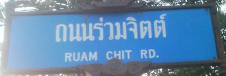
In that case here are a few pictures, let us classify them for example's sake and create a visual guide on how to classify each type of road:


- Roads are classified based on their legal classification. Often this is answered by "who is taking care of this road". We already have this classification. This principle is used in other parts of the world as well. Why do something non-standard in Thailand? If a road is not rendered "prominent" enough, it's a rendering issue. The example pictures below are a good hint to add "lanes", "surface", "width", "maxspeed", etc tags to actually describe the condition of a road. This is often a good source of information for the renderer or routing engine. I suggest to NOT change the classification based on subjective criteria like the personal impression of "importance". --Stephankn (talk) 23:29, 22 February 2013 (UTC)
- Good point Stephankn, so since we have a decent classification system for Thailand, do you have a proposal on how to classify roads in Bangkok based on their official designation? Should we be continuing this thread on the forum? --Mishari (talk) 04:20, 23 February 2013 (UTC)
- Yeah, I think it would be easier to discuss on the forums. I still think there are certain shortcomings with the current classification scheme; I might note them in a thread there. --Paul_012 (talk) 09:41, 26 February 2013 (UTC)
- Good point Stephankn, so since we have a decent classification system for Thailand, do you have a proposal on how to classify roads in Bangkok based on their official designation? Should we be continuing this thread on the forum? --Mishari (talk) 04:20, 23 February 2013 (UTC)
- Roads are classified based on their legal classification. Often this is answered by "who is taking care of this road". We already have this classification. This principle is used in other parts of the world as well. Why do something non-standard in Thailand? If a road is not rendered "prominent" enough, it's a rendering issue. The example pictures below are a good hint to add "lanes", "surface", "width", "maxspeed", etc tags to actually describe the condition of a road. This is often a good source of information for the renderer or routing engine. I suggest to NOT change the classification based on subjective criteria like the personal impression of "importance". --Stephankn (talk) 23:29, 22 February 2013 (UTC)