Template:Pl:Map Features:information
Jump to navigation
Jump to search
Informacja (information)
| Klucz | Wartość | Element | Komentarz | Rendering | Fotografia |
|---|---|---|---|---|---|
| information | office | Miejsce często komercyjne, w którym można uzyskać informacje na temat miasta i regionu. |  | ||
| information | visitor_centre | A place where you can get information about a specific attraction or place of interest. |  | ||
| information | board | Tablica z informacją. Aby opisać to bliżej, spojrzeć na board_type=*.
|
 | ||
| information | stele | A stele for information. |  | ||
| information | terminal | Terminal informacyjny zapewniający dostęp do informacji za pomocą elektronicznych metod. Przeważnie jest to w połączeniu z dostępem do internetu. (zobacz internet_access=*)
|
 | ||
| information | audioguide | Miejsce, gdzie można uzyskać informacje za pomocą słuchawek lub telefonu komórkowego. |  | ||
| information | map | Tablica z mapą. Aby określić typ lub przedstawione dane, używamy map_type=*, map_size=*. Aby opisać dostęp do przedstawionych tras korzystamy ze znacznika dostępu np. hiking=yes, bicycle=yes lub ski=yes.
|
  | ||
| information | tactile_map | Dotykowe mapy są mapami dla niewidomych, | niekoniecznie renderowane na wizualnych mapach, ale np. na blind.accessiblemaps i HaptoRender |  | |
| information | tactile_model | Dotykowe modele są modelami dla niewidomych reprezentujące budynki i otoczenie. | niekoniecznie renderowane na wizualnych mapach, ale np. na blind.accessiblemaps i HaptoRender |  | |
| information | guidepost | Drogowskazy/słupkami są często wzdłuż oficjalnych pieszych/rowerowych szlaków, aby wskazać drogę do różnych miejsc przeznaczenia. Aby opisać dostęp do przedstawionych tras wykorzystujemy znaczniki dostępu np. hiking=yes, bicycle=yes lub ski=yes.
|
 | ||
| information | post | A small pole, erected vertically, with information on the top or sides that may be inscribed, or on a small plaque. Somewhat similar to an information=stele, but smaller. |  | ||
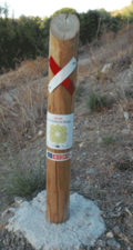
| information |
A marker that shows the position of the way of a route. Could be a symbol, a short pole or a painted marking. Note that two partially equivalent tag values are used: a more popular |
   | |||
| information | user defined | All commonly used values according to Taginfo |
This table is a wiki template with a default description in English. Editable here. Polską wersję można edytować tutaj.
Template for the information table in the Map Features page. Use the default English text or use the template arguments for your translations
==Usage==
All parameters are optional. By default, text is in English.
English writers shall write their comments in the template itself (avoiding double edition).
Other languages are translated in template arguments, not in the template itself.
== section header ==
|name=        (section header line)
|description= (displayed before and/or after the table; optional)

== One key/value row ==
|barrier:key=   |motorway:value=   |motorway:desc=   | motorway:render=   | motorway:photo=

}}


