Key:power
 |
| Description |
|---|
| Facilities for generation and distribution of electrical power. |
| Group: power |
| Used on these elements |
| Documented values: 32 |
| See also |
| Status: approved |
| Tools for this tag |
This key is used to identify a wide range of facilities and features that relate to the generation and distribution of electrical power including power lines, power generation, pylons and sub-stations.
- Power generation gives more details to map power generation means.
- Power networks gives more details about mapping electricity paths.
Values
For mapping electrical power plants, substations lines and associated infrastructure.
This table is a wiki template with a default description in English. Editable here.
Lifecycle
The use of lifecycle prefixes is encouraged for power infrastructure.
Construction
If an object is under construction, it should be tagged with the construction:power=* key, for example construction:power=line. It's not recommended to add power objects to OpenStreetMap until construction has started on the ground, because plans do change. If you do add pre-construction objects, they should be tagged with planned:power=*.
Open Infrastructure Map shows objects tagged with construction:power=* and renders them differently.
Disused & demolished objects
Disused objects should be tagged based on their appearance:
- Disused plants, substations, and similar facilities should be tagged with
disused:power=*, along with an appropriate landuse tag such aslanduse=brownfield. - Disused power lines should be tagged with
disused=yes, as they are still visibly power lines and should be rendered as such on general-use maps. (See Tag:power=line#Lifecycle for more info.)
Demolished objects should be tagged with the demolished:power=* tag while they are still visible on major aerial imagery layers. Once gone from aerial imagery, they should be deleted.
Proposals
Here are the primary proposals that lead to current tagging model:
 Proposed features/Power generation refinement
 Proposed features/Substation refinement
 Proposed features/Power switching extension
 Proposed features/Transformer extension proposal
 Proposed features/Transformers classification refinement
 Proposed features/Substation nodes extension
 Proposed features/Power routing proposal
Rendering
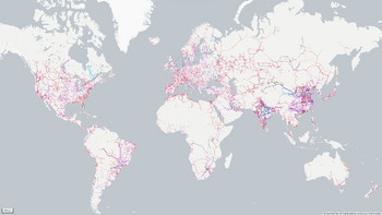
OpenInfraMap renders electricity, telecommunications, water, petroleum, and microwave communications infrastructure, also features a similar rendering of power lines in one of its overlays, Names of substations and their highest voltage, and power plants are also indicated.

Another visualization can be seen at Flosm.de.
Possible tagging mistakes
Quality control
Power_networks/Quality_Assurance
See also
man_made=utility_pole- A single pole supporting elevation of any of various and unspecified public utilities, such as power transmission, lighting or telephonyelectricity=*- To indicate the source of electricity used in a building, a dwelling or a settlement