Zh-hant:Tag:highway=primary
| 說明 |
|---|
| 連結大型市鎮的道路。 |
| 在OSM Carto中渲染 |

|
| 組: 道路 |
| 用於這些元素 |
| 暗含 |
| 常用組合 |
| 狀態:習慣使用 |
| 此標籤的工具 |
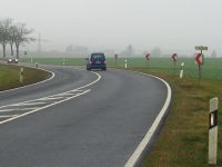
連結大型市鎮的主要道路,已發展國家常有2線道。在基礎設施較差的地區,道路品質常會更差。雙向車道常未設置中央分隔島隔離。
注解:在臺灣,一級道路為省道。
如何繪製
繪製一個簡單的一級道路,您只需為它畫一條線。選擇屬於該道路的所有路徑,並使用highway=primary標記。當道路無法雙向行駛時,使用oneway=yes標記,並確保路徑方向與行駛方向一致,否則請翻轉路徑方向或使用oneway=-1(建議當路徑方向無法翻轉時使用)。
為道路加入更多資訊,請進一步添加下列標籤:
- name=名稱 - 道路名稱。例如:「中山路」「 Zhongshan Road」
- maxspeed=數字 - 道路法定最高限速(公里每小時)。例如:「70」
- minspeed=數字 - 表示行駛道路必須達到的最低限速
- ref=編制名稱 - 道路的編制號碼。例如「1甲」、「1A」
- loc_name=名稱 - 非官方或地方道路名稱
- maxweight=數字 - 最大載重限制(噸)。例如「5.5」
- surface=* - 道路路面材質說明。例如「asphalt(柏油)」
- width=數字 或 est_width=數字 - 道路寬度(公尺)。例如「30」
- lanes=數字 - 道路可使用的車道數,常為「2」或「4」。若對向車輛通過不需減速,即使無中央分隔線,仍為「2」。
特殊情況
下列位置非屬一般道路:
各國案例
| 國家 | 說明 | 更多詳情 |
|---|---|---|
| Greece | 2nd-tier National Roads | WikiProject Greece § Road Network |
| Italy | Strada Statale (SS) or Strada Regionale (SR) | The "SSs" are mostly primary. You should also indicate the name of the highway, if it has one, example:
"SRs" can be tagged as primary as well, if they have a relevant role in linking two major cities. In general the highway-tag is not representing the administrative class but the importance of the connection. By default this kind of highway is rendered:
|
| New Zealand | State Highways and strategic local roads | All State Highways which do not meet the criteria for highway=trunk. Generally two lanes undivided with limited passing lanes and occasionally one-lane bridges.
Strategic local roads are generally the most important roads that are not State Highways. They may be multi-lane divided, or connect major airports, seaports or isolated areas of a city. Examples include South Eastern Highway and Manuaku Road in Auckland, Wairere Drive in Hamilton, and the "Four Avenues" in Christchurch. |
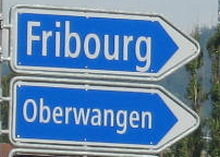
| Switzerland | Hauptstrasse | There are two kind of "Hauptstrassen" in Switzerland:
In contrast to other routes, for example cycling or hiking routes, we do not use relations to model numbered "Hauptstrassen" in Switzerland, use ref=number as described above. |
| United States | Primary highway or arterial road. | U.S. Highways are mostly primary. You should also indicate the name of the highway if it exists, example:
Some State Roads or State Routes may also be primary, if they have a significant role in linking two major cities. By default this kind of highway is rendered:
|
| Brazil | Via arterial urbana (urban arterial way), estrada estadual (state road), >50-60 km/h | |
| Philippines | Other national roads that is used as a city/ arterial road rather than an intercity road, or a connector, if it only feeds secondary/tertiary roads. Provincial roads linking municipalities with a major highway. Roads linking a city/municipal center (poblacion) with a major national highway. | National roads usually fall as trunk highways, as they carry most intercity traffic, but some national roads should be tagged primary if they are usually roads serving local traffic in a city/rural area or a connector between two trunk highways, when it feeds roads tagged as secondary or tertiary. |
| ||||||||||||||||||||||||||||||


