Software/Desktop
This page lists all software used by OSM or using maps/data from OSM on desktop devices (PCs, Macs and laptops).
General information
| Name | Genre | Screenshot | Windows Versions | Mac Versions | Linux Versions | Framework | Display map | Navigate | Make track | Monitor | License | Price | Languages | Version | Description |
|---|---|---|---|---|---|---|---|---|---|---|---|---|---|---|---|
| AlaCarte [1] | renderer | win | no | linux | Cairo | yes | no | no | no | GNU AGPL 3+ | free | EN | 2016-12-28 0.4 |
Tile renderer written in C++11, using Cairo for rendering and Boost-Spirit for MapCSS parsing. | |
| ArcGIS Editor for OSM [2] | display; editor; analyse | 
|
win; win2k; winxp | no | no | ?
|
yes | no | no | no | Apache License 2.0 | free | En | 2018-01-27 10.6 |
Allows users to download, edit, and upload OSM data in ArcMap, and/or create feature services based on OSM data in ArcGIS Server |
| Autosputnik 5 [3] | display; navi; router | 
|
win; win2k; winxp | no | no | proprietary | yes | yes | no | yes | proprietary | free | EN; RU; UA; BY; KZ; UZ | 2015-01-13 5.1 |
Easy and nice UI, web-like search, routing, navigation. OSM support: http://openstreetmaps.ru |
| BaseCamp [4] | display | win; winxp | macos | no | ?
|
yes | no | no | no | proprietary | free | ?
|
2021-05-19 4.7.4 |
BaseCamp is software for viewing maps, waypoints, routes and tracks, and transferring them to or from a Garmin GPS device. | |
| Cartagen [5] | renderer | 
|
win | macos | linux | HTML5 | ?
|
?
|
?
|
?
|
?
|
?
|
EN | 2018-08-21 ?
|
|
| CartoType Maps App [6] | display; navi; router; renderer | 
|
win | macos | linux | CartoType | yes | yes | yes | yes | commercial | free | EN | 2021-10-18 7.6 |
a multi-platform desktop application for viewing maps, calculating routes, finding places, creating map images, and adding your own map data |
| Ceyx | renderer | 
|
win | macos | linux | ?
|
?
|
?
|
?
|
?
|
GPL v2+ | free | EN | 2010-10-01 (no stable release) |
|
| Cruiser [7] | display; navi; router; renderer | 
|
win | macos | linux | Java | yes | yes | no | no | proprietary | free | EN | 2021-12-25 2.1.2 |
Cruiser is a map and navigation platform for Android and Desktop. |
| florb [8] | display; logger; | 
|
no | no | linux | FLTK | yes | no | yes | yes | MIT | free | DE; EN; | 2016-02-28 1.1 |
A simple map viewer and GPX editor |
| FoxtrotGPS [9] | display; logger | no | no | linux | GTK+ | yes | no | yes | yes | GPL | free | BG; CS; DE; EN; FI; FR; HU; NL; RU; SK | 2019-07-10 1.2.2 |
Simple mapping application (fork of tangoGPS) | |
| Geotransformer [10] | analyse | 
|
win | macos | linux | .NET | yes | no | yes | no | commercial | 11.95€ | DE; EN | 2020-12-11 1.1.0 |
GPS Route converter and database of POIs and Routes |
| Google Sketchup Plugin [11] | editor | 
|
win | macos | no | ?
|
no | no | no | no | BSD | free | EN | 2017-08-27 ?
|
Plugin to use OSM in the SketchUp editor |
| GPS TrackMaker [12] | editor | win (XP, Vista, 7, ?) | no | ?
|
yes | no | yes | yes | proprietary (free and paid version available) | free / 167.44 € | EN; ES; PT | ? 13.9 |
GPS down/upload, track edit, tour planning (no routing), ... | ||
| GPS-Mate [13] | navi; logger; router; | 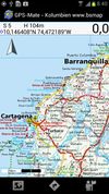
|
win | no | no | ?
|
yes | yes | yes | yes | proprietary | 23€ | DE; EN | 2010-05-31 2.2.2 |
|
| GpsDrive [14] | logger; display | 
|
no | macos | linux | GTK+ | yes | yes | yes | yes | GPL 2+ | free | EN; DE; DA; EL; ES; ET; FR; GL; HU; ID; IT; JA; NB; NL; PA; RO; RU; SK; SV; TR; VI; ZH | 2012-07-21 2.12svn2685 |
Image: OpenCycleMap downloaded on the fly |
| GPSlog [15] | logger | win | no | no | RapidQ | no | no | no | no | GPL | free | EN; FR | 2004-08-13 1.0 |
Console based GPX logger | |
| GpsMaster [16] | display; editor; converter; analyser | 
|
win | macos | linux | ?
|
yes | no | no | no | GPL | free | EN | 2021-06-04 0.64.01rc1 |
Map Viewer, GPX Viewer, Tour Analyser, Track Editor, Trip Planner, File Format Converter |
| GpsPrune [17] | display; analysis | 
|
win | macos | linux | J2SE | yes | no | no | yes | GPL | free | CZ; DE; EN; ES; FR; HU; IT; JA; KO; NL; PL; PT; RU; ZH | November 2021 21 |
Track editor, analyser, creator and converter |
| gpsVP [18] | navi | 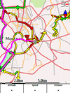
|
win | no | no | ?
|
yes | yes | yes | yes | BSD | free | 14 | 2012-02-05 0.4.24 |
|
| GPX Viewer [19] | display; analyse | 
|
no | no | linux | GTK+ | yes | no | no | yes | GPL | free | AR; CS; DE; EN; ES; HU; IT; RU; UK; ZH | 2013-11-30 0.4 |
A simple tool to visualize tracks and waypoints stored in a gpx file |
| gpxmap [20] | renderer; analyse | 
|
win | no | linux | Processing | ?
|
?
|
?
|
?
|
GPL | free | EN | 2010-09-02 0.5 |
Renders GPX to image |
| GPXSee [21] | display; analyse | 
|
win | macos | linux | Qt | yes | no | no | yes | GPL | free | CA; CS; DA; DE; EN; EO; ES; FI; FR; HU; IT; KO; NO; PL; PT-BR; RU; SV; TR; UK; ZH | 2025-05-20 13.43 |
GPX, TCX, KML, FIT, IGC, LOC, SLF, CUP, GPI, OziExplorer (PLT, RTE, WPT) and NMEA viewer and analyzer |
| GPXViewer [22] | display; analyse | no | no | linux | GTK+ | yes | no | no | yes | GPL | free | CS; DE; EL; EN; ES; FR; HR; IT; JA; NL; PL; PT; RU; SL; SV; TH; UK; ZH | 2020-04-25 1.1.0 |
Allow users to easily view GPS traces they have created in the GPX file format | |
| GraphHopper [23] | router; navi | 
|
win | macos | linux | ?
|
yes | ?
|
?
|
?
|
Apache License 2.0 | free | EN | 2021-09-29 4.0 |
Routing server and Android library |
| Halcyon | renderer | 
|
win | macos | linux | ?
|
?
|
?
|
?
|
?
|
?
|
?
|
EN | ?
|
|
| Jagme [24] | display; analyse | 
|
win | macos | linux | J2SE | yes | no | no | yes | GPL | free | DE; EN; HU | 2010-03-02 0.0.3 |
A tool providing map-based services |
| Java Applet | editor | 
|
win | macos | linux | ?
|
?
|
?
|
?
|
?
|
GPL | free | EN | 2007-12-24 ?
|
discontinued, replaced by Potlatch |
| JGPSTrackEdit [25] | editor | 
|
win | macos | linux | ?
|
yes | yes | ?
|
yes | GPLv3 | free | EN; DE | 2021-04-24 1.7.2-RC1 |
Tool for editing gps tracks and planning (multiple days) tours. |
| JOSM [26] | editor | 
|
win | macosx | linux | Java SE | yes | ?
|
?
|
?
|
GPL | free | BG; CS; DA; DE; EN; EN-CA; EN-AU; EN-GB; EL; ES; ET; EU; FI; FR; GL; HU; ID; IT; JA; NB; NL; PL; PT; PT-BR; RU; SK; SV; TR; UK; ZH-CN; ZH-TW; | 2021-11-01 18303 |
Offline highly expandable map editor |
| Justmapzz [27] | display | 
|
yes | no | no | .NET | yes | yes | yes | yes | proprietary | 6.95 € | EN | ? 6.0.5 |
map viewer, multiple map sources, route calculations, hybrid routing, track creation+import/export, favourites, streetview. |
| Kogutowicz [28] | renderer | 
|
win | macos | linux | ?
|
?
|
?
|
?
|
?
|
Apache | free | EN | 2010-06-06 0.2 |
under development |
| Kosmos [29] | renderer | 
|
win | ?
|
?
|
?
|
?
|
?
|
proprietary | free | EN | 2009-06-05 2.5.405.6 |
deprecated, sucessor is Maperitive | ||
| LiveMapViewer [30] | display | 
|
win | no | linux | ?
|
yes | yes | no | no | proprietary | free | ?
|
?
|
Simple tool to see live changes in OSM. |
| LocationWizard [31] | display; navi; analyse; | 
|
win; winxp; win7,vista | no | no | Qt | yes | no | no | no | proprietary | 85$ | EN | 2011-07-30 1.1 |
Map multiple addresses, find nearby client |
| luckyGPS [32] | navi; logger; router | 
|
win | no | linux | QT | yes | ?
|
yes | ?
|
GPL | free | DE; EN; HU | 2010-11-22 0.751 |
|
| MapDiff [33] | analyse | win | macos | linux | ?
|
?
|
?
|
?
|
?
|
BSD | 20$;35€ | EN | 2008-03-06 1.0 |
Visualizes User Activities | |
| Maperitive [34] | renderer | 
|
win | no | linux | .NET; Mono | ?
|
?
|
?
|
?
|
proprietary | free | EN | 2011-11-08 2.3.32 |
Desktop based |
| mapFactor Navigator free [35] | navi | 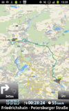
|
win | no | no | ?
|
yes | yes | yes | yes | proprietary | free | CZ; DE; EN; RU; ... | 2013-05-20 12.1.10 |
professional framework for OSM-based car navigation |
| Mapgen.pl | renderer | 
|
no | no | linux | ?
|
?
|
?
|
?
|
?
|
?
|
?
|
EN | 2010-11-17 1.12 |
easy to use cause limited concept |
| Mapnik [36] | renderer | win | macos | linux | ?
|
?
|
?
|
?
|
?
|
LGPL | free | EN | 2021-01-08 3.1.0 |
||
| MapOSMatic [37] | renderer | 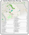
|
win | macos | linux | Django | ?
|
?
|
?
|
?
|
AGPLv3 | free | 7 | 2021-12-17 (unstable) |
Mapnik render and streetlist |
| Maps4Mac [38] | display; navi; logger | 
|
no | macos | no | Cocoa; PyObjC | yes | yes | yes | yes | GPL | free | EN | 2011-03-23 Beta 2 |
An offline map browser for MacOS |
| Maptitude Mapping Software [39] | display; editor; renderer; converter; analyser; gis | 
|
win | no | no | .NET | yes | yes | no | no | proprietary | $395,00 - $695,00 | EN | 2021-04-28 2021 |
a proprietary, Windows Desktop Geographical Information System, GIS Software |
| Maptorium Tiles downloader [40] | display; downloader; | win | mac | linux | nodejs 16+ | yes | no | no | no | LGPL | free | EN | 2022-08-18 0.8.9 |
Tiles map mass downloader for using it offline. Based on Leaflet and write on nodejs to run on remote servers. | |
| Marble [41] | display | 
|
win | macos | linux | QT; | yes | yes | yes | yes | LGPL | free | DE; EN; ... | ? 2.2.0 |
Virtual globe with multiple projections, tiles and vector data, routing and POI search |
| MB-Ruler [42] | analyse | 
|
win | no | no | GTK+; mono; JME; OpenGL; | ?
|
?
|
?
|
?
|
proprietary | free | DE; EN; ... | ? 5.4 |
Onscreen triangular ruler and protractor |
| Memphis [43] | renderer | win; win2k; winxp | no | linux | eXpat; Cairo; Glib | ?
|
?
|
?
|
?
|
LGPL | free | EN | 2011-03-20 0.2.4 |
map rendering application and library | |
| Merkaartor [44] | editor | 
|
win | macos | linux | Qt4 | ?
|
?
|
?
|
?
|
GPL | free | EN | 2021-08-27 0.19.0 |
Good editor with styling |
| mkgmap [45] | 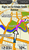
|
win | macos | linux | Java SE | ?
|
?
|
?
|
?
|
GPL | free | ?
|
2021-12-30 4839 |
Make OSM maps for your Garmin device | |
| MoNav [46] | display; router; navi | 
|
win | no | linux | Qt | yes | yes | yes | no | GPL | free | EN | 2011-04-23 0.3 |
Contraction Hierarchies routing, custom speed profiles, extremely fast and resource conservative routing, can handle huge graphs like Europe on mobile devices. Only source code available for download - has to be compiled by yourself! |
| Mumpot [47] | navi; logger; router; editor | 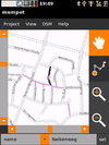
|
no | no | linux | GTK | yes | ?
|
yes | ?
|
GPL | free | DE; EN; ... | 2009-04-20 0.6 |
Touchscreen based Data editor |
| NASA World Wind [48] | display; analyse | 
|
win | macos | linux | OpenGL; | yes | ?
|
?
|
?
|
?
|
?
|
EN | 2020-08-12 2.2.0 |
3D Globe that can be extended by a lots of AddOns, Layers,... |
| NAVeGIS [49] | navi | 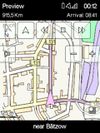
|
wince | no | no | .NET | yes | yes | yes | yes | GPLv3 | free | EN; ES; FR; GE; GR; IT | 2020-09-14 2.0.1.19 |
|
| Navio [50] | navi; logger; | 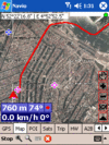
|
win | no | no | ?
|
yes | yes | yes | yes | 25$ | ?
|
EN | ? 3.15 |
|
| NaviPOWM [51] | navi; logger; router | 
|
win | no | no | ?
|
yes | yes | yes | yes | GPL | free | EN | 2011-07-05 0.2.6 |
|
| Navit [52] | navi; logger; router | 
|
win | no | linux | GTK+; SDL; OpenGL; | yes | yes | yes | yes | GPLv2 | free | 43 | 2021-03-06 0.5.6 |
Most popular OpenSource Car navigation tool; maps (offline-"custom"), vector-rendered |
| Navitel [53] | navi | 
|
wince | no | no | ?
|
yes | yes | yes | no | proprietary | 17€ | EN; RU | ? ?
|
Popular in Russia |
| NavSys [54] | navi; logger; router | 
|
no | no | linux | Cairo; | yes | yes | yes | yes | GPL | free | EN | 2005-03-11 0.0.9 |
Navi and Mediaplayer |
| Nomino [55] | editor | win | macos | linux | Web | yes | ?
|
?
|
?
|
AGPL | free | EN; FR; CA | 2014-01-06 ?
|
||
| Open Car InfoTainmenT system [56] | navi; router | 
|
win; win2k; winxp | no | linux | ?
|
yes | no | yes | no | GPL | free | EN | 2008-06-12 0.1.0-rc1 |
Navi as part of an car infotainment system |
| OpenJUMP [57] | gis; viewer; analyse | 
|
yes | yes | yes | Java SE | yes | no | no | no | GPL | free | EN | 2021-01-03 1.16 |
OpenJUMP is an open source GIS written in the Java programming language, its particular strength is the editing of geometry and attribute data |
| Open Source Routing Machine [58] | router | 
|
no | macos | linux | ?
|
?
|
yes | ?
|
?
|
BSD | free | EN | 2021-09-21 5.26.0 |
Routing server, Contraction Hierarchies routing, extremely fast |
| OpenStreetMap-in-a-Box (osminabox) [59] | renderer, converter | 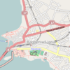
|
win, win2k, winxp | no | ?
|
yes | ?
|
?
|
?
|
New BSD License | n/a | EN; DE | 2013-03-31 1.1 |
A ready-made map and geodata server including a highly configurable converter which synchronizes OpenStreetMap data. | |
| OSM2Go [60] | logger; editor | 
|
no | no | linux | GTK | yes | no | yes | no | GPL | free | EN | 2020-12-06 0.9.17 |
Mobile, touchscreen based editor |
| OSM2Palm [61] | navi; logger; display | 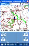
|
win | no | no | ?
|
yes | no | yes | yes | GPL | free | EN | 2009-05-24 1.6 |
|
| OSM2World [62] | converter | 
|
win | yes | linux | ?
|
?
|
?
|
?
|
?
|
LGPL | free | EN | 2019-06-23 0.2.0 |
Creates a 3D model of the world from OSM data. |
| Osm2xp [63] | flight simulators scenery generator | 
|
win | no | linux | ?
|
?
|
?
|
?
|
?
|
GPL v3 | free | EN | 2012-08-03 2.0.2 |
osm2xp generated scenery under x-plane 10. |
| Osmarender | renderer | 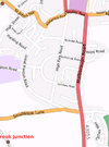
|
win | macos | linux | XSLT parser | ?
|
?
|
?
|
?
|
GPL | free | EN | ?
|
|
| Osmbrowser [64] | display | no | no | linux | wxwidgets; Cairo | ?
|
?
|
?
|
?
|
?
|
?
|
EN | 2012-10-17 ?
|
Viewer for large OSM files | |
| osmeditor | editor | 
|
win | macos | linux | Django | ?
|
?
|
?
|
?
|
GPL | free | EN | 2009-12-24 ?
|
discontinued |
| Osmeditor (QT) | editor | 
|
win; win2k; winxp | no | linux | QT | ?
|
?
|
?
|
?
|
GPL | free | EN | 2006-12-24 ?
|
discontinued |
| OSMembrane [65] | converter | 
|
win | macos | linux | ?
|
?
|
?
|
?
|
?
|
GPL | free | EN | 2018-06-26 1.2.0 |
Frontend for Osmosis |
| Osmrender.pl | renderer | 
|
no | no | linux | ?
|
?
|
?
|
?
|
?
|
GPL | free | EN | ?
|
deprecated, successor is Mapgen.pl |
| OSMroute [66] | display | win | no | linux | GTK+ | yes | no | yes | no | GPL | free | EN | 2010-10-13 alpha |
Very early stage! | |
| OsmSharp [67] | routing | 
|
win; Windows Phone | no | linux | .NET; Mono | ?
|
?
|
?
|
?
|
GPLv3 | free | EN | 2022-11-30 7.0.0-pre022 |
OSM routing and optimisation library. |
| OziExplorer [68] | 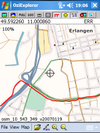
|
win | no | no | ?
|
yes | yes | yes | yes | proprietary | 30€ | EN | 2016-02 3.95.6f |
Feature-rich | |
| PocketGIS [69] | display; navi; logger; router; analyse | 
|
win; win2k; winxp | no | no | ?
|
yes | yes | yes | yes | proprietary | 0 | RU; | 2011-04-16 0.95/0.60 "Сейда" |
Easy and nice UI, web-like search, routing, navigation. |
| Potlatch 1 [70] | editor | 
|
win | macos | linux | ming | ?
|
?
|
?
|
?
|
PD | free | DE; EN | 2010-12-24 1.4 |
|
| Pyrender | renderer | 
|
win | macos | linux | Cairo | ?
|
?
|
?
|
?
|
?
|
?
|
EN | ?
|
|
| Pyroute [71] | display; router | 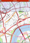
|
win | no | linux | Cairo | yes | no | no | no | GPL | free | EN | ?
|
Routing tool, predecessor of rana |
| QGIS [72] | display; editor; renderer; converter; analyser; gis | win | macos | linux | Qt | ?
|
?
|
?
|
?
|
GPL | free | EN, ? | 2021-12-17 3.22.2 |
a free, multiplatform GIS application | |
| QGIS [73] | editor; converter; analyse | 
|
win | macos | linux | QT | ?
|
?
|
?
|
?
|
GPL | free | DE; EN | 2010-07-29 1.5 |
Plugin adding OSM support to QGIS |
| QuoVadis [74] | display; navi; logger; router; editor; renderer; converter; analyser | 
|
win; winxp; win7; win8 | no | no | .NET | yes | yes | yes | yes | proprietary | 0,00 € - 279,95 € | DE; EN | ? 7.4 |
|
| Rana | navi; logger; router | 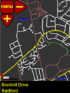
|
no | no | pyGTK; Cairo | yes | yes | yes | yes | GPL | free | EN | ?
|
Touchscreen based Navi | |
| RiscOSM [75] | display | 
|
no | no | no | ?
|
yes | yes | yes | no | proprietary | £18 | EN | 2022-06-08 2.11 |
Requires RISC OS |
| RoadMap [76] | display; router | 
|
win | no | linux | ?
|
yes | yes | yes | no | GPL | free | EN | 2009-02-02 1.2.1 |
|
| RoadMap Editor [77] | display; router | 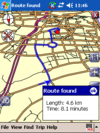
|
win | no | linux | J2ME; Cibyl | yes | yes | yes | no | GPL | free | EN; HE | ?
|
Fork of RoadMap |
| RoadNav [78] | navi; router | 
|
win | macos | linux | ?
|
yes | yes | yes | no | GPL | free | EN | 2007-10-19 0.19 |
|
| RouteConverter [79] | analyse | 
|
win | macos | linux | ?
|
yes | no | no | yes | GPL | free | DE; EN; FR; NE; ES | 2021-09-07 2.30 |
GPS routes analyser with an experimental branch for offline routing with mapsforge maps |
| Routino [80] | router | 
|
no | macos | linux | ?
|
?
|
?
|
?
|
?
|
Affero GPLv3 | free | EN; DE; NL; FR; RU | 2020-12-30 3.3.3 |
Flexible router with web interface and routing data analyser. |
| RTKLIB [81] | positioning | 
|
win | no | linux | Embarcadero / Borland VCL | ?
|
?
|
?
|
?
|
BSD 2, GPL ≥ v3 for versions before and including 2.4.2b11 | free | EN | 2018-01-29 2.4.2 p13 |
Open source program package for GNSS positioning |
| RTrender | display | 
|
win | no | no | DirectX | ?
|
?
|
?
|
?
|
proprietary | free | EN | 2010-10-30 ?
|
Realtime OSM rendering |
| Running Reality [82] | world history; editor; data transformer | win | macos | linux | Java | yes | no | yes | ?
|
Free | Free | EN | continuous releases | Explore the history of human civilization from 3000BC to today. Running Reality is a world history model with free web and app versions. | |
| SAS.Planet [83] | display; logger | win; win2k; winxp | no | no | CodeGear Delphi 2007 | yes | yes | yes | yes | GPLv3 | free | EN; RU | 2020-12-12 201212 |
||
| ShareNav [84] | display; navi; logger; router; editor; renderer | 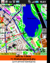
|
win; win2k; winxp | macos | linux | Android; J2ME; java | yes | yes | yes | yes | GPLv2 | €2.99 on Google Play Store (may vary depending on local taxes) | EN; DE; FI; CS; PL; RU; FR; IT; ES; SK | 2012-11-12 0.8.8 |
very portable navi for Android&J2ME mobile phones, uses offline vector maps, audio navigation |
| ShugenDoMap [85] | display | 
|
win | no | no | ShugenDo Engine | ?
|
?
|
?
|
?
|
proprietary | free | EN | 2011-11-19 alpha |
Realtime 3D OSM rendering on multiple platforms. |
| Spatial Manager Desktop™ [86] | display; converter | 
|
winxp; win7; win8; win8.1 | no | no | .NET | yes | no | no | no | proprietary | $149,00 - $499,00 | EN; ES | 7.0.3.11198 | Manage spatial data in a simple, fast and inexpensive way. Includes its own OSM data provider |
| Spatial Manager™ for AutoCAD [87] | display; converter | 
|
win7; win8; win8.1 | no | no | .NET; AutoCAD API 2008-2015 | yes | no | no | no | proprietary | $99,00 - $179,00 | EN; ES | 7.0.3.11198 | Powerful AutoCAD plug-in. Imports spatial data in a simple, fast and inexpensive way. Includes its own OSM data provider |
| TangoGPS | 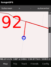
|
no | no | linux | ?
|
yes | ?
|
yes | yes | GPL | free | DE; EN; ... | 2010-06-25 0.99.4 |
Logger even for heartrate-monitors! | |
| TEAM - Tutor for editable audio maps [88] | navi; logger; router; renderer | 
|
win; win2k; winxp; win7 | no | no | ?
|
yes | no | no | no | GPL | free | DE; EN | 2013-02-02 4.0 |
Audible Maps Generator for accessibility |
| Track2Karte [89] | analyse | 
|
win | no | no | ?
|
yes | no | no | no | proprietary | free | DE | 4.1 | Very Simple Track Viewer |
| TransCAD Transportation GIS Software [90] | display; editor; renderer; converter; analyser; gis | 
|
win | no | no | .NET | yes | yes | no | no | proprietary | $6000 - $12000 | EN | 2018-03-08 8.0 |
a proprietary, Windows Desktop Transportation Geographical Information System, GIS Software |
| Traveling Salesman [91] | navi; router | 
|
win; win2k; winxp | no | linux | ?
|
yes | yes | no | no | GPL | free | EN | 2009-12-25 1.0.3-RC1 |
Highly modular router |
| Trip4YouMaps [92] | router; navi; tracker; display; converter | 
|
win | yes | yes | ?
|
yes | yes | yes | yes | proprietary | free | DE; EN; | 2023-04-27 2.0.61 |
Trip4YouMaps is a modern App for Route planning, Navigation & Tracking; optimised for outdoor activities; different maps; up to 50 waypoints, routes can be saved, shared and exported as gpx-files; show path surfaces on the map; for Desktop, Android & iOS |
| Turbo GPS [93] | 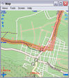
|
win | no | no | ?
|
yes | yes | yes | yes | proprietary | free | DE; EN; ... | 2012-09-07 2.73 |
TurboGPS is a fast all in one GPS tool. Moving maps custom or online, tracks, way points. | |
| VataviaMap [94] | display | win; win2k; winxp | macos | linux | .NET; mono | yes | no | no | no | GPL; Artistic License | free | EN | 2011-22-03 0.0.0.3 |
Display for several map sources like OSM, Yahoo and others ... Desktop version requires .NET-Framework 2.0 or newer, tested with MONO-framework under Linux and MacOS | |
| Viking [95] | display; navi; logger | 
|
win | no | linux | GTK+ | yes | yes | yes | yes | GPL | free | CS; DA; DE; EL; EN; ES; FI; FR; HR; ID; IT; JA; LT; LV; NB; NL; PL; PT; RU; SL; SV; UK; ZH | 2021-11-27 1.10 |
GTK+2 application to manage GPS data |
| VisualGPS [96] | logger; analyse | 
|
win | no | no | ?
|
yes | no | no | no | proprietary | free | EN | 2009-03-29 4.2 |
GPS signal analyses |
| YAAC [97] | display; logger; tracker | 
|
win; win2k; winxp | macos | linux | JavaSE | yes | no | yes | yes | GPL | free | EN; ... | 2021-12-13 1.0-beta167 |
Amateur Radio Automatic Packet Reporting System client written in Java that uses OSM data to render maps on the fly. Under active development with rapid development release cycle. |
| YourPocketMap [98] | display | 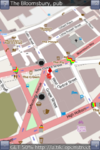
|
no | no | ?
|
yes | no | no | yes | proprietary | free | EN | 2010-11-11 0.1.3 |

This table in the past was generated automatically by a bot. Learn more.
Map display features
| Name | Shows map as vector | Shows map as bitmap | Stores map-data on-board | Stores map-data off-board (downloads from internet) | Rotate map | 3D view |
|---|---|---|---|---|---|---|
| ArcGIS Editor for OSM | yes | no | yes | yes | no | no |
| Autosputnik 5 | yes | no | yes | no | yes | yes |
| BaseCamp | yes | yes | yes | no | yes;no | yes |
| CartoType | yes | yes | yes | yes | yes | yes |
| Cruiser | yes | yes | yes | yes | no | ?
|
| florb | no | yes | yes | yes | no | no |
| FoxtrotGPS | no | yes | yes (cache) | yes | no | no |
| Gnome Map Application | yes | yes | yes | no | ?
|
?
|
| Gosmore | yes | no | yes | no | yes | yes |
| GPS TrackMaker | ?
|
?
|
?
|
?
|
?
|
?
|
| GPS-Mate | no | yes | yes | yes | yes | no |
| gps3D | no | yes | no | yes | no | yes |
| GpsDrive | no | yes | yes | yes | no | no |
| GpsMaster | no | yes | no | yes | no | no |
| GpsPrune | no | yes | no | yes | no | yes |
| gpsVP | yes | yes | yes | no | yes | yes |
| GPX Viewer | no | yes | no | yes | no | no |
| GPXSee | yes | yes | yes | yes | no | no |
| GPXViewer | no | yes | no | yes | no | no |
| GraphHopper | ?
|
?
|
yes | no | ?
|
?
|
| Jagme | no | yes | no | yes | no | no |
| JGPSTrackEdit | no | yes | yes (cache) | no | ?
|
?
|
| JOSM | yes | yes | yes | no | ?
|
?
|
| LiveMapViewer | ?
|
?
|
?
|
?
|
?
|
?
|
| LocationWizard | no | yes | no | yes | no | no |
| luckyGPS | yes | yes | yes | yes | yes | no |
| mapFactor Navigator free | yes | no | yes | no | yes | yes |
| Maps4Mac | yes | no | yes | no | no | no |
| Marble | yes | yes | yes | yes | yes | yes |
| MoNav | no | yes | yes | yes | yes | no |
| Mumpot | yes | yes | yes | yes | ?
|
no |
| NASA World Wind | ?
|
?
|
no | yes | ?
|
yes |
| NAVeGIS | yes | no | yes | no | yes | no |
| Navio | no | yes | ?
|
?
|
yes | no |
| NaviPOWM | yes | no | yes | no | yes | no |
| Navit | yes | no | yes | no | yes | yes |
| Navitel | yes | no | yes | no | yes | yes |
| NavSys | ?
|
?
|
?
|
?
|
?
|
?
|
| Nomino | yes | no | no | yes | no | no |
| Open Car InfoTainmenT system | yes | no | yes | no | ?
|
no |
| OpenJUMP | yes | no | yes | yes | ?
|
no |
| OpenStreetMap-in-a-Box (osminabox) | yes | yes | yes | yes | ?
|
?
|
| OSM2Go | yes | no | yes | no | yes | no |
| OSM2Palm | no | yes | yes | no | ?
|
no |
| OSMroute | yes | no | yes | no | no | no |
| OziExplorer | yes | yes | yes | yes | yes | yes |
| PocketGIS | yes | no | yes | no | yes | no |
| Pyroute | yes | no | yes | no | no | no |
| QuoVadis | yes | yes | yes | yes | yes | yes |
| Rana | yes | no | yes | no | ?
|
no |
| RiscOSM | yes | no | no | yes | yes | no |
| RoadMap | yes | no | yes | no | yes | yes |
| RoadMap Editor | yes | no | yes | no | yes | yes |
| RoadNav | yes | no | yes | no | ?
|
yes |
| RouteConverter | no | yes | no | yes | no | no |
| ShareNav | yes | yes | yes | yes | yes | yes |
| Spatial Manager Desktop™ | yes | no | yes | no | no | no |
| Spatial Manager™ for AutoCAD | yes | no | yes | no | no | no |
| TangoGPS | no | yes | yes (cache) | yes | ?
|
no |
| TEAM - Tutor for editable audio maps | yes | no | yes | yes | no | no |
| Track2Karte | no | yes | no | yes | no | no |
| Traveling Salesman | yes | no | yes | no | yes | no |
| Trip4YouMaps | no | yes | no | yes | yes | no |
| Turbo GPS | no | yes | yes | yes | yes | no |
| VataviaMap | no | yes | yes | yes | ?
|
no |
| Viking | no | yes | yes (cache) | yes | no | no |
| VisualGPS | ?
|
?
|
?
|
?
|
no | no |
| YAAC | yes | no | yes | no | no | no |
| YourPocketMap | no | yes | yes (cache) | yes | yes | yes |

This table in the past was generated automatically by a bot. Learn more.
| Name | Windows Versions | Mac Versions | Linux Versions | Navigate to point | Find location | Find nearby POIs | Navigate along predefined route | Create route manually | Calculate route | Calculate route without internet | Car routing | Bike routing | Foot routing | Turn restrictions | Navigation with voice | Keep on road | Works without GPS |
|---|---|---|---|---|---|---|---|---|---|---|---|---|---|---|---|---|---|
| Autosputnik 5 | win; win2k; winxp | no | no | yes | yes | yes | ?
|
?
|
?
|
?
|
yes | no | no | yes | yes | yes | yes |
| CartoType | win | macos | linux | yes | yes | yes | yes | ?
|
yes | yes | yes | yes | yes | yes | ?
|
yes | yes |
| Cruiser | win | macos | linux | yes | no | no | no | ?
|
yes | yes | yes | yes | yes | yes | no | no | yes |
| Gosmore | win; wince | no | linux | yes | yes | yes | no | ?
|
yes | ?
|
yes | yes | yes | yes | yes | ?
|
?
|
| GPS-Mate | win | no | no | yes | yes | yes | ?
|
?
|
?
|
?
|
?
|
?
|
?
|
?
|
no | ?
|
?
|
| GpsDrive | no | macos | linux | ?
|
?
|
?
|
?
|
?
|
?
|
?
|
yes | yes | yes | ?
|
?
|
?
|
yes |
| gpsVP | win | no | no | yes | yes | yes | ?
|
?
|
?
|
?
|
?
|
?
|
?
|
?
|
no | no | yes |
| JGPSTrackEdit | win | macos | linux | ?
|
?
|
?
|
?
|
?
|
?
|
?
|
?
|
?
|
?
|
?
|
?
|
?
|
?
|
| LiveMapViewer | win | no | linux | ?
|
?
|
?
|
?
|
?
|
?
|
?
|
?
|
?
|
?
|
?
|
?
|
?
|
?
|
| mapFactor Navigator free | win | no | no | yes | yes | yes | no | ?
|
yes | yes | yes | no | yes | yes | yes | yes;no | yes |
| Maps4Mac | no | macos | no | ?
|
no | yes | ?
|
?
|
?
|
?
|
no | no | no | no | ?
|
?
|
yes |
| Marble | win | macos | linux | no | yes | no | ?
|
?
|
?
|
?
|
yes | yes | yes | no | yes | no | yes |
| MoNav | win | no | linux | yes | yes | no | ?
|
?
|
?
|
?
|
yes | yes | yes | no | no | ?
|
?
|
| NAVeGIS | wince | no | no | yes | yes | yes | no | ?
|
yes | ?
|
yes | no | no | yes | yes | yes | yes |
| Navio | win | no | no | ?
|
?
|
?
|
?
|
?
|
?
|
?
|
?
|
?
|
?
|
?
|
?
|
?
|
?
|
| NaviPOWM | win | no | no | ?
|
?
|
?
|
?
|
?
|
?
|
?
|
yes | yes | yes | ?
|
no | ?
|
?
|
| Navit | win | no | linux | yes | yes | yes | no | ?
|
yes | yes | yes | no | yes | yes | yes | yes | no |
| Navitel | wince | no | no | yes | yes | yes | no | ?
|
yes | yes | yes | yes | yes | yes | yes | yes | yes |
| NavSys | no | no | linux | ?
|
?
|
?
|
?
|
?
|
?
|
?
|
?
|
?
|
?
|
?
|
?
|
?
|
?
|
| Open Source Routing Machine | no | macos | linux | ?
|
?
|
?
|
?
|
?
|
?
|
?
|
?
|
?
|
?
|
yes | ?
|
?
|
?
|
| OziExplorer | win | no | no | ?
|
?
|
?
|
?
|
?
|
?
|
?
|
?
|
?
|
?
|
?
|
no | ?
|
yes |
| PocketGIS | win; win2k; winxp | no | no | yes | yes | yes | ?
|
?
|
?
|
?
|
yes | no | no | no | yes | no | yes |
| QuoVadis | win; winxp; win7; win8 | no | no | yes | yes | yes | yes | ?
|
yes | yes | yes | yes | yes | yes | yes | yes | yes;no |
| Rana | no | no | ?
|
?
|
yes | ?
|
?
|
?
|
?
|
?
|
?
|
?
|
?
|
no | ?
|
?
| |
| RiscOSM | no | no | no | ?
|
yes | yes | ?
|
yes | yes | yes | yes | yes | yes | no | no | ?
|
?
|
| RoadMap | win | no | linux | yes | yes | no | ?
|
?
|
?
|
?
|
?
|
?
|
?
|
no | no | ?
|
yes |
| RoadMap Editor | win | no | linux | yes | yes | no | ?
|
?
|
?
|
?
|
?
|
?
|
?
|
no | no | ?
|
yes |
| RoadNav | win | macos | linux | ?
|
?
|
?
|
?
|
?
|
?
|
?
|
?
|
?
|
?
|
?
|
yes | ?
|
yes |
| ShareNav | win; win2k; winxp | macos | linux | yes | yes | yes | no | no | yes | yes | yes | yes | yes | yes | yes | yes | yes |
| Traveling Salesman | win; win2k; winxp | no | linux | ?
|
yes | ?
|
?
|
?
|
?
|
?
|
?
|
?
|
?
|
?
|
?
|
no | yes |
| Trip4YouMaps | yes | yes | yes | ?
|
no | yes | no | yes | yes | yes | no | no | yes | yes | |||
| win | no | no | yes | yes | yes | ?
|
?
|
?
|
?
|
?
|
?
|
?
|
?
|
?
|
?
|
yes | |
| Viking | win | no | linux | no | yes | no | ?
|
?
|
?
|
?
|
yes | no | no | yes | no | no | yes |

This table in the past was generated automatically by a bot. Learn more.
Track making features
| Name | Customizable log interval | GPX format | KML format | NMEA format | All formats | Geo-tagged notes | Geo-tagged photos | Geo-tagged audio | Fast POI buttons |
|---|---|---|---|---|---|---|---|---|---|
| florb | no | yes | no | no | gpx | no | no | no | yes |
| FoxtrotGPS | no | yes | no | no | gpx | no | yes | no | no |
| Gosmore | ?
|
?
|
?
|
?
|
?
|
?
|
?
|
?
|
?
|
| GPS TrackMaker | ?
|
yes | yes | no | gpx;kml;… | ?
|
?
|
?
|
?
|
| GPS-Mate | ?
|
yes | yes | yes | gpx,kml,nmea,csv,txt,loc,tur | yes | no | no | yes |
| GpsDrive | ?
|
yes | no | no | gpx | ?
|
?
|
?
|
?
|
| gpsVP | yes | yes | no | no | gpx;ozi;plt | yes | no | no | ?
|
| luckyGPS | ?
|
?
|
?
|
?
|
?
|
?
|
?
|
?
|
?
|
| mapFactor Navigator free | ?
|
no | no | yes | nmea | ?
|
?
|
?
|
?
|
| Maps4Mac | no | yes | no | no | gpx | yes | no | no | yes |
| Marble | no | no | yes | no | kml | ?
|
?
|
?
|
yes |
| MoNav | ?
|
?
|
?
|
?
|
?
|
?
|
?
|
?
|
?
|
| Mumpot | ?
|
?
|
?
|
?
|
?
|
?
|
?
|
?
|
yes |
| NAVeGIS | ?
|
no | no | no | img | no | no | no | ?
|
| Navio | ?
|
?
|
?
|
?
|
?
|
?
|
?
|
?
|
?
|
| NaviPOWM | yes | no | no | yes | nmea | no | no | no | no |
| Navit | ?
|
yes | no | yes | bin, garmin, gpx, nmea | ?
|
?
|
?
|
?
|
| Navitel | yes | yes | no | no | gpx | ?
|
?
|
?
|
?
|
| NavSys | ?
|
?
|
?
|
?
|
?
|
?
|
?
|
?
|
?
|
| Open Car InfoTainmenT system | ?
|
?
|
?
|
?
|
?
|
?
|
?
|
?
|
?
|
| OSM2Go | ?
|
?
|
?
|
?
|
?
|
?
|
?
|
?
|
?
|
| OSM2Palm | ?
|
yes | no | no | gpx | ?
|
?
|
?
|
?
|
| OSMroute | no | yes | no | yes | gpx;nmea | no | no | no | no |
| OziExplorer | yes | ?
|
?
|
?
|
?
|
?
|
?
|
?
|
?
|
| PocketGIS | no | no | no | yes | nmea, lmt | no | yes | no | yes |
| QuoVadis | yes | no | no | no | ewc;img;tdb;tiff;png;bmp;shp;dxf;online-maps | yes | yes | yes | yes |
| Rana | yes | ?
|
?
|
?
|
?
|
?
|
?
|
?
|
?
|
| RiscOSM | no | yes | yes | ?
|
?
|
?
|
?
|
?
|
?
|
| RoadMap | ?
|
?
|
?
|
?
|
?
|
?
|
?
|
?
|
?
|
| RoadMap Editor | ?
|
?
|
?
|
?
|
?
|
?
|
?
|
?
|
?
|
| RoadNav | ?
|
?
|
?
|
?
|
?
|
no | no | no | ?
|
| ShareNav | yes | yes | no | yes | gpx;nmea | yes | yes | yes | yes |
| TangoGPS | ?
|
yes | no | no | gpx | no | yes | no | ?
|
| Trip4YouMaps | no | yes | no | no | gpx | no | no | no | yes |
| Turbo GPS | yes | yes | yes | no | gpx;kml;loc | no | no | no | ?
|
| Viking | no | yes | yes | no | gpx;kml | no | yes | no | no |
| YAAC | no | no | no | no | none | no | no | no | yes |

This table in the past was generated automatically by a bot. Learn more.
Monitoring features
| Name | Show current track | Open existing track | Altitude diagram | Show DOP value | Satellite view | Show live NMEA data | Send current position via SMS | Upload current position |
|---|---|---|---|---|---|---|---|---|
| Autosputnik 5 | no | no | no | no | yes | no | ?
|
?
|
| florb | yes | yes | no | yes | no | no | no | no |
| FoxtrotGPS | yes | yes | no | no | no | no | no | yes |
| Gosmore | ?
|
?
|
?
|
?
|
?
|
?
|
?
|
?
|
| GPS TrackMaker | yes | yes | yes | ?
|
?
|
?
|
yes | yes |
| GPS-Mate | yes | yes | yes | yes | yes | yes | no | no |
| gpsd | no | no | no | no | yes | no | ?
|
?
|
| GpsDrive | yes | yes | yes | yes | yes | yes | no | no |
| GpsPrune | no | yes | yes | no | no | no | ?
|
?
|
| gpsVP | yes | yes | no | yes | no | no | no | no |
| GPX Viewer | no | yes | yes | no | no | no | ?
|
?
|
| GPXSee | no | yes | yes | no | no | yes | no | no |
| GPXViewer | no | yes | no | no | no | no | ?
|
?
|
| Jagme | no | yes | no | no | no | no | ?
|
?
|
| JGPSTrackEdit | ?
|
?
|
?
|
?
|
?
|
?
|
?
|
?
|
| mapFactor Navigator free | yes | yes | ?
|
?
|
yes | ?
|
no | no |
| Maps4Mac | yes | yes | no | no | no | no | no | no |
| Marble | yes | yes | yes | no | no | no | no | no |
| NAVeGIS | no | no | no | no | yes | ?
|
?
|
?
|
| Navio | yes | yes | yes | yes | yes | ?
|
?
|
?
|
| NaviPOWM | no | no | no | yes | yes | no | no | no |
| Navit | yes | ?
|
no | yes | no | no | no | no |
| NavSys | ?
|
?
|
?
|
?
|
?
|
?
|
?
|
?
|
| OSM2Palm | yes | yes | ?
|
?
|
?
|
?
|
?
|
?
|
| OziExplorer | yes | yes | yes | yes | yes | ?
|
no | no |
| PocketGIS | yes | yes | no | no | yes | yes | no | no |
| QuoVadis | yes | yes | yes | yes | ?
|
yes;no | yes | yes |
| Rana | yes | no | no | yes | no | no | no | no |
| RiscOSM | yes | no | yes | ?
|
no | no | no | no |
| RouteConverter | no | yes | yes | ?
|
?
|
no | ?
|
?
|
| ShareNav | yes | yes | yes | yes | yes | yes | yes | no |
| TangoGPS | yes | ?
|
?
|
?
|
?
|
?
|
no | yes |
| Trip4YouMaps | yes | ?
|
yes | no | no | no | no | no |
| Turbo GPS | yes | yes | yes | yes | yes | yes | no | yes |
| Viking | yes | yes | yes | yes | yes | no | no | no |
| YAAC | yes | yes | no | yes | yes | yes | no | no |
| YourPocketMap | no | no | no | no | no | no | ?
|
?
|

This table in the past was generated automatically by a bot. Learn more.
OpenStreetMap editing features
| Name | Add POIs | Edit / Delete POIs | Edit arbitrary tags of existing OSM objects | Edit geometries | Support imagery offset DB | Upload to OSM |
|---|---|---|---|---|---|---|
| ArcGIS Editor for OSM | yes | yes | yes | yes | ?
|
yes |
| Google Sketchup Plugin | ?
|
?
|
?
|
?
|
?
|
?
|
| GPS TrackMaker | ?
|
?
|
?
|
?
|
?
|
no |
| GpsMaster | no | yes;no | yes;no | yes;no | yes;no | yes;no |
| Java Applet | ?
|
?
|
?
|
?
|
?
|
?
|
| JGPSTrackEdit | no | no | no | no | ?
|
no |
| JOSM | yes | yes | yes | yes | yes | yes |
| Merkaartor | yes | yes | yes | yes | no | yes |
| Mumpot | ?
|
yes | ?
|
?
|
?
|
yes |
| Nomino | no | no | yes | no | ?
|
yes |
| OSM2Go | yes | yes | yes | yes | ?
|
yes |
| osmeditor | ?
|
?
|
?
|
?
|
?
|
?
|
| Osmeditor (QT) | ?
|
?
|
?
|
?
|
?
|
?
|
| Potlatch 1 | yes | yes | yes | yes | no | yes |
| QGIS | ?
|
?
|
?
|
?
|
?
|
?
|
| QGIS | ?
|
?
|
?
|
?
|
?
|
?
|
| QuoVadis | yes | yes | yes | yes;no | ?
|
no |
| ShareNav | yes | yes | yes | not directly, will open web browser editor for area | ?
|
yes |

This table in the past was generated automatically by a bot. Learn more.
Browser Extensions
OSM Smart Menu helps OpenStreetMap contributors to easily switch between different maps and analysis tools from the community.
Making an OpenStreetMap handler for Operator documents the process of creating a new handler for the geo microformat for the Operator extension for Firefox.
OpenStreetMap Finder is a Firefox extension for the Mozilla Firefox web browser.
osm.js is a plugin for handling the geo microformat for the Operator extension for Firefox.
Discontinued Software
| Name | Genre | Screenshot | Windows Versions | Mac Versions | Linux Versions | Framework | Display map | Navigate | Make track | Monitor | License | Price | Languages | Version | Description |
|---|---|---|---|---|---|---|---|---|---|---|---|---|---|---|---|
| Amenity Editor | editor | 
|
win | macos | linux | ?
|
?
|
?
|
?
|
?
|
GNU AGPL 3+ | free | EN | 2016-11-16 0.96 |
Very limited but easy to use online editor |
| APRSISCE/32 [99] | display; logger; tracker | 
|
win; win2k; winxp | macos | linux | ?
|
yes | no | yes | yes | proprietary | free | EN; ... | 2012-08-29 2012/08/29 |
Feature rich Amateur Radio Automatic Packet Reporting System client that uses OSM tiles as the base map. |
| BetterSoftwareGPS | logger | 
|
win2k | no | no | .NET | yes | no | no | yes | proprietary | free | EN | 2010-05-13 3.5.2.8 |
|
| Brigantine [100] | display | 
|
win | no | linux | ?
|
yes | ?
|
?
|
?
|
MIT | free | EN | 2013-06-04 1306 |
|
| Cobra | renderer | 
|
win | no | no | .NET; CAIRO | ?
|
?
|
?
|
?
|
?
|
?
|
EN | 2010-02-03 0.3.9 |
project paused |
| Emerillon [101] | display | 
|
no | no | linux | GTK+; | yes | no | no | no | GPL | free | AR; CS; DA; DE; EN; ES; FR; GL; ID; IS; IT; JA; LV; NB; PL; PT; SL; SV; ZH | 2011-09-07 0.1.90 |
Simple map viewer for GNOME Desktop |
| Glosm | display | 
|
win | no | linux | OpenGL; SDL | ?
|
?
|
?
|
?
|
GPL v3 | free | EN | ? 0.0.3 |
Framework for developing high-performance geospatial data visualization applications of both interactive and batch nature featuring OpenGL-based 3D first-person and tile renderers |
| Gnome Map Application [102] | display | 
|
win | no | yes | mono | yes | ?
|
?
|
no | GPL | free | EN | 2010-07-02 0.4.3 |
Offers a Warp view and rotate view |
| Gosmore [103] | navi | 
|
win; wince | no | linux | GTK+ | yes | yes | yes | yes | BSD | free | EN; DE | 2011-11-22 - |
|
| gps3d | display | 
|
win | no | linux | OpenGL | yes | no | no | no | GPL | free | EN | 2002-03-11 1.2 |
Very simple 3D Globe |
| gpsd [104] | analyse | 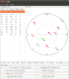
|
no | macos | linux | ?
|
no | no | no | yes | BSD | free | EN | 2010-07-13 2.95 |
Connect to GPS receiver, and analyse the connection |
Map display features
| Name | Shows map as vector | Shows map as bitmap | Stores map-data on-board | Stores map-data off-board (downloads from internet) | Rotate map | 3D view |
|---|---|---|---|---|---|---|
| APRSISCE/32 | no | yes | yes | yes | no | no |
| BetterSoftwareGPS | no | yes | ?
|
?
|
?
|
?
|
| Brigantine | yes | yes | yes | yes | ?
|
?
|
| Emerillon | no | yes | no | yes | no | no |
| Name | Windows Versions | Mac Versions | Linux Versions | Navigate to point | Find location | Find nearby POIs | Navigate along predefined route | Create route manually | Calculate route | Calculate route without internet | Car routing | Bike routing | Foot routing | Turn restrictions | Navigation with voice | Keep on road | Works without GPS |
|---|
Track making features
| Name | Customizable log interval | GPX format | KML format | NMEA format | All formats | Geo-tagged notes | Geo-tagged photos | Geo-tagged audio | Fast POI buttons |
|---|---|---|---|---|---|---|---|---|---|
| APRSISCE/32 | yes | no | no | no | none | no | no | no | yes |
Monitoring features
| Name | Show current track | Open existing track | Altitude diagram | Show DOP value | Satellite view | Show live NMEA data | Send current position via SMS | Upload current position |
|---|---|---|---|---|---|---|---|---|
| APRSISCE/32 | yes | yes | no | yes | yes | yes | no | no |
| BetterSoftwareGPS | ?
|
?
|
?
|
?
|
?
|
yes | no | no |
OpenStreetMap editing features
| Name | Add POIs | Edit / Delete POIs | Edit arbitrary tags of existing OSM objects | Edit geometries | Support imagery offset DB | Upload to OSM |
|---|---|---|---|---|---|---|
| Amenity Editor | yes | yes | yes | no | ?
|
yes |