Advertising, information signs and guideposts in Uganda
| Advertising, information signs and guideposts in Uganda | |
|---|---|
| This page is localised for | |
| Status: | Draft (under way) |
| Proposed by: | Bert Araali |
| Tagging: | advertising=* |
| Applies to: | |
| Definition: | An extended and advanced scheme to tag all kinds of advertisement and information signs, including billboards and guideposts in Uganda |
| Drafted on: | 25 Dec 2019 |
| Voting members: | talk-ug+Core Members |
|
This page is under continuous development. The described tagging and mapping conventions/guidelines are the ones most commonly used in Uganda This page is intended to help those mappers in Uganda |
Terminology
We distinguish, describe and give conventions/guidelines on how to map them properly on the following types:
Advertising boards and Billboards (also called a hoarding): for advertising. See advertising=board and advertising=billboard
Information: to indicate the name of roads, educational or information signs along roads and on buildings etc...
Guideposts: to indicate the directions to different destinations or names of places or routes.
How to map
Advertisement
Generally, the keys used and their possible values are:
| Tag or key | Type | Requirements | Values in Uganda with description |
|---|---|---|---|
| advertising=* | Identification | Mandatory | advertising=board: Is the standard tag on OSM to identify a board (small scale advertisements). advertising=billboard: Is the standard tag on OSM to identify a billboard (large scale advertisements). |
| man_made=* | Identification | Optional | man_made=advertising: Should be added additionally to the mandatory advertising=billboard tag to support all kinds of rendering and to identify it specifically as a man made structure. |
| support=* | Technical details | Optional | support=post: The billboard is supported by one or more posts. support=pole: The billboard is supported by one or more poles. |
- Appearance
- size=* : the dimensions of the billboard itself (omitting its support)
- height=* : the height of the billboard (including its support)
- lit=* : is the billboard lit ?
- luminous=* : is the billboard luminous ?
- animated=* : is the billboard animated ? By which method ?
- sides=* : how many sides does the billboard have (generally 1 or 2)
- Management
- operator=* : the company or government organisation operating the billboard
- ref=* : the billboard reference
- access=* : can everybody change the content of the billboard ?
- land_property=* : who is the owner of the land under the billboard ?
- Content and visibility
- message=* : the kind of content shown on the billboard. The key message=* gives an indication on the type of message of an advertising device. It is NOT the message itself (refer to Key:message). Since the message can change regularly, DO NOT store it. Static, non changing messages can be stored for information guideposts, like street names. The name is then defined in the key name=*. In all other case the key name=* is NOT USED.
- display_surface=* : the surface dedicated to the display of message (without the frame)
- orientation=* : how is the billboard directed compared to people/traffic flow
- direction=* : how is the billboard directed (using cardinal points)
- visibility=* : how far is the billboard visible ?
Advertisement
| Sign type | Image | Rendering on OSM / Mapnik | Possible or proposed rendering | Description | Tags |
|---|---|---|---|---|---|
| Public billboard - trunked Advertising tree |

|
not rendered | 
|
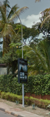
Major public billboards located typically along major roads. The advertising content can change often as it is sold or leased by authorities or officially contracted companies to advertisers on a limited time base. It is a grounded advertising billboard, supported by a single trunk (analogy with the trunk of a natural tree, this type of device is also called an "advertising tree"). Some are lit and/or animated with winding posters, multiple sides, installed. In most cases on public domain along (busy) public roads. |
General mapping: due to their mostly significant size map as an |
| Public advertising board or billboard other then advertising tree |  |
not rendered | 
|
Major public billboards located typically along major roads. |
In regard to supports three major cases:
In regard to size two major cases:
General mapping: as an |
Information signs
| Sign type | Image | Description | Tags |
|---|---|---|---|
| Information signs | 
|
Information signs |
Tagging |
Guideposts
In Uganda we follow the approved tagging scheme described in tourism=information with the key information=guidepost.
Special case: official street name markers
A proposal or apporved tagging scheme on OSM for tagging street name markers does not exist. Different solutions are used in different countries, due to the different formats of how to mark street names in the field. In Uganda there is no consistent or official way for the marking of street names. The following table is a proposal how to tag the different formats so they can easily be identified in the field and on maps. They are used to mark the start and or end of an officially named highway, so therefore we use the common key marker=*. To distinguish or detail the marker additional tags may be optonally used as described below.
How to map
Create a separate node ![]() at the exact position and tag with the values described in the following table. Please do not tag a crossroads or a node on a highway.
at the exact position and tag with the values described in the following table. Please do not tag a crossroads or a node on a highway.
| Sign type | Image | Rendering | Description | Tags | ||||||||||||||||||
|---|---|---|---|---|---|---|---|---|---|---|---|---|---|---|---|---|---|---|---|---|---|---|
| Street name as guidepost | 
|
in OSM Carto: |
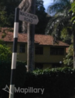
Example of a street name installed as a guidepost (Nakasero, Kampala by KCCA-Kampala Capital City Authority). They are part of the street real estate and get vandalised or stolen quite often. In case that during a field survey the guidepost has disappeared, try to find out if it was deliberately removed or replaced by the operator or was illegally removed. In the latter case don't remove the node. |
For all mapping styles:
|
For detailed and micro mapping the following tagging scheme can be added:
Relation:destination_sign is used for the complete description of the signpost. This is a complex tagging scheme as it requires its own relation with at least three members for the direction the sign points to.
| Key | Value | Required | Example | Description |
|---|---|---|---|---|
| type=* | destination_sign | Required | destination_sign | The type of relation. |
| destination=* | a name | Required | MACKINON ROAD | The destination as it says on the sign. Do not include any given reference numbers. See destination:ref=*. |
| height=* | a height in meters (m) | Optional | 3 | The height of the complete post including the sign. |
| size=* | a size in the format length*height | Optional | 0.5*0.2 | The size of the actual inscribed sign (see size=*). |
| colour:back=* | a colour | Optional | white | The background colour of the sign (see colour=*). |
| colour:text=* | a colour | Optional | black | The text colour of the sign. |
| colour:arrow=* | a colour | Optional | white | The border/arrow colour of the sign. |
| material=* | a material | Optional | metal | The material the inscribed sign is made of (see material=*. |
| destination:ref=* | a reference | Optional | The reference as indicated on the sign. See Destination details. |
For signs pointing containing additional symbols, the tag destination:symbol=* could be used. So far we have not found any in the field.


