File:Dscf0105 600.jpg
Jump to navigation
Jump to search
Dscf0105_600.jpg (600 × 450 pixels, file size: 65 KB, MIME type: image/jpeg)
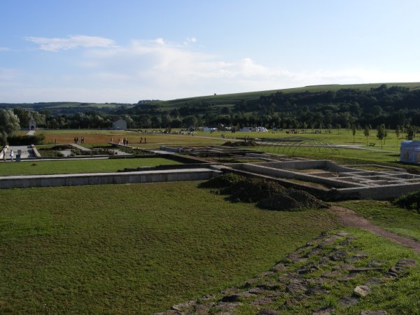
Europäischer Kulturpark Bliesbruck-Reinheim
File history
Click on a date/time to view the file as it appeared at that time.
| Date/Time | Thumbnail | Dimensions | User | Comment | |
|---|---|---|---|---|---|
| current | 21:35, 24 September 2008 |  | 600 × 450 (65 KB) | FrankM (talk | contribs) | Europäischer Kulturpark Bliesbruck-Reinheim |
You cannot overwrite this file.
File usage
The following 68 pages use this file:
- Ar:Map Features
- Ast:Map Features
- Bg:Map Features
- Cs:Key:historic
- Cs:Map Features
- Cs:Tag:historic=archaeological site
- Fa:Map Features
- Fi:Kartan ominaisuudet
- He:Map Features
- Hu:Map Features
- Ko:Tag:historic=archaeological site
- Lt:Map Features
- Lv:Map Features
- MENTZ GmbH/Modellierungsvorschläge POI extra
- Ne:Map Features
- Oc:Elements cartografics
- Pl:Key:historic
- Pl:Mapowanie obiektów
- Pl:Mapowanie obiektów/S
- Pt:Key:historic
- Pt:Map Features
- Pt:Tag:historic=archaeological site
- Sr:Map Features
- Tag:historic=archaeological site
- Tr:Key:historic
- Uk:How to map a
- Uk:Key:historic
- Uk:Об'єкти мапи
- Zh-hant:Map Features
- User:FrankM/Images
- User:Mateusz Konieczny/notify uploaders/FrankM
- Wiki:Files used by data items/2
- Template:Ar:Map Features:historic
- Template:Cs:Map Features:historic
- Template:DE:Map Features:historic
- Template:Et:Map Features:historic
- Template:FR:Map Features:historic
- Template:Fi:Map Features:historic
- Template:Generic:ES:Map Features:historic
- Template:Generic:Map Features:historic
- Template:Hu:Map Features:historic
- Template:IT:Map Features:historic
- Template:JA:Map Features:historic
- Template:NL:How to map a:A
- Template:NL:Map Features:historic
- Template:Oc:Map Features:patrimòni
- Template:Pl:Map Features:historic
- Template:Pt:Map Features:historic
- Template:Uk:Map Features:historic
- Template:Zh-hant:Map Features:historic
- DE:Key:historic
- DE:MENTZ GmbH/Modellierungsvorschläge POI extra
- DE:Map Features
- DE:Tag:historic=archaeological site
- FR:Key:historic
- FR:Tag:historic=archaeological site
- FR:Éléments cartographiques
- ES:Tag:historic=archaeological site
- IT:Key:historic
- IT:Map Features
- IT:Tag:historic=archaeological site
- NL:How to map a
- NL:Kaartelementen
- NL:Key:historic
- RU:Tag:historic=archaeological site
- JA:Key:historic
- JA:Map Features
- JA:Tag:historic=archaeological site
