Tag:natural=water
| Description |
|---|
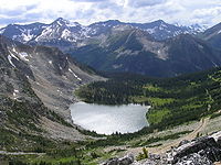
| Any inland body of water, from natural such as a lake or pond to artificial like a moat or canal |
| Rendering in OSM Carto |

|
| Group: natural |
| Used on these elements |
| Useful combination |
|
| See also |
| Status: approved |
| Tools for this tag |
|
Used to tag both still (lakes, reservoirs,...) and flowing (rivers, canals,...) inland areas of water. The type of water body can be specified with water=*. Note that despite key name it is also used for artificial structures like moats, basins of a wastewater treatment plants, canals etc, including areas covered with water only intermittently.
However, landuse=salt_pond is used instead for salt evaporation ponds, and leisure=swimming_pool for open-air man-made swimming pools. Wetlands are mapped with natural=wetland. Marine water areas and the edges of seas are delineated by the natural=coastline.
How to use
This tag can be placed on an area (i.e. a closed way) for a simple lake, or it can be placed on a Relation:multipolygon if the area of water either contains islands or is too big to map with a single way. In addition water=* tag can be used to further specify the type of waterbody e.g. water=river, water=canal, water=lake, water=reservoir, water=basin.
River
- Draw a closed way that follows both riverbanks.
- To avoid creating very large objects you can:
- Split the river area into smaller neighboring areas/sections that follow the course of a river.
- Split the way into segments and group them together in Relation:multipolygon.
- To avoid creating very large objects you can:
- Tag as natural=water + water=river.
Simple Lake
- Draw or select a closed way around the perimeter of the lake. It doesn't matter which way around the way goes.
- Tag the way with natural=water and maybe a name=* if the area has a common name.
- For a lake, add a tag water=lake.
Creating islands in lakes
To create islands in a lake, the lake should be a Relation:multipolygon.
First create the lake:
- Draw or select the way around the perimeter of the lake.
- Create or select a Relation to serve as the lake.
- In Potlatch: the chain-like button just above the tag button accesses relations. It lets you create a new relation or add the way to an existing relation. Relations are listed as properties of the ways just like tags. Clicking on the left part of the relation accesses the relation's tags, and the right part accesses the tag's role in the relation.
- Tag the relation with type=multipolygon, natural=water, name=*, etc. Redundant tags should be removed from the way.
- Add the way to the relation and set the role to outer.
Then carve a hole in the lake by adding the island as an inner ring:
- Draw or select a way around the perimeter of the island.
- Tag the island as appropriate with natural=*, name=*, etc. If natural=* is missing, the island will assume the natural-type (e.g. wood) of the land surrounding the lake.
- Add the island to the lake relation with the role of inner.
Creating lakes on islands
Points
In some cases natural=water is used on nodes. It is acceptable if mapping as area is not possible, but should be replaced by area once possible.
It can be used for example for known lakes (especially named) where imagery and GPS traces is not good enough to map its geometry.
Automatic water mapping
- JOSM plugin scanaerial works like OCR for water. You need 1 click per lake.
Related tags
- natural=coastline is used for ocean coastlines, including marginal seas and areas of marine water such as bays, tidal channels, and some lagoons and estuaries.
- Key:waterway lists some useful related features.
See also
- waterway=river - used for all rivers to map the linear flow of the water.
- waterway=riverbank - more common alternative used to map the water area of rivers
- natural=coastline - for the sea (ocean), including marginal areas such as tidal channels, bays, lagoons and estuaries
- natural=wetland - a wetland: a land area that is saturated with water, either permanently or seasonally
- landuse=salt_pond - for salt evaporation ponds
- leisure=swimming_pool - for open-air man-made swimming pools
- landuse=reservoir - is also used for artificial lakes and ponds if they are formed by a dam across a valley or natural depression, as an alternative to water=reservoir
- landuse=basin - is also used for an area of land artificially graded to hold water, as an alternative to water=basin
- Proposed_features/Water_cover (eg. intermittent water)
