Key:water
Jump to navigation
Jump to search
 |
| Description |
|---|
| Specification of a water body. |
| Group: water |
| Used on these elements |
| Documented values: 25 |
| Requires |
| Useful combination |
|
| Status: approved |
| Tools for this tag |
Used to specify a type of inland body of water. It must be tagged in conjunction with natural=water.
Possible values
These tables are a general overview of each feature. For detailed explanation of each, refer to their specific pages.
Natural features
| Tagging | Description | Sample photo |
|---|---|---|
water=cenote
|
A cenote: a deep natural well or sinkhole, especially in Central America, formed by the collapse of surface limestone that exposes groundwater underneath. | 
|
water=lagoon
|
A lagoon: a body of shallow sea water or brackish water separated from the sea by some form of barrier. It's better to specify saltness of water with salt=yes/no.
|

|
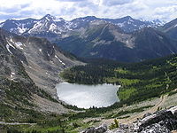
water=lake
|
A lake: A body of relatively still fresh or salt water. Artificially created water bodies should be tagged with water=pond or water=reservoir.
|
|
water=oxbow
|
An oxbow lake: U-shaped body of water formed when a wide meander from the main stem of a river is cut off to create a lake. | 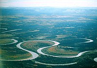
|
water=rapids
|
A fast-flowing, often turbulent, section of a watercourse such as a river, often containing exposed rocks or boulders. This tag is only for mapping rapids area. Rapids still have to be mapped on river centerline, see waterway=rapids and for more rapids properties whitewater:rapid_grade=*.
|

|
water=river
|
The water area of a river. Should contain waterway=river way inside.
|

|
water=stream
|
The water covered area of a stream: a naturally-formed watercourse which is narrower than a river | 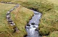
|
water=stream_pool
|
A stream pool; a small and usually deep collection of fresh water, occurring along a stream. Water velocity in the pool is typically much lower than in the stream. Frequently found below a waterfall. May be used as a "swimming hole". | 
|
Artificial features
| Tagging | Description | Sample photo |
|---|---|---|
water=basin
|
An area of land artificially graded to hold water. For more details you can use basin=*.
|

|
water=canal
|
A body of a canal, a man-made channel for water. Should contain waterway=canal way inside.
|

|
water=ditch
|
Water covered area of a waterway=ditch - a linear waterbody serving as a barrier or for draining surrounding land. Should contain waterway=ditch way inside.
|

|
water=drain
|
The water covered area of a waterway=drain - an artificial waterway, lined with concrete or similar, used to carry superfluous water. Should contain waterway=drain way inside.
|

|
water=fish_pass
|
The body of a fish pass for the fish to pass waterway dams or weirs. Should contain waterway=fish_pass way inside.
|

|
water=harbour
|
A harbour is a sheltered body of water where ships, boats, and barges can be docked. | 
|
water=lock
|
A lock chamber outline: a part of river, canal or lake system, level of which can be manipulated. The mapping of a lock and its parts is described on wiki-site lock=*.
|

|
water=moat
|
A deep, wide defensive ditch, normally filled with water, surrounding a fortified habitation. | 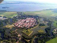
|
water=pond
|
A pond: a body of standing water, man-made in most cases, that is usually smaller than a lake. Salt evaporation ponds should be tagged with landuse=salt_pond, open-air swimming pools — with leisure=swimming_pool.
|

|
water=reflecting_pool
|
A reflecting pool: a water feature found in gardens, parks, and at memorial sites. It usually consists of a shallow pool of water, undisturbed by fountain jets, for a calm reflective surface. | 
|
water=reservoir
|
A reservoir - An artificial body of water used to store water, usually formed by a dam over a natural water course to retain the water. | 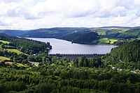
|
water=wastewater
|
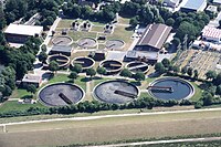
A clarifier/settling basin of a wastewater treatment plant. The whole land area of the plant should be mapped with man_made=wastewater_plant.
|
|
Obsolete uses
water=intermittent: consider usingintermittent=yesinsteadwater=tidal: consider usingtidal=yesinsteadwater=coveandwater=bay: the established tagging for bays, coves and inlets isnatural=bay
Possible tagging mistakes
See also
natural=mud- Area covered with mud: water saturated fine grained soil without significant plant growthman_made=storage_tank+content=water- A man-made tank for holding waterman_made=reservoir_covered- A large man-made tank for holding fresh water
landuse=salt_pond- A place where sea water is evaporated to extract its saltamenity=lavoirwhere use ofwater=yesis being recommended- Proposed features/Water details